Blog
They Cut Trees, Don’t They? An Assessment of the Israeli Practices on the Palestinian Agricultural Sector
Restrictive measures by the Israeli occupation authority against the Palestinian economy and especially during the period 29/9/2000 – 28/2/2001 created numerous obstacles, which have further complicated and aggravated

The Heavy Bombardment of Bethlehem City
Since the beginning of Al-Aqsa Intifada (28th of September 2000), Israel has escalated military actions against Palestinian civilians in different areas of Palestine. Israel has commenced a policy
The Myth of Natural Growth, Who Are They Fooling?
The recent declaration of the Israeli Housing Ministry that it plans to construct 5,000 housing units in Jewish settlements in the West Bank in 2001 drew a lot
Israeli Strategies Behind the recent Campaign of Land Confiscation and Property Destruction in the Gaza Strip
Located on the Mediterranean Sea bordering Egypt and Israel, the Gaza Strip is home to about 1,087,000 Palestinians. The total area of the Strip is 363,800 dunums (363.8

The Demolishing of Palestinian Wells in the Gaza Strip
The Gaza Strip has long suffered from the scarcity of natural resource especially water and land. The residents of the Strip depend on rain and the water aquifer
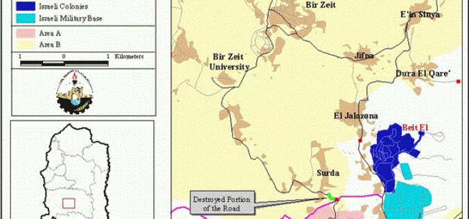
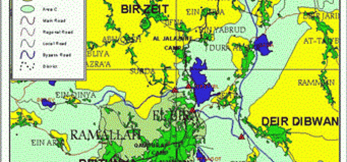
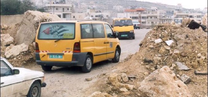
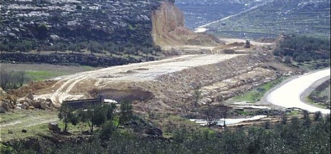
The Destruction of the Road between Ramallah and Birzeit
During the night of March 7, the eve of Ariel Sharon's swearing in at the Knesset, the Israeli Military Forces destroyed the main and only remaining road between Ramallah
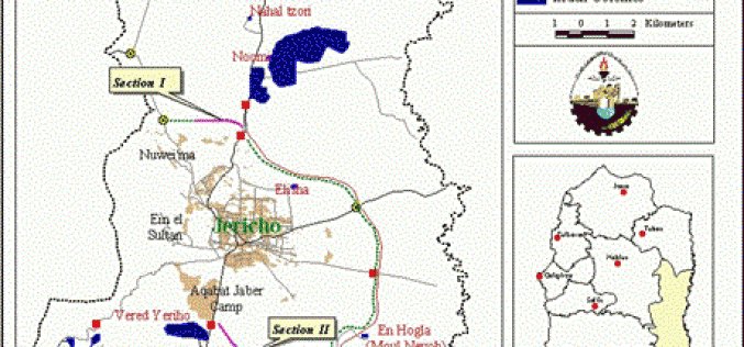
The Tightening of the Siege on Jericho: Israel Employs a New Policy of Trench Digging
The city of Jericho lies in the Jordan Valley, 10 km northwest of the Dead Sea and 7 km to the west of the Jordan River; see map.
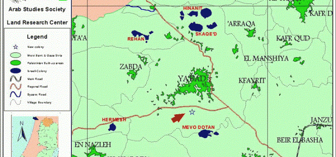
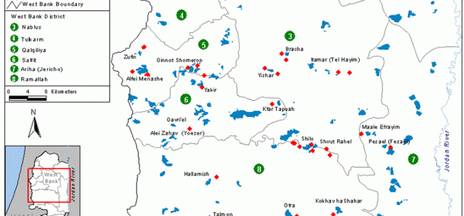
Renewal of Colonial Activity in Ya’abad – Jenin … The First Colonial Site Since the Inauguration of Ariel Sharon
Ariel Sharon's pledge no to renew andor encourage colonial activity on the Palestinian occupied lands was just a media fa'ade under which he hid his true colonial intentions. As
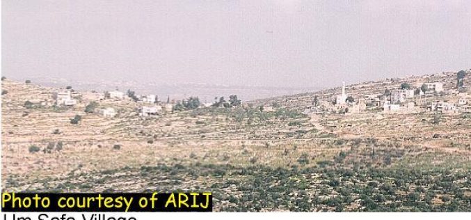
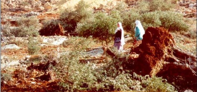
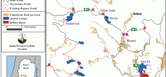
The Difficulties for Umm Safa Village during the Intifada
Umm Safa is a Palestinian village located 9 km northwest of Ramllah city, between Birzeit and Bani Zied; see photo. The village is also known as Kafr Ishwa'. There are
Decline in the Standard of Living in the Gaza Strip: Selected Socio-economic Indicators
The Gaza Strip is a narrow piece of land located on the Mediterranean Sea to the southwest of Israel on the border with Egypt; see map. The Strip
Mines and Unexploded Ordnance (UXO) in the West Bank
Minefields in the West Bank In 1998, the US State department estimated that there were around 260,000 landmines in Israel and the occupied territories, these include landmines laid
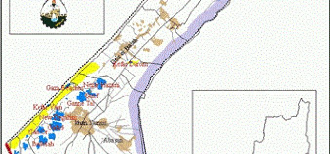
Al Mawasi Region in Gaza … The Reality of the Israeli War Against Land and Humans
Prelude: The name ''Al Mawasi'' refers to the agriculturally fertile strip of land laying parallel to the Mediterranean Sea in Gaza. The 16-kilometer-long strip starts in the city of
Isolation Policy Implemented By Israeli Army in the Occupied Territories … The Case of Ramallah and Al Bireh Districts
The Land Research Center (LRC) has been exposing the attempts carried out by the forces of Israeli occupation to mince the Palestinian territories into a number of isolated and
The Fourth Intermediary Report for the Monitoring Israeli Colonizing Activities
This report highlights the events concerning colonizing activities in the West Bank and Gaza that occurred between the months of November and January. The report describes and evaluates
The So-called “Lifting of the Siege”
On 12th March 2001, less than a week into the new government, Prime Minister Sharon seemed to be feeling the weight of public pressure following the international attention
Settlement Expansion in Al Shufa Village, Tulkarem
The village of Al Shufa is located 5 kilometers to the south of the city of Tulkarem. Its population is about 2500 Palestinians mostly working in agriculture. The
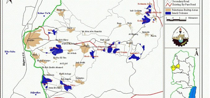
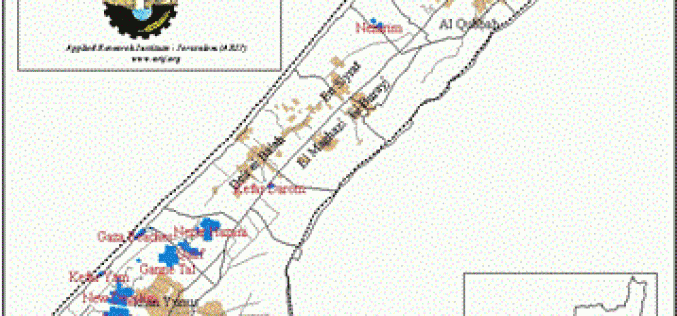
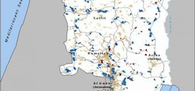
Losses in the Agricultural Sector in Qalqiliya District
The district of Qalqiliya lies in the northwest part of the West Bank, bordered in the west by the 1948 Armistice Line with Israel; see map1 . Most of the
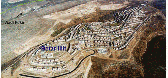
Betar Illit settlement Expansion and The Fate of Wadi Fukin Village
In the far western part of Bethlehem district there are three Palestinian villages, Husan, Wadi Fukin and Nahhalin. In between these three villages two ''Betar Settlements'' have been built,
The FIRST Comprehensive Report
Introduction The data that appears in the monthly, quarterly and comprehensive reports is collected from Palestinian and Israeli newspapers, satellite images, aerial photos, fieldworkers' reports, ARIJ and LRC
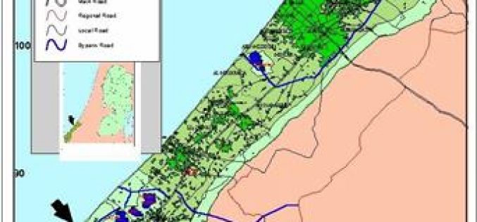
The Struggles of a Palestinian Community due to the West Bank Closure
'Atara is a Palestinian village in Ramallah District located only three kilometers south of Birzeit which is north of Ramallah; see map. The village stands on the second highest
The Changing Landscape of Hebron District
Driving from Hebron towards the West Bank's southern border, one notices many changes being made by the Israeli army and Jewish settlers alike. The bulldozing of land, which
The Agriculture Sector in Gaza Strip Faces the Fiercest Israeli Attacks During the Intifada
Introduction: Since the inception of Intifadat Al Aqsa on the 29th of September 2000, the agriculture sector in the Gaza Strip has suffered a great number of attacks and
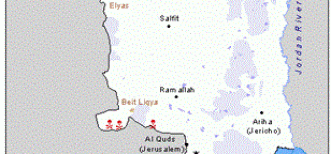
The Hardships Resulting From Blockading Villages In Ramallah District
Rantis is a Palestinian village located 9 km northwest of Ramallah city. Rantis has suffered much under the Israeli occupation. On two occasions since 1967, the village has been
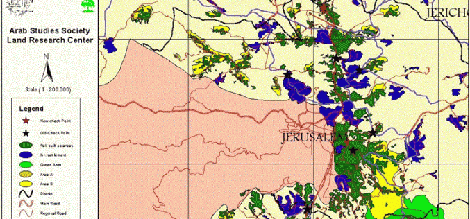
Isolation Policy Implemented By Israeli Army in the Occupied Territories
Introduction: Jerusalem is considered to be the epic center of Palestinian polity, culture, economic and spirituality. Such significance came as Jerusalem is at the heart and the capital

Research Difficulties during the Current Situation
Since the establishment in 1990, the Applied Research Institute-Jerusalem has recognized the importance of the agricultural sector and has focused its work on applied research and on-farm field
