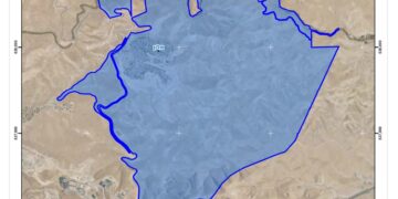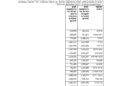
On the 13th of July 2016, the so called “Israeli Ministry of Defense” handed citizens of Al Bireh town a new military order citing the confiscation of 5.691 dunums of Palestinian land in the area for security purposes; mainly to fortify an Israeli bypass road near Beit El settlement by setting up a new watch tower in the area. The military order holds number (16/8/T) and states that the seizure of land is imperative for military reasons due to the special security situation in the region and the need to take necessary measures to prevent hostile attacks against Israeli settlers. Table 1 below gives details of the affected Palestinian lands in the Area.
|
Table 1: Details of Lands affected in Al Bireh according to the military Order 16/8/T |
||
|
No |
Block No. |
Parcel No. |
|
1 |
12 |
89-92, 87,88, 153, 132, 151, 96, 94 |
|
2 |
13 |
110,111,105, 102, 101, 100, 99, 73, 62, 44, 166-171 |
|
3 |
15 |
15, 7 |
|
Source: Al Bireh Municipality, 2016 |
||

Photo 1: a copy of the Israeli Military Order No 16/8/T
Note that the issued Israeli military order No. (16/8/T) replaces two other previously issued military orders on the 9th and 29th of February 2016 and stated the confiscation of almost the same area of land and for the same purpose, but with slight changes on the location of watch town. The two previously issued orders hold numbers No. 16/05/MD and 16/05/MD (Border Amendment). Table 2 gives details of the blocks and parcels that are targeted in the military orders.
|
Table 2: Details of Lands affected in Al Bireh town according to the military Order No. 16/05/MD & Military Order No. 16/05/MD (Border Amendment) |
||||
|
No |
|
Block No. |
Parcel No. |
Area Targeted in the Military Order (Dunums) |
|
1 |
military Order No. 16/05/MD |
12 |
81, 89-92, 86, 87, 137, 139, 151, 96, 94, 140, 142, 143, 145-149 |
5.942 |
|
|
|
15 |
15, 7 |
|
|
|
||||
|
2 |
Military Order No. 16/05/MD (Border Amendment) |
12 |
89-92, 87,88, 153, 132, 151, 96, 94 |
0.555 |
|
|
|
13 |
110,111,105, 102, 101, 100, 99, 73, 62, 44, 166-171 |
|
|
|
|
15 |
15, 7 |
|
|
Source: Al Bireh Municipality, 2016 |
||||


Photos 2-3: Copy of the Militray order No. 16/05/MD


Photos 4-5: Copy of the Militray order No. 16/05/MD (Border Amendment)
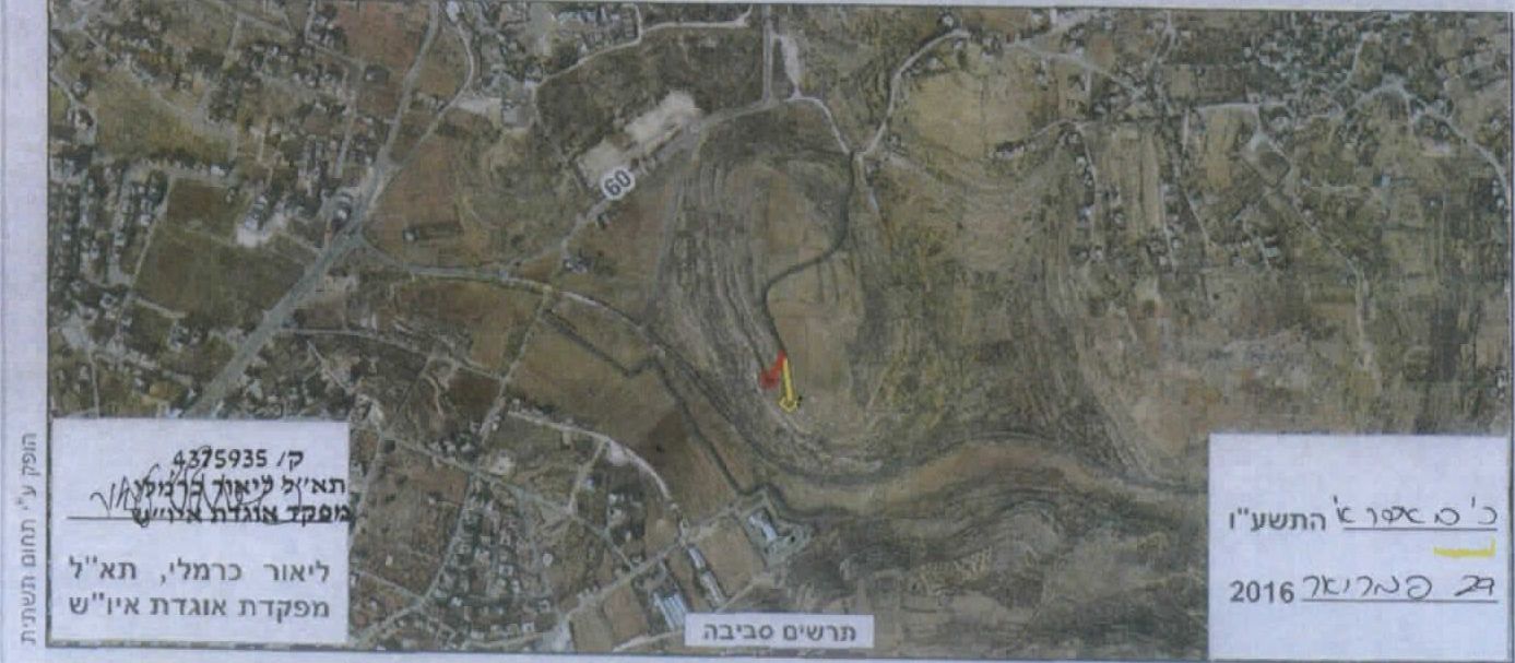
Comparing data given in Table 2, with the recently issued military order, we notice the similarity in the targeted blocks and parcels in the military orders. Additionally, the military watchtower will be erected just south of Beit El settlement and north of Al Bireh Town, parallel to a road that is used by Israeli settlers and Palestinians at the same time and separates Al Bireh Town from Beit El Settlement, referred to “Road 0” in the issued military orders. See Map 1

Map 1: Details of the issued military orders in Al Bireh Town
A translation of the original Military order 16/05/MD which was issued back in February for the construction of a new watch tower and reinforcing a road that is used by Palestinians and Israelis in Al Bireh Town.
|
Israel Defense Forces Order to Seize lands n0 16/05/MD According to my authorities as a Military Chief Commander in the Region of Judea and Samaria, and as I believe that it is imperative for military reasons due to the special security situation in the region and the need to take necessary measures to prevent hostile attacks, I order the following: Definitions 1- In This Order: The 'Map' – signed in scale 1: 500 signed by me, and attached to the order is an essential part of this order. The 'Lands' 1- An area of land which is 5.942 dunums marked in red in the map is marked for new seizure: 2- Lands marked for seizure are located in Al Bireh city Block No. 12: Parcels 81, 86, 87, 89-91, 137, 139, 140, 142, 143, 145-149, Block No. 15: Parcels 15, 7 Land Seizure 2- I announce by that the above mentioned lands are seized for imperative security purposes, to fortify the road and set up a military watch tower. Acquisition 3- The IDF seize the lands and an absolute control of the land is given to the Military Chief Commander of the Central Region through the Ministry of Defense Chief Officer in the Civil Administration Office. Usage and Compensation Fees 4- Land Owners have the right to go to the District Coordination Office in Ramallah Area to get usage expenses and compensation. Submission 5- Copies of this military order and the attached map are handed out to Land owners or to the District Co-ordination Office in Jerusalem Area. Publication 6A-This military order is to be notified to Land Owners or those who act on behalf of them by posting it at the District Coordination Office in Ramallah Area and dispersing it on the lands by any possible mean. 6B- Copies of the military order and the attached map are available for interested parties during working hours at the DCO of Ramallah Area, Offices of the juridical advisor in Judea and Samaria, and head of the Infrastructure at the Civil Administration. Right to Objection 7- Land owners or those who act on behalf of ownership have the right to object the military order through the District Coordination Office in Ramallah area or at the Office of the juridical advisor in the region until the 15th of February 2016. Order Validity This order is valid from the date it was signed and until 01/04/2016. 9- This order is called: 'Order to seize lands n0 16/05/MD (Judea & Samaria) 5765-2016.
Leur Karmieli |
To conclude
Israel continues with the confiscation of owned Palestinian land in the occupied Palestinian territory with no regard to Palestinians' civil and humanitarian rights, which are totally and explicitly violated. The Palestinians are losing more than their lands and natural resources as Israel continues to oppress their freedom and their rights to movement, freedom of religion and to proper education and health services, right to work and to live adequately in houses and areas of their choice without restrictions, all of which guaranteed to them under International laws and Human rights conventions.
Israel violate its obligations as an occupying power under international law rules and clearly contradict with:
The International Covenant on Economic, Social and Cultural Rights (ICESCR) – Food (ICESCR, art. 11): The States Parties to the present Covenant recognize the right of everyone to an adequate standard of living for himself and his family, including adequate food, clothing and housing, and to the continuous improvement of living conditions. The States Parties will take appropriate steps to ensure the realization of this right, recognizing to this effect the essential importance of international co-operation based on free consent.
The International Covenant on Civil and Political Rights (ICCPR) – Property (ICCPR, article 1) provides that: All peoples have the right of self-determination. By virtue of that right they freely determine their political status and freely pursue their economic, social and cultural development.
Prepared By
The Applied Research Institute – Jerusalem
ARIJ