• About The Project
  • Palestine in Century
  • Selected Maps
  • Glossary
  • About ARIJ
  • About LRC
  • By Year
    • Case Studies By Year
    • Daily Report By Year
Tuesday, May 5, 2026
POICA
No Result
View All Result
  • Home
  • Settlements
    • New Israeli Settlements
    • Settlement Expansion
  • Israeli Violations
    • Agriculture
    • Confiscation
    • Demolition
    • Environment
    • Eviction of Palestinians
    • Settlers Attacks
  • Bypass Roads
  • Israeli Plans
  • Segregation
    • Checkpoints
    • Closure
    • Separation Plans
  • Military Orders
  • Reports
    • Daily Report
    • Monthly Report
    • Quarterly Report
No Result
View All Result
POICA
No Result
View All Result

The occupation is to establish eight watchtowers on lands from Nablus suburbs

January 13, 2016
in Military Orders
The occupation is to establish eight watchtowers on lands from Nablus suburbs


  • Violation: confiscation orders on lands
  • Location:  Madama, Tal, Huwwara and Burin villages
  • Date:  January 12, 2016
  • Perpetrators: Israeli Occupation Forces
  • Victims:  residents of the villages

Details:

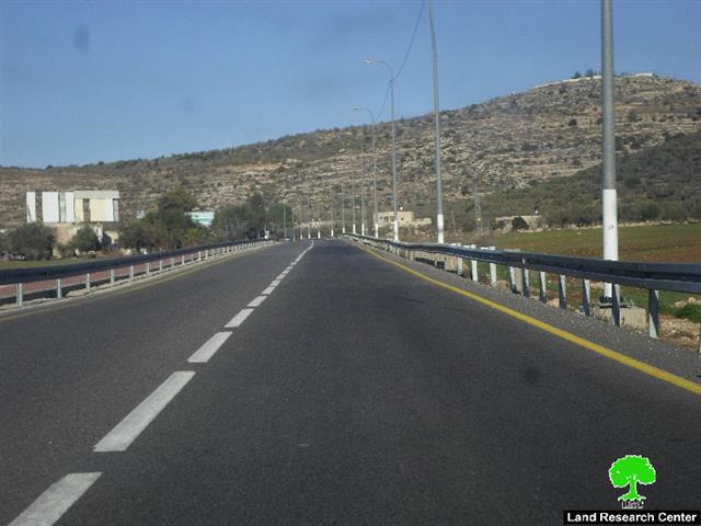
In  a new step to take over the Nablus southern suburbs, the Israeli occupation authorities declared on January 12, 2016 the confiscation of some lands from the villages and towns of Madama, Tal, Huwwara and Burin for the sake of establishing eight watchtowers. Note that the confiscation locations are founded nearby the bypass road number 147 that travels by Yizhar colony.

The responsible of the colonization file in the northern West Bank, Ghassan Daghlas, told Land Research Center that such measures aim at confiscating more lands and will cause farmers and lands owners become denied from accessing and using their plots.

When established, the watchtowers will ban people to approach lands from a distance of 100-150 meters. This will double the confiscated area as mentioned in the military order. Note that the new area will be declared as closed military zones where Palestinians are not allowed in for any reason whatsoever.

It should be marked that the military orders claimed control on the lands on the pretext of Public Interest. The orders were signed by the officer of the infrastructure department at Civil Administration Iby'ad Kasfi. The confiscation will be valid until December 31, 2018 but it is likely that the occupation will call for an extension when the deadline is to end.

The following table shows information about the locations of the suggested watchtowers:

Town village

No. of natural block

Location

Affected aream2 according to the order

Actual affected aream2

No. of watchtowers

No. of military order

Huwwara

13

Al-Amd location

0.4

400

One watchtower on the road no. 147

15/1/ش م ص

Madama

4

Al-Aqab and Al-Amayra locations

.018

700

Two watchtowers at Nablus circle 

15/3/ ش م ص

Tal

10

Al-Araq location

.018

700

Two watchtowers at Nablus circle 

15/4/ ش م ص

Burin

8

Al-Silsileh

.009

350

One watchtower rat Nablus circle 

15/2/ ش م ص

Tal

10

Al-Arqan

.009

350

One watchtower rat Nablus circle 

15/6/ ش م ص

Tal

16

Sl-Sahlat

.009

350

One watchtower rat Nablus circle 

15/5/ش م ص

Total

0.463

2850


Source : Field observation- Department of Monitoring Israeli Violations- Land Research Center-2016


Photos 1-7: the military orders

It should be marked that the southern suburbs of Nablus city have been a constant target for attacks and violations conducted by army troops and colonists. Attacks were represented in cutting trees off, torching properties and assaulting farmers after sending them out of their lands.

The colonies of Bracha, Yizhar and Itamar that are founded in the area are forming an imminent threat on Palestinians. Colonists are reported to carry out attacks and crimes against unarmed and marginalized Palestinians in an inhumane way that contradicts all international laws and human rights conventions. Ironically, the Israeli Occupation Forces protect and support colonists in their violence against Palestinians.


Prepared by
 The Land Research Center
LRC
 

Recommended For You

مناطق نفوذ المستوطنات ودورها في إعادة تشكيل الجغرافيا الفلسطينية

by arij
April 23, 2026
0
مناطق نفوذ المستوطنات ودورها في إعادة تشكيل الجغرافيا الفلسطينية

أصدرت سلطات الاحتلال الإسرائيلي في العاشر من شهر نيسان 2026 الكراسة رقم (273)، وهي وثيقة تضم مجموعة من المناشير والأوامر والتعيينات الإسرائيلية المتعلقة بالجوانب الأمنية والعسكرية والإدارية، إضافة...

Read moreDetails

INFOGRAPHIC: Mapping Control – Israeli Militray Orders across the occupied West Bank – 2025

by arij
April 16, 2026
0

    Prepared by:   The Applied Research Institute – Jerusalem

Read moreDetails

سلطات الاحتلال الإسرائيلي تستهدف قرية الجيب بأمر عسكري جديد

by arij
March 17, 2026
0
سلطات الاحتلال الإسرائيلي تستهدف قرية الجيب بأمر عسكري جديد

نشر المسؤول عن الأملاك الحكومية وأملاك الغائبين في الإدارة المدنية الإسرائيلية في الحادي عشر من شهر اذار من العام 2026 اعلاننا مفاده نية ما يسمى " المسؤول عن...

Read moreDetails

سلطات الاحتلال الإسرائيلي تستخدم الأوامر العسكرية لتعمق المشروع الاستيطاني في الضفة الغربية المحتلة

by arij
February 26, 2026
0
سلطات الاحتلال الإسرائيلي تستخدم الأوامر العسكرية لتعمق المشروع الاستيطاني في الضفة الغربية المحتلة

تقديم منذ احتلال الضفة الغربية عام 1967، اعتمدت سلطات الاحتلال الإسرائيلي منهجية واسعة عبر استخدام الأوامر العسكرية كأداة "قانونية" لفرض الوقائع الجغرافية والديموغرافية على الأرض الفلسطينية. وأصبحت هذه...

Read moreDetails

بين مطرقة الأوامر العسكرية وسندان التقييد الجغرافي, أوامر عسكرية إسرائيلية جديدة تطال أكثر من 1000 دونم في طوباس

by arij
November 26, 2025
0
بين مطرقة الأوامر العسكرية وسندان التقييد الجغرافي, أوامر عسكرية إسرائيلية جديدة تطال أكثر من 1000 دونم في طوباس

في الحادي والعشرين من شهر تشرين الأول لعام 2025، تسلّم أهالي محافظة طوباس سلسلة من الأوامر العسكرية الإسرائيلية التي استهدفت مساحات واسعة من الأراضي الفلسطينية في المحافظة. وقد...

Read moreDetails
Next Post
لصالح أمن المستعمرين الاحتلال يعلن عن إقامة ثمانية أبراج عسكرية على حساب الأراضي الفلسطينية في قرى ريف نابلس الجنوبي

لصالح أمن المستعمرين الاحتلال يعلن عن إقامة ثمانية أبراج عسكرية على حساب الأراضي الفلسطينية في قرى ريف نابلس الجنوبي

LATEST NEWS

مناطق نفوذ المستوطنات ودورها في إعادة تشكيل الجغرافيا الفلسطينية

مناطق نفوذ المستوطنات ودورها في إعادة تشكيل الجغرافيا الفلسطينية

by arij
April 23, 2026
0

........................................................

التمدد الاستيطاني الإسرائيلي في الضفة الغربية المحتلة وأثره في تقويض مقومات الدولة الفلسطينية

التمدد الاستيطاني الإسرائيلي في الضفة الغربية المحتلة وأثره في تقويض مقومات الدولة الفلسطينية

by arij
April 16, 2026
0

........................................................

INFOGRAPHIC: ISRAELI SETTLER VIOLENCE IN 2025

by arij
April 16, 2026
0

........................................................

العدالة المؤجلة ورأي بلا تنفيذ: من قرار المحكمة إلى واقع الضم

أدوات غير مباشرة للاستيطان الإسرائيلي في مناطق (أ) و(ب) لإعادة تشكيل الجغرافيا والسيطرة في الضفة الغربية   

by arij
April 16, 2026
0

........................................................

flag_yellow_lowEU-PfP-Logo

This website and its content were initiated in 1993 by the Applied Research Institute – Jerusalem (ARIJ) and the Land Research Center (LRC) with the support from the European Union up until 2023. Since then, the Applied Research Institute – Jerusalem (ARIJ) has taken over the continued development and maintenance of the website. The views expressed remain solely those of ARIJ) and do not necessarily reflect those of the European Union.

© 2026 Copyright | ARIJ | All Rights reserved.

No Result
View All Result
  • Home
  • Settlements
    • New Israeli Settlements
    • Settlement Expansion
  • Israeli Violations
    • Agriculture
    • Confiscation
    • Demolition
    • Environment
    • Eviction of Palestinians
    • Settlers Attacks
  • Bypass Roads
  • Israeli Plans
  • Segregation
    • Checkpoints
    • Closure
    • Separation Plans
  • Military Orders
  • Reports
    • Daily Report
    • Monthly Report
    • Quarterly Report

© 2026 Copyright | ARIJ | All Rights reserved.