• About The Project
  • Palestine in Century
  • Selected Maps
  • Glossary
  • About ARIJ
  • About LRC
  • By Year
    • Case Studies By Year
    • Daily Report By Year
Saturday, October 10, 2026
POICA
No Result
View All Result
  • Home
  • Settlements
    • New Israeli Settlements
    • Settlement Expansion
  • Israeli Violations
    • Agriculture
    • Confiscation
    • Demolition
    • Environment
    • Eviction of Palestinians
    • Settlers Attacks
  • Bypass Roads
  • Israeli Plans
  • Segregation
    • Checkpoints
    • Closure
    • Separation Plans
  • Military Orders
  • Reports
    • Daily Report
    • Monthly Report
    • Quarterly Report
No Result
View All Result
POICA
No Result
View All Result

An Israeli Colonial Expansion in Sinsanah Settlement in Southern Hebron Governorate

April 4, 2009
in Settlement Expansion
An Israeli Colonial Expansion in Sinsanah Settlement in Southern Hebron Governorate
The Haaretz Israeli daily newspaper revealed on March 18, 2009 that the Israeli Defense Minister Ehud Barak has approved an expansion plan of an existing Illegal Israeli settlement in southern Hebron Governorate. The plan includes the expansion of Sinsanah settlement and an outpost located to its north, called ‘Sinsanah North’. 
 
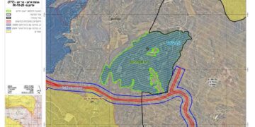
The newspaper added that the Israeli Civil Administration had already set a plan for the expansion of Sinsanah settlement and outpost with reference to plan number (505/01) which included (1) granting permits to the already built 50 houses in the settlement outpost in an attempt to legitimize the existence of this colonial outpost which was constructed in year 2002 and (2) designation of another area for future construction of a total of 440 new housing units in the settlement to accommodate more than 2,500 Israeli settlers. See Map 1

Map 1: Location of Sinsanah Settlement – Southern Hebron Governorate
 
Palestinian land owners of Ar Ramadin village filed an objection to the Israeli higher council of planning and construction (affiliated to the Israeli Civil Administration), indicating that the Israeli plan is Illegal and their lands will be totally surrounded by Sensana settlement and the Segregation Wall. Furthermore, the threatened Palestinian lands will be allocated to the expansion of the settlement and for the security zone which usually extends from 100-300 meters from the settlement boundary.
 
A glance about Sinsanah settlement:-
Sinsanah Settlement was built in the year 1999 on 234 dunums of lands of Ar Ramadin area in southern Hebron Governorate. The settlement is a home to almost 250 Israeli settlers. The settlement is located along the 1948 Armistice Line (Green Line) and is already annexed to Israel through the construction of the Israeli Segregation Wall in that area. See Map 1
 
Legal & International Status
It became clear that the Israeli government is insisting on violating all the International agreements, conventions, and International law rules, by expanding the illegal Israeli settlements in the Palestinian Occupied Territory horizontally and vertically; neglecting and violating the political commitments and pledges toward the International legitimacy and the Quartet and toward its Palestinian partner in peace process.
 
The Israeli plans and expansions in the West Bank Settlements clearly contradict the following:
  • UNSC Resolution 452:’Calls upon the Government and people of Israel to cease, on an urgent basis, the establishment, construction and planning of settlements in the Arab occupied Territory since 1967, including Jerusalem.’
  • UN Resolution 446 calls on Israel to rescind its previous measures and to desist from taking any action which would result in changing the legal status and geographical nature and materially affecting the demographic composition of the Arab territories occupied since 1967, including Jerusalem and, in particular, not to transfer parts of its own civilian population into the occupied Arab territories’ .
  • Article 49 of the Fourth Geneva Convention of 1949:’the occupying power shall not deport or transfer parts of its own population into the Territory it occupies.’
  • The Forth Geneva Convention in Article 174 also prohibits the ‘extensive destruction and appropriation of property not justified by military necessity and carried out unlawfully and wantonly.’
  • Article XXXI, Oslo II, 1995: ‘Neither side shall take any step that will change the status of the West Bank and the Gaza Strip.
  • The Roadmap signed on April 30, 2003, between Israel and the Palestinians (originally developed by the United States, in cooperation with Russia, the European Union, and the United Nations (the Quartet)) under which the Israeli Government agreed to freeze all settlement.
  • In May 2001, the head of the International Red Cross delegation to Israel and the Occupied Territories said that settlements are ‘equal in principle to war crimes’. (Note: ‘The transfer, the installation of population of the occupying power into the occupied territories is considered as an illegal move and qualified as a ‘grave breach.’ It’s a grave breach, formally speaking, but grave breaches are equal in principle to war crimes’, Rene Kosirnik, head of the ICRC delegation to Israel and the OPT, press conference 17 May 2001.)


 Prepared by:
The Applied Research Institute – Jerusalem
(ARIJ)

Recommended For You

Approval of a Major Expansion Plan for the Tekoa Settlement East of Bethlehem

by arij
September 1, 2026
0
Approval of a Major Expansion Plan for the Tekoa Settlement East of Bethlehem

Targets ≈6,000 dunams of Palestinian land On July 20, 2026, the so-called “Gush Etzion Settlement Regional Council” in the occupied West Bank approved a large-scale settlement master plan...

Read moreDetails

First Half of 2026
“Israeli Settlement Expansion Targets More Than 22,000 Dunams of Palestinian Land”

by arij
September 2, 2026
0
First Half of 2026  “Israeli Settlement Expansion Targets More Than 22,000 Dunams of Palestinian Land”

  Preface, Israeli settlement construction in the occupied West Bank is one of the  tools used by Israel to consolidate control over Palestinian land and reshape the Palestinian...

Read moreDetails

على ما مساحته 1006.4 دونما من أراضي بلدة يانون
“سلطات الاحتلال الإسرائيلي تشرع بتغيير نفوذ بؤرة استيطانية في الضفة الغربية المحتلة”

by arij
March 14, 2026
0
على ما مساحته 1006.4 دونما من أراضي بلدة يانون  “سلطات الاحتلال الإسرائيلي تشرع بتغيير نفوذ بؤرة استيطانية في الضفة الغربية المحتلة”

في الثاني عشر من شهر شباط من العام 2026, نشر رئيس قسم الاستيطان والتنظيم فيما يسمى "بالإدارة المدنية الإسرائيلية", الذراع الأيمن لحكومة الاحتلال الإسرائيلية اعلانا مفاده " اعلان...

Read moreDetails

حين تتقلص الخريطة: تسارع غير مسبوق في توسّع المستوطنات الإسرائيلية خلال عام 2025

by arij
February 16, 2026
0
حين تتقلص الخريطة: تسارع غير مسبوق في توسّع المستوطنات الإسرائيلية خلال عام 2025

مقدمة: - ان السياسة الاستيطانية الإسرائيلية في الضفة الغربية المحتلة هي واحدة من أكثر القضايا التي تقف عائقا في تحقيق سلام عادل وقابل للحياة في الأراضي الفلسطينية المحتلة....

Read moreDetails

حين يصبح الاستيطان سياسة دولة: 26 ألف وحدة جديدة تهدد الضفة الغربية

by arij
November 27, 2025
0
حين يصبح الاستيطان سياسة دولة: 26 ألف وحدة جديدة تهدد الضفة الغربية

في ظلّ صمتٍ دوليٍّ متزايد، يكشف معهد الأبحاث التطبيقية – القدس (أريج) عن طرح سلطات الاحتلال الإسرائيلي مخططات بناء استيطانية لأكثر من 26 ألف وحدة استيطانية جديدة في...

Read moreDetails
Next Post

The Israeli Colonization activities in the Occupied Palestinian Territory during the First Quarter of 2009

LATEST NEWS

“في خدمة المستوطنات والبؤر الاستيطانية الإسرائيلية”  سلطات الاحتلال تصدر 32 أمرًا عسكريًا لإنشاء خطوط مياه جديدة

“في خدمة المستوطنات والبؤر الاستيطانية الإسرائيلية”
سلطات الاحتلال تصدر 32 أمرًا عسكريًا لإنشاء خطوط مياه جديدة

by arij
September 29, 2026
0

........................................................

سلطات الاحتلال الإسرائيلي تستولي على 370 دونما من أراضي أبو ديس بذريعة أملاك حكومية

سلطات الاحتلال الإسرائيلي تستولي على 370 دونما من أراضي أبو ديس بذريعة أملاك حكومية

by arij
September 23, 2026
0

........................................................

سلطات الاحتلال الإسرائيلي تتم رسميا اعداد المخطط الهيكلي للبؤرة الاستيطانية «أفيا» (يتسيف/شديما سابقًا) شرق مدينة بيت ساحور

سلطات الاحتلال الإسرائيلي تتم رسميا اعداد المخطط الهيكلي للبؤرة الاستيطانية «أفيا» (يتسيف/شديما سابقًا) شرق مدينة بيت ساحور

by arij
September 17, 2026
0

........................................................

الاحتلال الإسرائيلي يخصص 1627 دونما لصالح البؤرة الاستيطانية “كيدا ” في محافظة نابلس

الاحتلال الإسرائيلي يخصص 1627 دونما لصالح البؤرة الاستيطانية “كيدا ” في محافظة نابلس

by arij
September 10, 2026
0

........................................................

flag_yellow_lowEU-PfP-Logo

This website and its content were initiated in 1993 by the Applied Research Institute – Jerusalem (ARIJ) and the Land Research Center (LRC) with the support from the European Union up until 2023. Since then, the Applied Research Institute – Jerusalem (ARIJ) has taken over the continued development and maintenance of the website. The views expressed remain solely those of ARIJ) and do not necessarily reflect those of the European Union.

© 2026 Copyright | ARIJ | All Rights reserved.

No Result
View All Result
  • Home
  • Settlements
    • New Israeli Settlements
    • Settlement Expansion
  • Israeli Violations
    • Agriculture
    • Confiscation
    • Demolition
    • Environment
    • Eviction of Palestinians
    • Settlers Attacks
  • Bypass Roads
  • Israeli Plans
  • Segregation
    • Checkpoints
    • Closure
    • Separation Plans
  • Military Orders
  • Reports
    • Daily Report
    • Monthly Report
    • Quarterly Report

© 2026 Copyright | ARIJ | All Rights reserved.