Location;
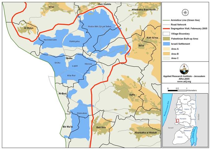
The Modi'in Block is a group of Israeli-Jewish settlements located approximately 8 Km northwest of Jerusalem along the 1949 Armistice Line. The block contains 8 settlements listed in the following table one.
Table one: the Modi'in Illit Bloc of settlements
|
Settlement Name |
Date of Establishment |
Area 10 (in Dunums) |
Population in 2004 |
|
|
|
|
|
|
Modi'in Illit (Qiryat Sefer) |
1991 |
3973 |
27386 |
|
Hashmonaim |
1985 |
1050 |
2235 |
|
Mattityahu |
1980 |
683 |
1347 |
|
Lapid |
1996 |
459 |
2200 |
|
Shilta |
1977 |
978 |
370 |
|
Menora |
1998 |
759 |
1302 |
|
Kfar Rut |
1977 |
835 |
210 |
|
Makkabim |
1982 |
1941 |
11235 |
|
|
|
|
|
|
Total |
10,678 |
46,285 |
|
Source; (ARIJ) GIS Databases, 2005
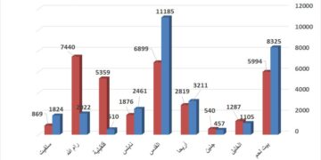
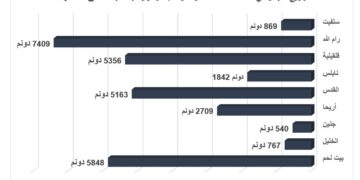
The eight illegal Israeli settlements occupy an area of 10,678 dunums (10.678 km²) and established on lands originally owned by Palestinians from Al Midya, Ni'lin, Al Burj, Shilta, Saffa, Beit Sira, Bir Mai'n, Deir Qiddies, Bil'in and Khirbet Al Misbah within the governorate of Ramallah. Table two below details the lands' areas that were confiscated from those villages for establishment of the Israeli settlements.
Table 2: New lands confiscated from Palestinian villages to expand the Israeli settlements of Modi'in Illit.
|
Settlement name |
Original village name |
Area confiscated from the village in dunums |
Percent of total village boundary |
|
|
|
|
|
|
Hashmonaim |
Al Midya |
116 |
5% |
|
Hashmonaim, Mattityahu, Menora, Modin Illit (Qiryat Sefer) and Shilta. |
Ni'lin |
1963 |
13% |
|
Kfar Rut & Makkabim |
Al Burj |
3 |
0% |
|
Shilta, Menora, Lapid and Kfar Rut |
Shilta |
2455 |
80% |
|
Menora, Lapid, Kfar Rut and Makkabim |
Saffa |
1149 |
12% |
|
Makkabim |
Beit Sira |
847 |
18% |
|
Makkabim |
Bir Ma'in |
367 |
36% |
|
Modin Illit (Qiryat Sefer) and Mattityahu |
Deir Qiddis |
2174 |
26% |
|
Modin Illit (Qiryat Sefer) & Menora |
Bal'in |
811 |
20% |
|
Kharbatha Al Misbah |
793 |
18% |
|
|
|
|
|
|
|
Total |
10,678 Dunums |
||
Source: (ARIJ) GIS databases, 2005
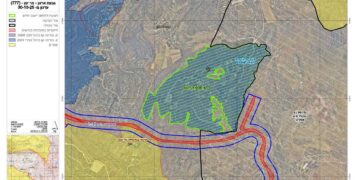
Table two shows the total land area that was expropriated from Palestinian villages for building Israeli settlements totaled 10678 dunums (10.678 km²), 26 % of the villages' total area. (See map one below)

The Israeli Expansion inside Modi'in Illit settlement;
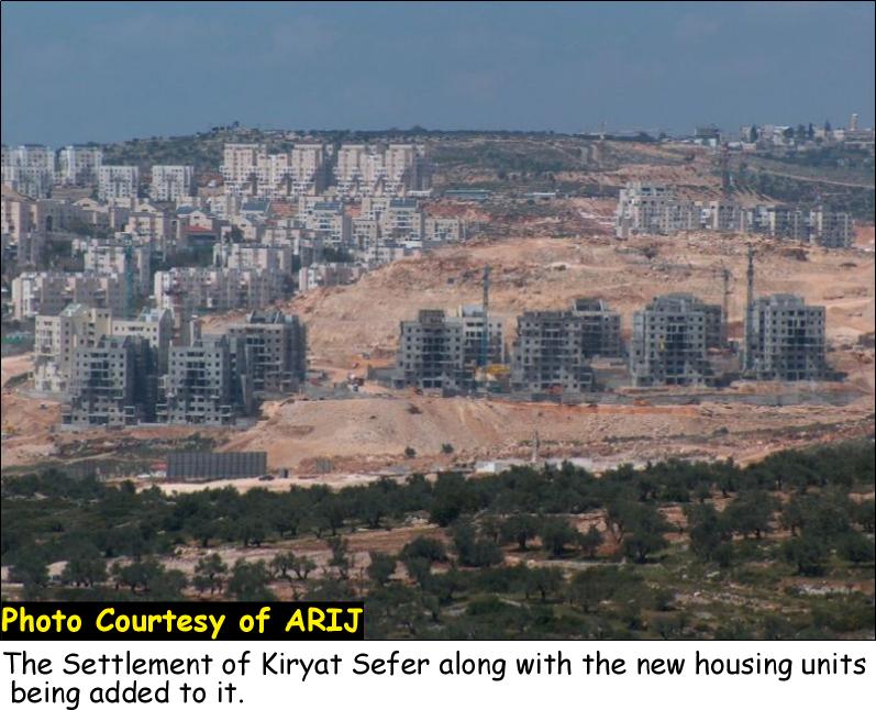
The construction of the new housing units in Modi'in Illit settlement bloc started earlier to the announcement of the construction of the Segregation Wall in the area in 2003. The expansion ofModi'in Illit came on the expanse of many Palestinian villages (Bil'in, Ni'lin, Deir Qiddis, Kharbath Al Misbah, Beit Sira, Bir Ma'in, Saffa, Al Midya, Al Burj and Shilta), making the settlement in occupied West Bank territory.
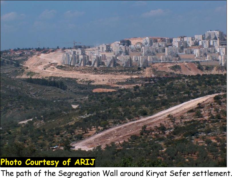
As the Segregation Wall around Modi'in Illit settlements block is nearly completed, the Israeli government decided to intensify the construction process of new housing units to the settlement block. On January 2006, the Israeli civil administration issued license to build 1500 new housing units on lands owned by Palestinians from Bil'in village but enclosed within the Segregation Wall and declared as a State land.
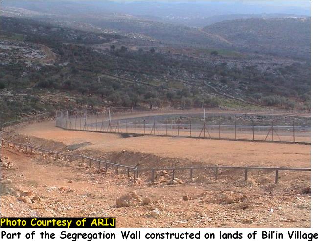
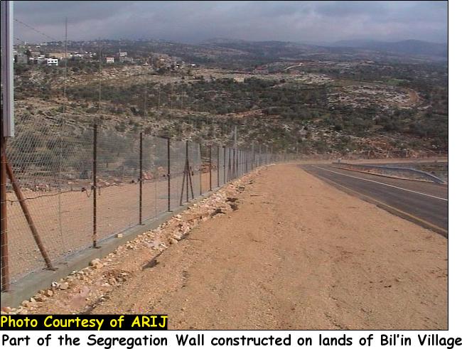

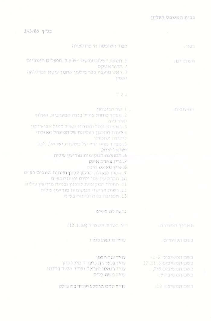
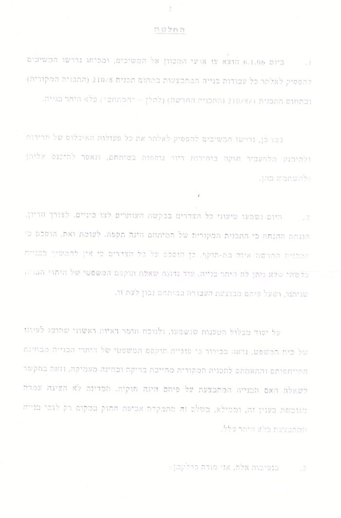
Bil'in villagers filed petition to revoke the expropriation of lands and the construction order for the new units, which induced the Israeli court to issue order number (143/ 06) to halt all constructions carried out at the area in question until further notice.
Photo 1, Photo 2 & Photo 3: Court Order (143/06)

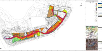
The Israeli plan in the area:
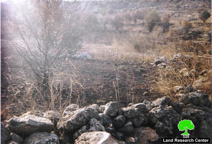
The Israeli plan did not stop at that but went even further, as plan of new settlement on lands from near by Saffa village between Modi'n Illit (Qiryat Sefer) and Lapidsettlements; were revealed when the Israeli Army made it available for Saffa residents to see. The new settlement called 'Mattiyahu east, indicating a location east of the currently standing Mattiyahu settlement. The new settlement will take 60 Dunums of Saffa lands area; cultivated with olive trees to build some 1500 new housing units. See Photo 4 & Photo 5 & Photo 6

The theft of lands and blockade of Palestinian villages and towns by the Israeli government is one of many pre-planned policies that the Israelis are implementing in order to construct and expand illegal Israeli settlements in the West Bank; all which to create facts on the ground.
The Road map plan proposed by the USA and the Quartet emphasize the necessity to freeze all settlements related activities in the Occupied Palestinian Territory (OPT). Israel's continuos violation of the road map and the siged peace accords, the international law and the fourth Geneva Convention has caused the Palestinian – Israeli negotiations to steep the peace process into the predicament it is wrapped up with today.
Conclusion:
The illegal construction of the Israeli Segregation Wall in the West Bank under the pretext of security has given the Israeli government the means to engulf most the Israeli settlements blocks in the occupied West Bank toward Israel. Moreover, it allowed Israel to capture the bulk of Palestinian natural resources, particularly water reserves (aquifers). In addition to that Israel has shown persistence of violations of international humanitarian laws particularly, the Hague Regulations of 1907, which contains specific provisions outlawing Israel's colonization activities; destruction of Palestinian civilian properties, land seizure specifically Article 23 (G), which clearly states that the occupying power is forbidden 'to destroy or seize the enemy's property, unless such destruction or seizure be imperatively demanded by the necessities of war.'
Prepared by
The Applied Research Institute – Jerusalem
ARIJ