On January 21, 2008, and while Palestinian farmers from Al-Jaba’a and Wadi Fukin villages southwest Bethlehem Governorate were cultivating their lands they came across several Israeli military orders tossed on the dirt in their fields, the order were issued by the Israeli Custodian of Absentee Land Property in the Israeli Army. The orders were in fact warning notices for the Palestinian farmers to evacuate their lands and to remove and dismantle all what exists on the land point out in the warning notices; this includes but not limited to trees, infrastructure installations, or anything else, under the pretext that the lands area is “State Land.”
In Al Jaba’a village, the local farmers found five Israeli military orders notifying them to evacuate more than 71 dunums of lands under the aforementioned pretext. ARIJ field workers had visited the owners of the targeted lands, interviewed the owners of these lands, and documented the damages, which were as follows:
|
No. |
Owner |
Military Order’s No. |
Area of Land- Dunums |
No. Trees
|
|
1 |
Abdel Rahman Isma’eel Abu Luha |
1.2 |
100 |
|
|
2 |
Ibrahim Isma’eel Abu Luha |
1.2 |
150 |
|
|
3 |
Hassan Isma’eel Abu Luha |
1.2 |
150 |
|
|
4 |
Muhammad Isma’eel Abu Luha |
1.2 |
150 |
|
|
5 |
Abdel ‘Aziz Muhammad Abu Luha |
1.2 |
150 |
|
|
6 |
Hilal Mohammad Masha’leh |
8.3 |
250 |
|
|
7 |
Ibrahim Muhammad Ibrahim |
1.2 |
90 |
|
|
8 |
Musa Ahmad Masha’leh |
1.2 |
220 |
|
|
9 |
Fadel Ahmad Abdel Majid Hmdan |
5.5 |
70 |
|
|
10 |
Nu’man Ahmad Hamdan |
5.5 |
100 |
|
|
11 |
Mohammad Ahmad Hamdan |
5.5 |
80 |
|
|
12 |
Na’im Ahmad Hamdan |
5.5 |
50 |
|
|
13 |
Nabil Ibrahim Hamdan |
8.5 |
70 |
|
|
14 |
Khaled Naji Masha’leh |
12/05/B |
24 |
150 |
|
TOTAL |
*** |
71.2 |
1780 |
|
Source: ARIJ GIS Database 2008
The owners of the targeted lands indicated that they have the certificates and registration documents (Turkish and British Tabo) which prove their ownership of their lands.
Just few kilometers north of Al Jaba’a village in Wadi Fukin village, the Palestinian farmer Mr. Maher Taha Mustapha Manasra had found an Israeli military order holding number (51/05/B), issued by the Israeli Custodian of Absentee Land Property in the Israeli Army warning him to evacuate his land under the same pretext. In an interview with ARIJ field workers, Mr. Manasra said that his 25.5 dunums piece of land is cultivated with hundreds of Olive and Almonds trees; furthermore, he has a Turkish and British Tabo n addition to a Palestinian issued title deed, which prove his ownership of his land. See Photos of threatened lands
It is worth mentioning that all of the targeted lands in Al-Jaba’a and Wadi Fukin villages are located in Area C where
Israel fully in controls of security and administrative parts of life there while the Palestinian Authority has the responsibility over civil issues such as health and education….etc. the following table shows land classification in Al’-Jaba’a and Wadi Fukin’s lands according to Oslo agreement:
|
Al- Jab’a’s Land Classification according to Oslo Agreement of 1995 |
||
|
Land Classification |
Area- Dunums |
% from the village’s Area |
|
Area A |
0 |
0 |
|
Area B |
276 |
3.9 |
|
Area C |
6,845 |
96.1 |
|
Total Area |
7,120 |
100 |
|
Wadi Fukin’s Land Classification according to Oslo Agreement of 1995
|
||
|
Land Classification |
Area- Dunums |
% from the village’s Area |
|
Area A |
0 |
0 |
|
Area B |
277 |
6.4 |
|
Area C |
4070 |
93.6 |
|
Total Area |
4347 |
100 |
|
Source : ARIJ Data Base |
||
Source: ARIJ GIS Database 2008
Al-Jaba’a & Wadi Fukin, Location & Population
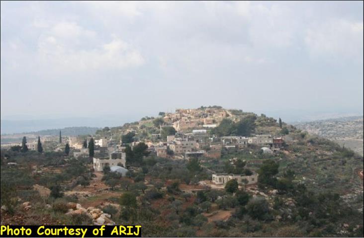
Al- Jaba’a village is located southwest of Bethlehem Governorate and is the home to 906 Palestinians (PCBS 2006). The total area of Al-Jaba’a is 7121 dunums, 6845 of which (96% from the total area of the village) classified as Area C. Moreover, the village is surrounded from all directions by Illegal Israeli settlements and the Israeli Apartheid Segregation Wall. The Illegal Israeli settlement of Bitar ‘Illit bordered the village from the north, Giva’ot settlement from the south and the proposed route of the Segregation Wall from its southern and western sides.
Wadi Fukin, located southwest of Bethlehem Governorate and populated by 1201 resident (PCBS 2006), the majority of which rely on agriculture related activity for income generation. The village is bordered by the Illegal Israeli settlements of Bitar ‘Illit and Hadar Bitar from its north and eastern sides, Al-Jaba’a village from its south side and the Green Line (Armistice Line of 1949) and the planned route of the Israeli Apartheid Segregation Wall from its western side. See Map 1
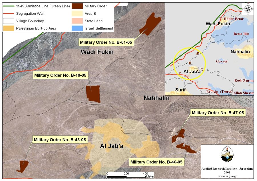
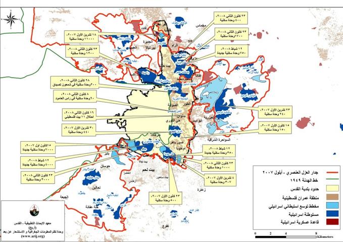
Map 1: Israeli Military Orders in Al Jaba’a &Wadi Fukin
Acquisition by Declaring 'State Land'
When Israel occupied the West Bank and Gaza Strip, only 1/3 of the Palestinian lands were registered on the names of the Palestinian citizens, were they had a registration documents (Turkish and British “Tabo” certificates) that prove their ownership of the lands, which means “private ownership”, while the remaining 2/3 of these lands had not registered formally on the name of their owners. Right at the time the Israeli Army occupied the Palestinian territory, it froze all land registration process in all of the occupied territory, which had started during the time when the Hashemite Kingdom of Jordan retained its control on the West Bank to update the land registration in the Palestinian area. When Israel occupied the Palestinian territory in June 1967 it imposed military rule and illegally classified all the lands that did not have any formal registration documents or Tabo certificates a 'State Land' and transferred their ownership to the Israeli Government according to the Illegal Israeli law # 59 issued by the Illegal Israeli military occupation in the year 1967 in which determined registered land as private and otherwise as 'State Land'.
The UNSCR (United Nation Security Council Resolutions) and specifically the resolutions: 242 and 338 called upon Israel to completely withdraw from all of the territories it occupied in its aggression in the year 1967, which means that the Israeli existence in these territories is Illegal, therefore , all of the rules , decisions, laws or any regulations issued by the Illegal occupation authorities is null and void , and accordingly this applies to Al- Jaba’a and Wadi Fukin lands.
Today, and after 41 years of the Illegal Israeli occupation of the Palestinian territories, Israel insists on neglecting all of the International Law rules and conventions regarding its illegitimate procedures, policies, and violations practiced against Palestinians and their lands and properties.
:::::::::::::::_
* , According to Oslo Agreement signed between the Palestinian Liberation Organization and Israel in 1995
Prepared by
The Applied Reserach Institute – Jerusalem