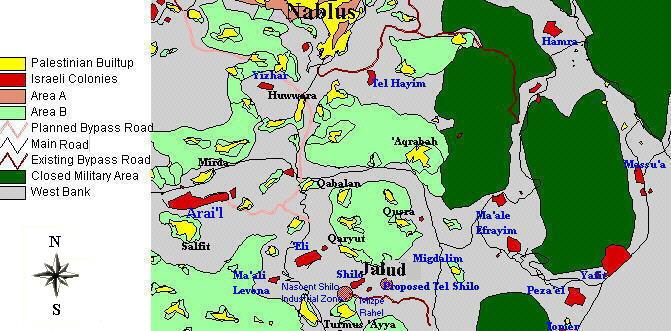
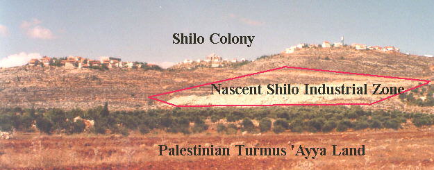
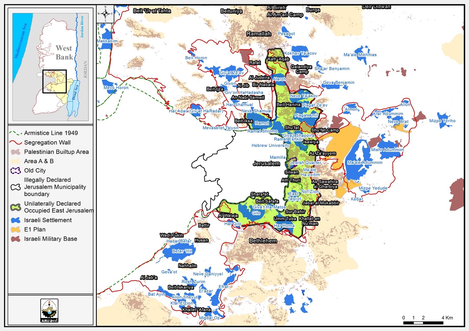
Jalud is a small Palestinian agricultural village spreading over an area of 4,000 acres. It is located 16 miles from the Palestinian city of Nablus (Figure 1). Since 1967, Jalud has been subjected to a continuous wave of aggression by the Israeli occupying authority. In 1992, 750 acres were confiscated from Jalud and the nearby village of Turmus ’Ayya to construct an industrial zone to serve the nearby colonies (Figure 2).). Since 1967, Jalud has been subjected to a continuous wave of aggression by the Israeli occupying authority. In 1992, 750 acres were confiscated from Jalud and the nearby village of Turmus ’Ayya to construct an industrial zone to serve the nearby colonies ().
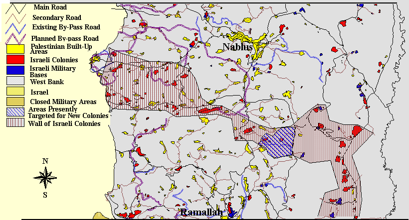
In November 1996, hundreds of acres of agricultural land belonging to the Palestinian villages of Jalud and Qaryut were bulldozed. More recently, three hundred fruit trees have been uprooted to facilitate the construction of a road to primarily serve Jewish colonists. So far, two colonies called Shillo and Mizpe Rahil have been constructed on Jalud's cultivated land. A new proposed colony, called Tel Shillo, is to be constructed on Jalud's land at a location south of Shillo. The expropriation of Jalud's agricultural land for the purpose of building Israeli colonies and their infrastructure is part of a comprehensive plan by Israel to retain control over the west central parts of the West Bank, in an attempt to create a wall of colonies that would separate The Ramallah District in the central parts of the West Bank from Nablus in the north.
Figure 1: Location map of Jalud
Figure 2: Photo illustrating the Israeli activities on the land of Jalud and Turmus ‘Ayya.
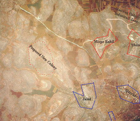
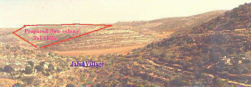
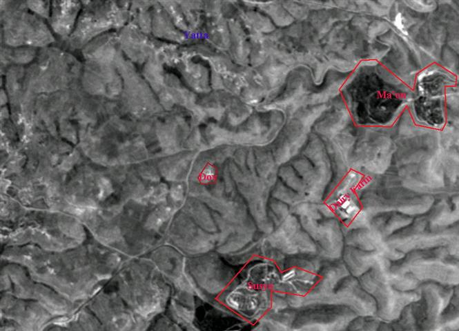
The new colony of Tel Shillo will be an independent colony in its own. The construction of this colony has already led to the confiscation of more than 1,000 acres of land belonging to the village of Jalud. Additionally, around 500 trees were uprooted from the nearby village of Qaryut to make space for a road to service this colony. Tel Shillo will be a stumbling block for the development of the surrounding Palestinian areas; its location hinders the geographical contiguity of the occupied Palestinian territories.
Figure 3: Aerial photo showing the location of the new proposed colony Tel Shillo
Figure 4: Photo showing the location of Tel Shillo close to Jalud village.
In sum, the colonizing activities in and around Jalud are part of an Israeli scheme in the occupied Palestinian territories to build a wall of colonies which would disconnect the southern parts of the West Bank from its northern parts (Figure 1). This scheme aims at creating a linkage between the Israeli colonies southwest of Nablus with one another and with Ma’ale Levona colony on Lubban road and the neighboring colony of Eli, further extending to Shillo, Rachelim, Migdalim and Ma’ale Efraym on the borders of the Jordan Valley. The land continuity between Ramallah and Nablus Districts will therefore be lost, thus isolating the northern parts from the remaining parts of the West Bank (Figure 5). This scheme will place Palestinian cities and villages in buntustans with access to each other only through Israeli controlled territories. The bird’s eye view of the geographical distribution of these colonizing activities indicates the construction of this wall of colonies extending horizontally across the borders of the West Bank (Figure 6). Such a scheme is another unilateral act by Israel which jeopardizes the progress of the peace talks and manipulates the outcome of the final status negotiations. Such schemes dictate Israel's will and compromise the Palestinians' legitimate right to a Palestinian State in which individuals are able to travel around without any restrictions. ). This scheme aims at creating a linkage between the Israeli colonies southwest of Nablus with one another and with Ma’ale Levona colony on Lubban road and the neighboring colony of Eli, further extending to Shillo, Rachelim, Migdalim and Ma’ale Efraym on the borders of the Jordan Valley. The land continuity between Ramallah and Nablus Districts will therefore be lost, thus isolating the northern parts from the remaining parts of the West Bank (). This scheme will place Palestinian cities and villages in buntustans with access to each other only through Israeli controlled territories. The bird’s eye view of the geographical distribution of these colonizing activities indicates the construction of this wall of colonies extending horizontally across the borders of the West Bank (). Such a scheme is another unilateral act by Israel which jeopardizes the progress of the peace talks and manipulates the outcome of the final status negotiations. Such schemes dictate Israel's will and compromise the Palestinians' legitimate right to a Palestinian State in which individuals are able to travel around without any restrictions.
Figure 5: Map showing the wall of colonies in the center of the West Bank.
Figure 6: Satellite image showing the continuity of the Israeli colonies in a horizontal line.
Prepared by:
The Applied Research Institute – Jerusalem


