• About The Project
  • Palestine in Century
  • Selected Maps
  • Glossary
  • About ARIJ
  • About LRC
  • By Year
    • Case Studies By Year
    • Daily Report By Year
Saturday, May 10, 2025
POICA
No Result
View All Result
  • Home
  • Settlements
    • New Israeli Settlements
    • Settlement Expansion
  • Israeli Violations
    • Agriculture
    • Confiscation
    • Demolition
    • Environment
    • Eviction of Palestinians
    • Settlers Attacks
  • Bypass Roads
  • Israeli Plans
  • Segregation
    • Checkpoints
    • Closure
    • Separation Plans
  • Military Orders
  • Reports
    • Daily Report
    • Monthly Report
    • Quarterly Report
No Result
View All Result
POICA
No Result
View All Result

Israeli Occupation Authorities Confiscate Tens of Agricultural Dunums in the Village of Jalboun

October 7, 2009
in Confiscation
Violation: The declaration of the confiscation of 73.5 dunums while obligating farmers to remove all what have been rehabilitated as to return the land to its previous initial status.
 
Date: July 25th, 2009.
 
Location: Jalboun lands in Parcel 12 pieces 11 and 12.
 
Land Description: Mostlyagricultural lands.
 
Violator: The Central Investigation Committee associated by the so-called Israeli “Civil” Administration. 
 
Confiscation Motive: To establish a road to be used for military purposes. The road is planned to connect between the village of Jalboun and the military gate in the Racist Isolation Wall isolating lands south of the village.
 
Owners of Targeted Lands: The owners of the targeted lands are all from the town of Ya’abad. The following table lists them and other relevant information:
Name of Farmer
Area in Dunums
Parcel No.
The brothers Omar. Mohammad and Farhan Ragheb Al Roub
 
64
Parcel 12, Piece Number 11
Hasan Asa’ad Abu Al Roub
9.5
Parcel 12, Piece Number 12
TOTAL
73.5
 
 
Details:
On the 25th of July, 2009, the said Committee issued a military order confiscating agricultural lands located near the Racist Isolation Wall east of the village. The stated purpose of the confiscation is to construct a military road running parallel to the Racist Wall.
 
 
Order 1+2: The Military Order in Hebrew
  

Order A+B+C: The Military Order in Arabic
 
The ‘Civil” Administration claims that the targeted lands that are ‘State Lands” while the farmers insist that they own andor work in the lands in accordance with official papers issued during the Jordanian rein of power.
 
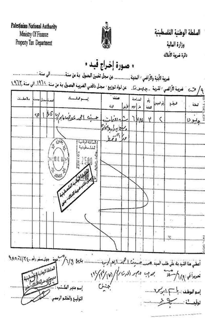
Photo 1: An ownership deed proving the land ownership in
the name of Mr. Hussein Ahmad Awad Abu Al Roub.
 
The intended road covers a distance of 2 kilometers stretching from the eastern outskirts of the village of Jalboun until it reaches the said gate in the Racist Wall. It is designed to be used, according to the Order, only by the Israeli Military. Tens of dunums along the path of the new road will be confiscated and the Palestinian population living in the vicinity of the road will be affected one way or the other due to Israeli expected practices.  
 
Jalboun Village is Dying Due to Surrounding Colonies and the Isolation Wall:
The village of Jalboun is considered to be a prime and classical example of the suffering of Palestinian villages since the Nakba of 1948; it has seen all of the policies and violations perpetrated by the Israeli occupation while resisting all of these policies through being steadfast on the ground despite all of the daily threats and harassment from the occupation forces.   
 
It is worth pointing out that the Israeli occupation forces have confiscated most of the lands of the village which used to reach as far as the Jordanian borders. The violations continued upon the establishment of the Racist Isolation Wall in the year 2002 as more than 2,000 dunums were confiscated from the villages’ lands to erect the Wall which stands at a distance of 4 meters away from some of the houses in the village.
 
Another aspect of the suffering of the village is the establishment of Israeli colonies atop its lands which caused, among other things, an environmental pollution in the village as most of the waste water and sewage produced by these colonies are dumped deliberately into the northern and eastern parts of the village causing a number of environmental and health ills.
 

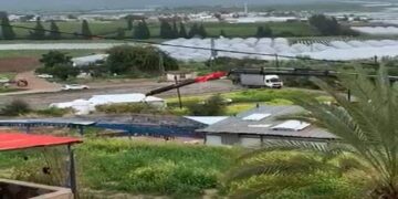
Photo 2: A general view of the Israeli Racist Wall established atop Jalbouns’ lands.
 
 Jalboun Village: General Information
The village of Jalboun is located 10 kilometers northeast of the city of Jenin. Its total area is 9,308 dunums while its build-up area is estimated to be 590 dunums. Israeli occupation forces confiscated 1,432 dunums of its lands for the benefit of the Israeli Racist Wall and the colonies of Jalbou’a and King Yashou’. The population of the village is 2,390, according to the Palestinian Central Bureau of Statistics’s census of 2007.
 
The village is located 300 meters above sea level. The villages of Faqou’a and Al Mughayyer are located north of the village, Deir Abu Da’eif is located west of the village while the village of Al Mughayyer is located south of it.
 
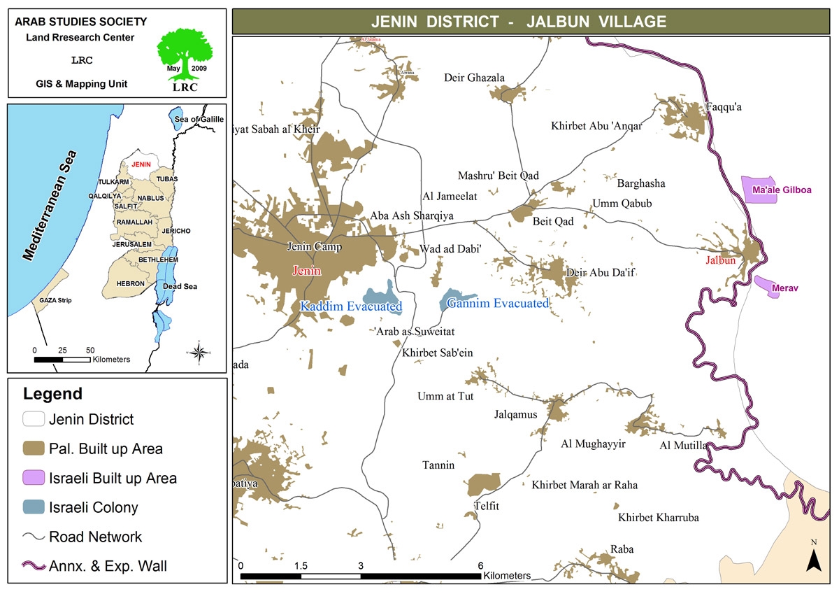
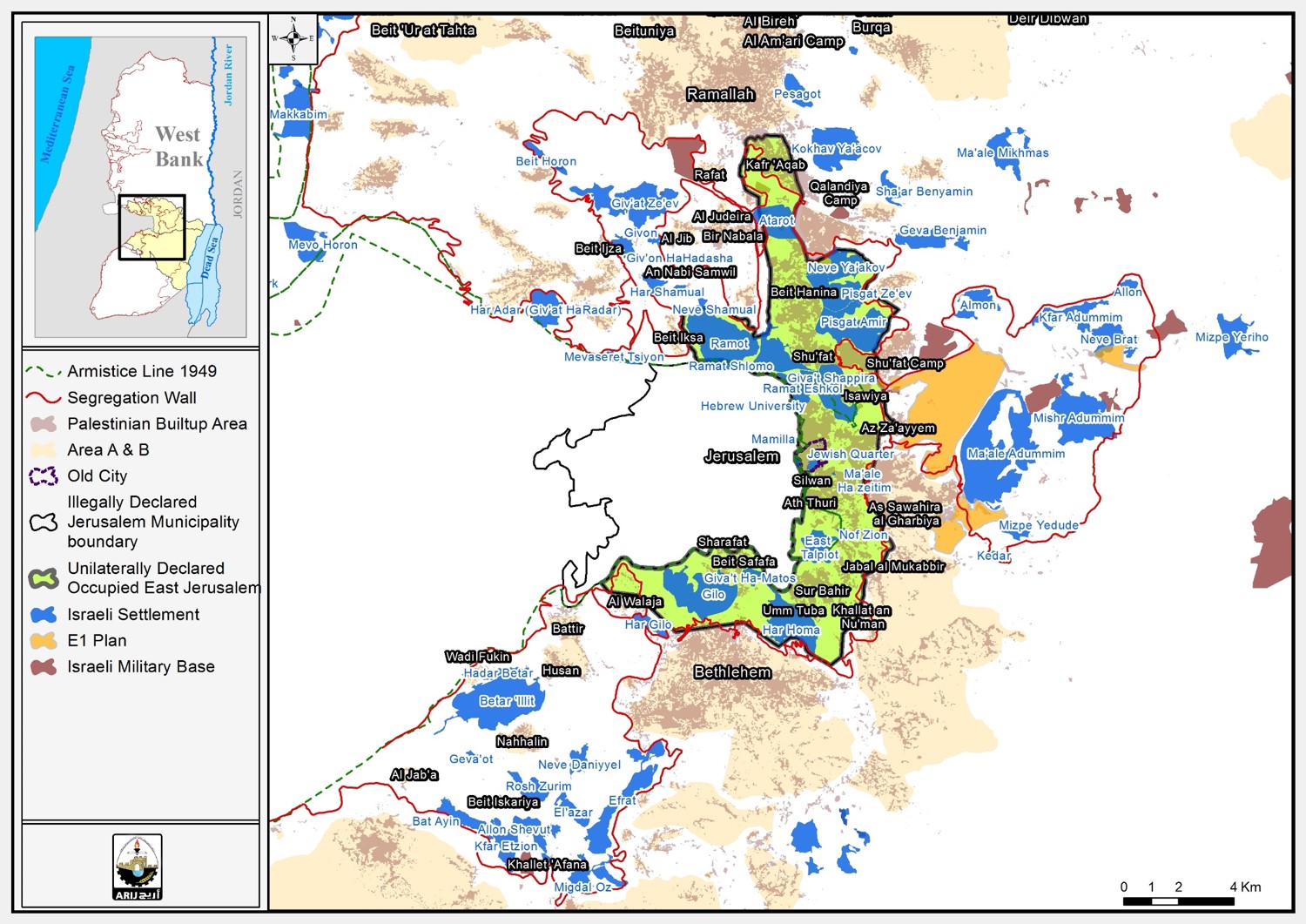
Map 1: The Village of Jalboun
 
There is only one clan in the village; the clan of Abu Al Roub. Around 90% of the inhabitants of the village are 1948 refugees.


Prepared by:
The Land Research Center
LRC


Recommended For You

هدم وسرقة بيت تعبئة زراعي في كردلة – ضربة موجعة للاقتصاد المحلي

by arij
January 21, 2025
0
Demolition and Theft of an Agricultural Packing Facility in Kardala: A Severe Blow to the Local Economy

تفاصيل الانتهاك: منذ احتلال الضفة الغربية عام 1967، باتت قرية كردلة هدفًا رئيسيًا للاحتلال الإسرائيلي الذي يسعى بكل الوسائل لتفريغها من سكانها الأصليين، تمهيدًا للاستيلاء على أراضيها ومواردها....

Read moreDetails

Demolition and Theft of an Agricultural Packing Facility in Kardala: A Severe Blow to the Local Economy

by arij
January 20, 2025
0
Demolition and Theft of an Agricultural Packing Facility in Kardala: A Severe Blow to the Local Economy

Since the occupation of the West Bank in 1967, the village of Kardala has become on the list of the prime and major targets for the Israeli occupation,...

Read moreDetails

تستهدف ما يزيد عن6900, تسجيل الأراضي في القدس في خدمة مشروع الاستيطان الإسرائيلي وشرعنة الاستيلاء على الأرض

by arij
May 8, 2023
0
POSITION PAPER: A Land Mine before the “Two State Solution

   تسوية الأراضي هي أحدى اهم حيل إسرائيل لتهويد القدس الشرقية، وقد كان القضاء الإسرائيلي قد أصدر إعلاناً عن بدء "تسوية أراضٍ" بمسميات وأرقام جديدة للأحواض في احياء...

Read moreDetails

الاحتلال يصادر محتويات منتزه في جبل السنداس جنوب مدينة الخليل

by arij
September 14, 2022
0
الاحتلال يصادر محتويات منتزه في جبل السنداس جنوب مدينة الخليل

  الانتهاك: مصادرة مواد منتزه. تاريخ الانتهاك: 31/08/2022. الموقع: جبل السنداس/ مدينة الخليل. الجهة المعتدية: الإدارة المدنية التابعة للإحتلال. الجهة المتضررة: المواطن يسري الجمل. التفاصيل: أقدمت سلطات الاحتلال...

Read moreDetails

The Occupation Confiscates Properties of a Park Owner at Hebron City

by arij
September 15, 2022
0
الاحتلال يصادر محتويات منتزه في جبل السنداس جنوب مدينة الخليل

  Violation: Confiscation of park properties. Date: August 31st 2022. Location: As-Sindas Mountain / Hebron city. Perpetrators: The Israeli Civil Administration. Victims: Citizen Yusri Aj-Jamal. Description: Wednesday ,...

Read moreDetails
Next Post

Water – A question of survival For Palestinians

LATEST NEWS

الأراضي الفلسطينية بين الذرائع الأمنية والأطماع الاستيطانية – “الأمن، الآثار، والطبيعة كحجج لاقتلاع الفلسطينيين من أراضيهم”

by arij
April 15, 2025
0

........................................................

الطرق الالتفافية الاسرائيلية وأثرها على البيئة الفلسطينية

انتهاك للطبيعة والهوية في الأراضي الفلسطينية المحتلة

by arij
March 17, 2025
0

........................................................

Israel Advances Settlement Plan on Ancient Olive Groves on lands of Beit Jala city, Violating International Law and depriving Palestinians their lands

إسرائيل تمضي قدمًا في مخطط استيطاني جديد على أراضي مدينة بيت جالا، في انتهاك للقانون الدولي وحرمان الفلسطينيين من أراضيهم

by arij
April 29, 2025
0

........................................................

Israel Advances Settlement Plan on Ancient Olive Groves on lands of Beit Jala city, Violating International Law and depriving Palestinians their lands

Israel Advances Settlement Plan on Ancient Olive Groves on lands of Beit Jala city, Violating International Law and depriving Palestinians their lands

by arij
April 29, 2025
0

........................................................

flag_yellow_lowEU-PfP-Logo

This website has been produced with the assistance of the European Union. The contents of this publication are the sole responsibility of ARIJ & LRC and can in no way be taken to reflect the views of the European Union.

© 2025 Copyright ARIJ . All Rights reserved. .

No Result
View All Result
  • Home
  • Settlements
    • New Israeli Settlements
    • Settlement Expansion
  • Israeli Violations
    • Agriculture
    • Confiscation
    • Demolition
    • Environment
    • Eviction of Palestinians
    • Settlers Attacks
  • Bypass Roads
  • Israeli Plans
  • Segregation
    • Checkpoints
    • Closure
    • Separation Plans
  • Military Orders
  • Reports
    • Daily Report
    • Monthly Report
    • Quarterly Report

© 2025 Copyright ARIJ . All Rights reserved. .