• About The Project
  • Palestine in Century
  • Selected Maps
  • Glossary
  • About ARIJ
  • About LRC
  • By Year
    • Case Studies By Year
    • Daily Report By Year
Tuesday, May 26, 2026
POICA
No Result
View All Result
  • Home
  • Settlements
    • New Israeli Settlements
    • Settlement Expansion
  • Israeli Violations
    • Agriculture
    • Confiscation
    • Demolition
    • Environment
    • Eviction of Palestinians
    • Settlers Attacks
  • Bypass Roads
  • Israeli Plans
  • Segregation
    • Checkpoints
    • Closure
    • Separation Plans
  • Military Orders
  • Reports
    • Daily Report
    • Monthly Report
    • Quarterly Report
  • Home
  • Settlements
    • New Israeli Settlements
    • Settlement Expansion
  • Israeli Violations
    • Agriculture
    • Confiscation
    • Demolition
    • Environment
    • Eviction of Palestinians
    • Settlers Attacks
  • Bypass Roads
  • Israeli Plans
  • Segregation
    • Checkpoints
    • Closure
    • Separation Plans
  • Military Orders
  • Reports
    • Daily Report
    • Monthly Report
    • Quarterly Report
No Result
View All Result
POICA
No Result
View All Result

Halt of Work Notices for Residential and Agricultural facilities in Kafr Ad-Dik / Salfit governorate

January 11, 2021
in Military Orders
إخطارات بوقف العمل في منشآت سكنية وزراعية في بلدة كفر الديك بمحافظة سلفيت


  • Violation: Halt Of Work Notices for Residential and Agricultural facilities.
  • Location: Kafr Ad-Dik / West Salfit.
  • Date: July 16th 2020.
  • Perpetrator: The Building and Organization Department – The Civil Administration.
  • Victims / Affected: A mosque and 14 families at the village.

Description:

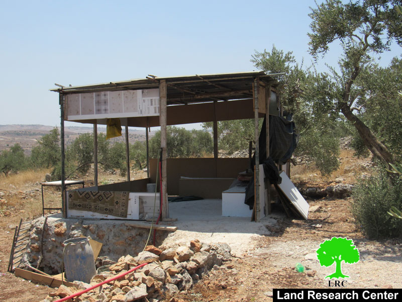
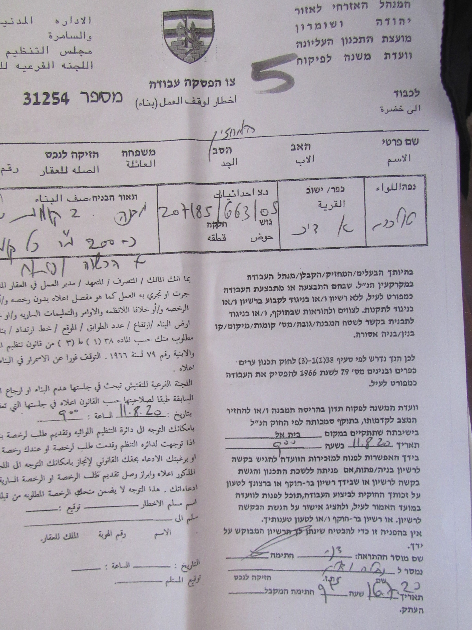
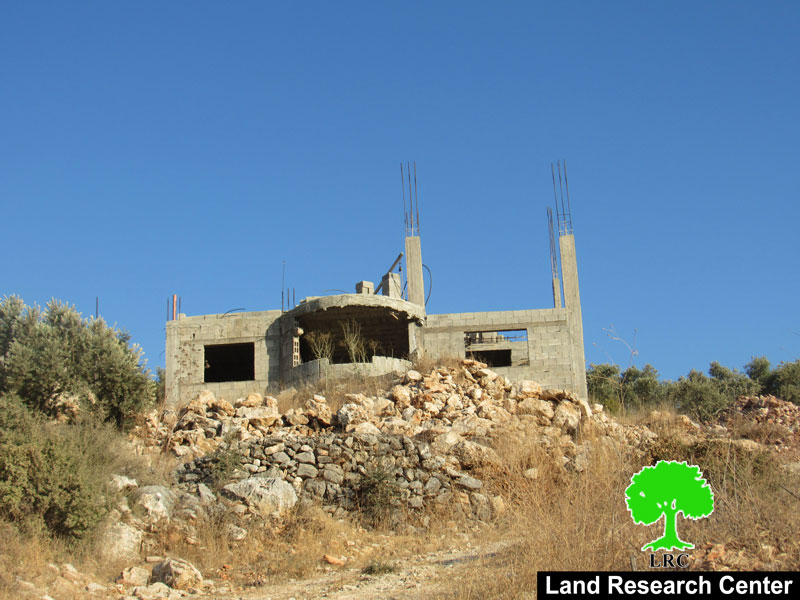
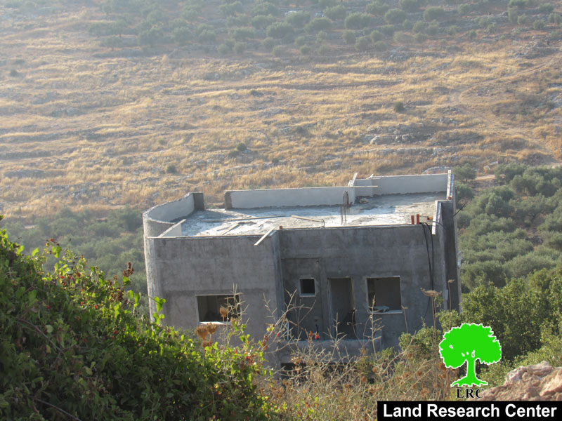
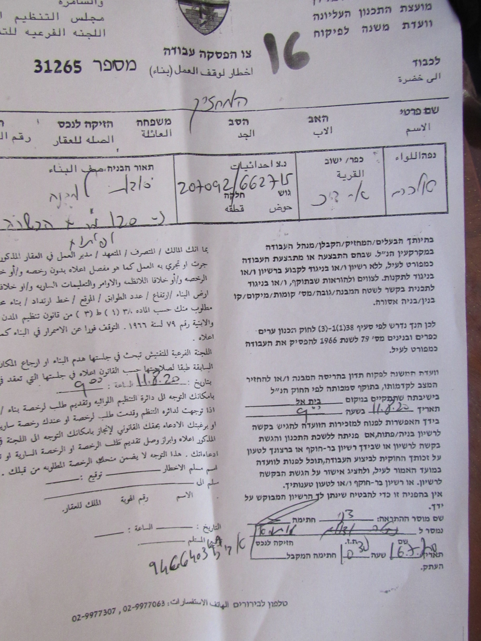
Thursday, July 16th 2020, The Israeli Occupation forces accompanied by the building and organization officer In the Israeli Civil Administration raided Ash-She’ab area to the west of Kafr Ad-Dik , and served halt of work notices on the pretext of building in C area without licenses , the targeted structures are located in an area nearby Peduel settlement cluster and Alei Zahav colony on the town’s lands.

The following table shows more information about the targeted facilities:

Owner

Family members

Notice number

The targeted facility

Photo

Rami ‘Ali Ahmed

8

31251

Under construction house / two floors (320 m2)

1

Younis Ad-Deek

5

31253

Inhabited house / one floor (180 m2)

2

Yaoub Naji

2

31254

One floor house and a Basement (210 m2)

3

Under Construction mosque

–

31256

Under construction house / One floor (200 m2)

4

Othman Ad-Deek

3

31257

Under construction house / One floor 90 m2

5

Mahdi Ad-Deek

6

31258

Under Construction house and a basement (210 m2)

6

Ihab Ad-Deek

3

31042

Inhabited house  two floors (280m2)

7

‘Adnen Ad-Deek

6

N/A

Under Construction house / One floor 180 m2

8

Ahmed Ad-Deek

2

31260

Under Construction house / One floor 210 m2

9

Adam Ad-Deek

2

N/A

Under Construction house / One floor 180 m2

10

Basheer Ad-Deek

7

N/A

Under Construction house / One floor and a ceiling 200 m2

11

Mohammed Naji

2

31263

Stores / under construction 145 m2

12

Rami Naji

8

31264

House / two floors under construction  340m2

13

Hani Naji

5

31265

Agricultural room 60 m2 built of bricks and zinc.

14

Ibrahim Naji

4

31266

Agricultural room built of bricks and zinc 45 m2.

15

total

63


Source: Firsthand field observation, Israeli Violations Monitoring Section – Land Research Center.

Kafr Ad-Deek mayor Mohammed Issa Ad-Deek told LRC the following:

“Al-She’ab area is the only escape for people of Kafr Ad-Deek now that construction is increasing rapidly , as a result of the occupation authorities ban of construction in both northern and western areas of the village , residents have only the middle to build in , this created a rough reality and made life almost impossible in the village.”

Kafr ad Dik:[1]

Kafr ad Dik is located 15 km to the west of Salfit. It is surrounded by Bidya (north), Rafat and Deir Ballut (west), Bruqin and Sarta (east), and Bani Zaid villages (south).

Kafr ad Dik has a population of 5551 people, according to a 2017 census.

Its total area is 15529 dunums; however, it has been suffocated by bypasses and 3 Israeli colonies that lay over its lands.

This has further limited its expansion knowing that it had already had a 791-dunum organizational plan (built-up area); it also isolated the village from its surroundings.

The Israeli occupation confiscated 2477 dunums of Kafr ad Dik lands for the benefit of:

  1. Colonies devoured 1225 dunums, and they are:

Name of colony

Year of construction

Area of confiscated land/ dunum

Number of colonists

Har Eli Zahav

1983.

134.

339.

Eli Zahav- Yoezer

1982.

290.

424.

Bedoel

1984.

800.

1088.

·

1999.

1.

339.

·

1225.

1512.

*Source: Field Research- Monitoring Israeli Violations Team- Land Research Centre (LRC).

  1. Bypasses stole 362 dunums
  2. The Apartheid Wall seized 890 dunums and isolated 8824 dunums and is expected to be 8905 long in Kafr ad Dik lands.

Lands of Kfar ad-Dik are categorized according to Oslo Accords into lands under Area B (15% of the lands) and lands under Area C (85% of the lands).


[1] GIS-LRC


Prepared by

The Land Research Center
LRC

Recommended For You

سلطات الاحتلال الإسرائيلي بصدد الاستيلاء على موقع قبر النبي صموئيل شمال غرب مدينة القدس

by arij
May 23, 2026
0
سلطات الاحتلال الإسرائيلي بصدد الاستيلاء على موقع قبر النبي صموئيل شمال غرب مدينة القدس

 نشرت سلطات الاحتلال الإسرائيلي في الثامن عشر من شهر أيار من العام 2026 اعلانا مفاده الاستيلاء على الأراضي الفلسطينية في قرية النبي صموئيل شمال غرب القدس المحتلة. وجاء...

Read moreDetails

إقامة منطقة عسكرية عسكرية داخل أراضي (أ) في جنين

by arij
May 19, 2026
0
إقامة منطقة عسكرية عسكرية داخل أراضي (أ) في جنين

   في السابع من شهر أيار من العام 2026، وزعت سلطات الاحتلال الإسرائيلي أمرا عسكريا جديدة على أهالي مدينة جنين يقضي بمصادرة 7.2 دونما من الأراضي الفلسطينية في...

Read moreDetails

“بمساحة اجمالية 177 دونما من أرضي البيرة وبيتين”, طريق استيطاني لخدمة البؤر الاستيطانية في محافظة رام الله

by arij
May 18, 2026
0
“بمساحة اجمالية 177 دونما من أرضي البيرة وبيتين”, طريق استيطاني لخدمة البؤر الاستيطانية في محافظة رام الله

في الحادي عشر من شهر أيار من العام 2026, نشرت دائرة أراضي إسرائيل اعلانا جديدا يقضي بمصادرة المزيد من الأراضي الفلسطينية في محافظة رام الله لأغراض استيطانية في...

Read moreDetails

“في خدمة مستوطنة ناحال حيلتس”, طريق استيطاني إسرائيلي جديد على أراضي بتير وبيت جالا في محافظة بيت لحم

by arij
May 18, 2026
0
“في خدمة مستوطنة ناحال حيلتس”, طريق استيطاني إسرائيلي جديد على أراضي بتير وبيت جالا في محافظة بيت لحم

تواصل سلطات الاحتلال الإسرائيلي إحكام سيطرتها على المزيد من الأراضي الفلسطينية في الضفة الغربية المحتلة، وهذه المرة من خلال استهداف أراضي محافظة بيت لحم. ففي السادس والعشرين من...

Read moreDetails

مناطق نفوذ المستوطنات ودورها في إعادة تشكيل الجغرافيا الفلسطينية

by arij
April 23, 2026
0
مناطق نفوذ المستوطنات ودورها في إعادة تشكيل الجغرافيا الفلسطينية

أصدرت سلطات الاحتلال الإسرائيلي في العاشر من شهر نيسان 2026 الكراسة رقم (273)، وهي وثيقة تضم مجموعة من المناشير والأوامر والتعيينات الإسرائيلية المتعلقة بالجوانب الأمنية والعسكرية والإدارية، إضافة...

Read moreDetails
Next Post
Notice of demolition for three agricultural facilities in Rantis village / Ramallah governorate

Notice of demolition for three agricultural facilities in Rantis village / Ramallah governorate

LATEST NEWS

سلطات الاحتلال الإسرائيلي بصدد الاستيلاء على موقع قبر النبي صموئيل شمال غرب مدينة القدس

سلطات الاحتلال الإسرائيلي بصدد الاستيلاء على موقع قبر النبي صموئيل شمال غرب مدينة القدس

by arij
May 23, 2026
0

........................................................

إقامة منطقة عسكرية عسكرية داخل أراضي (أ) في جنين

إقامة منطقة عسكرية عسكرية داخل أراضي (أ) في جنين

by arij
May 19, 2026
0

........................................................

الآثار كأداة للضم الزاحف: مشروع القانون الإسرائيلي لإعادة هندسة الجغرافيا والهوية في الضفة الغربية

الآثار كأداة للضم الزاحف: مشروع القانون الإسرائيلي لإعادة هندسة الجغرافيا والهوية في الضفة الغربية

by arij
May 23, 2026
0

........................................................

النكبة الفلسطينية في ذكراها الثامنة والسبعين: من التطهير العرقي إلى الإبادة وإعادة هندسة الجغرافيا الفلسطينية 

النكبة الفلسطينية في ذكراها الثامنة والسبعين: من التطهير العرقي إلى الإبادة وإعادة هندسة الجغرافيا الفلسطينية 

by arij
May 18, 2026
0

........................................................

flag_yellow_lowEU-PfP-Logo

This website and its content were initiated in 1993 by the Applied Research Institute – Jerusalem (ARIJ) and the Land Research Center (LRC) with the support from the European Union up until 2023. Since then, the Applied Research Institute – Jerusalem (ARIJ) has taken over the continued development and maintenance of the website. The views expressed remain solely those of ARIJ) and do not necessarily reflect those of the European Union.

© 2026 Copyright | ARIJ | All Rights reserved.

No Result
View All Result
  • Home
  • Settlements
    • New Israeli Settlements
    • Settlement Expansion
  • Israeli Violations
    • Agriculture
    • Confiscation
    • Demolition
    • Environment
    • Eviction of Palestinians
    • Settlers Attacks
  • Bypass Roads
  • Israeli Plans
  • Segregation
    • Checkpoints
    • Closure
    • Separation Plans
  • Military Orders
  • Reports
    • Daily Report
    • Monthly Report
    • Quarterly Report

© 2026 Copyright | ARIJ | All Rights reserved.