• About The Project
  • Palestine in Century
  • Selected Maps
  • Glossary
  • About ARIJ
  • About LRC
  • By Year
    • Case Studies By Year
    • Daily Report By Year
Sunday, June 14, 2026
POICA
No Result
View All Result
  • Home
  • Settlements
    • New Israeli Settlements
    • Settlement Expansion
  • Israeli Violations
    • Agriculture
    • Confiscation
    • Demolition
    • Environment
    • Eviction of Palestinians
    • Settlers Attacks
  • Bypass Roads
  • Israeli Plans
  • Segregation
    • Checkpoints
    • Closure
    • Separation Plans
  • Military Orders
  • Reports
    • Daily Report
    • Monthly Report
    • Quarterly Report
No Result
View All Result
POICA
No Result
View All Result

Infographic – The Geopolitics of Area C

February 11, 2020
in Israeli Violations
Infographic – The Geopolitics of Area C

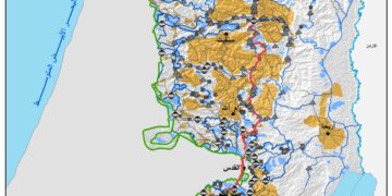
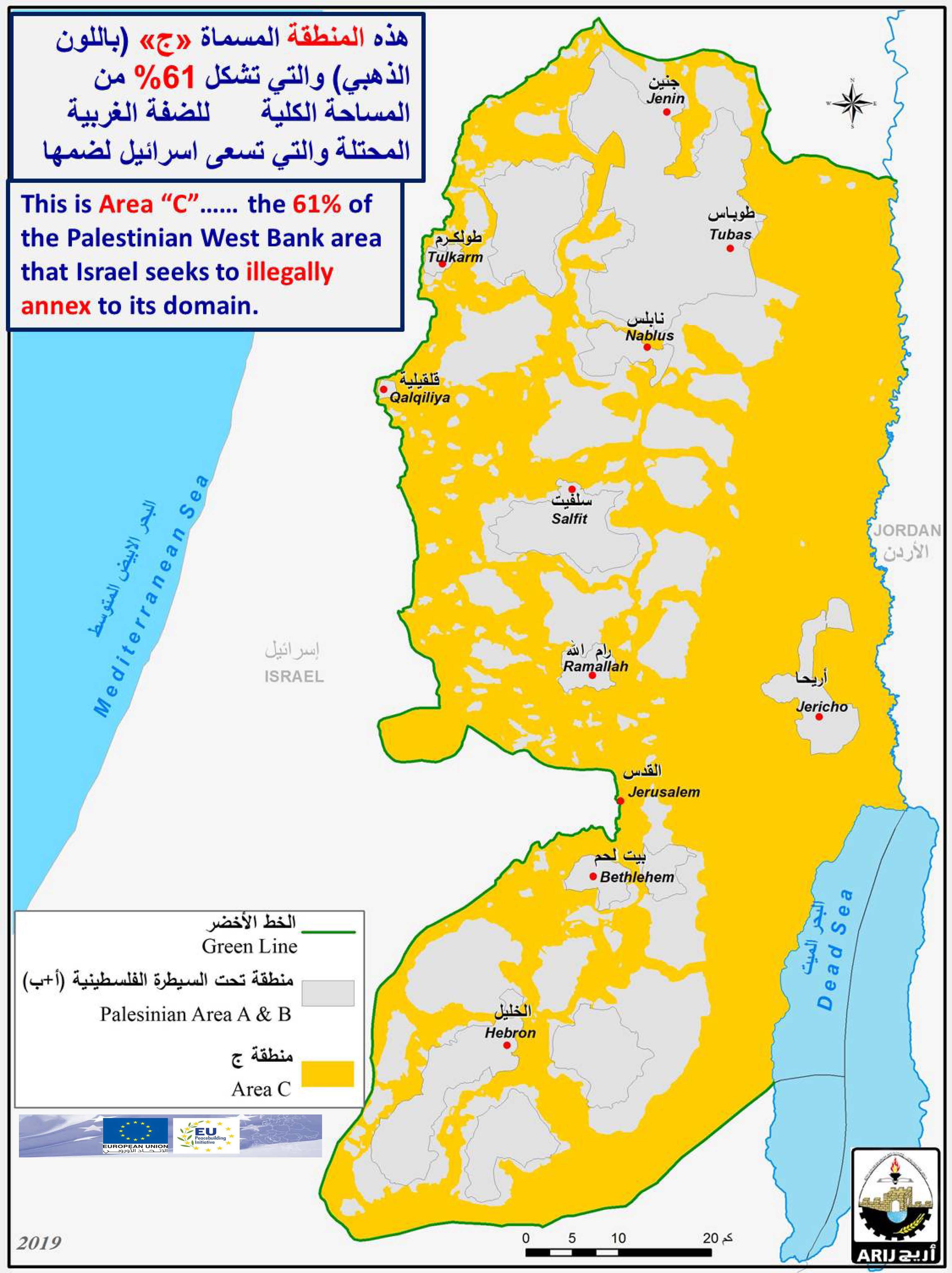
This is Area “C”…… the 61% area of the Palestinian West Bank that Israel seeks to illegally annex to its domain. Without it Palestinians can’t enjoy viable geographically contiguous State and:

  • Viable Independent Economy,
  • Access to the outside world,
  • Control over resources (Land & Water),
  • Freedom of Movement,
  • Expansionist habitable areas
  • Agricultural, Industrial & Commercial areas

#Area_C #Palestine #restrictions #viable_state #natural_resources


هذه المنطقة المسماة «ج» والتي تشكل 61% من المساحة الكلية للضفة الغربية المحتلة والتي تسعى اسرائيل لسلخها من الاراضي الفلسطينية وضمها. بدونها لا يمكن للفلسطينيين التمتع بدولة حيوية قابلة للحياة ذات تواصل جغرافي، وايضا:


• اقتصاد مستقل قابل للحياة ،
• الوصول إلى العالم الخارجي ،
• السيطرة على الموارد (الأرض والمياه) ،
• حرية الحركة
• المناطق التوسعية الصالحة للحياة
• المناطق الزراعية والصناعية والتجارية

#منطقة_C #فلسطين #موارد_طبيعية #حرية_حركة


Prepared by
The Applied Research Institute – Jerusalem
ARIJ

Recommended For You

النكبة الفلسطينية في ذكراها الثامنة والسبعين: من التطهير العرقي إلى الإبادة وإعادة هندسة الجغرافيا الفلسطينية 

by arij
May 18, 2026
0
النكبة الفلسطينية في ذكراها الثامنة والسبعين: من التطهير العرقي إلى الإبادة وإعادة هندسة الجغرافيا الفلسطينية 

تحل الذكرى الثامنة والسبعون للنكبة الفلسطينية في ظل واحدة من أكثر المراحل دموية وخطورة في التاريخ الفلسطيني المعاصر، حيث تتداخل آثار النكبة الأصلية لعام 1948 مع واقع الحرب...

Read moreDetails

بين قصرة وترمسعيا: العنف الاستيطاني الاسرائيلي يضرب المجتمع الفلسطيني

by arij
May 6, 2026
0

في الثالث من شهر أيار من العام 2026، شهد مزارعون في عدة قرى في الضفة الغربية المحتلة على مشهد بات مألوفًا وقاسيا في آنٍ واحد: أشجار مثمرة مقطوعة...

Read moreDetails

INFOGRAPHIC: ISRAELI SETTLER VIOLENCE IN 2025

by arij
April 16, 2026
0

INFOGRAPHIC: ISRAELI SETTLER VIOLENCE IN 2025     Prepared by:   The Applied Research Institute – Jerusalem  

Read moreDetails

أدوات غير مباشرة للاستيطان الإسرائيلي في مناطق (أ) و(ب) لإعادة تشكيل الجغرافيا والسيطرة في الضفة الغربية   

by arij
April 16, 2026
0
العدالة المؤجلة ورأي بلا تنفيذ: من قرار المحكمة إلى واقع الضم

منذ توقيع اتفاقيات أوسلو في تسعينيات القرن الماضي، تم تقسيم الضفة الغربية إلى ثلاث مناطق إدارية وأمنية: (أ)، (ب)، و(ج)، بهدف تنظيم المرحلة الانتقالية نحو تسوية نهائية. وبموجب...

Read moreDetails

INFOGRAPHIC: Palestinian Trees – Victims of the Israeli occupation Army & Settler Groups in 2025

by arij
April 16, 2026
0

    INFOGRAPHIC: Palestinian Trees - Victims of the Israeli occupation Army & Settler Groups in 2025 Prepared by:   The Applied Research Institute – Jerusalem  

Read moreDetails
Next Post

ARIJ Daily Report – Wed, 11th 09 2019

LATEST NEWS

الاحتلال الاسرائيلي يوسع سيطرته على أراضي جبل الفرديس بمصادرة 317 دونما

الاحتلال الاسرائيلي يوسع سيطرته على أراضي جبل الفرديس بمصادرة 317 دونما

by arij
June 13, 2026
0

........................................................

بواقع 19 دونما – سلسلة من الأوامر العسكري الإسرائيلي تستهدف أراضي محافظة بيت لحم بذريعة الأغراض العسكرية

بواقع 19 دونما – سلسلة من الأوامر العسكري الإسرائيلي تستهدف أراضي محافظة بيت لحم بذريعة الأغراض العسكرية

by arij
June 13, 2026
0

........................................................

بمساحة اجمالية بلغت 208 دونما – سلطات الاحتلال الإسرائيلي تصادر الاراضي في محافظة طوباس لصالح معسكر اسرائيلي

بمساحة اجمالية بلغت 208 دونما – سلطات الاحتلال الإسرائيلي تصادر الاراضي في محافظة طوباس لصالح معسكر اسرائيلي

by arij
June 13, 2026
0

........................................................

الاحتلال يرسّخ بؤرة “يتسيف” الاستيطانية عبر تخصيص 92 دونماً من أراضي بيت ساحور

الاحتلال يرسّخ بؤرة “يتسيف” الاستيطانية عبر تخصيص 92 دونماً من أراضي بيت ساحور

by arij
June 9, 2026
0

........................................................

flag_yellow_lowEU-PfP-Logo

This website and its content were initiated in 1993 by the Applied Research Institute – Jerusalem (ARIJ) and the Land Research Center (LRC) with the support from the European Union up until 2023. Since then, the Applied Research Institute – Jerusalem (ARIJ) has taken over the continued development and maintenance of the website. The views expressed remain solely those of ARIJ) and do not necessarily reflect those of the European Union.

© 2026 Copyright | ARIJ | All Rights reserved.

No Result
View All Result
  • Home
  • Settlements
    • New Israeli Settlements
    • Settlement Expansion
  • Israeli Violations
    • Agriculture
    • Confiscation
    • Demolition
    • Environment
    • Eviction of Palestinians
    • Settlers Attacks
  • Bypass Roads
  • Israeli Plans
  • Segregation
    • Checkpoints
    • Closure
    • Separation Plans
  • Military Orders
  • Reports
    • Daily Report
    • Monthly Report
    • Quarterly Report

© 2026 Copyright | ARIJ | All Rights reserved.