• About The Project
  • Palestine in Century
  • Selected Maps
  • Glossary
  • About ARIJ
  • About LRC
  • By Year
    • Case Studies By Year
    • Daily Report By Year
Friday, August 7, 2026
POICA
No Result
View All Result
  • Home
  • Settlements
    • New Israeli Settlements
    • Settlement Expansion
  • Israeli Violations
    • Agriculture
    • Confiscation
    • Demolition
    • Environment
    • Eviction of Palestinians
    • Settlers Attacks
  • Bypass Roads
  • Israeli Plans
  • Segregation
    • Checkpoints
    • Closure
    • Separation Plans
  • Military Orders
  • Reports
    • Daily Report
    • Monthly Report
    • Quarterly Report
  • Home
  • Settlements
    • New Israeli Settlements
    • Settlement Expansion
  • Israeli Violations
    • Agriculture
    • Confiscation
    • Demolition
    • Environment
    • Eviction of Palestinians
    • Settlers Attacks
  • Bypass Roads
  • Israeli Plans
  • Segregation
    • Checkpoints
    • Closure
    • Separation Plans
  • Military Orders
  • Reports
    • Daily Report
    • Monthly Report
    • Quarterly Report
No Result
View All Result
POICA
No Result
View All Result

Israeli authorities lay their hands on a Palestinian Natural Reserve for the favour of “Alfei Menashe” colony/ Qalqilya governorate

June 13, 2019
in Military Orders
Israeli authorities lay their hands on a Palestinian Natural Reserve for the favour of “Alfei Menashe” colony/ Qalqilya governorate


  • Violation: issuing a military order targeting a Palestinian natural reserve, in an attempt to take over the area for colonial expansion.
  • Location: An-Nabi Elyas village / Qalqilya governorate.
  • Date: 05/05/2019.
  • Perpetrator: The Israeli occupation army commander in the West Bank.
  • Victims: Families in An-Nabi Elyas.

Description:

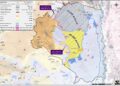
The Israeli forces commander in West Bank (Nidav Aloof) issued a military order in the 5th of May 2019, entitled “An order to cancel the declaration of a natural reserve in British Mandate era 5779 – 2019”, the order includes changing the utilities of the natural reserve that is located close to “Alfei Menashe” illegal settlement , leveling to annex the plot for the sake of expanding “Alfei Menashe”.


As the military order says, the occupation authorities gave themselves the right to change the Topographical status of a Palestinian land, in order to go in line with their colonial schemes, which is a clear violation of UN resolutions that calls on Israel to rescind its previous measures and to desist from taking any action which would result in changing the legal status and geographical nature and materially affecting the demographic composition of the Arab territories occupied since 1967. The Israeli occupation authorities consider themselves the guardian on Palestinian natural resources and properties, and frequently come up with methods to Judaize the area , change its historical identity and devour its natural resources.


An-Nabi Elyas village council head told LRC reporter:

“On one hand the occupation is imposing blockage on Ab-Nabi  Elyas village and notifying number of structures and facilities on the pretext of building without licenses – the town’s built up area is only 113 dunums which is insufficient for the village’s natural expansion – .on the other hand , they are grabbing more lands for the favor of colonization.”

 About Nabi Elyas:[1]

It is located 3km to the east of Qalqiliya governorate and is edged by Izbbet Al-Tabib and Aslah villages from the east, Arab Abu Fardeh area from the west, Jayyous town from the north and Ras Tayreh from the south.

The village populates 1399 inhabitants (2017 census) that are relative to three main families namely ( Hannun, Khleif and Majd)

Nabi Elyas has a total area of 4435 dunums, of which 113 dunums are considered the village’s built-up area.

  • Israeli illegal settlements devoured about (1,912 dunums” for the favor of Alfei Menashe settlement , which was established in 1981 , and populates 5,347 illegal Israeli settlers.
  • Bypass 55 devoured more than 134 dunums.
  • The segregation wall devoured under its route about 250 dunums , and blocked 2,539 dunums.

Oslo conventions classified the land to :

B area : (89) dunums.

C area : (4,346) dunums.

About Alfei Menashe colony:

The colony started in the 1980s after the Israeli Occupation Forces confiscated some agricultural areas from Nabi Elyas and Ras Atyyeh villages to turn them into military base. The base later developed to accommodate more colonists and caravans. In 1986, colonial activity escalated to the level of opening new roads and developing the infrastructure, devouring more dunums from the area for the sake of the colony’s expansion .

After the establishment of the apartheid wall in 2002, colonists took advantage of it to confiscate more lands and expand their colony on.

The Apartheid wall that surrounds the colony is 18,565 m long, 9,397 m are built of cement , and the rest are a steal siege.

The settlement is close to bypass 55 which leads to the occupied territories of 1948.

Israel is a racist state, it is clearly illustrated in the following examples:

  • When a natural reserve has existed in Palestine before the occupation, the Israeli authorities intent to turn the area into a colonial reserve – which is what happening to An-Nabi elyas natural reserve.
  • When a privately owned Palestinian land is naturally used by its , the occupation’s government intend to declare it a natural reserve. That is what is what happened in the case of Prophet Nun mount lands in Yanun village east Nablus, that are now declared as natural reserve and their owners were denied accessing it.

The occupation is imposing facts on the ground and changing Palestinian land’s usages.

The existence of the Israeli settlements and outposts in the West Bank and their expansions are Illegal and contradicts with the international law rules, United Nations Security Council Resolutions such as 237 (1967), 271 (1969), 446 (1979), 452 (1979) ,465 (1980.

  • Resolution 446 March 22, 1979 calls on Israel to rescind its previous measures and to desist from taking any action which would result in changing the legal status and geographical nature and materially affecting the demographic composition of the Arab territories occupied since 1967, including Jerusalem and, in particular, not to transfer parts of its own civilian population into the occupied Arab territories”
  • Also the resolution 452 of the 1979 “calls upon the Government and people of Israel to cease, on an urgent basis, the establishment, construction and planning of settlements in the Arab territories occupied since 1967, including Jerusalem.”
  • Furthermore the Forth Geneva Convention also states in Article 49 that “The occupying power shall not deport or transfer parts of its own population into the territories it occupies.” and Article 174 of the same convention “prohibits the ‘extensive destruction and appropriation of property not justified by military necessity and carried out unlawfully and wantonly.”
  • In May 2001, the head of the International Red Cross delegation to Israel and the Occupied Territoriessaid that settlements are “equal in principle to war crimes”. (Note: “The transfer, the installation of population of the occupying power into the occupied territories is considered as an illegal move and qualified as a ‘grave breach.’ It’s a grave breach, formally speaking, but grave breaches are equal in principle to war crimes”, Rene Kosirnik, head of the ICRC delegation to Israel and the OPT, press conference 17 May 2001


[1] GIS-LRC


Prepared by
 The Land Research Center
LRC

Recommended For You

” 118 ألف دونم مهددة بالعزل في محافظة طوباس”
إسرائيل تستكمل مشروع “الخط القرمزي” وتوسع عزل الأراضي الفلسطينية شرق الضفة الغربية المحتلة

by arij
July 29, 2026
0
” 118 ألف دونم مهددة بالعزل في محافظة طوباس”  إسرائيل تستكمل مشروع “الخط القرمزي” وتوسع عزل الأراضي الفلسطينية شرق الضفة الغربية المحتلة

  بعد مرور تسعة أشهر على إصدار سلطات الاحتلال الإسرائيلي مجموعة من الأوامر العسكرية التي استهدفت إنشاء ما أصبح يُعرف بين الفلسطينيين بـ “الخط القرمزي" في منطقة الأغوار...

Read moreDetails

الاحتلال الاسرائيلي يوسع سيطرته على أراضي جبل الفرديس بمصادرة 317 دونم اخرى

by arij
June 15, 2026
0
الاحتلال الاسرائيلي يوسع سيطرته على أراضي جبل الفرديس بمصادرة 317 دونم اخرى

  في الخامس والعشرين من شهر ايار من العام 2026 نشرط سلطات الاحتلال الاسرائيلي امرا عسكريا جديدا يحمل اسم "أمر بشأن قانون الأراضي استملاك للمصلحة العامة) (يهودا والسامرة)...

Read moreDetails

بواقع 19 دونما – سلسلة من الأوامر العسكري الإسرائيلي تستهدف أراضي محافظة بيت لحم بذريعة الأغراض العسكرية

by arij
June 13, 2026
0
بواقع 19 دونما – سلسلة من الأوامر العسكري الإسرائيلي تستهدف أراضي محافظة بيت لحم بذريعة الأغراض العسكرية

سلمت سلطات الاحتلال الإسرائيلي أهالي محافظة بيت لحم سلسلة من الأوامر العسكرية لمصادرة مساحات شاسعة من الأراضي الفلسطينية في المحافظة بذريعة أغراض عسكرية. واستهدفت الأوامر العسكرية الجديدة عددا...

Read moreDetails

بمساحة اجمالية بلغت 208 دونما – سلطات الاحتلال الإسرائيلي تصادر الاراضي في محافظة طوباس لصالح معسكر اسرائيلي

by arij
June 13, 2026
0
بمساحة اجمالية بلغت 208 دونما – سلطات الاحتلال الإسرائيلي تصادر الاراضي في محافظة طوباس لصالح معسكر اسرائيلي

سلّمت سلطات الاحتلال الإسرائيلي، في السابع من حزيران 2026، أهالي مدينة طوباس شمال الضفة الغربية المحتلة أمراً عسكرياً جديداً بعنوان: "أمر بشأن وضع اليد على أراضٍ رقم 79/26/ت...

Read moreDetails

الاحتلال يرسّخ بؤرة “يتسيف” الاستيطانية عبر تخصيص 92 دونماً من أراضي بيت ساحور

by arij
June 9, 2026
0
الاحتلال يرسّخ بؤرة “يتسيف” الاستيطانية عبر تخصيص 92 دونماً من أراضي بيت ساحور

أصدر جيش الاحتلال الإسرائيلي في الخامس من شهر اذار من العام 2026 إعلاناً عسكرياً جديداً موقع من قبل ما يُسمّى بـ “قائد قوات جيش الدفاع الإسرائيلي في منطقة...

Read moreDetails
Next Post
Israeli authorities lay their hands on a Palestinian Natural Reserve for the favour of “Alfei Menashe” colony/ Qalqilya governorate

في سابقة قانونية خطيرة ... القائد العسكري الإسرائيلي للضفة الغربية يلغي محمية طبيعية فلسطينية لصالح مستعمرة " الفيه منشيه / محافظة قلقيلية

LATEST NEWS

” 118 ألف دونم مهددة بالعزل في محافظة طوباس”  إسرائيل تستكمل مشروع “الخط القرمزي” وتوسع عزل الأراضي الفلسطينية شرق الضفة الغربية المحتلة

” 118 ألف دونم مهددة بالعزل في محافظة طوباس”
إسرائيل تستكمل مشروع “الخط القرمزي” وتوسع عزل الأراضي الفلسطينية شرق الضفة الغربية المحتلة

by arij
July 29, 2026
0

........................................................

إقرار مخطط توسعي رئيسي في مستوطنة تقوع شرق بيت لحم

إقرار مخطط توسعي رئيسي في مستوطنة تقوع شرق بيت لحم

by arij
July 28, 2026
0

........................................................

تستهدف 6000 دونما من الأراضي الفلسطينية وشرعنة ستة مستوطنات جديدة  إقرار مخططات توسعة رئيسية في تجمع غوش عتصيون الاستيطاني جنوب الضفة الغربية المحتلة

تستهدف 6000 دونما من الأراضي الفلسطينية وشرعنة ستة مستوطنات جديدة
إقرار مخططات توسعة رئيسية في تجمع غوش عتصيون الاستيطاني جنوب الضفة الغربية المحتلة

by arij
July 22, 2026
0

........................................................

“حتى النصف الأول من العام 2026 “, ” الاستيطان يلتهم الأرض الفلسطينية: ما يزيد عن 22 ألف دونم مستهدفة و 19 ألف وحدة استيطانية”

“حتى النصف الأول من العام 2026 “, ” الاستيطان يلتهم الأرض الفلسطينية: ما يزيد عن 22 ألف دونم مستهدفة و 19 ألف وحدة استيطانية”

by arij
July 22, 2026
0

........................................................

flag_yellow_lowEU-PfP-Logo

This website and its content were initiated in 1993 by the Applied Research Institute – Jerusalem (ARIJ) and the Land Research Center (LRC) with the support from the European Union up until 2023. Since then, the Applied Research Institute – Jerusalem (ARIJ) has taken over the continued development and maintenance of the website. The views expressed remain solely those of ARIJ) and do not necessarily reflect those of the European Union.

© 2026 Copyright | ARIJ | All Rights reserved.

No Result
View All Result
  • Home
  • Settlements
    • New Israeli Settlements
    • Settlement Expansion
  • Israeli Violations
    • Agriculture
    • Confiscation
    • Demolition
    • Environment
    • Eviction of Palestinians
    • Settlers Attacks
  • Bypass Roads
  • Israeli Plans
  • Segregation
    • Checkpoints
    • Closure
    • Separation Plans
  • Military Orders
  • Reports
    • Daily Report
    • Monthly Report
    • Quarterly Report

© 2026 Copyright | ARIJ | All Rights reserved.