• About The Project
  • Palestine in Century
  • Selected Maps
  • Glossary
  • About ARIJ
  • About LRC
  • By Year
    • Case Studies By Year
    • Daily Report By Year
Thursday, May 21, 2026
POICA
No Result
View All Result
  • Home
  • Settlements
    • New Israeli Settlements
    • Settlement Expansion
  • Israeli Violations
    • Agriculture
    • Confiscation
    • Demolition
    • Environment
    • Eviction of Palestinians
    • Settlers Attacks
  • Bypass Roads
  • Israeli Plans
  • Segregation
    • Checkpoints
    • Closure
    • Separation Plans
  • Military Orders
  • Reports
    • Daily Report
    • Monthly Report
    • Quarterly Report
No Result
View All Result
POICA
No Result
View All Result

Israeli colonists sabotage and steal water pipelines in Tubas governorate

January 15, 2018
in Settlers Attacks
Israeli colonists sabotage and steal water pipelines in Tubas governorate

Violation: sabotaging and stealing properties

Location: AL-Sakut area

Date: November 05, 2017

Perpetrators: Mehola colonists

Victims: Palestinian owners of lands


Details:

It should be noted that Union of Agricultural Work Committees  UAWC established on June September 2016 a 6 inch water pipeline. It goes from Ain Al-Deir and Ein Bleibil areas towards Al-Sakut area for the sake of reviving the area and encouraging farmers to cultivate their lands long left unused.

On Friday,  November 03,  2017 a group of Mehola colonists attacked farmer Zamil Daraghmeh (56) while taking care of his land founded in AL-Sakut area. Colonists assaulted the farmer until he sustained bruises and fainted down. They also threatened him of murder in case he is back to the site again.

In the same context, a group of colonist accompanied by a dozer dismantled 400 meters of water pipelines on November 05, 2017 and another 605 meters next day. Noteworthy, the pipelines were thrown in a deep valley.

Photos 1-3:  the sabotaged water pipelines in Al-Sakut area

 It should be noted that this attack deprived more than 5500 agricultural dunums from irrigation water.

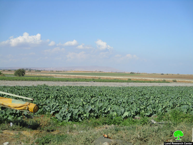
Photo 4: Al-Sakut area

Reportedly, a big number of farmers filed a complaint to Israel Police about the incident but to no avail. In the contrary, Israeli policemen and army soldiers provide protection to colonists at time of carrying out attacks and violations against Palestinians.

Photo 5: the complaint filed to the Police

About AL-Sakut:

Khirbet al-Sakut is one of the 32 small villages located alongside the area of the  Jordan river; the area was home for agricultural families who lived in there before the year of 1967. Noteworthy, all the aforementioned areas witnessed the so-called Catastrophe in the aftermath of 1967 war, which resulted in declaring the majority of land as "Buffer zone".

150 meters away from the Jordan river and 7km west of Ein al-Bida area, al-Sakut resides there with at least 20 agricultural families inhabiting the area before 1967. In synchronization with 1967 war, the occupation demolished the clay houses and pens relative to the inhabitants of the area, displaced them and declared the area a buffer zone with Jordan. As a result, the area was fenced and landmines were planted to draw boarders.

After the Peace Treaty held between Jordan and Israel, the occupation dismantled the landmines from the boarders area; the free-from-landmines areas were given to colonist to benefit from. The area of al-Sakut was within the lands given to colonists; al-Sakut was known for its water springs, which are now exploited by colonists as  touristic resort named "Ein Sokot". Palestinians are restrictively allowed in the area under intense surveillance.


Prepared by
 The Land Research Center
LRC
 

Recommended For You

بين قصرة وترمسعيا: العنف الاستيطاني الاسرائيلي يضرب المجتمع الفلسطيني

by arij
May 6, 2026
0

في الثالث من شهر أيار من العام 2026، شهد مزارعون في عدة قرى في الضفة الغربية المحتلة على مشهد بات مألوفًا وقاسيا في آنٍ واحد: أشجار مثمرة مقطوعة...

Read moreDetails

INFOGRAPHIC: ISRAELI SETTLER VIOLENCE IN 2025

by arij
April 16, 2026
0

INFOGRAPHIC: ISRAELI SETTLER VIOLENCE IN 2025     Prepared by:   The Applied Research Institute – Jerusalem  

Read moreDetails

The West Bank: Between Settler Aggression and Occupation Support – 2025 Highlights

by arij
March 25, 2026
0
The West Bank: Between Settler Aggression and Occupation Support – 2025 Highlights

In the occupied West Bank (oWB), the violence committed by Israeli settlers is no longer a series of isolated, random attacks; it has effectively become a de facto...

Read moreDetails

From a Circle of Violence to a Circle of Impunity: The Structural Empowerment of Settlers

by arij
November 24, 2025
0

Beyond the “Violence Circle” In much of the global discourse, the Israeli settlers on the Palestinians frame the Israeli–Palestinian conflict as a “circle of violence”, a continuous sequence...

Read moreDetails

من دائرة العنف إلى دائرة الإفلات من العقاب: التمكين البنيوي للمستوطنين الإسرائيليين

by arij
November 24, 2025
0
“ما يزيد عن 25 ألف دونم من أراض الزيتون”, موسم الزيتون في فلسطين تحت رهن الأوامر العسكرية

ما وراء "دائرة العنف"              يشهد الصراع الفلسطيني الإسرائيلي منذ عقود متغيرات دراماتيكية، حيث يتجاوز العنف الذي تمارسه اسرائيل على الأرض الحدود التقليدية للمواجهات المسلحة ليصبح جزءا من هيكلية...

Read moreDetails
Next Post

ARIJ Daily Report – Sun, 5th 11 2017

LATEST NEWS

إقامة منطقة عسكرية عسكرية داخل أراضي (أ) في جنين

إقامة منطقة عسكرية عسكرية داخل أراضي (أ) في جنين

by arij
May 19, 2026
0

........................................................

النكبة الفلسطينية في ذكراها الثامنة والسبعين: من التطهير العرقي إلى الإبادة وإعادة هندسة الجغرافيا الفلسطينية 

النكبة الفلسطينية في ذكراها الثامنة والسبعين: من التطهير العرقي إلى الإبادة وإعادة هندسة الجغرافيا الفلسطينية 

by arij
May 18, 2026
0

........................................................

“بمساحة اجمالية 177 دونما من أرضي البيرة وبيتين”, طريق استيطاني لخدمة البؤر الاستيطانية في محافظة رام الله

“بمساحة اجمالية 177 دونما من أرضي البيرة وبيتين”, طريق استيطاني لخدمة البؤر الاستيطانية في محافظة رام الله

by arij
May 18, 2026
0

........................................................

“في خدمة مستوطنة ناحال حيلتس”, طريق استيطاني إسرائيلي جديد على أراضي بتير وبيت جالا في محافظة بيت لحم

“في خدمة مستوطنة ناحال حيلتس”, طريق استيطاني إسرائيلي جديد على أراضي بتير وبيت جالا في محافظة بيت لحم

by arij
May 18, 2026
0

........................................................

flag_yellow_lowEU-PfP-Logo

This website and its content were initiated in 1993 by the Applied Research Institute – Jerusalem (ARIJ) and the Land Research Center (LRC) with the support from the European Union up until 2023. Since then, the Applied Research Institute – Jerusalem (ARIJ) has taken over the continued development and maintenance of the website. The views expressed remain solely those of ARIJ) and do not necessarily reflect those of the European Union.

© 2026 Copyright | ARIJ | All Rights reserved.

No Result
View All Result
  • Home
  • Settlements
    • New Israeli Settlements
    • Settlement Expansion
  • Israeli Violations
    • Agriculture
    • Confiscation
    • Demolition
    • Environment
    • Eviction of Palestinians
    • Settlers Attacks
  • Bypass Roads
  • Israeli Plans
  • Segregation
    • Checkpoints
    • Closure
    • Separation Plans
  • Military Orders
  • Reports
    • Daily Report
    • Monthly Report
    • Quarterly Report

© 2026 Copyright | ARIJ | All Rights reserved.