• About The Project
  • Palestine in Century
  • Selected Maps
  • Glossary
  • About ARIJ
  • About LRC
  • By Year
    • Case Studies By Year
    • Daily Report By Year
Monday, June 8, 2026
POICA
No Result
View All Result
  • Home
  • Settlements
    • New Israeli Settlements
    • Settlement Expansion
  • Israeli Violations
    • Agriculture
    • Confiscation
    • Demolition
    • Environment
    • Eviction of Palestinians
    • Settlers Attacks
  • Bypass Roads
  • Israeli Plans
  • Segregation
    • Checkpoints
    • Closure
    • Separation Plans
  • Military Orders
  • Reports
    • Daily Report
    • Monthly Report
    • Quarterly Report
No Result
View All Result
POICA
No Result
View All Result

“Additional opportunity to object demolition” orders served in Tulkarm

March 22, 2016
in Military Orders
“Additional opportunity to object demolition” orders served in Tulkarm


  • Violation: serving orders on structures and residence
  • Location:  Far'un village- Tulkarm
  • Date:  March 21, 2016
  • Perpetrators: Planning and Construction Committee- Israel Civil Administration
  • Victims:  four families and soccer field

Details:

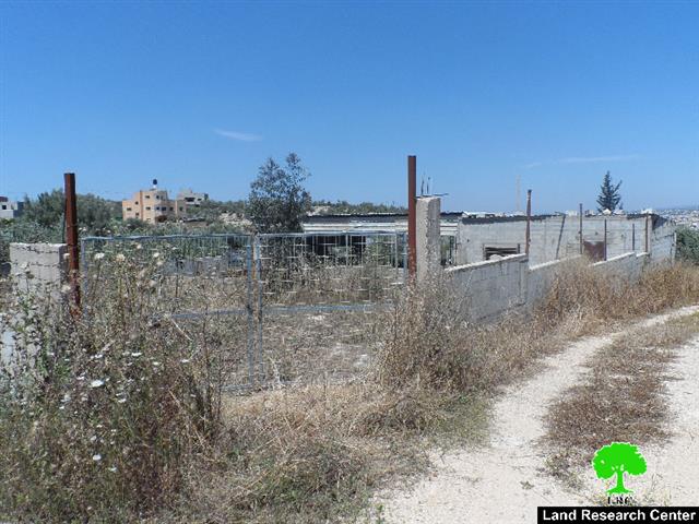
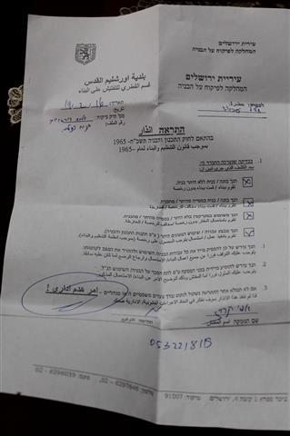
A massive force from Israeli Occupation Army accompanied by the so-called Planning and Construction Committee- Israel Civil Administration on March 21, 2016 raided Far'un village, southwest Tulkarm and delivered military orders of "Additional opportunity to object demolition"  for four citizens and a soccer field. Noteworthy, the orders gave a deadline of only three days to object to previous orders.

It should be marked that the notified structures belong to four families (28 members including 14 children) from the villages. The targeted structures namely ( residence, two sheep barracks, carpentry shop and soccer field) are founded nearby the apartheid wall that travels through the village. Israeli occupation authorities exploit the presence of the apartheid wall to impose restrictions on construction within the walls periphery (500m).

It is reported that all of the notified structures were built even before the apartheid wall was constructed on lands classified "C" according to Oslo Accords.

The chairman of Far'un village council, Muhyildeen Atir, told Land Research Center the following:

" The soccer field is the only breather for youth in this besieged village. Despite that the fields is somehow abandoned due to its proximity to the wall, the occupation came and demolished it. As for farmers,  they are deprived from establishing any farms since the master plan of the area only totals 150 dunums, which is not even sufficient for demographic expansion". The following table shows information about the affected people and properties:

Affected citizenstructure

Family

Minors

Aream2

No. of notified structures

Nature of structure

No. of military order

Date of latest demolition order

Photo

Soccer field

–

—

12 dunums

1

Fenced

205973

5/10/2010

1

Samer Khalil

7

5

120

1

One story house

305840

5/10/2015

2

Abdelhamid Shalabi

9

4

90

1

Carpentry shop

305847

19/8/2015

N/A

Ahmad Hazahzih

7

2

60

1

Remains of dismantled barrack

140489

3/4/2005

3

Kamal Khattab

5

3

160

1

Barrack for sheep

305973

5/10/2010

4

Total

28

14

430

5


Source : Field observation- Department of Monitoring Israeli Violations- Land Research Center-2016


Photographing residence:

Israeli Occupation Forces recently embarked on photographing residences in the village from the western side. Families fear that this act would be a step to be notified of stop-work or demolition from the occupation.

About Far'un:

Far'un is located 3 km to the south of Tulkarm, edging the armistice line. Its total area is 8000 dunums which were reduced to 4000 due to the construction of the segregation wall. It is inhabited by 3500 people, most of them are farmers.

70 % of the village lands are planted with olives and citrus; however, the planted area is shrinking due to water shortage and land confiscations.


Prepared by
 The Land Research Center
LRC
 

Recommended For You

سلطات الاحتلال الإسرائيلي بصدد الاستيلاء على موقع قبر النبي صموئيل شمال غرب مدينة القدس

by arij
May 23, 2026
0
سلطات الاحتلال الإسرائيلي بصدد الاستيلاء على موقع قبر النبي صموئيل شمال غرب مدينة القدس

 نشرت سلطات الاحتلال الإسرائيلي في الثامن عشر من شهر أيار من العام 2026 اعلانا مفاده الاستيلاء على الأراضي الفلسطينية في قرية النبي صموئيل شمال غرب القدس المحتلة. وجاء...

Read moreDetails

إقامة منطقة عسكرية عسكرية داخل أراضي (أ) في جنين

by arij
May 19, 2026
0
إقامة منطقة عسكرية عسكرية داخل أراضي (أ) في جنين

   في السابع من شهر أيار من العام 2026، وزعت سلطات الاحتلال الإسرائيلي أمرا عسكريا جديدة على أهالي مدينة جنين يقضي بمصادرة 7.2 دونما من الأراضي الفلسطينية في...

Read moreDetails

“بمساحة اجمالية 177 دونما من أرضي البيرة وبيتين”, طريق استيطاني لخدمة البؤر الاستيطانية في محافظة رام الله

by arij
May 18, 2026
0
“بمساحة اجمالية 177 دونما من أرضي البيرة وبيتين”, طريق استيطاني لخدمة البؤر الاستيطانية في محافظة رام الله

في الحادي عشر من شهر أيار من العام 2026, نشرت دائرة أراضي إسرائيل اعلانا جديدا يقضي بمصادرة المزيد من الأراضي الفلسطينية في محافظة رام الله لأغراض استيطانية في...

Read moreDetails

“في خدمة مستوطنة ناحال حيلتس”, طريق استيطاني إسرائيلي جديد على أراضي بتير وبيت جالا في محافظة بيت لحم

by arij
May 18, 2026
0
“في خدمة مستوطنة ناحال حيلتس”, طريق استيطاني إسرائيلي جديد على أراضي بتير وبيت جالا في محافظة بيت لحم

تواصل سلطات الاحتلال الإسرائيلي إحكام سيطرتها على المزيد من الأراضي الفلسطينية في الضفة الغربية المحتلة، وهذه المرة من خلال استهداف أراضي محافظة بيت لحم. ففي السادس والعشرين من...

Read moreDetails

مناطق نفوذ المستوطنات ودورها في إعادة تشكيل الجغرافيا الفلسطينية

by arij
April 23, 2026
0
مناطق نفوذ المستوطنات ودورها في إعادة تشكيل الجغرافيا الفلسطينية

أصدرت سلطات الاحتلال الإسرائيلي في العاشر من شهر نيسان 2026 الكراسة رقم (273)، وهي وثيقة تضم مجموعة من المناشير والأوامر والتعيينات الإسرائيلية المتعلقة بالجوانب الأمنية والعسكرية والإدارية، إضافة...

Read moreDetails
Next Post
تحت تهديد بلدية الاحتلال, عائلة العباسي في سلوان تهدم مسكنها بنفسها

تحت تهديد بلدية الاحتلال, عائلة العباسي في سلوان تهدم مسكنها بنفسها

LATEST NEWS

سلطات الاحتلال الإسرائيلي بصدد الاستيلاء على موقع قبر النبي صموئيل شمال غرب مدينة القدس

سلطات الاحتلال الإسرائيلي بصدد الاستيلاء على موقع قبر النبي صموئيل شمال غرب مدينة القدس

by arij
May 23, 2026
0

........................................................

إقامة منطقة عسكرية عسكرية داخل أراضي (أ) في جنين

إقامة منطقة عسكرية عسكرية داخل أراضي (أ) في جنين

by arij
May 19, 2026
0

........................................................

الآثار كأداة للضم الزاحف: مشروع القانون الإسرائيلي لإعادة هندسة الجغرافيا والهوية في الضفة الغربية

الآثار كأداة للضم الزاحف: مشروع القانون الإسرائيلي لإعادة هندسة الجغرافيا والهوية في الضفة الغربية

by arij
May 23, 2026
0

........................................................

النكبة الفلسطينية في ذكراها الثامنة والسبعين: من التطهير العرقي إلى الإبادة وإعادة هندسة الجغرافيا الفلسطينية 

النكبة الفلسطينية في ذكراها الثامنة والسبعين: من التطهير العرقي إلى الإبادة وإعادة هندسة الجغرافيا الفلسطينية 

by arij
May 18, 2026
0

........................................................

flag_yellow_lowEU-PfP-Logo

This website and its content were initiated in 1993 by the Applied Research Institute – Jerusalem (ARIJ) and the Land Research Center (LRC) with the support from the European Union up until 2023. Since then, the Applied Research Institute – Jerusalem (ARIJ) has taken over the continued development and maintenance of the website. The views expressed remain solely those of ARIJ) and do not necessarily reflect those of the European Union.

© 2026 Copyright | ARIJ | All Rights reserved.

No Result
View All Result
  • Home
  • Settlements
    • New Israeli Settlements
    • Settlement Expansion
  • Israeli Violations
    • Agriculture
    • Confiscation
    • Demolition
    • Environment
    • Eviction of Palestinians
    • Settlers Attacks
  • Bypass Roads
  • Israeli Plans
  • Segregation
    • Checkpoints
    • Closure
    • Separation Plans
  • Military Orders
  • Reports
    • Daily Report
    • Monthly Report
    • Quarterly Report

© 2026 Copyright | ARIJ | All Rights reserved.