• About The Project
  • Palestine in Century
  • Selected Maps
  • Glossary
  • About ARIJ
  • About LRC
  • By Year
    • Case Studies By Year
    • Daily Report By Year
Monday, June 8, 2026
POICA
No Result
View All Result
  • Home
  • Settlements
    • New Israeli Settlements
    • Settlement Expansion
  • Israeli Violations
    • Agriculture
    • Confiscation
    • Demolition
    • Environment
    • Eviction of Palestinians
    • Settlers Attacks
  • Bypass Roads
  • Israeli Plans
  • Segregation
    • Checkpoints
    • Closure
    • Separation Plans
  • Military Orders
  • Reports
    • Daily Report
    • Monthly Report
    • Quarterly Report
No Result
View All Result
POICA
No Result
View All Result

Stop-work orders on structures in the Qalqiliya village of Jit

July 22, 2015
in Military Orders
Stop-work orders on structures in the Qalqiliya village of Jit


Violation: serving stop-work orders

Location:  Jit village- Qalqiliya

Date:  22/07/2015

Perpetrators: Planning and Construction Committee- Israel Civil Administration

Victims:  9 Palestinian families

Details:

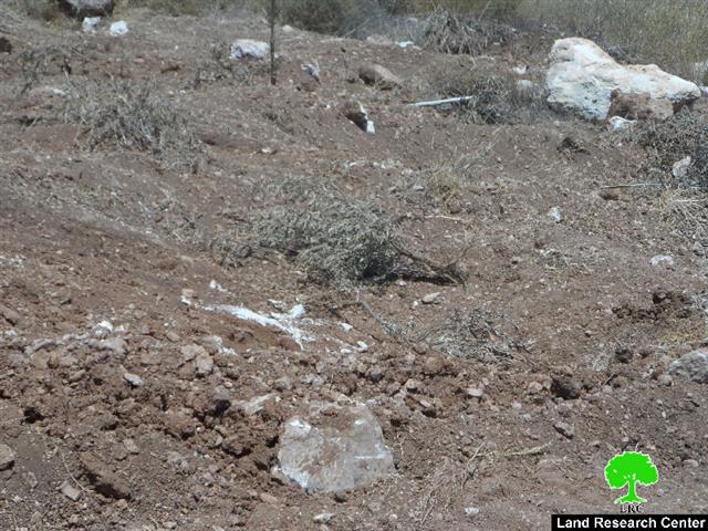
Targeting Palestinian building is a systematic policy of the Israeli occupation that aims at taking over Palestinian land and imposing a de facto that is hard to deal with. It also deprives the Palestinian citizen from hisher basic rights represented in the  right to adequate and safe housing.

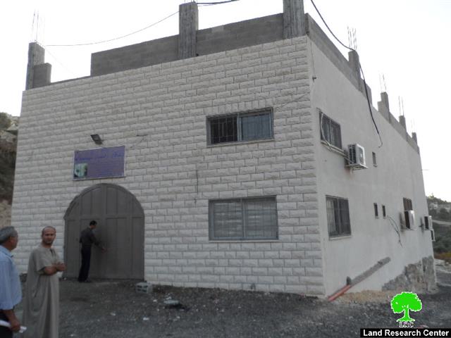
It should be marked that a massive force from the Israeli occupation army accompanied by a staff from Civil Administration on July 22, 2015 raided the village and delivered stop-work orders on six residences, a chicken farm and a wedding hall. The orders came under the pretext of “unlicensed construction” within an area classified C according to Oslo Accords.

The affected people were given a deadline until September 16, 2015 to complete all licensing procedures. This comes in time with the hearing session of the Planning and Construction Committee in the Israeli court of Beit El colony to consider the status of the notified structures. The following table shows information about the damage resulted due to the orders:

Affected citizen

Location

Family

Minors

Area/m2

No. of order

Nature of structure

Photo

Mahir Yamin

Karm Abu Dhiab

9

3

125

180260

Under construction house (one floor)

4

Iyad Al Sakhen

Karm Abu Dhiab

8

3

160

180261

Inhabited house( one floor)

3

Shadi Hamid

Ibqi’ El Zayid

7

5

160

180266

Inhabited one floor house

6

Ahmad Yamin

Karm Abu Dhiab

7

1

145

180263

Under construction house (one floor)

1

Qassem Sadih

Karm Abu Dhiab

9

7

400

180264

Chicken farm

2

Majdi Yamin

Karm Abu Dhiab

5

3

170

180259

Inhabited one floor house

5

Rashid Yamin

Ibqi’ El Zayid

5

3

150

180265

Under construction house (one floor) and a basement

7

Nidal Yamin+ Amjad Yamin

Ibqi’ El Zayid

12

8

600

180262

A wedding hall

8

Total

62

33

1910


Source : Field observation- Department of Monitoring Israeli Violations- Land Research Center-2105

Jit – an Overview:

Jit is located 12 km to the south west of Nablus city, on An Nar Mountain. It is also 14 km to the east of Qalqiliya city and is located under the jurisdictions of Qalqiliya Governorate. The village residences are placed over two parallel mountains overlooking the main road connecting Nablus and Qalqiliya. Jit is surrounded by various Palestinian communities including Surra and Tal (east), Far’ata. Al Funduq, Immatin, and Hijja (south), Qusin and Kafr Kaddum (north). It is also edged by the expanding Israeli colony of Kadummim.

Its total area is 6460 dunums including 243 dunums of built up area.

The Israeli Occupation confiscated more than 1200 of the village lands for colonial expansion purposes including the expansion of Kadummim and Gil’ad Zohar colonial nucleus. Such colonial entities cause day-to-day suffering to surrounding Palestinian population because of the Israeli army measures in addition to the daily aggressions committed by the colonists. Such attacks included attacks against agricultural fields and farmers.

The colonies take every chance to plant more mobile homes and confiscate lands; concurrently, the Israeli Occupation Army targets Palestinian structures on various justifications, mainly, the lack of construction permits; on the other hand, not only the colonists are free to plant their mobile homes anywhere in the West Bank but they also receive full support from their government and army. Jit is inhabited, according to the latest statistics done by the Village Council, by round 2700 people. The unemployment rate reached 34% of the total population. The Israeli measures and land confiscation drastically contributed to such high rate.


Prepared by
 The Land Research Center
LRC
 

Recommended For You

سلطات الاحتلال الإسرائيلي بصدد الاستيلاء على موقع قبر النبي صموئيل شمال غرب مدينة القدس

by arij
May 23, 2026
0
سلطات الاحتلال الإسرائيلي بصدد الاستيلاء على موقع قبر النبي صموئيل شمال غرب مدينة القدس

 نشرت سلطات الاحتلال الإسرائيلي في الثامن عشر من شهر أيار من العام 2026 اعلانا مفاده الاستيلاء على الأراضي الفلسطينية في قرية النبي صموئيل شمال غرب القدس المحتلة. وجاء...

Read moreDetails

إقامة منطقة عسكرية عسكرية داخل أراضي (أ) في جنين

by arij
May 19, 2026
0
إقامة منطقة عسكرية عسكرية داخل أراضي (أ) في جنين

   في السابع من شهر أيار من العام 2026، وزعت سلطات الاحتلال الإسرائيلي أمرا عسكريا جديدة على أهالي مدينة جنين يقضي بمصادرة 7.2 دونما من الأراضي الفلسطينية في...

Read moreDetails

“بمساحة اجمالية 177 دونما من أرضي البيرة وبيتين”, طريق استيطاني لخدمة البؤر الاستيطانية في محافظة رام الله

by arij
May 18, 2026
0
“بمساحة اجمالية 177 دونما من أرضي البيرة وبيتين”, طريق استيطاني لخدمة البؤر الاستيطانية في محافظة رام الله

في الحادي عشر من شهر أيار من العام 2026, نشرت دائرة أراضي إسرائيل اعلانا جديدا يقضي بمصادرة المزيد من الأراضي الفلسطينية في محافظة رام الله لأغراض استيطانية في...

Read moreDetails

“في خدمة مستوطنة ناحال حيلتس”, طريق استيطاني إسرائيلي جديد على أراضي بتير وبيت جالا في محافظة بيت لحم

by arij
May 18, 2026
0
“في خدمة مستوطنة ناحال حيلتس”, طريق استيطاني إسرائيلي جديد على أراضي بتير وبيت جالا في محافظة بيت لحم

تواصل سلطات الاحتلال الإسرائيلي إحكام سيطرتها على المزيد من الأراضي الفلسطينية في الضفة الغربية المحتلة، وهذه المرة من خلال استهداف أراضي محافظة بيت لحم. ففي السادس والعشرين من...

Read moreDetails

مناطق نفوذ المستوطنات ودورها في إعادة تشكيل الجغرافيا الفلسطينية

by arij
April 23, 2026
0
مناطق نفوذ المستوطنات ودورها في إعادة تشكيل الجغرافيا الفلسطينية

أصدرت سلطات الاحتلال الإسرائيلي في العاشر من شهر نيسان 2026 الكراسة رقم (273)، وهي وثيقة تضم مجموعة من المناشير والأوامر والتعيينات الإسرائيلية المتعلقة بالجوانب الأمنية والعسكرية والإدارية، إضافة...

Read moreDetails
Next Post
تجريف أراضي واقتلاع أشجار زيتون ومصادرتها في بلدة بيت أولا / محافظة الخليل

تجريف أراضي واقتلاع أشجار زيتون ومصادرتها في بلدة بيت أولا / محافظة الخليل

LATEST NEWS

سلطات الاحتلال الإسرائيلي بصدد الاستيلاء على موقع قبر النبي صموئيل شمال غرب مدينة القدس

سلطات الاحتلال الإسرائيلي بصدد الاستيلاء على موقع قبر النبي صموئيل شمال غرب مدينة القدس

by arij
May 23, 2026
0

........................................................

إقامة منطقة عسكرية عسكرية داخل أراضي (أ) في جنين

إقامة منطقة عسكرية عسكرية داخل أراضي (أ) في جنين

by arij
May 19, 2026
0

........................................................

الآثار كأداة للضم الزاحف: مشروع القانون الإسرائيلي لإعادة هندسة الجغرافيا والهوية في الضفة الغربية

الآثار كأداة للضم الزاحف: مشروع القانون الإسرائيلي لإعادة هندسة الجغرافيا والهوية في الضفة الغربية

by arij
May 23, 2026
0

........................................................

النكبة الفلسطينية في ذكراها الثامنة والسبعين: من التطهير العرقي إلى الإبادة وإعادة هندسة الجغرافيا الفلسطينية 

النكبة الفلسطينية في ذكراها الثامنة والسبعين: من التطهير العرقي إلى الإبادة وإعادة هندسة الجغرافيا الفلسطينية 

by arij
May 18, 2026
0

........................................................

flag_yellow_lowEU-PfP-Logo

This website and its content were initiated in 1993 by the Applied Research Institute – Jerusalem (ARIJ) and the Land Research Center (LRC) with the support from the European Union up until 2023. Since then, the Applied Research Institute – Jerusalem (ARIJ) has taken over the continued development and maintenance of the website. The views expressed remain solely those of ARIJ) and do not necessarily reflect those of the European Union.

© 2026 Copyright | ARIJ | All Rights reserved.

No Result
View All Result
  • Home
  • Settlements
    • New Israeli Settlements
    • Settlement Expansion
  • Israeli Violations
    • Agriculture
    • Confiscation
    • Demolition
    • Environment
    • Eviction of Palestinians
    • Settlers Attacks
  • Bypass Roads
  • Israeli Plans
  • Segregation
    • Checkpoints
    • Closure
    • Separation Plans
  • Military Orders
  • Reports
    • Daily Report
    • Monthly Report
    • Quarterly Report

© 2026 Copyright | ARIJ | All Rights reserved.