• About The Project
  • Palestine in Century
  • Selected Maps
  • Glossary
  • About ARIJ
  • About LRC
  • By Year
    • Case Studies By Year
    • Daily Report By Year
Saturday, October 10, 2026
POICA
No Result
View All Result
  • Home
  • Settlements
    • New Israeli Settlements
    • Settlement Expansion
  • Israeli Violations
    • Agriculture
    • Confiscation
    • Demolition
    • Environment
    • Eviction of Palestinians
    • Settlers Attacks
  • Bypass Roads
  • Israeli Plans
  • Segregation
    • Checkpoints
    • Closure
    • Separation Plans
  • Military Orders
  • Reports
    • Daily Report
    • Monthly Report
    • Quarterly Report
No Result
View All Result
POICA
No Result
View All Result

“Built on Private Palestinian Lands” New facilities in the illegal settlements of Giv’at Ze’ev and Mod’in ‘Ilit

June 20, 2015
in Settlements
“Built on Private Palestinian Lands”

New facilities in the illegal settlements of Giv’at Ze’ev and Mod’in ‘Ilit


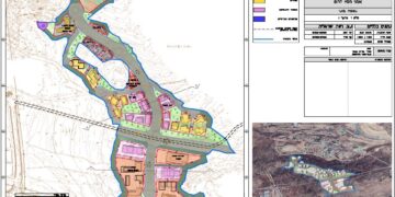
On the 15th of June 2015,”Walla” an Israeli Hebrew news website, published a report  revealed that the Israeli Police station and the fire department in the Israeli settlement of Giv’at Ze’ev were built on Palestinian private land owned by Palestinians residents from Beituniya town in Ramallah Governorate.

 According to the report, the targeted land where the Police station and fire department  built, failed in the “Blue line team” test for classifying the land as “state land”. Moreover, the same case in Modi'in Illit settlement, where the fire department was built on a private Palestinian land located within the boundary of Ni’lin village west of Ramallah Governorate.

An analysis conducted by the Geo-informatics Department at ARIJ, confirmed that the Police Station as well as the fire Department in the illegal settlement of Giv’at Ze’ev were not built on what is Israel claimed as “State Lands”, but on private Palestinian lands expropriated from Palestinian residents from Beituniya town in Ramallah Governorate.

 Furthermore, significant land space inside the claimed boundaries of the settlement used for the expansion of Giv’at Ze’ev. The expansion included the building of housing units ,parking, commercial and public buildings (including the police and fire departments aforementioned in report).


For   Modi’in Illit settlement, the analysis showed that the fire department in the settlement wasn’t  built in what is so-called “State land” and owned by Palestinians in Nil’in village, west of Ramallah city. Also, there are vast areas in the settlement didn’t classified as state land, but the Israeli Authorities used the lands to build the settlement and to expand it.

Obviously, the Israeli Authorities confiscated Palestinian lands under several illegal claims that contradicts with the status of  Palestine as an occupied Territory  according to the international law rules . Accordingly, these expropriations mainly aim  to serve their colonial projects; such as building settlements, construction the segregation wall and opening new bypass road to benefit the Israeli settlers.

To make their actions legal, the Israeli authorities  claimed that the land they aimed to confiscate classified as “State land”, and therefore to be able to use the land to build illegal settlements and expanding them. These two cases; Modi’in Illit and Giv’at Ze’ev settlements, are  just two clear example for dozens of cases where the Israeli Authorities confiscated Palestinian lands under the pretext of “State land”, but the land failed in the “Blue line team” test. (Blue Line team: a team in the Israeli Civil Administration related to the Israeli Ministry of Defense. The sole scope of work of the team  is to check the status of the Palestinian lands and to classify them if they are located within the “state land” zone or not. If the checked lands were classified and fall within “State Land” area, the blue line team inform the related authorities with results to push them toward expropriating the land ).

The Israeli settlement of Giva’t Ze’ev established in 1982, and located north of Jerusalem Governorate. The total area of the settlement  reach to 2,998 dunums, this area were confiscated from Palestinian land in Beituniya town in Ramallah governorate and Al Jib and Beit Ijza villages in Jerusalem Governorate. The  settlement inhabited by 12,632 settlers (population of 2011).

The Israeli settlement of Modi’in Iliit (Qiryat Sefer) established in 1991, and located west of Ramallah governorate. The total area of the settlement reach to 4,045 dunums and inhabited by 52,060 settlers (population of 2011).

Prepared by:  
The Applied Research Institute – Jerusalem

Recommended For You

سلطات الاحتلال الإسرائيلي تتم رسميا اعداد المخطط الهيكلي للبؤرة الاستيطانية «أفيا» (يتسيف/شديما سابقًا) شرق مدينة بيت ساحور

by arij
September 17, 2026
0
سلطات الاحتلال الإسرائيلي تتم رسميا اعداد المخطط الهيكلي للبؤرة الاستيطانية «أفيا» (يتسيف/شديما سابقًا) شرق مدينة بيت ساحور

بعد اقل من عام على انشائها، أتمت سلطات الاحتلال الإسرائيلي اعداد مخطط هيكلي استيطاني جديد للبؤرة الاستيطانية "أفيا" (شديما - يتسيف) التي اقيمت شرق مدينة بيت ساحور في...

Read moreDetails

على قرابة 7,000 دونم”, إسرائيل تعلن توسيع مناطق نفوذ أربعة مستوطنات في محافظتي بيت لحم والخليل”

by arij
September 17, 2026
0
على قرابة 7,000 دونم”, إسرائيل تعلن توسيع مناطق نفوذ أربعة مستوطنات في محافظتي بيت لحم والخليل”

في السابع والعشرين من شهر اب من العام 2026 أعلن رئيس ما يسمى "بمجلس إقليمي جوش عتصيون" الاستيطاني، ارون روزنفلت, عن أربعة مخططات استيطانية جديدة على أراضي في...

Read moreDetails

Approval of a Major Expansion Plan for the Tekoa Settlement East of Bethlehem

by arij
September 1, 2026
0
Approval of a Major Expansion Plan for the Tekoa Settlement East of Bethlehem

Targets ≈6,000 dunams of Palestinian land On July 20, 2026, the so-called “Gush Etzion Settlement Regional Council” in the occupied West Bank approved a large-scale settlement master plan...

Read moreDetails

First Half of 2026
“Israeli Settlement Expansion Targets More Than 22,000 Dunams of Palestinian Land”

by arij
September 2, 2026
0
First Half of 2026  “Israeli Settlement Expansion Targets More Than 22,000 Dunams of Palestinian Land”

  Preface, Israeli settlement construction in the occupied West Bank is one of the  tools used by Israel to consolidate control over Palestinian land and reshape the Palestinian...

Read moreDetails

“حتى النصف الأول من العام 2026 “, ” الاستيطان يلتهم الأرض الفلسطينية: ما يزيد عن 22 ألف دونم مستهدفة و 19 ألف وحدة استيطانية”

by arij
July 22, 2026
0
“حتى النصف الأول من العام 2026 “, ” الاستيطان يلتهم الأرض الفلسطينية: ما يزيد عن 22 ألف دونم مستهدفة و 19 ألف وحدة استيطانية”

ان البناء الاستيطاني الإسرائيلي في الضفة الغربية المحتلة هو أحد أبرز أدوات السيطرة الإسرائيلية على الأرض الفلسطينية وإعادة تشكيل الجغرافيا الفلسطينية، حيث شهدت الأعوام القليلة الماضية توسعًا متسارعًا...

Read moreDetails
Next Post

ARIJ Daily Report - Sat, 20th 06 2015

LATEST NEWS

“في خدمة المستوطنات والبؤر الاستيطانية الإسرائيلية”  سلطات الاحتلال تصدر 32 أمرًا عسكريًا لإنشاء خطوط مياه جديدة

“في خدمة المستوطنات والبؤر الاستيطانية الإسرائيلية”
سلطات الاحتلال تصدر 32 أمرًا عسكريًا لإنشاء خطوط مياه جديدة

by arij
September 29, 2026
0

........................................................

سلطات الاحتلال الإسرائيلي تستولي على 370 دونما من أراضي أبو ديس بذريعة أملاك حكومية

سلطات الاحتلال الإسرائيلي تستولي على 370 دونما من أراضي أبو ديس بذريعة أملاك حكومية

by arij
September 23, 2026
0

........................................................

سلطات الاحتلال الإسرائيلي تتم رسميا اعداد المخطط الهيكلي للبؤرة الاستيطانية «أفيا» (يتسيف/شديما سابقًا) شرق مدينة بيت ساحور

سلطات الاحتلال الإسرائيلي تتم رسميا اعداد المخطط الهيكلي للبؤرة الاستيطانية «أفيا» (يتسيف/شديما سابقًا) شرق مدينة بيت ساحور

by arij
September 17, 2026
0

........................................................

الاحتلال الإسرائيلي يخصص 1627 دونما لصالح البؤرة الاستيطانية “كيدا ” في محافظة نابلس

الاحتلال الإسرائيلي يخصص 1627 دونما لصالح البؤرة الاستيطانية “كيدا ” في محافظة نابلس

by arij
September 10, 2026
0

........................................................

flag_yellow_lowEU-PfP-Logo

This website and its content were initiated in 1993 by the Applied Research Institute – Jerusalem (ARIJ) and the Land Research Center (LRC) with the support from the European Union up until 2023. Since then, the Applied Research Institute – Jerusalem (ARIJ) has taken over the continued development and maintenance of the website. The views expressed remain solely those of ARIJ) and do not necessarily reflect those of the European Union.

© 2026 Copyright | ARIJ | All Rights reserved.

No Result
View All Result
  • Home
  • Settlements
    • New Israeli Settlements
    • Settlement Expansion
  • Israeli Violations
    • Agriculture
    • Confiscation
    • Demolition
    • Environment
    • Eviction of Palestinians
    • Settlers Attacks
  • Bypass Roads
  • Israeli Plans
  • Segregation
    • Checkpoints
    • Closure
    • Separation Plans
  • Military Orders
  • Reports
    • Daily Report
    • Monthly Report
    • Quarterly Report

© 2026 Copyright | ARIJ | All Rights reserved.