• About The Project
  • Palestine in Century
  • Selected Maps
  • Glossary
  • About ARIJ
  • About LRC
  • By Year
    • Case Studies By Year
    • Daily Report By Year
Tuesday, May 5, 2026
POICA
No Result
View All Result
  • Home
  • Settlements
    • New Israeli Settlements
    • Settlement Expansion
  • Israeli Violations
    • Agriculture
    • Confiscation
    • Demolition
    • Environment
    • Eviction of Palestinians
    • Settlers Attacks
  • Bypass Roads
  • Israeli Plans
  • Segregation
    • Checkpoints
    • Closure
    • Separation Plans
  • Military Orders
  • Reports
    • Daily Report
    • Monthly Report
    • Quarterly Report
No Result
View All Result
POICA
No Result
View All Result

A military order banning any Palestinian construction in periphery of the apartheid wall surrounding the colonies of Beit Arye and Ofarim

January 5, 2015
in Military Orders
A military order banning any Palestinian construction in periphery of the apartheid wall surrounding the colonies of Beit Arye and Ofarim


Violation:  banning the Palestinian construction  

Date: 05/01/2014

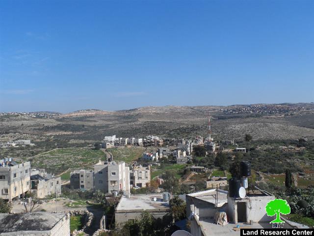
Location:  villages of Ramallah

Perpetrators: Israeli occupation army

Victims:  residents of the villages

Details:

In a new Israeli plan that aims at looting more area of lands and pinning down the Israeli presence in the West Bank, the commander of Israeli army Nitzan Alof on January 05, 2014 issued a military order on the  Palestinian villages (Shabqa , 'Abud, Lubban al-Gharbi, and Rantis). The order banned using the lands located nearby Ofarim and Beit Arye colonies.

The order entitled " Stop-work and termination no. 11/16/C in the buffer zone (Beit Arye- Ofarim) and extending validity no. (2) 5774-2014"  mentioned that the Israeli occupation army has the absolute right to prohibit Palestinians from any act of construction in the periphery of the apartheid wall surrounding the colonies of Ofarim and Beit Arye.

Predictably, the occupation justified the order under the pretext of organizing the area and maintaining the safety and security of the two colonies.


Photos1+2: the military Order


A new catastrophe on  the villages' residents:

The chairman of 'Abud village council told a researcher from Land Research Center the following: " This order is to be considered a catastrophe on the residents of these areas. The order is not just for banning construction but banning farmers from using lands from a distance of 500-800 m from the apartheid wall. The wall takes a shape of a circle surrounding the two colonies and devours hundreds of agricultural dunums from the area. In other words, an area of 200 dumums will be added for the favor of colonial expansion not mentioning the confiscated and annexed lands to colonies"

Beit Arye :

Beit Arye was established in 1977 over lands of Al Lubban and 'Abud to the north of Ramallah. Its total area nowadays is around 1653 dunums inhabited by over 3400 people.

The colony is named after Arye Ben-Eleizer one of the leaders of the Herut terrorist movement and one of the founder of the Israeli "Likud" party.

Ofarim:

Ofarim is a (religious- secular) community " Kiputs"  that was established in 1989 on lands from 'Abud, Rantis and Lubban al-Gharbi  villages. The colony's total area is 1380 dunums. The colony accommodate a synagogue, a daycare, a day club, and a library. Ofarim population totals around 870 until 2008.


Prepared by

 The Land Research Center
LRC


Recommended For You

مناطق نفوذ المستوطنات ودورها في إعادة تشكيل الجغرافيا الفلسطينية

by arij
April 23, 2026
0
مناطق نفوذ المستوطنات ودورها في إعادة تشكيل الجغرافيا الفلسطينية

أصدرت سلطات الاحتلال الإسرائيلي في العاشر من شهر نيسان 2026 الكراسة رقم (273)، وهي وثيقة تضم مجموعة من المناشير والأوامر والتعيينات الإسرائيلية المتعلقة بالجوانب الأمنية والعسكرية والإدارية، إضافة...

Read moreDetails

INFOGRAPHIC: Mapping Control – Israeli Militray Orders across the occupied West Bank – 2025

by arij
April 16, 2026
0

    Prepared by:   The Applied Research Institute – Jerusalem

Read moreDetails

سلطات الاحتلال الإسرائيلي تستهدف قرية الجيب بأمر عسكري جديد

by arij
March 17, 2026
0
سلطات الاحتلال الإسرائيلي تستهدف قرية الجيب بأمر عسكري جديد

نشر المسؤول عن الأملاك الحكومية وأملاك الغائبين في الإدارة المدنية الإسرائيلية في الحادي عشر من شهر اذار من العام 2026 اعلاننا مفاده نية ما يسمى " المسؤول عن...

Read moreDetails

سلطات الاحتلال الإسرائيلي تستخدم الأوامر العسكرية لتعمق المشروع الاستيطاني في الضفة الغربية المحتلة

by arij
February 26, 2026
0
سلطات الاحتلال الإسرائيلي تستخدم الأوامر العسكرية لتعمق المشروع الاستيطاني في الضفة الغربية المحتلة

تقديم منذ احتلال الضفة الغربية عام 1967، اعتمدت سلطات الاحتلال الإسرائيلي منهجية واسعة عبر استخدام الأوامر العسكرية كأداة "قانونية" لفرض الوقائع الجغرافية والديموغرافية على الأرض الفلسطينية. وأصبحت هذه...

Read moreDetails

بين مطرقة الأوامر العسكرية وسندان التقييد الجغرافي, أوامر عسكرية إسرائيلية جديدة تطال أكثر من 1000 دونم في طوباس

by arij
November 26, 2025
0
بين مطرقة الأوامر العسكرية وسندان التقييد الجغرافي, أوامر عسكرية إسرائيلية جديدة تطال أكثر من 1000 دونم في طوباس

في الحادي والعشرين من شهر تشرين الأول لعام 2025، تسلّم أهالي محافظة طوباس سلسلة من الأوامر العسكرية الإسرائيلية التي استهدفت مساحات واسعة من الأراضي الفلسطينية في المحافظة. وقد...

Read moreDetails
Next Post
المصادقة على نقل معسكر لجيش الاحتلال لبناء مئات الوحدات الاستعمارية مكانه لصالح المستعمرين

المصادقة على نقل معسكر لجيش الاحتلال لبناء مئات الوحدات الاستعمارية مكانه لصالح المستعمرين

LATEST NEWS

مناطق نفوذ المستوطنات ودورها في إعادة تشكيل الجغرافيا الفلسطينية

مناطق نفوذ المستوطنات ودورها في إعادة تشكيل الجغرافيا الفلسطينية

by arij
April 23, 2026
0

........................................................

التمدد الاستيطاني الإسرائيلي في الضفة الغربية المحتلة وأثره في تقويض مقومات الدولة الفلسطينية

التمدد الاستيطاني الإسرائيلي في الضفة الغربية المحتلة وأثره في تقويض مقومات الدولة الفلسطينية

by arij
April 16, 2026
0

........................................................

INFOGRAPHIC: ISRAELI SETTLER VIOLENCE IN 2025

by arij
April 16, 2026
0

........................................................

العدالة المؤجلة ورأي بلا تنفيذ: من قرار المحكمة إلى واقع الضم

أدوات غير مباشرة للاستيطان الإسرائيلي في مناطق (أ) و(ب) لإعادة تشكيل الجغرافيا والسيطرة في الضفة الغربية   

by arij
April 16, 2026
0

........................................................

flag_yellow_lowEU-PfP-Logo

This website and its content were initiated in 1993 by the Applied Research Institute – Jerusalem (ARIJ) and the Land Research Center (LRC) with the support from the European Union up until 2023. Since then, the Applied Research Institute – Jerusalem (ARIJ) has taken over the continued development and maintenance of the website. The views expressed remain solely those of ARIJ) and do not necessarily reflect those of the European Union.

© 2026 Copyright | ARIJ | All Rights reserved.

No Result
View All Result
  • Home
  • Settlements
    • New Israeli Settlements
    • Settlement Expansion
  • Israeli Violations
    • Agriculture
    • Confiscation
    • Demolition
    • Environment
    • Eviction of Palestinians
    • Settlers Attacks
  • Bypass Roads
  • Israeli Plans
  • Segregation
    • Checkpoints
    • Closure
    • Separation Plans
  • Military Orders
  • Reports
    • Daily Report
    • Monthly Report
    • Quarterly Report

© 2026 Copyright | ARIJ | All Rights reserved.