• About The Project
  • Palestine in Century
  • Selected Maps
  • Glossary
  • About ARIJ
  • About LRC
  • By Year
    • Case Studies By Year
    • Daily Report By Year
Saturday, September 12, 2026
POICA
No Result
View All Result
  • Home
  • Settlements
    • New Israeli Settlements
    • Settlement Expansion
  • Israeli Violations
    • Agriculture
    • Confiscation
    • Demolition
    • Environment
    • Eviction of Palestinians
    • Settlers Attacks
  • Bypass Roads
  • Israeli Plans
  • Segregation
    • Checkpoints
    • Closure
    • Separation Plans
  • Military Orders
  • Reports
    • Daily Report
    • Monthly Report
    • Quarterly Report
  • Home
  • Settlements
    • New Israeli Settlements
    • Settlement Expansion
  • Israeli Violations
    • Agriculture
    • Confiscation
    • Demolition
    • Environment
    • Eviction of Palestinians
    • Settlers Attacks
  • Bypass Roads
  • Israeli Plans
  • Segregation
    • Checkpoints
    • Closure
    • Separation Plans
  • Military Orders
  • Reports
    • Daily Report
    • Monthly Report
    • Quarterly Report
No Result
View All Result
POICA
No Result
View All Result

Preparations for Establishing a New Colony in Salfit Governorate

July 1, 2014
in Settlement Expansion
Preparations for Establishing a New Colony in Salfit Governorate


Violation: Large-scale construction and expansion work in preparation of building a new colony  
Location: Deir Saman, Kafr ad Dik- Salfit governorate
Date: 01 July 2014  
Perpetrators: The Israeli occupation army
Victims: People of the towns of Deir Ballut, Rafat, and Kafr ad Dik

Details:

Khirbet Deir Abu Saman, located northwest of Kafr ad Dik in Salfit, has a strategic location, enjoying greenery scenery and overlooking the coastline of the 1948 occupied Palestine. Deir Abu Saman is also considered an archaeological site with remains dating back to the Roman era as well as Byzantine, Islamic, and Ottoman, making the area an attraction site and a destination for researchers and tourists alike.

The Israeli occupation has not spared the area nonetheless. On the contrary, it has embraced the most racist and radical of means to strip Palestinians of their rights to it, destroy the nature of the place, loot its historical treasures, and forge history. The Israeli occupation forces have carried out nonstop large-scale ravaging operations in Deir Abu Saman, destroying most of its monuments and uprooting many trees in the process. In addition to that, monuments have been systematically stolen and transferred into nearby colonies.

Construction and expansion of Leisham:

Two years ago and since the beginning of 2012, the Israeli occupation bulldozers have not stopped ravaging work, not even for a single day in Deir Saman, until the whole mountain over which it resides has been swept away and the nature of the place irreversibly altered.

Visitors of Deir Saman are shocked at the new reality on the ground, knowing that more than 400 dunums of land were leveled while hundreds of Roman trees got totally uprooted, forever changing the character of the place.

Today, one only hears the noises of the bulldozers and diggers. Fresh air is scarce as dust prevails the atmosphere.


Construction of prefabricated houses, gardens, and public utilities:

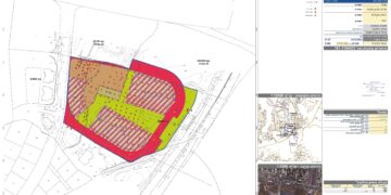
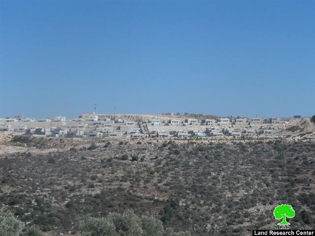
It should be marked, that according to LRC field research, about 35 houses are under construction for the new colony 'Leisham' in addition to the preparation of a road network and a number of public utilities within the colony to soon receive hundreds of Jewish families.

Destruction of a historical site:

Despite the international norms that ban any aggression on historical legacy and despite the signed conventions about the protection of people's property at time of war, especially the Fourth Geneva and Hague Conventions, which Israel is part of, it disregards all of mentioned and destroys the archaeological sites of Deir Saman by systematically sabotaging the historical place, in total disrespect for the international community.

According to eyewitnesses, the Israeli occupation stole the old stones adorning the area and moved them into Israeli colonies in an attempt to forge history and fool the world by proving they have always had connections to the place.

All these barbaric actions go unnoticed by the International community that stands helpless and passive.

A futuristic look at the area:

It is worth mentioning that while the Israeli occupation is planning to build Leisham, a new colony, only 2 kilometers away,  is being built simultaneously in an area known as  Dhahr Soboh, north of Kafr ad Dik, west of the West Bank city of Salfit.

And in parallel, the Israeli occupation is planning to connect all the new colonies with nearby ones: A road network that begins at Eli Zahav passing by Bedoel and then by Barkan up to Ariel and finally ending in Taffuh. Though the colonies are only 2 kilometers away from each other. But as one can see, the Israeli occupation tries to create a geographic connection and continuity between the Green Line and the Jordan Valley.   


Prepared by
 The Land Research Center
LRC

 

Recommended For You

Approval of a Major Expansion Plan for the Tekoa Settlement East of Bethlehem

by arij
September 1, 2026
0
Approval of a Major Expansion Plan for the Tekoa Settlement East of Bethlehem

Targets ≈6,000 dunams of Palestinian land On July 20, 2026, the so-called “Gush Etzion Settlement Regional Council” in the occupied West Bank approved a large-scale settlement master plan...

Read moreDetails

First Half of 2026
“Israeli Settlement Expansion Targets More Than 22,000 Dunams of Palestinian Land”

by arij
September 2, 2026
0
First Half of 2026  “Israeli Settlement Expansion Targets More Than 22,000 Dunams of Palestinian Land”

  Preface, Israeli settlement construction in the occupied West Bank is one of the  tools used by Israel to consolidate control over Palestinian land and reshape the Palestinian...

Read moreDetails

على ما مساحته 1006.4 دونما من أراضي بلدة يانون
“سلطات الاحتلال الإسرائيلي تشرع بتغيير نفوذ بؤرة استيطانية في الضفة الغربية المحتلة”

by arij
March 14, 2026
0
على ما مساحته 1006.4 دونما من أراضي بلدة يانون  “سلطات الاحتلال الإسرائيلي تشرع بتغيير نفوذ بؤرة استيطانية في الضفة الغربية المحتلة”

في الثاني عشر من شهر شباط من العام 2026, نشر رئيس قسم الاستيطان والتنظيم فيما يسمى "بالإدارة المدنية الإسرائيلية", الذراع الأيمن لحكومة الاحتلال الإسرائيلية اعلانا مفاده " اعلان...

Read moreDetails

حين تتقلص الخريطة: تسارع غير مسبوق في توسّع المستوطنات الإسرائيلية خلال عام 2025

by arij
February 16, 2026
0
حين تتقلص الخريطة: تسارع غير مسبوق في توسّع المستوطنات الإسرائيلية خلال عام 2025

مقدمة: - ان السياسة الاستيطانية الإسرائيلية في الضفة الغربية المحتلة هي واحدة من أكثر القضايا التي تقف عائقا في تحقيق سلام عادل وقابل للحياة في الأراضي الفلسطينية المحتلة....

Read moreDetails

حين يصبح الاستيطان سياسة دولة: 26 ألف وحدة جديدة تهدد الضفة الغربية

by arij
November 27, 2025
0
حين يصبح الاستيطان سياسة دولة: 26 ألف وحدة جديدة تهدد الضفة الغربية

في ظلّ صمتٍ دوليٍّ متزايد، يكشف معهد الأبحاث التطبيقية – القدس (أريج) عن طرح سلطات الاحتلال الإسرائيلي مخططات بناء استيطانية لأكثر من 26 ألف وحدة استيطانية جديدة في...

Read moreDetails
Next Post

ARIJ Daily Report - Tue, 1st 07 2014

LATEST NEWS

الاحتلال الإسرائيلي يخصص 1627 دونما لصالح البؤرة الاستيطانية “كيدا ” في محافظة نابلس

الاحتلال الإسرائيلي يخصص 1627 دونما لصالح البؤرة الاستيطانية “كيدا ” في محافظة نابلس

by arij
September 10, 2026
0

........................................................

على مساحة تقارب 7,000 دونم   إسرائيل توسّع نطاق نفوذ أربع بؤر استيطانية في محافظتي بيت لحم والخليل

على مساحة تقارب 7,000 دونم
 إسرائيل توسّع نطاق نفوذ أربع بؤر استيطانية في محافظتي بيت لحم والخليل

by arij
September 9, 2026
0

........................................................

المحميات الطبيعية في مرمى الاستيطان: حماية البيئة أم السيطرة على الأرض؟

المحميات الطبيعية في مرمى الاستيطان: حماية البيئة أم السيطرة على الأرض؟

by arij
August 24, 2026
0

........................................................

الولجة أمام موجة هدم إسرائيلية تهدد عشرات العائلات الفلسطينية

by arij
August 24, 2026
0

........................................................

flag_yellow_lowEU-PfP-Logo

This website and its content were initiated in 1993 by the Applied Research Institute – Jerusalem (ARIJ) and the Land Research Center (LRC) with the support from the European Union up until 2023. Since then, the Applied Research Institute – Jerusalem (ARIJ) has taken over the continued development and maintenance of the website. The views expressed remain solely those of ARIJ) and do not necessarily reflect those of the European Union.

© 2026 Copyright | ARIJ | All Rights reserved.

No Result
View All Result
  • Home
  • Settlements
    • New Israeli Settlements
    • Settlement Expansion
  • Israeli Violations
    • Agriculture
    • Confiscation
    • Demolition
    • Environment
    • Eviction of Palestinians
    • Settlers Attacks
  • Bypass Roads
  • Israeli Plans
  • Segregation
    • Checkpoints
    • Closure
    • Separation Plans
  • Military Orders
  • Reports
    • Daily Report
    • Monthly Report
    • Quarterly Report

© 2026 Copyright | ARIJ | All Rights reserved.