• About The Project
  • Palestine in Century
  • Selected Maps
  • Glossary
  • About ARIJ
  • About LRC
  • By Year
    • Case Studies By Year
    • Daily Report By Year
Tuesday, May 5, 2026
POICA
No Result
View All Result
  • Home
  • Settlements
    • New Israeli Settlements
    • Settlement Expansion
  • Israeli Violations
    • Agriculture
    • Confiscation
    • Demolition
    • Environment
    • Eviction of Palestinians
    • Settlers Attacks
  • Bypass Roads
  • Israeli Plans
  • Segregation
    • Checkpoints
    • Closure
    • Separation Plans
  • Military Orders
  • Reports
    • Daily Report
    • Monthly Report
    • Quarterly Report
No Result
View All Result
POICA
No Result
View All Result

Land Takeover in Salfit
Israeli Occupation Forces Extends the Seizure of 381 Dunums of the Lands of the Villages of Siniria and Al Zawiya in Qalqilia Governorate

May 14, 2014
in Military Orders
Land Takeover in Salfit  Israeli Occupation Forces Extends the Seizure of 381 Dunums of the Lands of the Villages of Siniria and Al Zawiya in Qalqilia Governorate


Violation: Occupation forces extend the seizure of a piece of land  
Location: Natural block number 3 of al-Matwi valley lands/ Salfit governorate
Date: 14/05/2014
Perpetrators: The Israeli occupation army
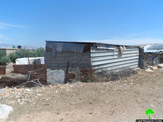
Victims: Farmers of Salfit

Detail:

On May 14, 2014, the Israeli Military Coalition handed the Palestinian party an order entitled “Continuation of Land Seizure” and called for the continuation of “placing the Army’s Hands” on a piece of land in the West Bank city of Salfit and called for the adjustment of land use. According to the order and attached map, the piece of land is located north of Salfit, within the natural block no. 3 in the area known as Wadi al- Matwi (or al-Matwi valley). It is 805 m2 in area and was stolen by the  Israeli occupation according to the order number (8/21) issued in 2008. The land was initially confiscated for the purpose of installing water pipelines towards the purification plant in the colony of Ariel, according to the Israeli occupation's claims. The plant extends on an area of 200 m2, west of the expropriated land. 


Pictures 1-3: The military order and attached map

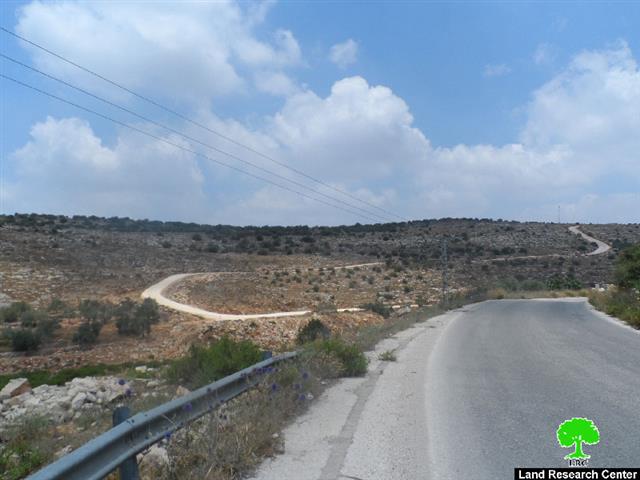
Pictures 4: The road leading to the purification plant

Today and after six years of land grab, the Israeli occupation Army High Commander in the West Bank has issued an order to renew the confiscation of land and change its usage so it is used for military purposes- though according to the order, the land was initially confiscated for the sake of opening a military road.

Through field research, it was found that the Israeli occupation did open a military road connecting Ariel's northern entrance with the purification plant and the road passes through the targeted area.

The road will lead to grave ramifications not only on the farmers of Salfit but also on the agricultural sector in the city at large. Here are some in details:

  1. The land of Al-Matwi and northern Salfit is considered among the most futile. Since the colonial road will pass through these areas, damage to the agricultural land would ensue as the Israeli occupation would use the road as a pretext to deny people access to their land and harass them for 'security reasons'.
  2. The road, according to the Israeli conception, means seizing more Palestinian land to make way for future expansion plans for the colonies, especially that according to eyewitness and field observations, the road will soon be a linking point between Ariel and Burqan colonies.   


Prepared by
The Land Research Center
LRC


Recommended For You

مناطق نفوذ المستوطنات ودورها في إعادة تشكيل الجغرافيا الفلسطينية

by arij
April 23, 2026
0
مناطق نفوذ المستوطنات ودورها في إعادة تشكيل الجغرافيا الفلسطينية

أصدرت سلطات الاحتلال الإسرائيلي في العاشر من شهر نيسان 2026 الكراسة رقم (273)، وهي وثيقة تضم مجموعة من المناشير والأوامر والتعيينات الإسرائيلية المتعلقة بالجوانب الأمنية والعسكرية والإدارية، إضافة...

Read moreDetails

INFOGRAPHIC: Mapping Control – Israeli Militray Orders across the occupied West Bank – 2025

by arij
April 16, 2026
0

    Prepared by:   The Applied Research Institute – Jerusalem

Read moreDetails

سلطات الاحتلال الإسرائيلي تستهدف قرية الجيب بأمر عسكري جديد

by arij
March 17, 2026
0
سلطات الاحتلال الإسرائيلي تستهدف قرية الجيب بأمر عسكري جديد

نشر المسؤول عن الأملاك الحكومية وأملاك الغائبين في الإدارة المدنية الإسرائيلية في الحادي عشر من شهر اذار من العام 2026 اعلاننا مفاده نية ما يسمى " المسؤول عن...

Read moreDetails

سلطات الاحتلال الإسرائيلي تستخدم الأوامر العسكرية لتعمق المشروع الاستيطاني في الضفة الغربية المحتلة

by arij
February 26, 2026
0
سلطات الاحتلال الإسرائيلي تستخدم الأوامر العسكرية لتعمق المشروع الاستيطاني في الضفة الغربية المحتلة

تقديم منذ احتلال الضفة الغربية عام 1967، اعتمدت سلطات الاحتلال الإسرائيلي منهجية واسعة عبر استخدام الأوامر العسكرية كأداة "قانونية" لفرض الوقائع الجغرافية والديموغرافية على الأرض الفلسطينية. وأصبحت هذه...

Read moreDetails

بين مطرقة الأوامر العسكرية وسندان التقييد الجغرافي, أوامر عسكرية إسرائيلية جديدة تطال أكثر من 1000 دونم في طوباس

by arij
November 26, 2025
0
بين مطرقة الأوامر العسكرية وسندان التقييد الجغرافي, أوامر عسكرية إسرائيلية جديدة تطال أكثر من 1000 دونم في طوباس

في الحادي والعشرين من شهر تشرين الأول لعام 2025، تسلّم أهالي محافظة طوباس سلسلة من الأوامر العسكرية الإسرائيلية التي استهدفت مساحات واسعة من الأراضي الفلسطينية في المحافظة. وقد...

Read moreDetails
Next Post
Stop-work orders for 7 Greenhouses in Bardala

Stop-work orders for 7 Greenhouses in Bardala

LATEST NEWS

مناطق نفوذ المستوطنات ودورها في إعادة تشكيل الجغرافيا الفلسطينية

مناطق نفوذ المستوطنات ودورها في إعادة تشكيل الجغرافيا الفلسطينية

by arij
April 23, 2026
0

........................................................

التمدد الاستيطاني الإسرائيلي في الضفة الغربية المحتلة وأثره في تقويض مقومات الدولة الفلسطينية

التمدد الاستيطاني الإسرائيلي في الضفة الغربية المحتلة وأثره في تقويض مقومات الدولة الفلسطينية

by arij
April 16, 2026
0

........................................................

INFOGRAPHIC: ISRAELI SETTLER VIOLENCE IN 2025

by arij
April 16, 2026
0

........................................................

العدالة المؤجلة ورأي بلا تنفيذ: من قرار المحكمة إلى واقع الضم

أدوات غير مباشرة للاستيطان الإسرائيلي في مناطق (أ) و(ب) لإعادة تشكيل الجغرافيا والسيطرة في الضفة الغربية   

by arij
April 16, 2026
0

........................................................

flag_yellow_lowEU-PfP-Logo

This website and its content were initiated in 1993 by the Applied Research Institute – Jerusalem (ARIJ) and the Land Research Center (LRC) with the support from the European Union up until 2023. Since then, the Applied Research Institute – Jerusalem (ARIJ) has taken over the continued development and maintenance of the website. The views expressed remain solely those of ARIJ) and do not necessarily reflect those of the European Union.

© 2026 Copyright | ARIJ | All Rights reserved.

No Result
View All Result
  • Home
  • Settlements
    • New Israeli Settlements
    • Settlement Expansion
  • Israeli Violations
    • Agriculture
    • Confiscation
    • Demolition
    • Environment
    • Eviction of Palestinians
    • Settlers Attacks
  • Bypass Roads
  • Israeli Plans
  • Segregation
    • Checkpoints
    • Closure
    • Separation Plans
  • Military Orders
  • Reports
    • Daily Report
    • Monthly Report
    • Quarterly Report

© 2026 Copyright | ARIJ | All Rights reserved.