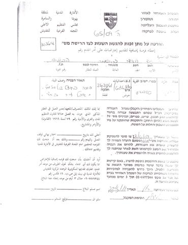
In Continuation of the ethnic cleansing policy practiced by the Israeli occupation authorities against the Palestinian citizens of the northern Jordan Valley, the Israeli Civil administration raided Kherbit Samra area east of Tammun city in Tubas Governorate on the 28th of March 2011 and handed over residents of Kherbit Samra orders to evacuate the area and demolish their residential structures and animal barns under the pretext of being illegally built in an area classified by the Israelis as ‘Closed Military Areas’. Table 1 gives more details of the threatened structures in Kherbit Samra
| Table 1; Threatened Palestinian Families in Kherbit Samra area – Tubas Governorate | ||||||||
| Notes | Tabon | Animal Barns | Barracks | Houses | No. of Family members | No. of sheep | Work Status | Owner Name |
| —— | 1 | 2 | 1 | 1 | 8 | 180 | Farmer | Muhammad Naji Mahyoub Abu ‘Amer |
| —— | 1 | 2 | 1 | 1 | 2 | 100 |
Farmer
|
‘Amer Jameel Abu Na’im |
| He was handed an evacuation order | 1 | 2 | 1 | 2 | 9 | 70 |
Farmer
|
‘Abed ‘Awad Fawzi ‘Amer |
| The family was given an evacuation order | 1 | 2 | 1 | 1 | 2 | 130 |
Farmer
|
Abu ‘Amer ‘Abed ‘Awad |
| He was handed an evacuation order | 1 | 2 | 1 | 1 | 9 | 120 |
Farmer
|
Abed Awad Abu Thiab ‘Amer |
| ——- | 1 | 2 | 1 | 1 | 8 | 120 |
Farmer
|
Abed Awad Abu Ayman ‘Amer |
| ——- | 6 | 12 | 6 | 7 | 38 | 720 |
——–
|
|
Source: ARIJ Team field 2011


Military Orders given to residents of Kherbit Samra
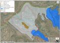
It is worth mentioning that Kherbit Samra is located among three Israeli military bases; the first is located to the east of Kherbit Samra and is called ‘Al Mazoqeh’ and is located on top of Al Mazoqeh Mountain, a strategic area overlooking the northern and southern valleys. The second military base is located to the west of Kherbit Samra and is used for military trainings and constitute a continuous threat to the lives of citizens living in Kherbit samra and the surrounding communities. The third military base is called ‘Al Masna’ base’ and is located to the south of Kherbit Samra. See Map 1

Previous Israeli orders targeting Kherbit Samra in Tubas Governorate
On March 24, 2010, the Israeli Civil Administration handed over residents of Khirbit Samra east of Tammun city in Tubas Governorate two halt of construction orders against a number of structures including barns, residential barracks and outdoor stoves. The Committee gave owns until the 15th of April 2010 to object the military orders at the military court of Beit El. Table 2 gives details of the targeted structures:-
|
Table 2; Threatened Palestinian Structures in Kherbit Samra – March 24, 2010
|
||||
|
Owner
|
Number of structures
|
Area
(m2)
|
Family members
|
Structure type
|
|
Moh’d Bani Odeh
|
1
|
60
|
9
|
Barn
|
|
Ghalib Bani Odeh
|
1
|
40
|
11
|
Residence (Metal)
|
|
2
|
45
|
—
|
Barn + outdoor stove
|
|
|
Total
|
4
|
145
|
20
|
|
Source: Land Research Center, 2011
The Israeli plans to demolish and evacuate Palestinian Communities in the Jordan Valley
Following the Israeli occupation of the West bank and the Gaza strip in 1967, Israel targeted the eastern part of the West Bank by announcing vast areas of it as ‘Closed Military Area’. This, in turn, had ceased Palestinian urban and economic development over the years and caused the displacement of many Palestinian families from their lands. This policy also constituted an obstacle to the growth of Palestinian communities in the eastern zone as most of Palestinian communities are located in areas where construction is prohibited unless a building permit is granted by the Israeli Civil Administration.
Israel has also depleted natural resources in the eastern part of the West Bank such as the agricultural lands and water sources (wells and springs) through the construction of artesian wells to divert water resources for the use of Israeli settlements in order to force Palestinians to leave.
The Israeli demolition and evacuation policies in the eastern zone come to confirm on the determination of the Israeli government to go forward with the implementation of its colonial plans, which were never set on the basis of security needs, military necessities, and unauthorized construction but with the aim to build Israeli settlements in the eastern zone. These practices violate all human rights under international law and the Fourth Geneva Convention of 1949:
-
Articles 53 & 147 of the Fourth Geneva Convention of 1949 provides that ‘any destruction by the Occupying power of real or personal property belonging individually or collectively to private persons, or to the State, or other public authorities or social or cooperative organizations is prohibited, except where such destruction is rendered absolutely necessary by military operations.’
-
Also Art. 23 of the Hague Convention of 1907 also provides: In addition to the prohibitions provided by special Conventions, it is especially forbidden to destroy or seize the enemy’s property, unless such destruction or seizure be imperatively demanded by the necessities of war;
-
Moreover under the Universal Declaration of Human Rights adopted and proclaimed by General Assembly resolution 217 a (III) of, December 10, 1948, Article 17 reads: ‘No one shall be arbitrarily deprived of his property.’ Which means it bans Israel from destroying or confiscating the property of the Palestinians at any case.
:::::::::::::::_
[1] The eastern part of the West Bank which is known today as the Eastern Segregation Zone.
Prepared by