• About The Project
  • Palestine in Century
  • Selected Maps
  • Glossary
  • About ARIJ
  • About LRC
  • By Year
    • Case Studies By Year
    • Daily Report By Year
Tuesday, June 9, 2026
POICA
No Result
View All Result
  • Home
  • Settlements
    • New Israeli Settlements
    • Settlement Expansion
  • Israeli Violations
    • Agriculture
    • Confiscation
    • Demolition
    • Environment
    • Eviction of Palestinians
    • Settlers Attacks
  • Bypass Roads
  • Israeli Plans
  • Segregation
    • Checkpoints
    • Closure
    • Separation Plans
  • Military Orders
  • Reports
    • Daily Report
    • Monthly Report
    • Quarterly Report
No Result
View All Result
POICA
No Result
View All Result

Evacuation Orders of Agricultural Lands

March 20, 2011
in Military Orders
Evacuation Orders of Agricultural Lands
Violation: Evacuation orders issued by the Israeli forces against agricultural lands.
Date: February and March 2011.
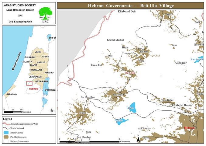
Location: Tawas, Wadi Al Qalamoun and Khillet Ahmad Harb west of Beit Ula.


Details:
Israeli occupation forces issued “evacuation orders” against Palestinian lands located in the west of the town of Beit Ula. According to the Municipality of Beit Ula, the targeted lands belong to the following:
The heirs of Abdel Jabbar Ali Salameh and Mr. Bahjat Affaneh: They have found the evacuation order in their agricultural lands in the area of Tawas west of the town. The Order number was 609 and was titled “Eviction Order”
 
 
Pic.1+2: The eviction Order.
 
The Order was issued on the 21st of February, 2011, and requested that land owners “to remove their possession of the land and to return it to its original status” as the land was classified according to the occupation forces as “State Land”. The Order gave the owners a period of 45 days to remove the “violation”. Otherwise, occupation forces would carry out the operation and the owners will be billed for it. 
 
The map associated with the Order shows that the targeted lands are located in Parcel 15 Piece 2 within the lands of Murjan Abu Aseidah. Its area is 28 dunums and is planted with almond trees while others are being currently rehabilitated.  The heirs of Mr. Salameh own about 20 dunums planted with 400 almond trees since the year 2006 while Mr. Affaneh owns 8 dunums undergoing rehabilitation.


Pic.3+4: Part of the lands of the heirs of Mr. Salameh.
 

Pic. 5+6: Partt of the lands of Mr. Affaneh
 
 
The heirs of Mr. Mohammad Al Adam:
The targeted lands are located in the area of Wadi Al Qalamoun. The eviction order in its regard was issued on the 1st of March, 2011.


Pic.7+8: Copy of the Order.
 
The Order gave the owners of the land a mere 50 hours to remove the “violation” since the issuing of the Order. It also indicated that the owners will be legally prosecuted due to the violation. The map associated with the Order indicates that the area of the targeted lands is between 70 and 80 dunums planted with almond and olive trees since a year ago. Other lands are planted with wheat.
 
  
Pic.9-11: Part of Al Adams’ lands.
 
 
It has to be noted that a bagger working on the land was confiscated during the rehabilitation process. It was released a year after the incident after paying a fine of NIS 4,000. Mr. Mahmoud Saleh Al Adam: The Order was found in Mr. Adam’s lands located in a location known as Khallet Ahmad Harb. The Order was issued on the 9th of March, 2011.
Pic.12: A copy of the Order pertaining to Mr. Adams’ lands.
 
The Order gave the owners a mere 35 hours to remove the “violation.” The map that is usually attached with the Order was not found with the Order. Yet, Mr. Adam indicated that he owns about 20-dunum piece of land east of the Racist Wall some of which are planted with olive tress while the others are not planted.
 
Pic.13+14: Part of the lands of Mr. Mahmoud Al Adam.
 
 
Farmers of Khallet Ahmad Harb have indicated that Israeli occupation forces have used the said lands for “military trainings” while an Israeli quarry was established only nearby east of the Wall.
Pic.15: A section of the Racist Wall in Khallet Ahmad Harb.
 
 
It has to be reported that during February 2011 Israeli occupation forces have issued a number of Stop Work Orders against Palestinian structures in the area of Attous of Beit Ula while the colony of Nahousha is experiencing a rapid expansion at the expense of Beit Ula lands located beyond the Racist Wall.
 
Pic.16: the colony of Nahousha expanding at the expense of Beit Ula lands.
 
Pic.17: Palestinian structures and houses with Stop Work Orders while the colony of Nahousha appears in the background.
 
Prepared by
The Land Research Center
LRC

Recommended For You

الاحتلال يرسّخ بؤرة “يتسيف” الاستيطانية عبر تخصيص 92 دونماً من أراضي بيت ساحور

by arij
June 9, 2026
0
الاحتلال يرسّخ بؤرة “يتسيف” الاستيطانية عبر تخصيص 92 دونماً من أراضي بيت ساحور

أصدر جيش الاحتلال الإسرائيلي في الخامس من شهر اذار من العام 2026 إعلاناً عسكرياً جديداً موقع من قبل ما يُسمّى بـ “قائد قوات جيش الدفاع الإسرائيلي في منطقة...

Read moreDetails

سلطات الاحتلال الإسرائيلي بصدد الاستيلاء على موقع قبر النبي صموئيل شمال غرب مدينة القدس

by arij
May 23, 2026
0
سلطات الاحتلال الإسرائيلي بصدد الاستيلاء على موقع قبر النبي صموئيل شمال غرب مدينة القدس

 نشرت سلطات الاحتلال الإسرائيلي في الثامن عشر من شهر أيار من العام 2026 اعلانا مفاده الاستيلاء على الأراضي الفلسطينية في قرية النبي صموئيل شمال غرب القدس المحتلة. وجاء...

Read moreDetails

إقامة منطقة عسكرية عسكرية داخل أراضي (أ) في جنين

by arij
May 19, 2026
0
إقامة منطقة عسكرية عسكرية داخل أراضي (أ) في جنين

   في السابع من شهر أيار من العام 2026، وزعت سلطات الاحتلال الإسرائيلي أمرا عسكريا جديدة على أهالي مدينة جنين يقضي بمصادرة 7.2 دونما من الأراضي الفلسطينية في...

Read moreDetails

“بمساحة اجمالية 177 دونما من أرضي البيرة وبيتين”, طريق استيطاني لخدمة البؤر الاستيطانية في محافظة رام الله

by arij
May 18, 2026
0
“بمساحة اجمالية 177 دونما من أرضي البيرة وبيتين”, طريق استيطاني لخدمة البؤر الاستيطانية في محافظة رام الله

في الحادي عشر من شهر أيار من العام 2026, نشرت دائرة أراضي إسرائيل اعلانا جديدا يقضي بمصادرة المزيد من الأراضي الفلسطينية في محافظة رام الله لأغراض استيطانية في...

Read moreDetails

“في خدمة مستوطنة ناحال حيلتس”, طريق استيطاني إسرائيلي جديد على أراضي بتير وبيت جالا في محافظة بيت لحم

by arij
May 18, 2026
0
“في خدمة مستوطنة ناحال حيلتس”, طريق استيطاني إسرائيلي جديد على أراضي بتير وبيت جالا في محافظة بيت لحم

تواصل سلطات الاحتلال الإسرائيلي إحكام سيطرتها على المزيد من الأراضي الفلسطينية في الضفة الغربية المحتلة، وهذه المرة من خلال استهداف أراضي محافظة بيت لحم. ففي السادس والعشرين من...

Read moreDetails
Next Post
الاحتلال الإسرائيلي يخطر 18 منشأة لتصنيع الفحم في بلدة يعبد بوقف البناء

الاحتلال الإسرائيلي يخطر 18 منشأة لتصنيع الفحم في بلدة يعبد بوقف البناء

LATEST NEWS

الاحتلال يرسّخ بؤرة “يتسيف” الاستيطانية عبر تخصيص 92 دونماً من أراضي بيت ساحور

الاحتلال يرسّخ بؤرة “يتسيف” الاستيطانية عبر تخصيص 92 دونماً من أراضي بيت ساحور

by arij
June 9, 2026
0

........................................................

سلطات الاحتلال الإسرائيلي بصدد الاستيلاء على موقع قبر النبي صموئيل شمال غرب مدينة القدس

سلطات الاحتلال الإسرائيلي بصدد الاستيلاء على موقع قبر النبي صموئيل شمال غرب مدينة القدس

by arij
May 23, 2026
0

........................................................

إقامة منطقة عسكرية عسكرية داخل أراضي (أ) في جنين

إقامة منطقة عسكرية عسكرية داخل أراضي (أ) في جنين

by arij
May 19, 2026
0

........................................................

الآثار كأداة للضم الزاحف: مشروع القانون الإسرائيلي لإعادة هندسة الجغرافيا والهوية في الضفة الغربية

الآثار كأداة للضم الزاحف: مشروع القانون الإسرائيلي لإعادة هندسة الجغرافيا والهوية في الضفة الغربية

by arij
May 23, 2026
0

........................................................

flag_yellow_lowEU-PfP-Logo

This website and its content were initiated in 1993 by the Applied Research Institute – Jerusalem (ARIJ) and the Land Research Center (LRC) with the support from the European Union up until 2023. Since then, the Applied Research Institute – Jerusalem (ARIJ) has taken over the continued development and maintenance of the website. The views expressed remain solely those of ARIJ) and do not necessarily reflect those of the European Union.

© 2026 Copyright | ARIJ | All Rights reserved.

No Result
View All Result
  • Home
  • Settlements
    • New Israeli Settlements
    • Settlement Expansion
  • Israeli Violations
    • Agriculture
    • Confiscation
    • Demolition
    • Environment
    • Eviction of Palestinians
    • Settlers Attacks
  • Bypass Roads
  • Israeli Plans
  • Segregation
    • Checkpoints
    • Closure
    • Separation Plans
  • Military Orders
  • Reports
    • Daily Report
    • Monthly Report
    • Quarterly Report

© 2026 Copyright | ARIJ | All Rights reserved.