On January 27, 2010, the Israeli occupation authorities handed over the citizens of Burin village, Nablus governorate a notice to stop building the mosque of Salman the Persian, in addition to handing over a demolition notice of ten shops located nearby the mosque. The notifications were issued under the pretext that the target structures are located in zone C of Oslo classifications which is subject to Israeli security and civic control and that any building in that area requires a license from the planning and construction committee affiliated to the so-called Israeli civil administration in the West Bank. This happens despite the fact that the two structures are located amidst a residential quarter inside the village borders.
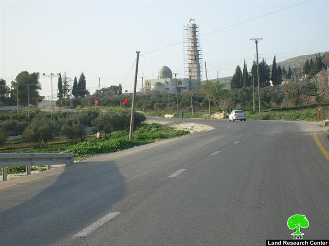
Photo 1: Burin, Nablus: A genral view of Salamn the Persian mosque
The notifications asked the people in charge of the mosque and the owner of the shops to appear before the Israel Beit Eil court in the main headquarters of the ‘ civil administration’ near the city of Ramallah on February 10, 2010 to consider their case. The notifications require them to obtain licenses but does not guarantee that it bestowed upon them.
Table 1: Notified structures by owner’s name, family members and area:
|
Owner’s name
|
# family members
|
Of whom children under 18
|
Type of structure
|
Area
M2
|
|
Hashim Musa Najjar
|
6
|
4
|
Under construction stores
|
150
|
|
The people of Burin village
|
—
|
—
|
An under construction mosque
|
380
|
|
Total
|
|
|
|
530
|
Source: LRC field work
With the above mentioned notifications the number of the halt of construction and demolition warnings in the village of Burin since 2000 until today mounts to 5. The occupation authorities carried out its threats against the village and demolished in 2003 a house located near the bypass road adjacent to the settlement of Yizhar and owned by Mr. Mahmoud Daoud Saleh.
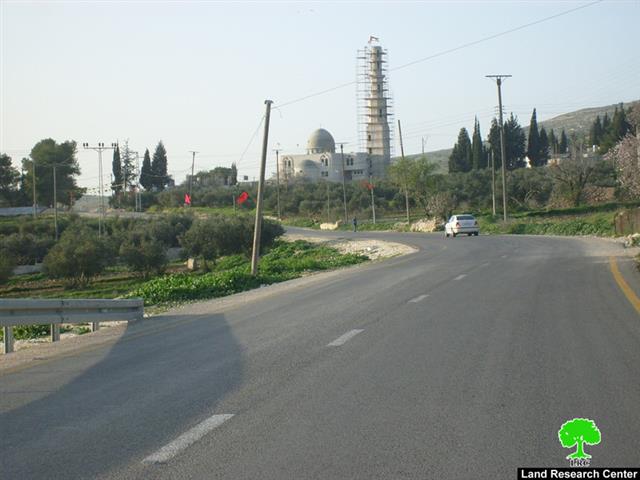
Photo 2: Burin, Nablus: A genral view of the threatned stores in fornt of the mosque
In an interview with LRC field researcher the head of Burin Village council, Mr.Ali Eid said: ‘ There must be a real confrontation by the Palestinian Authority against the on going Israeli demolition orders in its capacity as signatory to Oslo agreement with the Israeli side in 1993, where according to the agreement was supposed that the area on which the mosque was built should have been transferred ten years ago under the Palestinian jurisdiction. Therefore, there must be real legal and social support to the owners of structures affected by the Israeli measures as the Israeli occupation is acting hard without any restraint in this area to sabotage and destroy the Palestinian infrastructure in order to steal land and illegally annex it for the expansion of Israeli colonies built inside the occupied territories’.
Photo 3: Burin, Nablus: Another closer view of the mosque of Salman the Persian
A glimpse on Burin village:The village is located about 8 km south of Nablus. Its total land area is 10415 dunums ( 1 dunum = 1000 M
2) of which 335 dunums are built up zone imposed by the occupation authorities before the signing of the Oslo Accords in 1993
. It has a population of approximately 3500 people
, amongst them thee are about 400 refugee families whose members represent 32% of the total village population
.
Demolition face by construction
While the occupation authorities continue to inform owners of the village homes and mosques of demolition, massive construction plans are being pursued inside the Israeli colonies already established on the territory of the village such as Bracha and Yitzhar which confiscate vast tracts of lands of Burin village, in addition to building more outposts in the periphery of these colonies at the expense of the Palestinian territories.
Repeated incursions and attacks:
For more than two years now the4 village of Buring has been a target of of repeated incursions and attacks by settlers who burn Palestinian agricultural crops and cut down olive trees. It is worth mentioning that 80% of agricultural land from the village of Burin is located adjacent to the colonies of Bracha and Yitzhar, making it vulnerable to the ambitions of the Israeli occupation through the conversion of most of the land to military zones closed to Palestinian access or that can be accessed only through prior coordination with the District Coordination Office ( DCO) at certain times of the year. Attacks are concentrated in particular on the land in the basins of Karm Salim and Al Mayadin, which often occur in the custody of the occupation army, thereby facilitating the task of the settler’s control over the agricultural land.
In addition to the village of Burin, the nearby villages of Asira Al Qibliya and Madama have been subject to attacks by settlers over the past nine years, including:
1- Shooting towards the farmers and attacking their homes and the theft of agricultural tools.
2- Cracking olive trees by sharp instruments, as happened in the territory of Mr. Mohammed Raja Zain in Karm Salim basin last summer.
3- Burning more than 1470 dunums of agricultural lands of Burin, including 1200 olive trees, in addition to land planted with wheat which is a major source of income for 14 farmers’ families in the village. The Yitzhar settlers The burned these lands in the custody of the occupation army. The people of Burin, presented many complaints to a number of local and international human rights organizations, but to no avail until the date of preparation of this report.
Introduction to Yitzhar and Bracha:
Yizhar colony was founded in 1983 and its municipal boundaries cover an area 1223 dunums, of which 269 dunums built up zone
. The number of settlers by the end of 2008 was 864
.
While, the settlement of Bracha was founded in 1982 and its municipal boundaries cover an area of 262 dunums including 258 dunums built up zone. The total number of settlers by the end of 2008 was1364.
::::::::::_
[1] GIS department at LRC
[4] Foundation for Middle East Peace-Washington