• About The Project
  • Palestine in Century
  • Selected Maps
  • Glossary
  • About ARIJ
  • About LRC
  • By Year
    • Case Studies By Year
    • Daily Report By Year
Tuesday, May 20, 2025
POICA
No Result
View All Result
  • Home
  • Settlements
    • New Israeli Settlements
    • Settlement Expansion
  • Israeli Violations
    • Agriculture
    • Confiscation
    • Demolition
    • Environment
    • Eviction of Palestinians
    • Settlers Attacks
  • Bypass Roads
  • Israeli Plans
  • Segregation
    • Checkpoints
    • Closure
    • Separation Plans
  • Military Orders
  • Reports
    • Daily Report
    • Monthly Report
    • Quarterly Report
No Result
View All Result
POICA
No Result
View All Result

Re-opening of Bani Na’im roads: ease of restrictions or prelude to further settlement?

March 7, 2009
in Closure
Re-opening of  Bani Na’im roads: ease  of restrictions or prelude to further settlement?

Bani Na'im, Hebron: a Jalajel road  after re-opening


On February 14th, 2009, the Israeli occupation forces lifted all the roads barrier that were blocking the entrances to Bani Na'im town since the beginning of the second Intifada in the year 2000.

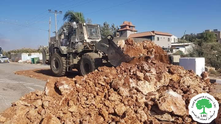
Mr. Radwan Manasra, the head of Bani Na'im municipal council said in an interview with LRC field researcher that the army's bulldozers arrived at the scene and began to open the cement blocks,  earth and rock mounds that were blocking the entrances to the town after a long process of legal complaints presented to Israeli courts against the blockage which lasted for nine years.

The opening of Wadi Al Juz main entrance road was the most important move  in this regards in addition to two other vital roads: Khalet Al Warda and Al Jalajel. Mr. Manasra went on to say that the closure of these three vital roads had blocked all the attempts made by the municipal council to re-build them. After the latest development there is a real possibility for re-building and enlargement. During the closure time all the citizens of Bani Na'im  were using a 32 km long alternative road through mountains to reach the city of Hebron instead of the original 14 km long road to Hebron.


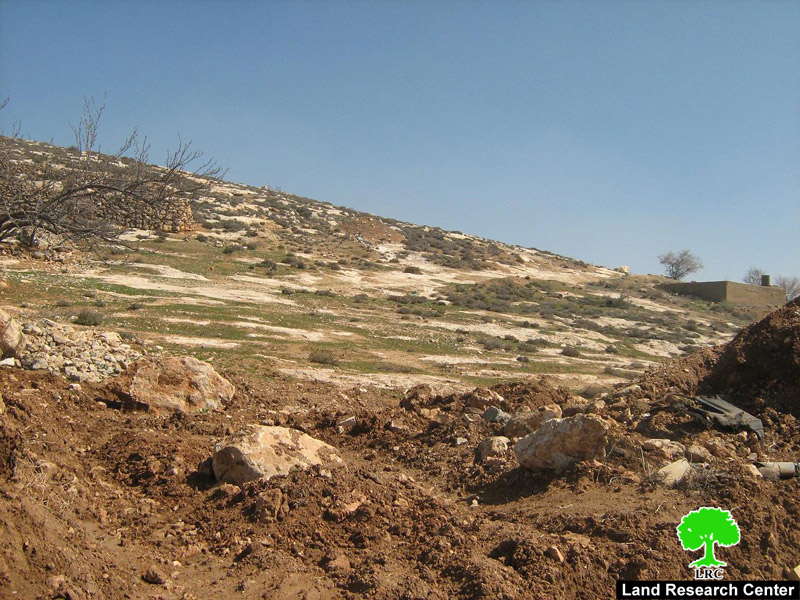
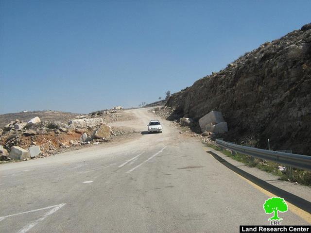
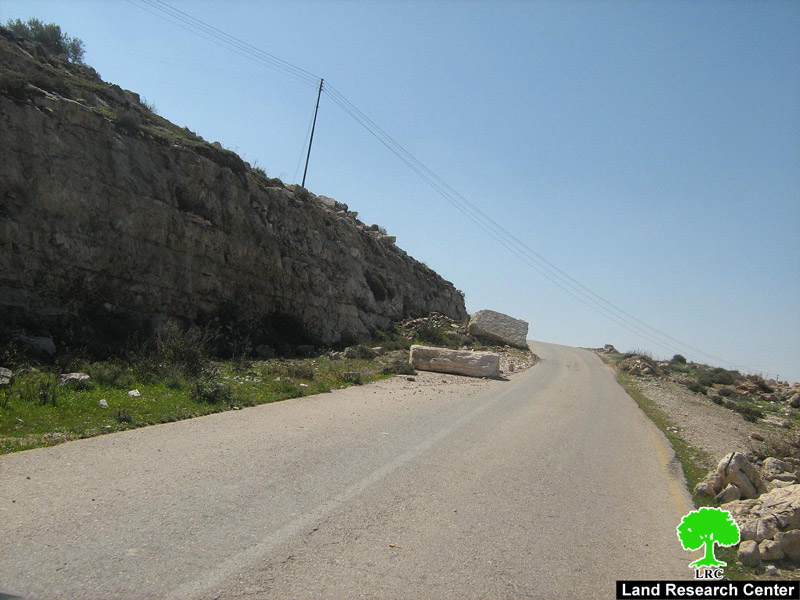
(Photo 1: Bani Na'im, Hebron: one of the rugged road that was used during the closure period to reach the city of Hebron )


Taxi and lorry drivers had to pay the biggest price for the closure because of the use of unsuitable roads that inflicted heavy damage to their vehicles. Bani Na'im is a prominent stone producing town and, therefore, dozens of lorries have to enter its boundaries every day, however, this process has been badly interrupted by the closure and the use of dirt and uneven surface roads through out the nine years of closure.


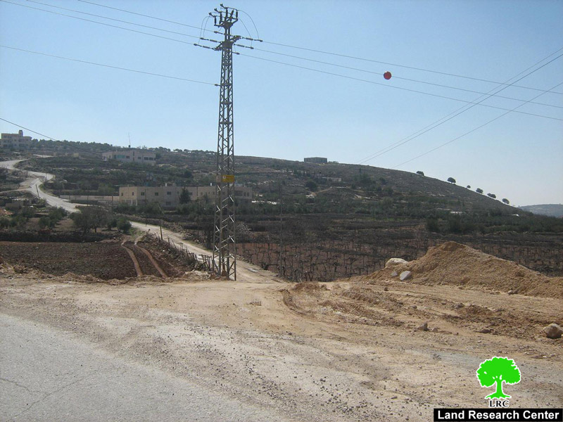
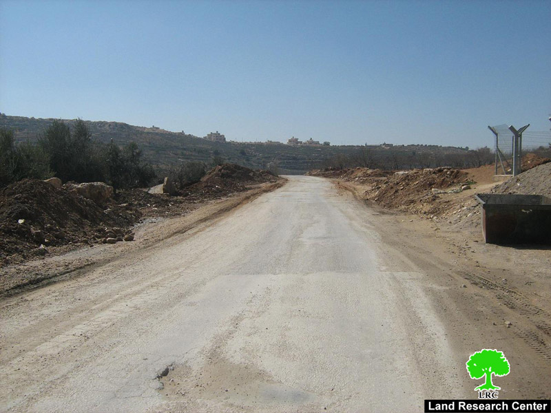
(Photo 2+3: Bani Na'im, Hebron: respectively Wadi Al Juz and Khlaet Al Warda after re-opening )


According to Bani Na'im municipality, the estimated financial losses inflicted on the town as a result of the closure has been 50 US $ per year, or 450000 US $ on the total for the nine year period.

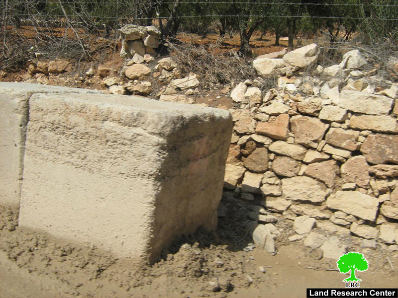
(Photo 5: Bani Na'im, Hebron: big rocks and earth mound that were blocking the Jalajel road )


 (Photo 6: Bani Na'im, Hebron: concrete blocks  that were blocking the Wadi Al Juz  road ) 


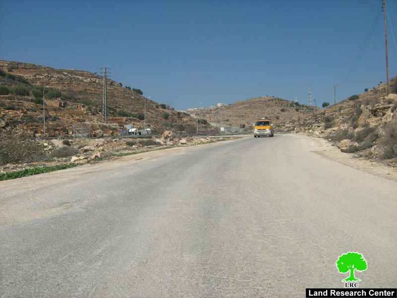
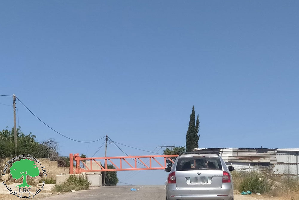
(Photo 7: Bani Na'im, Hebron: a taxi traveling Wadi Al Juz road after re-opening heading to Hebron city)


A cancer nucleus 

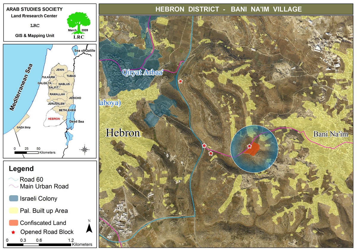
In 1967 the Israeli occupation authorities took control over 15 dunums of land located in Wadi Al Juz at the main entrance to the town at the distance of only 3 km from Kiriayt Arba'a colony. Nowadays, the 15 dunums became 40 surrounded with a barbed wire fence and metal gate and guarded by the army 24 hours a day. Currently, an Israeli settler settles the land after it had been provided with necessary infrastructure such as electricity, water and sewage. Also, two caravans (mobile homes) were introduced to the scene. Local citizens are worried of the likelihood of establishing a bigger colony at the site and, consequently, taking more of Bani Na'im's land not alone separating it from Hebron.

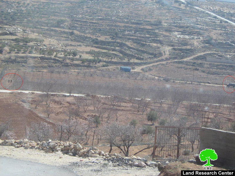
Photo 8: Bani Na'im, Hebron: location of the confiscated land at the main entrance to the town

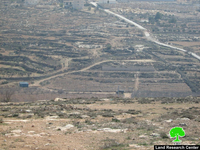
Photo 9: Bani Na'im, Hebron: the confiscated land  being guarded  by Israeli soldiers


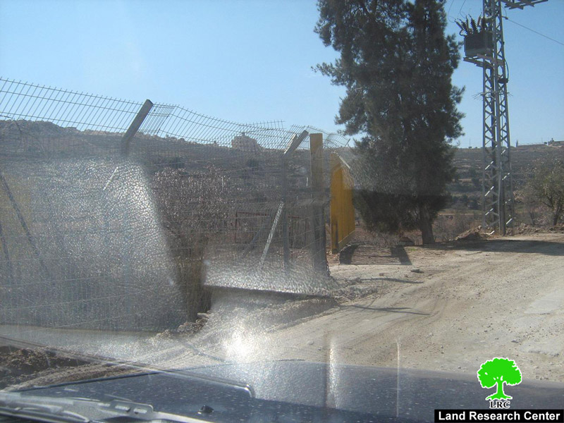
( Photo 10: Bani Na'im, Hebron: an iron gate that leads to the confiscated land  )

Background to Bani Na'im

It is situated 8 km to the east of Hebron city. It's total surface land area is  157774 dunums of which 98220 dunumd as built up zone. At the end of 2008 the total population toll was 22300. Bani Na'im is surrounded by the land of Hebron city, Sa'ir, Yatta, Jahalin and Ka'abna lands.

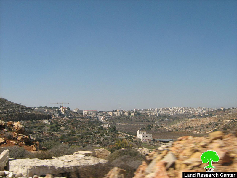
(Photo 11: Bani Na'im, Hebron: to the left is the colony of KiriyatArba'a facing Bani Na'im and to the right is the city of Hebron)


Prepared by:
The Land Research Center
LRC


Recommended For You

Israel tightens the Grip on Nablus Governorate –  الحصار يخنق محافظة نابلس 

by arij
October 20, 2022
0
Israel tightens the Grip on Nablus Governorate –  الحصار يخنق محافظة نابلس 

  The map of Israeli checkpoint stifling the daily life of more than 388 thousand Palestinians   الحصار يخنق محافظة نابلس  The Israeli Closure Policy in International Law The...

Read moreDetails

الاحتلال الإسرائيلي يغلق مدخل بلدة سلواد الجنوبي في محافظة رام الله والبيرة

by arij
November 7, 2022
0
الاحتلال الإسرائيلي يغلق مدخل بلدة سلواد الجنوبي في محافظة رام الله والبيرة

  الانتهاك: اغلاق طريق بالسواتر الترابية. الموقع: بلدة سلواد/ محافظة رام الله والبيرة. تاريخ الانتهاك: 06/10/2022م. الجهة المعتدية: جيش الاحتلال الاسرائيلي. الجهة المتضررة: أهالي بلدة سلواد. تفاصيل الانتهاك:...

Read moreDetails

إغلاق مدخل بلدة قصرة الرئيسي / محافظة نابلس

by arij
September 28, 2022
0
إغلاق مدخل بلدة قصرة الرئيسي / محافظة نابلس

  الانتهاك: إغلاق طريق. الموقع:بلدة قصرة جنوب مدينة نابلس. تاريخ الانتهاك:13 أيلول 2022م. الجهة المعتدية:جيش الاحتلال الإسرائيلي. الجهة المتضررة:أهالي بلدة قصرة والقرى المجاورة. تفاصيل الانتهاك: اقتحمت قوة كبيرة من...

Read moreDetails

Closure of the main iron gate entrance of Aboud village, Ramallah governorate

by arij
July 4, 2022
0
Closure of the main iron gate entrance of Aboud village, Ramallah governorate

  Violation: Closing the main entrance to the village. Location: Aboud village / Ramallah and Al-Bireh governorate. Violation date: 09/06/2022 AD. Perpetrators: The Israeli Occupation Army. Affected party:...

Read moreDetails

إغلاق المدخل الرئيسي بالبوابة الحديدية في قرية عابود بمحافظة رام الله

by arij
July 2, 2022
0
إغلاق المدخل الرئيسي بالبوابة الحديدية في قرية عابود بمحافظة رام الله

  الانتهاك: إغلاق المدخل الرئيسي بالبوابات الحديدية. الموقع: قرية عابود/ محافظة رام الله والبيرة. تاريخ الانتهاك: 09/06/2022م. الجهة المعتدية: جيش الاحتلال الاسرائيلي. الجهة المتضررة: سكان قرية عابود. تفاصيل...

Read moreDetails
Next Post
تعديل مسار الجدار الفاصل في المقطع الجنوبي من مدينة قلقيلية

تعديل مسار الجدار الفاصل في المقطع الجنوبي من مدينة قلقيلية

LATEST NEWS

Expansion of Gilo Settlement: A Strategic Plan to Isolate Bethlehem and Undermine Palestinian Rights

Expansion of Gilo Settlement: A Strategic Plan to Isolate Bethlehem and Undermine Palestinian Rights

by arij
May 12, 2025
0

........................................................

الأراضي الفلسطينية بين الذرائع الأمنية والأطماع الاستيطانية – “الأمن، الآثار، والطبيعة كحجج لاقتلاع الفلسطينيين من أراضيهم”

by arij
April 15, 2025
0

........................................................

الطرق الالتفافية الاسرائيلية وأثرها على البيئة الفلسطينية

انتهاك للطبيعة والهوية في الأراضي الفلسطينية المحتلة

by arij
March 17, 2025
0

........................................................

Israel Advances Settlement Plan on Ancient Olive Groves on lands of Beit Jala city, Violating International Law and depriving Palestinians their lands

إسرائيل تمضي قدمًا في مخطط استيطاني جديد على أراضي مدينة بيت جالا، في انتهاك للقانون الدولي وحرمان الفلسطينيين من أراضيهم

by arij
April 29, 2025
0

........................................................

flag_yellow_lowEU-PfP-Logo

This website has been produced with the assistance of the European Union. The contents of this publication are the sole responsibility of ARIJ & LRC and can in no way be taken to reflect the views of the European Union.

© 2025 Copyright ARIJ . All Rights reserved. .

No Result
View All Result
  • Home
  • Settlements
    • New Israeli Settlements
    • Settlement Expansion
  • Israeli Violations
    • Agriculture
    • Confiscation
    • Demolition
    • Environment
    • Eviction of Palestinians
    • Settlers Attacks
  • Bypass Roads
  • Israeli Plans
  • Segregation
    • Checkpoints
    • Closure
    • Separation Plans
  • Military Orders
  • Reports
    • Daily Report
    • Monthly Report
    • Quarterly Report

© 2025 Copyright ARIJ . All Rights reserved. .