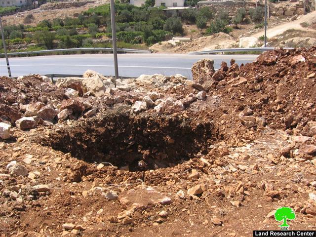
(Photo 1: A pit that has been dug up in Halhul land along road number
60 for the use of a high voltage power line)
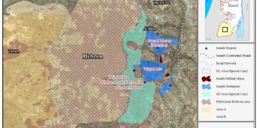
Last December, the Israeli electricity company announced a plan to construct two new high voltage power lines over the lands of Halhul and Beit Ummer towns and Hebron city to serve the Israeli colonies in the region. The first one aims at transferring a minimum of 161 kilo voltage from the Kiriayt Arba' colony's power station in Hebron governorate to Bitar illit colony in Bethlehem governorate. It is going to be one of the major power lines in the occupied Palestinian territories expanding over hundreds of dunums of Palestinian owned land to the east and north of the Hebron district and destroying hundreds of fruitful trees of different types. In addition, it will prevent any type of construction at the depth of 40 meters in each side. Eight Palestinian houses are, also, facing the threat of demolition in case this colonial project is implemented. See Map 1
While, the second line is 65 k voltage aiming at providing electricity to the colony of karma Tzur – located between the towns of Halhul and Beit Ummer- from the main power line on road number 35 which connects the Hebron colonies with Israeli proper through the Tarqumiay military checkpoint down to Beit Givrin inside the green line.
Works commenced in the second line during last September when an Israeli military force accompanied by bulldozers and large hammers began to dig pits and prepare land for the fixing of electric towers along bypass road number 60 in the eastern land of Halhul town.
(Photo 2 & 3: two other pits that have been dug up in Halhul land along
road number 60 for the use of a high voltage power line)
In an interview with LRC field worker, the mayor of Halhul town, Dr. Ziyad Abu Yusif, denounced this step clarifying that the municipality as well as affected farmers and land owners had presented an objection to the Israeli authorities at Beit Eil 'civil administration' immediately after the announcement of these plans last December. It seems that ' they gave a blind eye to our complaint', he went on to say.
It is worth mentioning, according to Dr. Abu Ziyad, that the Israeli occupation authorities didn't inform the municipality or affected land owners of the these plans whence announced in December. Instead, they knew about them only through an announcement in the Israeli newspapers. The Israeli practice in this regard mounts to land stealing because of the absence of due process.
Additional Land loss
The affected land will be inaccessible by its owners either because of the ensuing health dangers or of the Israeli entry limitations meaning that the target land will, eventually, be confiscated for exclusive Jewish use. No Palestinian construction, whatsoever, will be allowed in the vicinity of these two high voltage power lines.
Most of the target lands are cultivated with grape and almond trees. Halhul municipality sources said that the target Halhul lands are located in the east and north east side of the town. The target land is owned by many families, including Aqel, Ad Dawada and As Sa'di. On the other hand, sources at Beit Ummer municipality clarified that the target Beit Ummer lands are, also, located to the east and north east of the town. The land is owned by the families of Abu Ayyash, Ikhlayel and Wahadin.
(Photo 4 & 5: roads are opened at the expense of Palestinian land to
connect the newly dug up pits with the bypass road No. 60 east of Halhul)
According toDr. Abu Yusif the latest land confiscation will be added to more than 2850 dunums of land that have been confiscated from Halhul town for the construction of the bypass road number 60 since its commencement in the second half of the nineties of the last century. He confirmed that the confiscated land is of high agricultural value as it is located in the most fertile parts of the town. The bypass road along with the newly announced electric power line schemes will block any expansion in the town's built up area towards east and north and will separate huge areas of agricultural lands behind it's path, Mr. Abu Yusif went on to say.
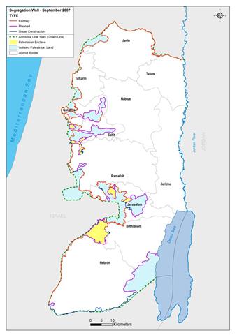
As for Beit Ummer, the latest confiscation will be added to more than 6000 dunums of land expected to be confiscated or separated for the purpose of building the Segregation Wall at the northern edge of the town. The Segregation Wall is planned to be constructed at the northern borders of the town to annex the ten settlement of Gush Etzion to Israeli. Such a measure will inflict far heavy losses at Palestinian land owners and farmers who will become landless. Similarly, the two proposed power lines and the current bypass road will stop any natural expansion for Beit Ummer town towards east and north.
Beit Ummer and Halhul towns
The town of Beit Ummer is about 12 km to the north of the city of Hebron. According to the Palestinian Central Bureau of Statistics the total population projection by the end of this year will rech 14400 and its total surface land area is 22000 dunums of which 3126 dunums are built up zone.
While, Halhul is located at the northern edge of Hebron city and will be having the population of 24673 by the end of this year as well. Its surface land area is estimated at 30000 dunum, including 7061 dunums as built up zone.
Despite continuous land grabbing on the part of the Israeli occupation, both towns are considered the most prosperous agricultural places in Hebron district as they are famous of grape, peach and apple trees.
Karmei Zur settlement
It was established in 1984 over land taken from Beit Ummer and Halhul towns. It is affiliated to Etzion Block settlements. In the year 2005, it had the population of 713 settlers. It's total municipal area is 226 dunums of which 160 dunums are built up are (source: Foundation for Middle East Peace).
(Photo 6: The colony of Karme Tzur with its colonial post )
On the eve of Sharon's winning of the general elections in the year 2001 a new colonial post was erected outside the settlement's south western borders. Currently, it contains about 25 caravans (mobile homes) as appeared in the attached aerial photo. This colonial post was established on Halhul land.
Prepared by
The Land Research Center
LRC


