• About The Project
  • Palestine in Century
  • Selected Maps
  • Glossary
  • About ARIJ
  • About LRC
  • By Year
    • Case Studies By Year
    • Daily Report By Year
Monday, August 3, 2026
POICA
No Result
View All Result
  • Home
  • Settlements
    • New Israeli Settlements
    • Settlement Expansion
  • Israeli Violations
    • Agriculture
    • Confiscation
    • Demolition
    • Environment
    • Eviction of Palestinians
    • Settlers Attacks
  • Bypass Roads
  • Israeli Plans
  • Segregation
    • Checkpoints
    • Closure
    • Separation Plans
  • Military Orders
  • Reports
    • Daily Report
    • Monthly Report
    • Quarterly Report
  • Home
  • Settlements
    • New Israeli Settlements
    • Settlement Expansion
  • Israeli Violations
    • Agriculture
    • Confiscation
    • Demolition
    • Environment
    • Eviction of Palestinians
    • Settlers Attacks
  • Bypass Roads
  • Israeli Plans
  • Segregation
    • Checkpoints
    • Closure
    • Separation Plans
  • Military Orders
  • Reports
    • Daily Report
    • Monthly Report
    • Quarterly Report
No Result
View All Result
POICA
No Result
View All Result

Israel maneuvers demography to manipulate geography

July 15, 2025
in Israeli Plans

Ever since its establishment, Israel pushed Palestinians away from their land to control the territory and confine their movement. Israel resorted to such scheme in 1948 when it confined the remaining 150,000 Palestinian in what is Israel territory now in 2.5% (524 km2) of the land. Today, the Palestinians in Israel count for 20% (2.1 million individual) of Israel’s population; which counts for a population density at 3,387 individual per km2, vs. 343 individual per km2 (Israel controls beyond the 1949 Armistice Line- aka “the Green Line”: 20,977 km2). That is 10 time folds, which reflects a masked Israeli “coercive” policy of methodological planning that only leads to voluntarily future displacement of the Palestinian population in Israel.

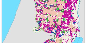
Following the 1967 war, Israel occupied the West Bank (5661 km2) and the Gaza Strip (362 km2) and confined the majority of the Palestinians to the contours of the main cities and the surrounding rural communities as drawn during the British Mandate (1920-1947) over Palestine in 1942. These areas were identified under the Oslo Accord as areas “A” and “B”- 2035 km2 (36%)- in addition to 170 km2  (3%) classified as “Nature Reserve” totaling 2205 km2-39% of the West Bank area. Accordingly, the 2.9 million Palestinian residing in Areas “A” and “B” live in a population density of 1,425 individual per km2.

On the other hand, “on paper agreement”, 2.1 million Palestinians live on 92% (333 km2) of the Gaza Strip, which  falls under Palestinian control (the remaining 29 km2– 8% an Israeli controlled security zone along Gaza border), which counts for a population density at 6,306 individual per km2). However, following October 2023 Israeli aggression, Israeli is cornering the Palestinians at the southern part of the Gaza Strip; some 90 km2 (25% of Gaza) making living condition beyond bearable as it is at 23,333 individual per km2.

The remaining territory (now under the Oslo Accord classified as Area “C” – 3456 km2– 61% of the West Bank area) went under various classification by Israeli, such as:

  • State land,
  • Absentee land,
  • Closed military area,
  • Firing zone area,
  • Nature reserve area,

Much of which was allocated under the Israeli settlement council jurisdiction, to build settlements (204), outposts (305) and as reserve area for future expansion, in addition to bypass road network the serves the 870,000 Israeli settlers (including 340,000 in East Jerusalem) living in Area “C”, in a population density of 252 individual per km2.

In light of the foregoing, it is clear that since its founding, Israel has pursued a deliberate policy of confining Palestinians to ever-smaller enclaves; through forced displacement, economic marginalization, and legal restrictions, in order to shift the demographic and geographic balance in favor of settlement expansion and control over the land. For every 1,425 Palestinians per square kilometer in Areas “A” and “B” of the West Bank, Israel entrenches its authority over 61 percent of the territory and 90 percent of its natural resources in Area “C”.

Likewise, successive sieges of Gaza and land confiscations in East Jerusalem are but extensions of a single strategy aimed at emptying the homeland of its indigenous population. The demands for concrete international action is urgently needed more than ever before to affirm the Palestinians’ inalienable rights to their land and livelihoods, which are stripped from them daily. Hence, to prevent further deterioration and avoid a humanitarian catastrophe, we must translate legal and political denunciations into enforceable measures that shield Palestinian communities from the forced demographic engineering now known as “manipulating demography to reshape geography.”


Prepared by:  
The Applied Research Institute – Jerusalem

Recommended For You

إقرار مخطط توسعي رئيسي في مستوطنة تقوع شرق بيت لحم

by arij
July 28, 2026
0
إقرار مخطط توسعي رئيسي في مستوطنة تقوع شرق بيت لحم

"تستهدف 6000 دونما من الأراضي الفلسطينية" صادقت الهيئة العامة لما يسمى "بالمجلس الإقليمي لمستوطنات غوش عتصيون" جنوب الضفة الغربية المحتلة في العشرين من شهر تموز من العام 2026...

Read moreDetails

تستهدف 6000 دونما من الأراضي الفلسطينية وشرعنة ستة مستوطنات جديدة
إقرار مخططات توسعة رئيسية في تجمع غوش عتصيون الاستيطاني جنوب الضفة الغربية المحتلة

by arij
July 22, 2026
0
تستهدف 6000 دونما من الأراضي الفلسطينية وشرعنة ستة مستوطنات جديدة  إقرار مخططات توسعة رئيسية في تجمع غوش عتصيون الاستيطاني جنوب الضفة الغربية المحتلة

صادقت الهيئة العامة لما يسمى "بالمجلس الإقليمي لمستوطنات غوش عتصيون" جنوب الضفة الغربية المحتلة في العشرين من شهر تموز من العام 2026 على مخطط هيكلي استيطاني واسع النطاق...

Read moreDetails

الآثار كأداة للضم الزاحف: مشروع القانون الإسرائيلي لإعادة هندسة الجغرافيا والهوية في الضفة الغربية

by arij
May 23, 2026
0
الآثار كأداة للضم الزاحف: مشروع القانون الإسرائيلي لإعادة هندسة الجغرافيا والهوية في الضفة الغربية

في خطوة تعكس تصاعد المساعي الإسرائيلية لإحكام السيطرة على الرواية التاريخية والجغرافيا الثقافية في الضفة الغربية، صادقت الهيئة العامة لـ الكنيست الإسرائيلي يوم 11 أيار 2026 على مشروع...

Read moreDetails

ذكرى الـ 50 ليوم الأرض: فلسطين بين ذاكرة الدم وصمود البقاء    

by arij
April 16, 2026
0

في الثلاثين من آذار، لا يستحضر يوم الأرض في الوعي الفلسطيني بوصفه مناسبة رمزية عابرة، بل كحدث تأسيسي متجدد يعكس استمرارية الصراع على الأرض والهوية. وبعد مرور خمسين...

Read moreDetails

Unprecedented Acceleration in Israeli Settlement Expansion in 2025

by arij
March 25, 2026
0
Unprecedented Acceleration in Israeli Settlement Expansion in 2025

Preface, The Israeli settlement policy in the occupied West Bank is one of the most significant obstacles to achieving a just and sustainable peace. Since the occupation of...

Read moreDetails
Next Post
ملاخي هشالوم: أكثر من مجرد بؤرة استيطانية … مشروع تهويد وتوسّع اسرائيلي

ملاخي هشالوم: أكثر من مجرد بؤرة استيطانية ... مشروع تهويد وتوسّع اسرائيلي

LATEST NEWS

” 118 ألف دونم مهددة بالعزل في محافظة طوباس”  إسرائيل تستكمل مشروع “الخط القرمزي” وتوسع عزل الأراضي الفلسطينية شرق الضفة الغربية المحتلة

” 118 ألف دونم مهددة بالعزل في محافظة طوباس”
إسرائيل تستكمل مشروع “الخط القرمزي” وتوسع عزل الأراضي الفلسطينية شرق الضفة الغربية المحتلة

by arij
July 29, 2026
0

........................................................

إقرار مخطط توسعي رئيسي في مستوطنة تقوع شرق بيت لحم

إقرار مخطط توسعي رئيسي في مستوطنة تقوع شرق بيت لحم

by arij
July 28, 2026
0

........................................................

تستهدف 6000 دونما من الأراضي الفلسطينية وشرعنة ستة مستوطنات جديدة  إقرار مخططات توسعة رئيسية في تجمع غوش عتصيون الاستيطاني جنوب الضفة الغربية المحتلة

تستهدف 6000 دونما من الأراضي الفلسطينية وشرعنة ستة مستوطنات جديدة
إقرار مخططات توسعة رئيسية في تجمع غوش عتصيون الاستيطاني جنوب الضفة الغربية المحتلة

by arij
July 22, 2026
0

........................................................

“حتى النصف الأول من العام 2026 “, ” الاستيطان يلتهم الأرض الفلسطينية: ما يزيد عن 22 ألف دونم مستهدفة و 19 ألف وحدة استيطانية”

“حتى النصف الأول من العام 2026 “, ” الاستيطان يلتهم الأرض الفلسطينية: ما يزيد عن 22 ألف دونم مستهدفة و 19 ألف وحدة استيطانية”

by arij
July 22, 2026
0

........................................................

flag_yellow_lowEU-PfP-Logo

This website and its content were initiated in 1993 by the Applied Research Institute – Jerusalem (ARIJ) and the Land Research Center (LRC) with the support from the European Union up until 2023. Since then, the Applied Research Institute – Jerusalem (ARIJ) has taken over the continued development and maintenance of the website. The views expressed remain solely those of ARIJ) and do not necessarily reflect those of the European Union.
© 2026 Copyright | ARIJ | All Rights reserved.

No Result
View All Result
  • Home
  • Settlements
    • New Israeli Settlements
    • Settlement Expansion
  • Israeli Violations
    • Agriculture
    • Confiscation
    • Demolition
    • Environment
    • Eviction of Palestinians
    • Settlers Attacks
  • Bypass Roads
  • Israeli Plans
  • Segregation
    • Checkpoints
    • Closure
    • Separation Plans
  • Military Orders
  • Reports
    • Daily Report
    • Monthly Report
    • Quarterly Report

© 2026 Copyright | ARIJ | All Rights reserved.