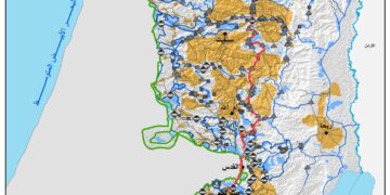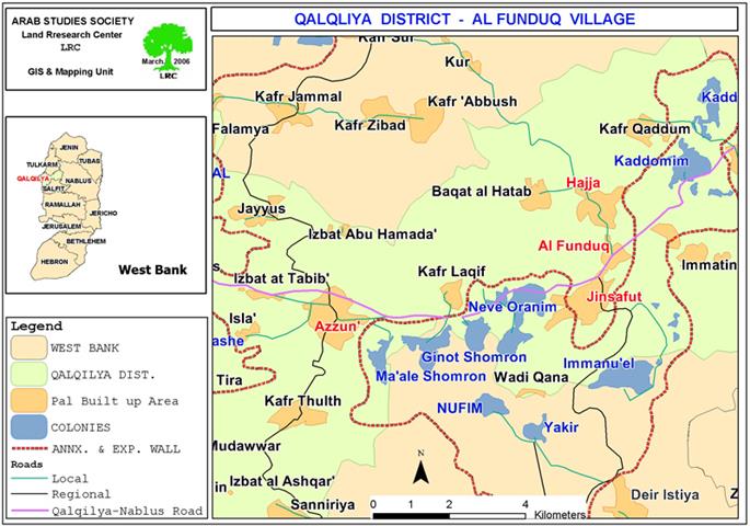
Qalgiliya Governorate
The settlers from the Israeli settlement of Kedumim, located on the main road connecting between the cities of Nablus and Qalqilia, have continued their harassment and attacks against the Palestinian residents of the villages of Al Funduq, Jinsafut and Hajja. The villages are al located on the same road leading to the city of Qalqilia and 2 kilometers away from the aforementioned settlement. Israeli settlers carry out aggressive attacks against Palestinians using the road with the support of occupation authorities and forces. Such aggressive attacks include physical violence, preventing farmers from reaching their lands located close to the settlement, inhibiting Palestinians from using the road leading to Qalqilia and Nablus, in addition to destroying trees and crops and prohibiting shepherds from accessing the area. It is worth noting here that all agriculture-bound lands located in the vicinity of the settlement (area is estimated to be hundreds of dunums) is classified as Area C which means that most of these lands is threatened to be confiscated at any given moment in accordance with Israeli settlement policy in the region.

Map 1: Qalqilyia Governorate
The Settlement of Kedumim
The settlement was established in 1975 on the lands of the Palestinian village of Kafr Qadum. Its population in 2004 reached around 3010, a number that is expected to increase due to the lucrative incentives occupation authorities is offering for those intending to live in the settlement. The build-up area in the settlement is 1003 dunums while the municipal boundaries is around 2039 dunums which makes it one of the largest settlements in the Governorate of Qalqiliya (Source: Foundation for Middle East Peace).

(Photo 1: The settlement of Kedumim at the top of the mountain overlooking
Nablus- Qalqiliya road), Photo courtesy of LRC
Continuous Appetite for Expansion
Israeli occupation started since the end of the 1967 war to confiscate and steal the largest area possible of fertile lands upon which settlements were established. This scenario was applied in the case of the settlement of Kedumim as occupation authorities confiscated fertile Palestinian lands and added it to the settlement since 1975. In the aftermath of the Oslo Accord in 1993 and its subsequent land division into three categories (A, B and C), Israeli forces have used this illegitimate land division to pressure Palestinians living in the vicinity of the settlement as these authorities did not allow the Palestinians to build new houses to expand to face the needs of natural expansion. For example, Israeli occupation forces issued 30 demolition orders against Palestinian houses in the area under the pretext that they were either built without obtaining the proper permits or because it is located close to the to the main road.
In reality, most of the threatened houses or those that were demolished are located one kilometer away from the main road including the house of Mr. Hamouda Mouhaisen Mohammad from the village of Hajja, which was demolished in February 2006. Three more houses were, also, demolished including the house of Mr. Jamal Hasan Hamed from the village of Al Funduq, Mr. Abdullah Saleem Abbas from the village of Hajja, in addition to the house of Mr. Majdi Hashem from the village of Al Funduq. The houses were demolished despite the fact that the owners of the houses have tried tirelessly to get a building permit for them. Yet, Israeli authorities have placed a large number of obstacles which led to the failure of the efforts of the owners despite the possession of all necessary legal documents that prove that the land is registered in their name.
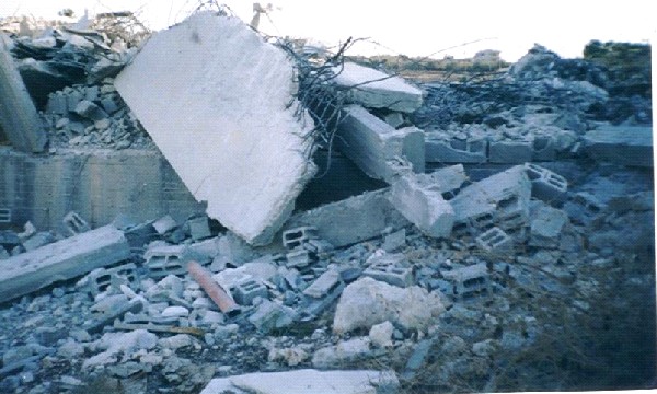

(Photos 2&3: ruins of the destroyed houses in Hajja village)
Photos courtesy of LRC
Prepared by
The Land Research Center
LRC