• About The Project
  • Palestine in Century
  • Selected Maps
  • Glossary
  • About ARIJ
  • About LRC
  • By Year
    • Case Studies By Year
    • Daily Report By Year
Monday, July 13, 2026
POICA
No Result
View All Result
  • Home
  • Settlements
    • New Israeli Settlements
    • Settlement Expansion
  • Israeli Violations
    • Agriculture
    • Confiscation
    • Demolition
    • Environment
    • Eviction of Palestinians
    • Settlers Attacks
  • Bypass Roads
  • Israeli Plans
  • Segregation
    • Checkpoints
    • Closure
    • Separation Plans
  • Military Orders
  • Reports
    • Daily Report
    • Monthly Report
    • Quarterly Report
  • Home
  • Settlements
    • New Israeli Settlements
    • Settlement Expansion
  • Israeli Violations
    • Agriculture
    • Confiscation
    • Demolition
    • Environment
    • Eviction of Palestinians
    • Settlers Attacks
  • Bypass Roads
  • Israeli Plans
  • Segregation
    • Checkpoints
    • Closure
    • Separation Plans
  • Military Orders
  • Reports
    • Daily Report
    • Monthly Report
    • Quarterly Report
No Result
View All Result
POICA
No Result
View All Result

The Israeli Segregation Wall hits Al-Khader village lands

March 9, 2017
in Military Orders
The Israeli Segregation Wall hits Al-Khader village lands

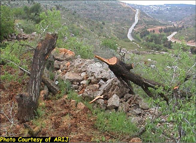
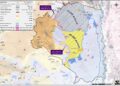
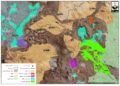
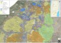
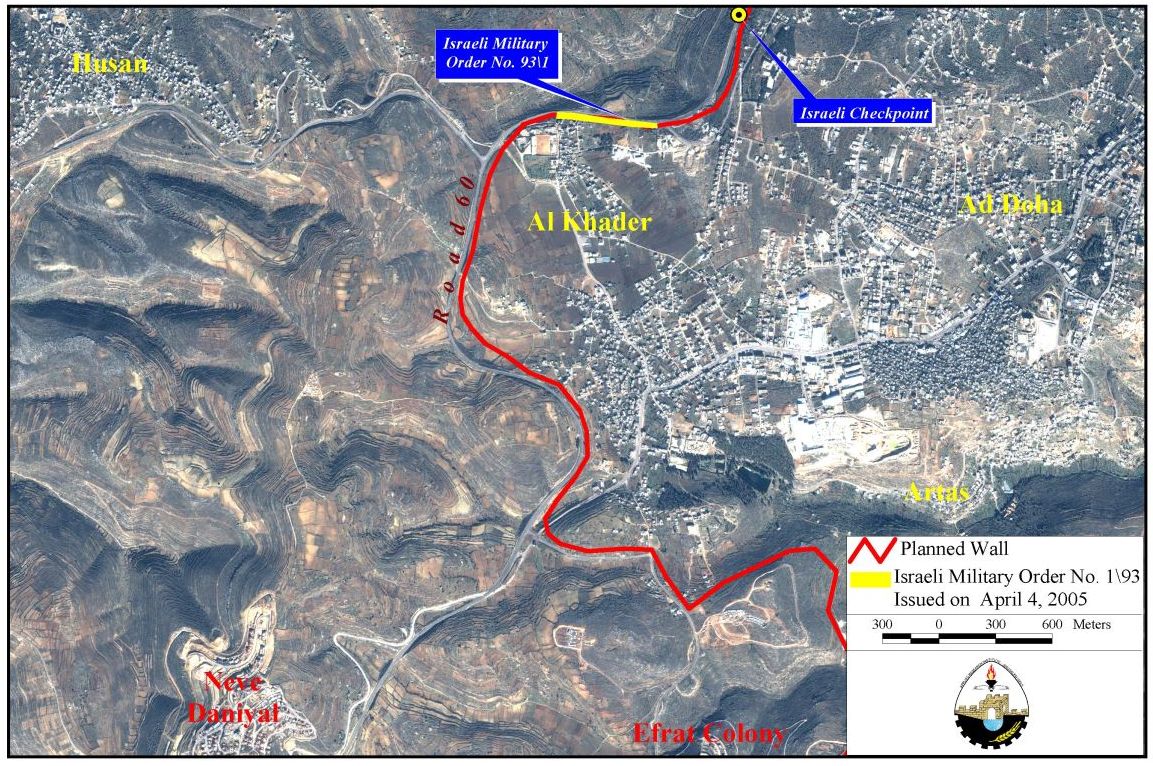
Residents of Al-Khader village west of Bethlehem district were served with military orders in the conventional manner of the Israeli Army (placing the military orders under a rock) informing them that their lands has been declared closed military areas. The Israeli military order signed April 4, 2005 targets an area of 7.5 Dunums (500 meters length, 15 meters wide) of agricultural land located at the town’s northern sector; along the Israeli bypass road number 60. The military order numbered (1/93) did not justify the reason for declaring the marked lands closed military area other than that it will be used for military purposes. Furthermore, the military order advised the landowners who wishes to object to the military order to do so via the District Coordination Office (DCO) in Bethlehem within 7 days of receiving the order or contact the custodian of Absentee property at Etzion (the Israeli Civil Administration). (See Map below))
What the Israeli would not say bluntly?

The fact of the matter is that the Israeli government gave the Israeli Army permission to proceed to recommence work on the Segregation Wall in Bethlehem district starting with the relatively least damaging areas. The military order is also the first of many others to follow during the months to come to complete the route of the Segregation Wall that will isolate the western rural areas from Bethlehem district (Hussan, Battier, Nahaleen, Wad Foukeen and Jab’a villages). The planned route of the Segregation Wall not only will entrap Al-Khader village completely as the south and eastern accesses of the village will remain open toward Bethlehem district. However, the northern and western accesses of the village will be shut off by the Segregation Wall denying the residents access to considerable areas(8400 Dunums, 42% of the village total area) including agricultural lands (87%, 6000 Dunums of total agricultural lands in the village) all located behind the Wall. Access to these lands will be conditional and limited to certain individuals who are eligible to receive entrance permits to these lands. Some of the Israeli requirements to grant permits to landowners beyond the Segregation Wall are:

  • Israeli issued documentation of landownership.

  • Fully paid land tax receipts for previous years.

  • Security clearance issued from the Israeli Civil Administration.

Even if residents were able to meet all the above, the permits are restricted to a limited timeframe and to the actual owner of the land. The following table shows the impact of the Israeli occupation on Al-Khader village.

Lands toxically damaged

200

Lands Segregated by the Wall

8400

Lands confiscated for settlements

2000

Palestinian houses demolished

Between 2000 & 2004

25

Uprooted trees

10,000

Source: ARIJ Database 2005

Conclusion:-

Despite Israel's statements that the Segregation Wall is meant for defensive purposes, the Wall does not follow the route of the Armistice line (the internationally recognized border between the West Bank and Israel).  Instead, the Wall cuts deep into occupied Palestinian territory in the West Bank and Gaza Strip, isolating many thousands of Palestinians from the remains of the OPT, creating small ethnic ghettos completely surrounded by walls and fences, and appropriating large tracts of Palestinian land.


Prepared by:
The Applied Research Institute – Jerusalem

Recommended For You

الاحتلال الاسرائيلي يوسع سيطرته على أراضي جبل الفرديس بمصادرة 317 دونم اخرى

by arij
June 15, 2026
0
الاحتلال الاسرائيلي يوسع سيطرته على أراضي جبل الفرديس بمصادرة 317 دونم اخرى

  في الخامس والعشرين من شهر ايار من العام 2026 نشرط سلطات الاحتلال الاسرائيلي امرا عسكريا جديدا يحمل اسم "أمر بشأن قانون الأراضي استملاك للمصلحة العامة) (يهودا والسامرة)...

Read moreDetails

بواقع 19 دونما – سلسلة من الأوامر العسكري الإسرائيلي تستهدف أراضي محافظة بيت لحم بذريعة الأغراض العسكرية

by arij
June 13, 2026
0
بواقع 19 دونما – سلسلة من الأوامر العسكري الإسرائيلي تستهدف أراضي محافظة بيت لحم بذريعة الأغراض العسكرية

سلمت سلطات الاحتلال الإسرائيلي أهالي محافظة بيت لحم سلسلة من الأوامر العسكرية لمصادرة مساحات شاسعة من الأراضي الفلسطينية في المحافظة بذريعة أغراض عسكرية. واستهدفت الأوامر العسكرية الجديدة عددا...

Read moreDetails

بمساحة اجمالية بلغت 208 دونما – سلطات الاحتلال الإسرائيلي تصادر الاراضي في محافظة طوباس لصالح معسكر اسرائيلي

by arij
June 13, 2026
0
بمساحة اجمالية بلغت 208 دونما – سلطات الاحتلال الإسرائيلي تصادر الاراضي في محافظة طوباس لصالح معسكر اسرائيلي

سلّمت سلطات الاحتلال الإسرائيلي، في السابع من حزيران 2026، أهالي مدينة طوباس شمال الضفة الغربية المحتلة أمراً عسكرياً جديداً بعنوان: "أمر بشأن وضع اليد على أراضٍ رقم 79/26/ت...

Read moreDetails

الاحتلال يرسّخ بؤرة “يتسيف” الاستيطانية عبر تخصيص 92 دونماً من أراضي بيت ساحور

by arij
June 9, 2026
0
الاحتلال يرسّخ بؤرة “يتسيف” الاستيطانية عبر تخصيص 92 دونماً من أراضي بيت ساحور

أصدر جيش الاحتلال الإسرائيلي في الخامس من شهر اذار من العام 2026 إعلاناً عسكرياً جديداً موقع من قبل ما يُسمّى بـ “قائد قوات جيش الدفاع الإسرائيلي في منطقة...

Read moreDetails

كراسة أوامر إسرائيلية جديدة تمهد لمصادرة أكثر من 20 ألف دونم في الضفة الغربية المحتلة

by arij
June 9, 2026
0
كراسة أوامر إسرائيلية جديدة تمهد لمصادرة أكثر من 20 ألف دونم في الضفة الغربية المحتلة

في الخامس من شهر اذار من العام 2026، أصدرت سلطات الاحتلال الإسرائيلي كراسة جديدة من الأوامر العسكرية التي تهدف إلى توسيع نطاق النشاطات الاستيطانية على الأراضي الفلسطينية، وذلك...

Read moreDetails
Next Post
State Vandalism: Israel Disrupts Nature in Al-Walaja Village

State Vandalism: Israel Disrupts Nature in Al-Walaja Village

LATEST NEWS

تصاعد انتهاكات المستوطنين الإسرائيليين بحق المدنيين الفلسطينيين وممتلكاتهم خلال النصف الأول من العام 2026

تصاعد انتهاكات المستوطنين الإسرائيليين بحق المدنيين الفلسطينيين وممتلكاتهم خلال النصف الأول من العام 2026

by arij
July 7, 2026
0

........................................................

“نحو أرض إسرائيل كاملة”   المستوطنون ينشرون خارطة بالمواقع الاستيطانية الرعوية في الضفة الغربية المحتلة

“نحو أرض إسرائيل كاملة”
المستوطنون ينشرون خارطة بالمواقع الاستيطانية الرعوية في الضفة الغربية المحتلة

by arij
July 4, 2026
0

........................................................

سلطات الاحتلال الإسرائيلي تهيئ لإقامة مستوطنة جديدة على أراضي محافظتي نابلس ورام الله شمال الضفة الغربية المحتلة

سلطات الاحتلال الإسرائيلي تهيئ لإقامة مستوطنة جديدة على أراضي محافظتي نابلس ورام الله شمال الضفة الغربية المحتلة

by arij
July 1, 2026
0

........................................................

سلطات الاحتلال الاسرائيلي تواصل تمويل المستوطنات الإسرائيلية عبر دعم السلطات الدينية فيها

سلطات الاحتلال الاسرائيلي تواصل تمويل المستوطنات الإسرائيلية عبر دعم السلطات الدينية فيها

by arij
June 29, 2026
0

........................................................

flag_yellow_lowEU-PfP-Logo

This website and its content were initiated in 1993 by the Applied Research Institute – Jerusalem (ARIJ) and the Land Research Center (LRC) with the support from the European Union up until 2023. Since then, the Applied Research Institute – Jerusalem (ARIJ) has taken over the continued development and maintenance of the website. The views expressed remain solely those of ARIJ) and do not necessarily reflect those of the European Union.


© 2026 Copyright | ARIJ | All Rights reserved.

No Result
View All Result
  • Home
  • Settlements
    • New Israeli Settlements
    • Settlement Expansion
  • Israeli Violations
    • Agriculture
    • Confiscation
    • Demolition
    • Environment
    • Eviction of Palestinians
    • Settlers Attacks
  • Bypass Roads
  • Israeli Plans
  • Segregation
    • Checkpoints
    • Closure
    • Separation Plans
  • Military Orders
  • Reports
    • Daily Report
    • Monthly Report
    • Quarterly Report

© 2026 Copyright | ARIJ | All Rights reserved.