- Violation: validating a colony's master plan
- Location: Ras Karkar and Al-Mazra'a Al-Qibliya villages
- Date: June 19, 2017
- Perpetrators: Talmon B colony
- Victims: Palestinian owners of lands
Details:
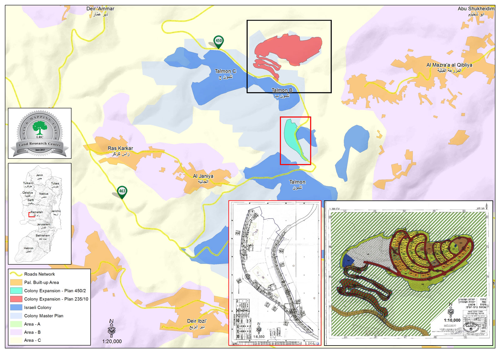
The webpage of Israel Ministry of Interior featured on June 919, 2017 an announcement for Higher Planning Council- Israel Civil Administration, which gives the validation number 235/10 to new master plan for Talmon B colony, north Ramallah governorate.
According to the plan coupled with an illustrative map, the use of 432 dunums founded in the periphery of Talmon B will be transferred from agricultural to residential and road uses. Also, the plan includes the construction of 255 residential units at the expense of Ras Karkar and Al-Mazra'a Al-Qibliya villages' lands.

Photo 1: the advertisement of the plan number 235/10

|

|

|

|
Photos 2-5: part of the plan number 235/10
It is reported that the targeted lands are founded within the natural block number 2 in the locations known as Wad Abu Mohammed and Wad Abu Qrei' from Al-Mazra'a Al-Qibliya village. From Ras Karkar village, the plan targeted lands founded within the natural block number 9 in the location known as Shu'bit Dheib.

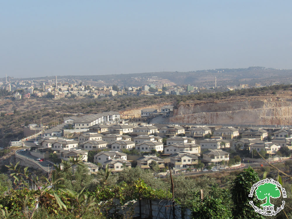
Photo 6: picture illustrating the targeted locations
The plan's objectives:
- Changing the use of lands from agricultural to residential areas A+B, public institutions, commercial zones, open areas, future planning area, landscape areas and roads.
- Determining the uses of lands designated for the plan
- Determining construction restrictions in the plan area
- Delineating road networks
- Determining conditions and phases of construction within the plan
The targeted lands are located nearby Talmon colony and are declared inaccessible for Palestinians for that reason. Owners and farmers cannot access lands but through special permits that are issued once or twice a year.
- Ras Karkar[i]
15 kilometer north west of Ramallah, Ras Karkar is surrounded by Deir 'Ammar (north), Kafr Ni'ma and Deir Ibziq (south), Al Jania (east), Bani Harth (west).
Ras Karkar has a population of 2450 people according to statistics conducted by the Palestinian Central Bureau of Statistics in 2008. It has a total area of 5050, 330 of which are a built-up area of the village.
The Israeli occupation devoured more than 32 dunums of the lands of the village for Talmon C colony which was built in 1989. Moreover, bypass number '463 took over 295 dunums of the village lands.
According to Oslo Accords, 19% of Ras Karkar is under Area B (PA has full civil and security control) while most of the village lands (81%) is under Area C (Israel maintains full security and administrative control). Here are the area in dunums:
- Area B (940) dunums
- Area C (4110) dunums
About Al-Mazra’a Al-Gharbiya:
It is located 12km to the northwest of Ramallah city. The village is edged by Abu Shkeidim area from the north, Talmon colony from the west, Abu Qash village from the east, and Ein Qiniya village from the south.
The village has a total land area of 15,275 dunums, of which 1165 dunums are the built-up area. Around 5000 people inhabit the village (2014).
The Israeli occupation confiscated around 329 dunums from the village’s lands to establish the colonies of Nahliel (1984) and the colony of Talmon (1989).
Also, the bypass road number 450 confiscated 75 dunums from the village.
According to Oslo lands classifications, the village lands are as follows:
- 8533 dunums are area classified “B”
- 6742 dunums are area classified “C”
[i] Source: Geographic Information System- Monitoring Israeli Violations Team- Land Research Center
Prepared by
The Land Research Center
LRC


