
- Violation: demolition order on a structure and a road
- Location: Al-Tawil hamlet- Nablus governorate
- Date: May 30, 2016
- Perpetrators: Planning and Construction Committee- Israel Civil Administration
- Victims: residents of the hamlet
Details:
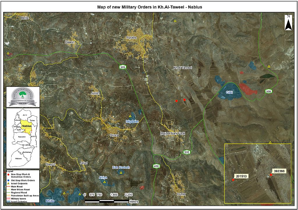
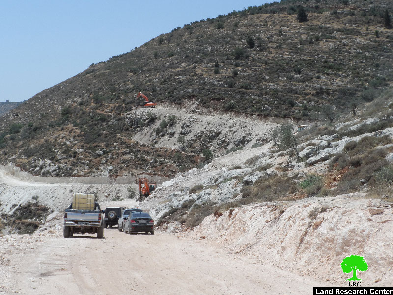
The so-called Planning and Construction Committee- Israel Civil Administration served on May 30, 2016 military order compelling stop-work on an agricultural road segment, south Al-Tawil hamlet in Nablus governorate.
It should be marked that the order was delivered to the contractor working on the road. The road is being implemented with funds from the Dutch Representative Office in Palestine.
According to the order, the affected were given a deadline until June 20, 2016 to complete all licensing procedures on the road. This comes in time with the hearing session of the Inspection Sub-Committee in the Israeli court of Beit EL colony to consider the legal status of the notified structure.
Noteworthy, with a total of 1500m, the road is still in the opening phase. It should be marked that one km of the road is located in area classified "C" according to Oslo Accords. If implemented, the road will serve an area of 200 dunums of pastoral and agricultural lands, which will be rehabilitated for the favor of cultivation and plantation.
Demolition order on agricultural barrack:
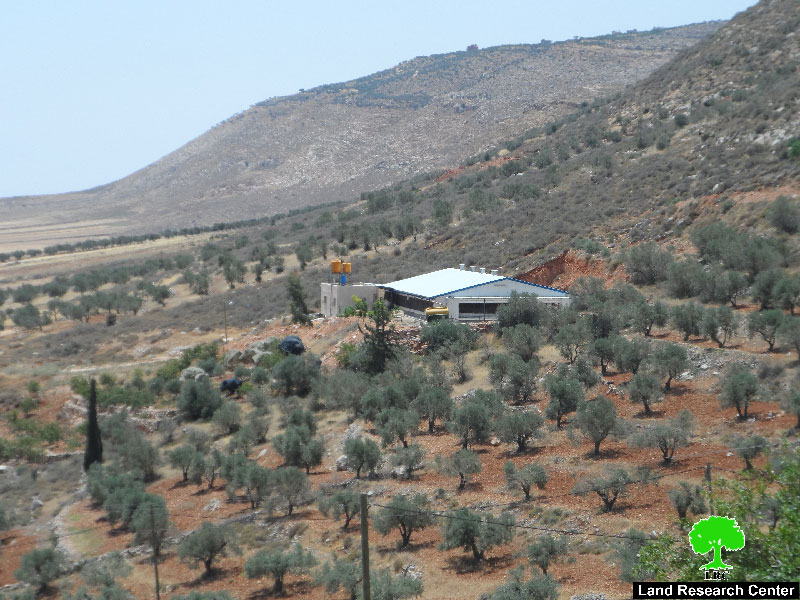
Israeli Occupation Forces hanged a military order of demolition on the barrack of Citizen Mutle' Bani Fadil from the town of Aqraba. The order was served on the claim of "unlicensed construction".
It should be marked that the order claimed serving a stop-work notice on the citizen's structure on April 03, 2016, which is what the farmer denied. Noteworthy, the occupation tends to leave orders in the nearby area of targeted structures and avoids delivering such notices to citizens by hand to trap people in the circle of loss. And this is the story of Bani Fadil.
It is reported the demolition order is final and that it was issued by the court of Beit El colony, which is responsible of licensing structures in the West Bank areas.
The farmer was given a seven day deadline to dismantle the barrack. If not compelled to the order, the occupation forces will demolish the structure and all charges will be billed to the owner.
The structure is an agricultural barrack of 200m2 that was built in the beginning of 2016 to be used for growing chicken. Noteworthy, the barrack provides living for an eleven member family. The following table shows information about the targeted structures:
|
Targeted structure |
Family |
Nature of structure |
Type of military order |
No. of order |
Photo |
|
Agricultural road |
|
1km road to serve 200 dunums |
Stop-work |
201513 |
|
|
Agricultural barrack owned by citizen Bani Fadil |
11 |
Metal slaps barrack for chicken |
Final demolition order |
200948 |
Source : Field observation- Department of Monitoring Israeli Violations- Land Research Center-2016
About al-Taweel :
The hamlet has around 30000 agricultural and pastoral dunums , of which 8000 dunums are arid area, 15000 dunums are planted with field crops and 7000 dunums are subject to colonial expansion activities. (source: Aqraba village council).
A big part of the aforementioned lands is classified area B where the major part is classified as C according to Oslo Accords. The rest of the lands is where the Israeli colonies of Jitit ,Ma'ale Afraym and Itmar extension are located.
- Jitit colony was established in 1973. It has a total population of 191 by (2005) and a total land area of 1720 dunums. It is only 37km away from the green line of 1949 "the armistice line of 1949".
- Ma'ale Afraym colony was established in 1970. It has a total population of 1423 by (2005) and a total land area of 4778 dunums.
- Itmar extension was established in 1984. It has a total population of 651 colonists by (2005) and a total land area of 7189 dunums; the colony is 28km away from the armistice line of 1949.
Prepared by
The Land Research Center
LRC


