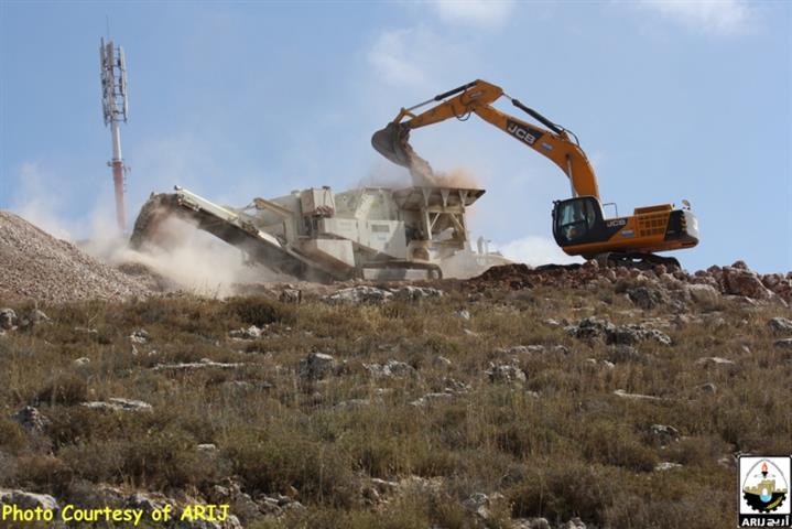
On the early morning of June 11, 2015,the Israeli bulldozers accompanied by military vehicles stormed Wadi Fukin village west of Bethlehem Governorate and stationed in Al-Bass and Khallet ‘Arrar area in the village.
The Israeli bulldozers and without prior notification , started razing 20 dunums piece of land owned by the local resident Sabri Rashad Mahmoud Manasra for the purpose of building new Industrial settlement within Wadi Fukin village boundary.
In an interview with ARIJ field workers , Mr. Manasra indicated that the he received an Israeli confiscation orders for his land in December 2012 under the pretext of “State land” issued by what is so-called “Custodian of Sate property” where the military orders hold the Numbers 178 & 179.See map 1 below:
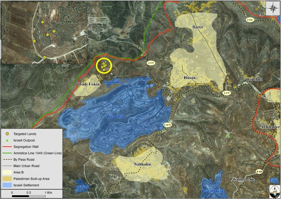
Map 1: the targeted lands in Wadi Fukin
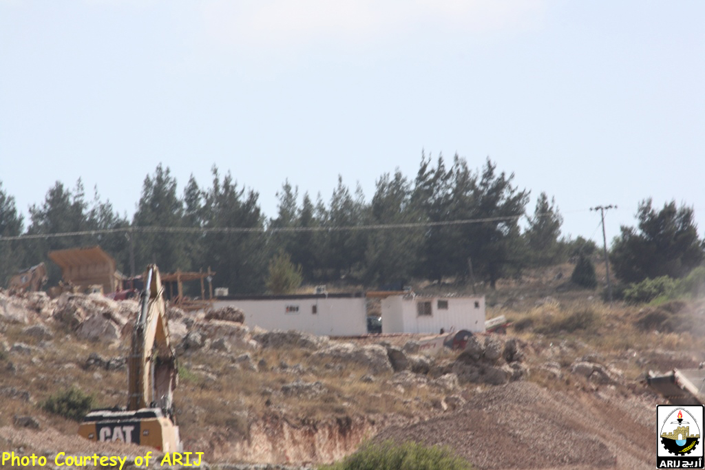
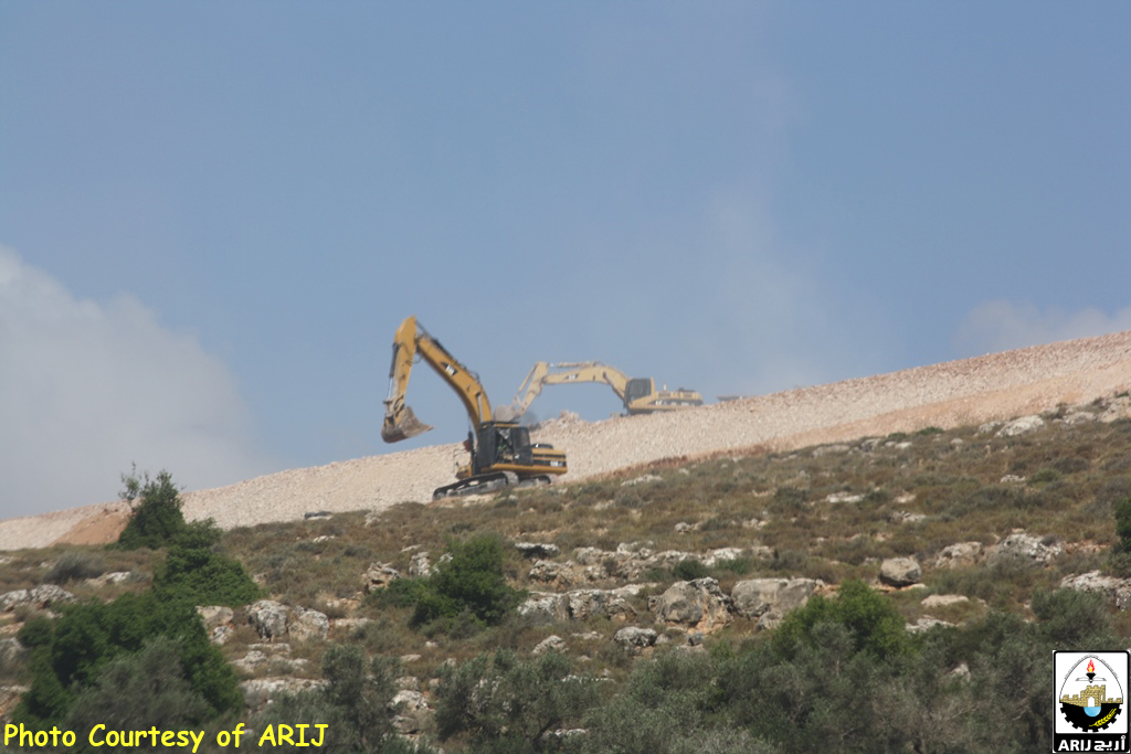
Mr. Manasra added that he submitted for the Israeli court defending his ownership for his land while after two years the court issued its decision for the Interest of the “Custodian of State Property” .See the photos below:

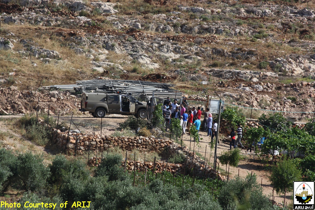


Photos 1-4: Land leveling in Wadi Fukin
In an analysis conducted by the Geo-informatics Department at ARIJ , we can find that the targeted land located in a strategic open space area between the illegal settlements of Bitar I’lit, Hadar Bitar via Green Line and the settlement of Tzur Hadasa.
Therefore, the Israeli capturing of land for the purpose of building new industrial settlement would block the urban development of Wadi Fukin village which already plagued by the Israeli settlements and the Apartheid Segregation Wall.
Wadi Fukin village, 4346 Dunums of land is one of the nine Palestinian villages located in the western part of Bethlehem Governorate. It lies 8 km away from Bethlehem center and approximately 16 km from East Jerusalem, and 0.5 km from the 1949 Armistice Line (the Green Line). The village houses a total population of 1,322 (PCBS 2012). Wadi Fukin village is one of the many Palestinian villages depopulated and destroyed during the 1948 war and was later rebuilt in the early 1970s when its original residents returned back to their lands to rebuilt their village.
Due to the semi mountainous lands, Wadi Fukin has rich agricultural lands, good grazing areas and open spaces to utilize, which reflect the good productivity of Grapes, fruits, Almond, and olive Oil.
The Israeli Colonial Activities in Wadi Fukin
Today, two illegal Israeli settlements: Hadar Bitar to the east and Bitar ‘Illit to the southeast are neighboring the Palestinian village of Wadi Fukin. The two settlements were established on lands originally owned by Palestinians and continued to expand throughout the years on the expense of the village lands.
More than that the Israeli bypass road #375 encircled the northeastern parts of Wadi Fukin where this bypass road stretches from the northeast of Wadi Fukin, heads towards the northeast and north edges of Betar Ellit and Hadar Betar settlements to finally intersect with bypass road 60 (the main north-south artery of the West Bank).
The Segregation Wall at Wadi Fukin
According to the latest Segregation Wall updated map issued by the Israeli Ministry of Defense on April 30, 2007, the entire western rural villages of Bethlehem was isolated from Bethlehem governorate, Battir and Husan villages were set to be entrapped in one ghetto, Nahalin in another Ghetto, Al Jaba to be included within Hebron governorate, cutting it off from Bethlehem Governorate and as for Wadi Fukin, it was excluded separately in an enclave between the Israeli settlements and the 1949 Armistice Line (Green Line).
Expropriation of 1152 Dunums from Wadi Fukin Village Lands
On August 31, 2014, the Israeli Civil Administration has declared the seizure of about 4000 dunums of land of Bethlehem and Hebron Governorate by declaring them “State Land”.
The military order was issued by the so-called “The Custodian of Absentee property & Israel Land Authority of Judea and Samaria ” attached to the Israeli Ministry of Defense/Civil Administration , Yousi Sigal, on the 25th of August 2014 and seizes 3799 dunums from five Palestinian villages in Hebron and Bethlehem Governorates, Wadi Fukin, Husan, Nahalin, Surif and Jab’a.
According to the military order, the "Custodian of the Absente Property” based in his decision to an illegal Israeli law issued following the Israeli military Occupation of the Palestinian Territory in 1967- (Order Concerning State Property (Judea & Samaria) (No. 59-1967))[1] – in which it considers the targeted land (3799 dunums) as state land. See map 2 below:
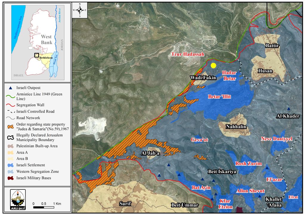
Map 2: Targeted lands in Wadi Fukin and west of Gush Etzion Bloc
The issued Israeli military orders 178 & 179 (20 dunums) as well as military order Absentee Property – Judea and Samaria- 59/1967 (3799 dunums) and the paves the way for the construction of a new Israeli settlement in the Gush Etzion settlement bloc. in a move that will cut the contiguity of the Palestinian communities in the area, at the same time, it will increase the correlation of Israeli settlements in the area and enhance the control over the Palestinian land, especially that this area is quite strategic and makes up the Gush Etzion settlement bloc, which Israel seeks to annex to its proper through the construction of the segregation wall and keep it under its absolute control.
ARIJ Detected Mass Construction in Bitar ‘Ilit & Hadar Bitar Settlements Adjacent to Wadi Fukin
On June 11, 2015, ARIJ field workers detected an enormous expansion in the illegal settlements of Bitar ‘Illit and Hadar Bitar specifically on the nearby lands of Wadi Fukin village. See the photos below:
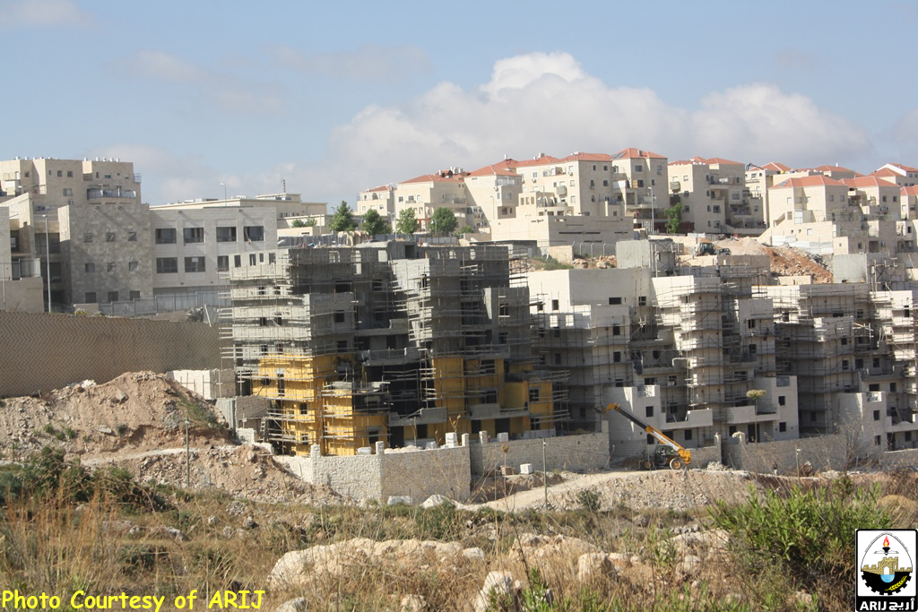
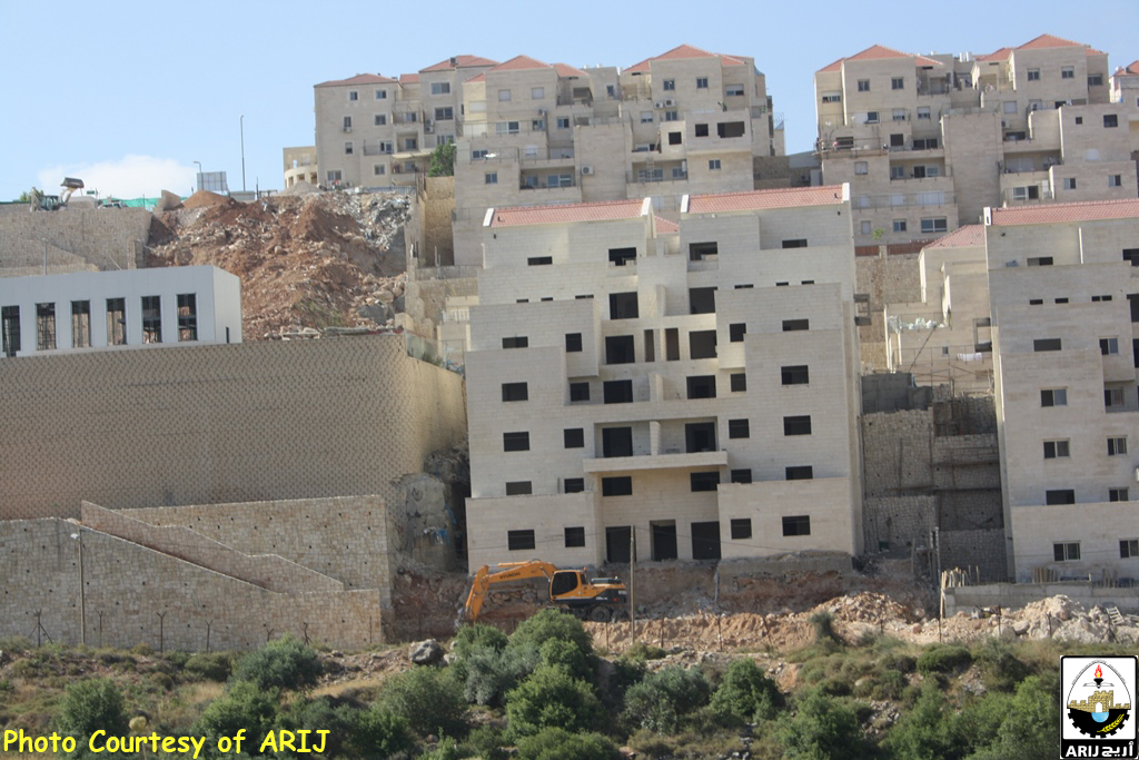

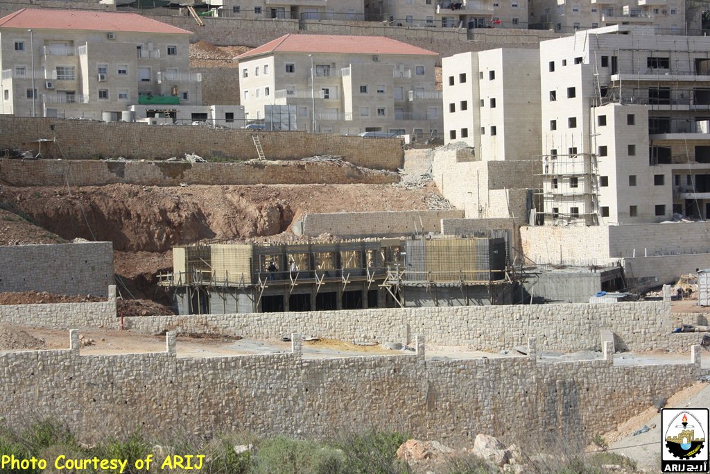
Photos 5-9: the expansion in Bitar ‘Ilit settlement
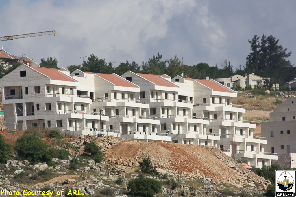
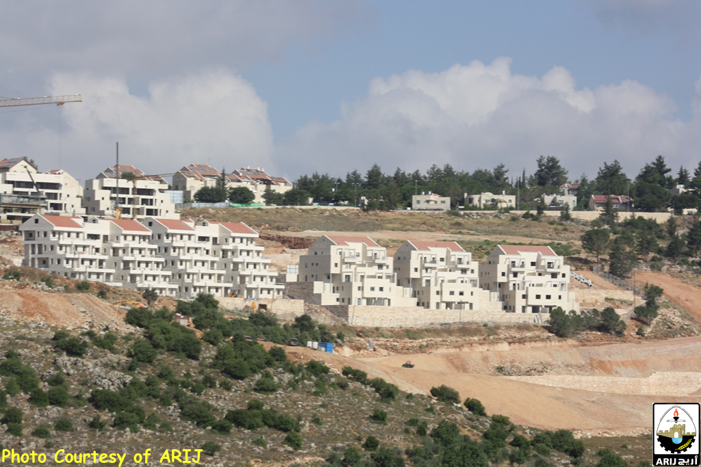

Photos 10-13: the expansion in Hadar Bitar settlement
Prepared by:
The Applied Research Institute – Jerusalem


