Violation: Wide-scale expansion of the colony of Jittit.
Date: Early February 2012
Location: Aqraba lands overlooking the Jordan Valley
Details:
The colony of Jittit, which overlooks the Jordan Valley near the Nablus town of Aqraba, is witnessing a large increase in the number of caravans placed within its premises. This step is seen as a sign of impending land confiscations for the benefit of the said colony on the expenses on Palestinian Bedouin communities living nearby. Most affected communities include the Bedouin clusters in Khirbet Al Taweel and the area of Houd Al Fahem. The Land Research Center (LRC)’s field research estimates the number of the newly-placed caravans to be 10.


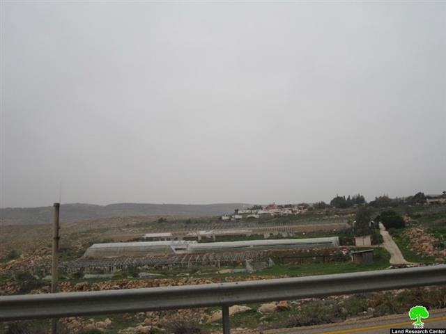
Pic.1+2: Newly-added caravans in the colony of Jittit
It is worth pointing out that while the new caravans were placed, the colonists of Jittit were establishing a number of farms and agricultural bruxes to raise chicken in the vicinity of the colony. The goal is to support the agricultural infrastructure of the colony with the vision to attract investments in the agricultural field. In addition, such dual-expansion (caravans and farms) is being used to pressure the Israeli government for additional concessions and to create unchangeable facts on the ground.
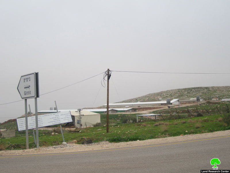
Pic. 3: The new Green Houses established atop Palestinian lands by Jittit colonists.
In terms of the colony of Jittit, it was established in the year 1973. Currently, its population is 119 with a built-up area of 1060.6 dunums. It is one of the agricultural colonies in the Jordan Valley area. Its current expansion is coupled with an intense campaign from the side of the Israeli occupation forces to demolish Palestinian residential and agricultural structures especially in the near-by Palestinian Bedouin community of Khirbet Al Taweel.
Colonization Activities in the Jordan Valley:
The overall area of the Jordan Valley is 720,000 dunums, according to the Palestinian ministries of Agriculture and Local Government. The boundaries of the Valley are Bisan in the north, Negev in the south, the midpoint of the Dead Sea in the east and the eastern ridges of the West Bank in the west. The area that can be used for agricultural purposes is around 280,000 dunums of which Palestinians can access only 50,000 dunums. The remaining lands were confiscated by the occupation forces and are being used by the colonists of the area.
Strategically speaking, the successive Israeli governments have considered the Jordan Valley as its eastern borders ever since it was occupied in 1967. As such, full Israeli control (movement, lands, colonial activity) is being practiced on a large and visible scale to illustrate the centrality of the Valley for the so-called “security of the State of Israel”.
Currently, there are 31 colonies in the Jordan Valley most of which are agricultural colonies. These colonies were established on 12,000 dunums while an additional 60,000 dunums are associated with the colonies and used for agricultural purposes. The number colonists in the Valley are estimated to be around 8,300 in addition to an unspecified number of Israelis who would come from inside the Green Line to work in agriculture in the Valley. Most of the said colonies are associated with the Colony Councils of Arvot Herden and Magilot.
Prepared by
The Land Research Center
LRC
The Land Research Center
LRC


