In the middle of February 2009, Israeli occupation forces informed the residents of the village of Al Rommana that 6 dunums and 100 meters from their lands in Parcel 2, Piece 6 located northwest of the village will be confiscated. See Map 1

A military order number T/16/08 signed by Jadi Shamni, the Commander of Israeli Occupation Forces in the West Bank, called for the confiscation of the said lands for the purpose of expanding the shooting range used by the occupation forces for fire practice. The area of the existing range, which is located 400 meters west of Salem Military Camp, is 18 dunums of Al Rommana lands.

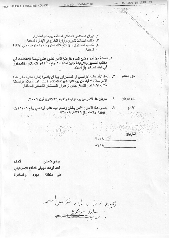
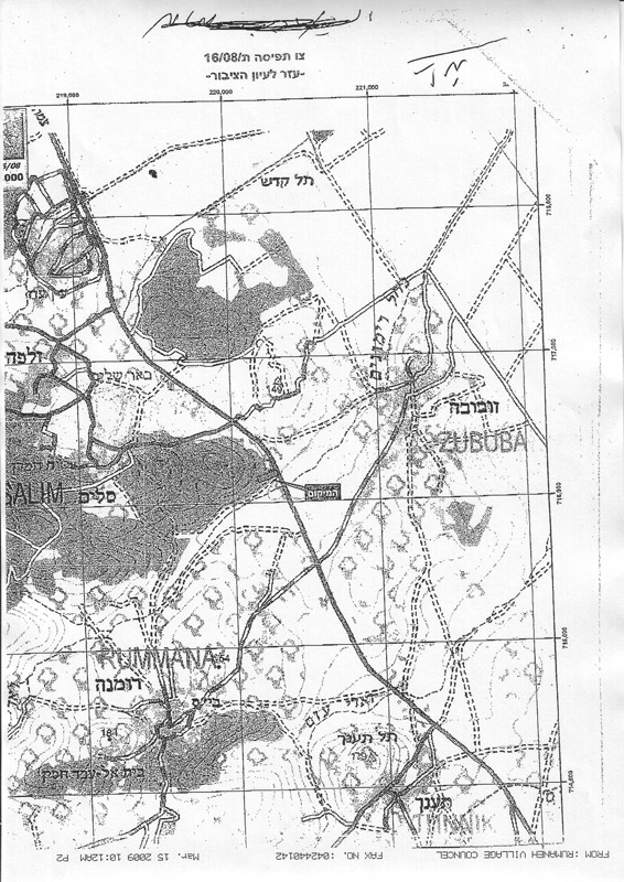
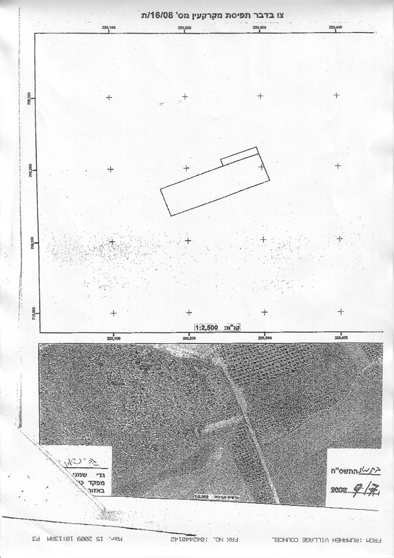
The Military Order with the associated map.
On the other hand, the currently existing shooting range is a source of fear and anxiety for the residents of the village especially given the fact that it is located only 640 meters away from the last house in the village. As such, it is considered to be life threatening for the residents owning farm lands in the proximity of the range. According to village councils’ records, there are 24 farmers who own lands located in the vicinity of the range.
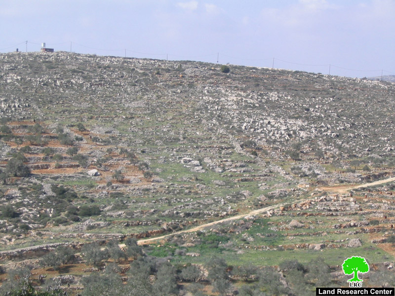
Photo 1: The shooting range in Al Rommana
The Village of Al Rommana and the Israeli Racist Wall:
The village of Al Rommana is located 13 kilometers northwest of the city of Jenin. The area of the village is about 9650 dunums of which 84 dunums were confiscated for the establishment of the Israeli Racist Isolation Wall. An additional 100 dunums were destroyed beneath the Wall. The built-up area of the village is around 280 dunums with an additional 1,000 dunums used for grazing purposes. The remaining lands are planted with almond and olive trees.
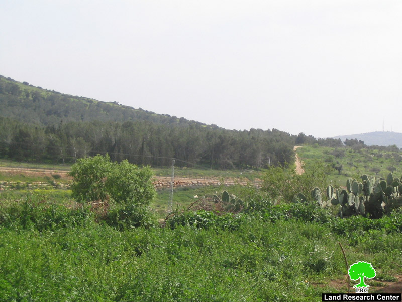
Photo 2: The targeted Al Rommana lands.
In terms of the Wall, Israeli occupation forces constructed a section of it on the northern, western and southwestern directions of the village. No gates were installed in the Wall surrounding the village.
Since the beginning of the current Intifada in 2000, Israeli occupation forces confiscated around 40 dunums of Al Rommana lands for the purpose of establishing Salem military checkpoint. Additional dunums were confiscated from the nearby village of Zabooba.

Photo 3: Salem checkpointcamp.
The checkpoint houses an office of the so-called “Civil Administration” and the Israeli Military Liaison Office in addition to a detention center. This checkpointcamp has turned the lives of Palestinians in the nearby villages into living nightmares due to the solid waste and wastewater pouring from it into the springs of the nearby village of Zabooba. That is in addition to the spread of mosquitoes and insects around the waste which raises health concerns amongst the Palestinian villagers living nearby.
Palestinian Immigration Due to the racist Wall:
According to data supplied by the Rommana village council, there are 32 families in the village (out of 450 comprising 3800 people as of the end of 2006) that left the village to other cities and villages due, on the one hand, to the presence of the Racist Wall and the inhumane practices of the occupation soldiers. On the other hand, another reason for moving away is the lack of any basic infrastructure in the village such as water or electrical networks.
The are a number of clans in the village such as Al Ahmad, Abu Baker, Al Omoor, Sbeihat while some other clans are registered refugees such as Jirbal, Abu Zein and Masarwa.


