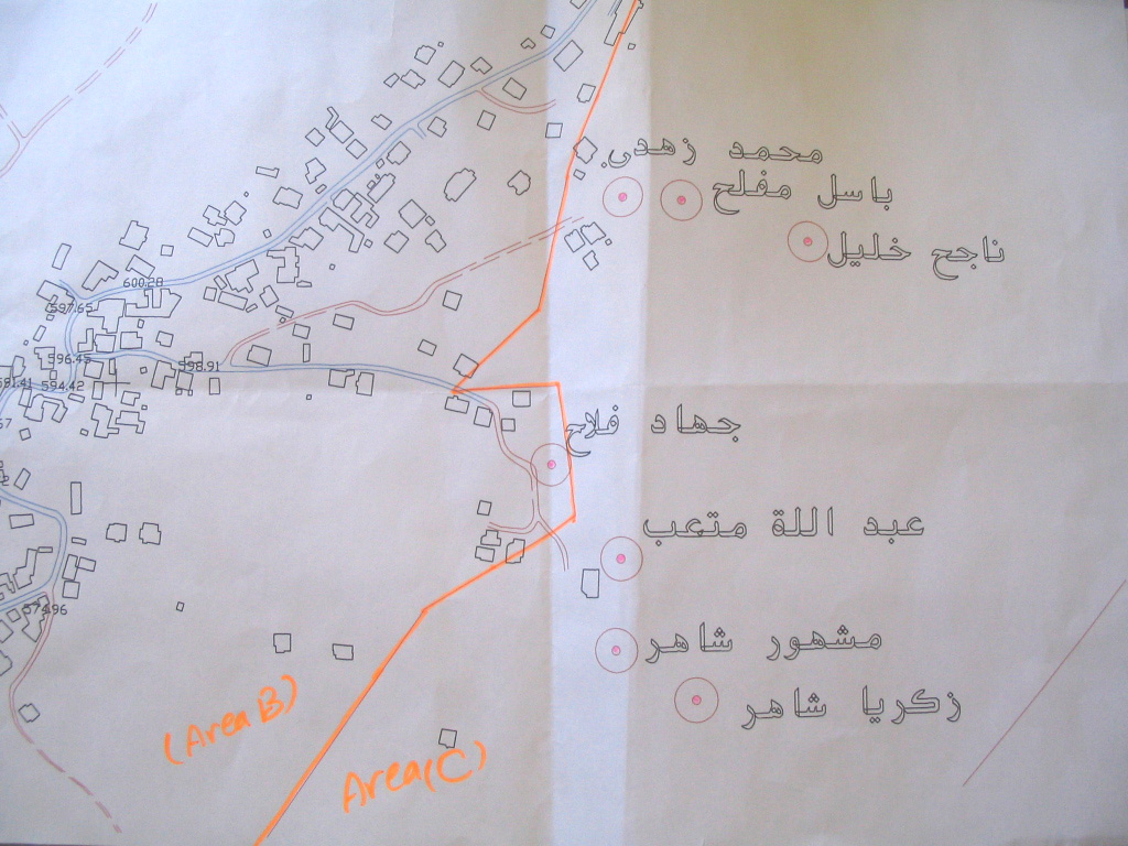
The Israeli occupation authorities issued a military decree stating the confiscation of 198 dunums and 400 square meters of the lands of Ya'bad, Zabadah and Barata'a villages in Jenin governorate. The decree which carries the number of T/10/01 said the lands would be confiscated for the establishment of a bypass colonial road at the length of 9354 meter ( an average width of 25-70 meters).
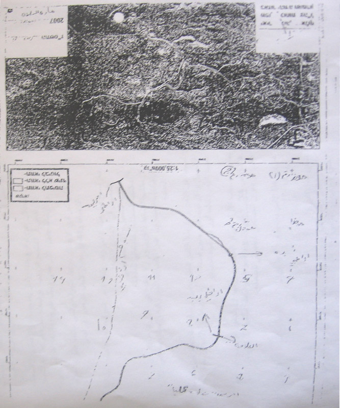
(Photo 1& 2: a copy of the military order)
The planned road is aimed at linking the colonial post of Mevo Dotan 2 established in the year 2004 with the Rihan colonial block to the west of the Annexation and Expansion Wall. By so doing, hundreds of dunums of fertile agricultural lands will be besieged between the bypass road, the colony of Mevo Dotan 2 and the Wall to the west.
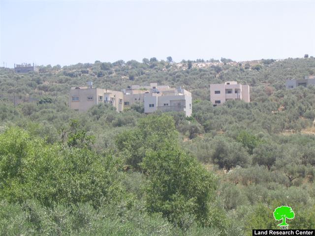
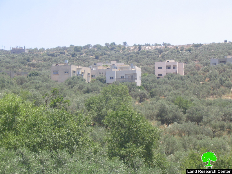
(Photo 3 : a view of Mevo Dotan colonial post)
The colony of Mevo Dotan 2 started on Yab'ad land with two caravans (mobile homes) in the year 2004 when there was much talking about the possibility of a unilateral Israeli withdrawal from the Gaza Strip and parts of the West Bank. Currently, it has 15 caravans and it has been provided with basic infrastructure requirements, such as, roads, water and electricity.
The original colony – Mevo Dotan 1- which is located few km to the east of Mevo Dotan 2 was established in the year 1978. In 2004, it had the total population of 287 and a municipal area of 3152 dunums of which 122 dunums are built up area (source- Foundation for Middle East Peace-Washington).
Background to Ya'bad town
The town is located 17 km to the south west of Jenin city with a total population of 15000. The town's total land area is 17258 dunums of which 3819 dunums built up area. 19% of the population is registered refugees who were dismissed of their homes and properties inside the green line during the war of 1948. About 150 families are currently dependent on foreign aid for living as a result of the closure and the going economic sanctions.
Ya'bad's land taken by the Wall
The head of Ya'bad municipality Mr. Walid Al 'Abadi said in an interview with LRC field worker that the farmers of Ya'bad have become more reluctant to tend their remaining agricultural lands in the south of the town due to continuous Israeli harassments and encroachments. He added that the Annexation and Expansion Wall has deducted about 20 % of Ya'bad lands (3451 dunums of the total land area of 17258 dunums). On the other hand, the bypass road that was opened between Ya'bad, Barta'a and Um Arihan in the other side of the Wall has destroyed or separated about 25 % of the total area of Ya'bad's lands, 4314 dunums.
(Photo 4: the untended land of Ya'bad town)
In the year 2004, the Israeli occupation authorities issued another military decree stipulating the confiscation of yet another 4000 dunums of the village's north western land for the purpose of establishing an industrial zone affiliated to Sheked colony, although no practical steps has been taken yet in this regards. In case this decree was implemented the only artisan well which currently provides the village with 100 m3/hour would be totally contaminated by the industrial waste.
Two agricultural gates
The occupation authorities imposed harsh restrictions on farmers' access into their lands separated by the Wall. Only 8% of the total farmers in the town were given passing permits by the Israeli military to go through the two Wall agricultural gates; gate number 300 which is located at the north western corner of the town, and gate number 356 located at the south western corner of the town.
The Israeli restrictions on farmers and land owners are coupled with similar measures against the town manpower who are denied access in to the Israeli labor market under security pretexts which increased the percentage of unemployment in the town to 62.
House demolition warnings
Recently, a number of house demolition warnings has been distributed to owners in the town under the pretext of building without license inside the borders of zone C, according to Oslo classification, although the town's municipality had presented a town planning scheme to Beit Eil court in the year 1980 and no decision has been taken upon it yet.
Seven colonies
The Ya'bad town and its periphery villages are surrounded with seven Israeli colonies which all set up at its land and the land of surrounding villages. Four of these colonies have already been annexed into Israeli proper by the Annexation and Expansion Wall, namely: Shaked, Hinnanit, Rihan and Tel Menashe which all situated in the north of Ya'bad and have the total population of 6797 in the year 2004 who live in a 1655 dunums built up area and municipal boundaries of 16270 dunums ( Source- Foundation for Middle East Peace- Washington DC). On the other hand, the southern Ya'bad land is controlled by Mevo Dotan 1 and 2 colonies and by bypass roads.
Prepared by
The Land Research Center
LRC


