Strategic Location:
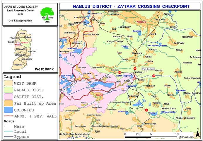
Za'tara (Tabuh) checkpoint is located 9 km to the south of the city of Nablus on main road number 60. It has been established over lands confiscated from the village of Huwwara, Nablus district and the village of Iskaka, Salfit district. The Za'tara junction is a linking point between the northern governorates of Jenin, Tulkarem and Nablus, and the southern governorates of Ramallah, Jerusalem, Bethlehem and Hebron ( through road number 60). It also links between the western governorates of Qalqiliya and Salfit and the eastern governorates of Jericho and the Jordan valley region ( through Trans Samaria high way number 505). Therefore, it occupies a strategic location in the heart of the West Bank. See Map 1

Map 1: Location of Za'tara crossing checkpoint
Map prepared by LRC
A long history of closure measures
Ever since the Israeli military occupation of the West Bank in 1967, sporadic permanent and flying checkpoints have been set up between now and then on this strategic junction to hinder Palestinian traffic movement. During the first three years of the current Intifada, mainly during the period of 2000 and 2003- the junction was completely closed in the face of Palestinian traffic forcing Palestinians to seek more dangerous, costly and longer alternative roads.
From the beginning of year 2004 until the end of October 2005, the checkpoint had been functioning for Palestinian traffic, but only upon valid passing permits from the Israeli military for cars and passengers.
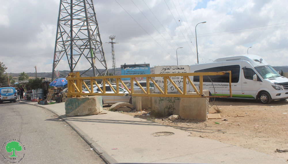
From the beginning of November 2005, the Israeli military forces started a wide-scale bulldozing process of the lands at the site changing it into a huge crossing checkpoint with many lanes, observation towers, inspection rooms and parking lots. It now looks as an international border crossing established despite the fact that it is located in the heart of the West Bank. It is a copy of Qalandyia crossing point between Jerusalem and Ramallah. See Photo 1 & Photo 2

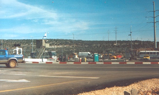
Photo 2 & Photo 3: Palestin Cars being Inspected by the Israeli Soldiers
at Tapuh Crossing, Photo courtesy of LRC
Impact on Palestinians
1. The hindrance of Palestinian movement on this strategic junction connecting between two main artery roads: road number 60 linking between southern and northern parts of the West Bank; and road number 505 linking between the western and eastern parts of the West Bank.
2. The arbitary control of the Palestinian movement through the complete closure of the checkpoint at any time. In such a case, all Palestinians are denied acessing the crossing including those with humanitarian cases.
3. The crossing point serves as a tool for humiliation and punishment, especially for the elderly. See Photo 3
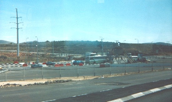
(Photo 3: a general view of Za'tara checkpoint)
Photo courtesy of LRC
Palestinian fears !!!
Palestinians are afraid that the construction of Za'tara (Tapuh) crossing might lead to eventual splitting off of the West Bank as it is accompanied by the erection of barbed wire fences around the Israeli settlements situated in the area including Ariel and Tapuh. Worst of this, the Israeli army is also erecting fences along Trans Samaria road number 505 which divides the West Bank into two separate entities.
Prepared by
The Land Research Center
LRC