A glimpse on Ar Ramadin and Arab Al Fureijat
The villages of Ar Ramadin and Arab Al Fureijat are border villages located about 12 km to the southwest of Ad Dahiriya town in the south western corner of the West Bank. Their current population totals about 5000. They are derived from two main clans, they are: the clan of Arab Al Fureijat and the clan of Az Zagharna. Today, the two clans form together the neighboring villages of Ar Ramadin and Arab Al Fureijat.
Prior to 1948 war, the people of Ar Ramadin and Arab Al Fureijat were living in their lands to the north of Bir Sheva in the following areas: Khirbet Khuweilfa, Khirbet Um Ar Ramahin, Khirbet Ash Shamsniat and Wadi Al Khalil. During the war, people were expelled out of almost half of their lands before confiscation and annexation to Israel. Following this first eviction, they settled in the remaining parts of their lands on the other side of the Green Line inside West Bank proper. The remained lands are located in the following sites: Wadi Al Khalil, Sahlit Al Furiejat, Um Sidra, Um Habala, Um Shumara, Hiazi' and At Tina.
The whole population of Ar Ramadin and Arab Al Fureijat was registered by UNRWA as refugees who had lost their lands and source of livelihood. Those who became landless were obliged to buy new plots of lands from Ad Dahiriya town land owners to settle in. The newly bought land became part of the current villages of Ar Ramadin and Arab Al Fureijat.

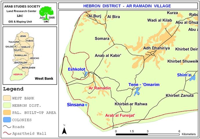
Map 1: location of the two villages of Ar Ramadin and Arab Al Fureijat
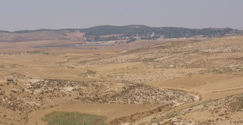
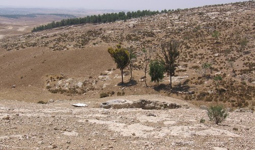
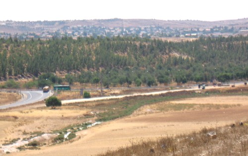
Photo 1: Khirbet Khuweilfa, the original living place of Ar Ramadin
Photo courtesy of LRC
From 1948 through 1967, some of Ar Ramadan people worked as conscripts in the Jordanian army, others pursued education while the rest depended on UNRWA provided aid or on animal husbandry and cereal production.
During the Jordanian era, the people of Ar Ramadin and Arab Al Fureijat strongly refused the establishment of a refugee camp by UNRWA and chose to live in caves and handmade tents in anticipation of return to their homes and lands to the west of the Green Line. Following the occupation of 1967, the core permanent villages of Ar Ramadin and Arab Al Fureijat began to formalize by constructing a road, building a school, a medical clinic, shops and some permanent housing. These installations were sporadically spread on some parts of the remaining lands inside West Bank. The people of Ar Ramadin and Arab Al Fureijatdepended on labor market inside Israel as main income due to the proximity of their villages to Israeli cities and markets in Beir Sheva area. Others exchanged trade between Hebron district and Beir Sheva. Animal husbandry and cereal production continued to be one of the main incomes despite the lack of water due to the dry climate.
Village area
The total village lands before 1948 war reached up to 30,000 dunums. Today, the village only occupies 15578 dunums, some of which were bought after the exodus in 1948. Ar Ramadin's built up area is 926 dunums, and Arab Al Fureijat's is 187 dunums. This remaining area is now threatened by the Israeli Segregation Wall.
Non stop suffering and harassment
Through out the years of the Israeli occupation, and despite the marking of borders and the establishment of closed nature reserves on their annexed lands on the western side of the Green Line, the people of Ar Ramadin and Arab Al Fureijat, particularly shepherds, continued to take risk by grazing their cattle in these lands. They were often exposed to arrest, beating, confiscation of herds, fines and even martyrdom at the hands of Israeli occupation forces patrolling the area. Also, a number of Palestinian houses and cisterns were demolished in the past years under the pretext of un-licensing. Crops were also vandalized several times at the hands of the so-called green patrols (Border police patrols) or Israeli settlers. This difficult situation forced some cattle breeders to migrate to other places in the West Bank such as Nablus, Tulkarem, Jericho and Qalqiliya districts looking for water and grass. Quite many Palestinian families were forced to quit this job as a result of the lack of grazing zones and water resources and due to the soaring prices of animal fodder.

The two villages were deprived of any basic services during the Israeli military occupation such as electricity, water network and roads.
Colonial activity
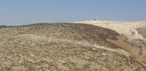
In 1982, the settlement of Eshkolot began to appear on the West Bank lands confiscated from Ar Ramadin village. According to the Foundation For Middle East Peace, the settlement, in 2003, housed a total population of 220 settlers ( See attached map above).
Today, the settlement occupies the main northern entrance to Ar Ramadin village and blocks any natural expansion in that direction. A new bypass road was established two years ago to connect this settlement with road number 60 to the east cutting the main entrance to Ar Ramadin village. Most of times, flying military checkpoints are set up at this section of the road in front of Ar Ramadin village to hinder pedestrian and vehicular movement in and out of the village towards the town of Ad Dahiriya. Even, this sole northern entrance was blocked by earth mounds, cement blocks and trenches during the first three years of the current Intifada forcing those willing to enter or exit the village to seek alternative roads and expose themselves to danger.
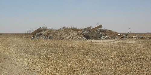
Another settlement, under the name of Sinsana, is being built to the west of the two villages of Ar Ramadin and Arab Arab Fureijat. This emerging settlement was initially a military base established in the year 1998 over 500 dunums of lands seized from Ar Ramadin village and Ad Dahiriya town. Recently, it was turned into a civilian compound. Israeli bulldozers are currently preparing infrastructure for permanent housing believed to be occupied by Israeli settlers expected to evacuate from Gaza Strip next August in compliance with Sharon's disengagement plan (See attached map above). In addition, The implemented sections of the Wall path have already annexed the settlements of Eshkolot and Sinsana into Israel (See attached map).

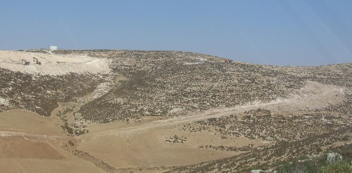
( Photos 4, 5 & 6: land leveling for permanent construction in the newly emerging colony of Sinsana . The Wall path can be seen surrounding the colony from east in preparation for total annexation to Israel) Photo courtesy of LRC
The Wall: a new means of eviction and expansion
Initial maps of the Segregation Wall path in the West Bank circulated by the Israeli army showed that Ar Ramadin and Arab Al Fureijat would be totally separated behind the Wall. However, on February 20th, 2005, and as a result of continuous protests, legal actions and international pressure, a new Wall map was circulated according to which many Palestinian built up areas were excluded from separation, including Ar Ramadin and Arab Al Fureijat.
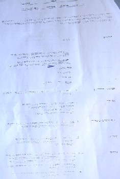
Earlier this year, a military order was issued by the Israeli army carrying the number of (T/05/71) (see attached copy) stipulating the confiscation of 689.9 dunums of land from Ar Ramadin and Arab Al Fureijat. See Photo 7: copy of military order number T/05/71)
According to Mr. Khalil Mohammed Al Fureijat, 50 years old, math teacher at Ar Ramadin Secondary School, the Wall path will stretch about 5 km into Ar Ramadin's and Arab Al Fureijat's lands in the west and south parts of the two villages. The 689.9 dunums mentioned in the military order above are to be taken only for the route of the wall, Mr. Al Fureijat added. In addition, another 800 dunums are expected to be segregated behind the Wall, bringing the total of lands expected to be confiscated or separated to almost 1500 dunums, he went on to say. By so doing, the people of Ar Ramadin and Arab Al Fureijat will face a second dispossession from their lands.
This second campaign started at the beginning of June, 2005, when the Israeli bulldozers moved to the lands of Ar Ramadin and Arab Al Fureijat and began the devastation process in preparation for Wall constructions. So far, 3 cisterns and 4 houses have been destroyed to make room for the construction of the Wall. Shepherds and herds were kicked out of the targeted area. A live cemetery is threatened with destruction under the pretext of being located on the way of the Wall path as hundreds of almond and olive trees are also expected to be uprooted.
( Photo 8: a cistern threatened with demolition by the Wall in Um Sidra, Ar Ramadin) photo courtesy of LRC
Another two military orders were published this year for the same purpose, the first of which carries the number of (T/04/05) stipulating the confiscation and separation of 10,104 dunums from the lands of As Samu', Yatta and Ad Dahiriya towns. The second carries the number of (T/02/05) stipulating the confiscation of 119 dunums from the lands of Ad Dahiriya town as well. ( Insert photos 9 & 10: copies of the two orders numbers T/04/05 and T/02/05). and ).


The following is a non-complete list of names of land owners affected by the Wall in Ar Ramadin and Arab Al Fureijat:
|
Number |
Owner name |
No. of dunums |
|
1 |
Mohammed Khalil Al Fureijat |
20 |
|
2 |
Jaber Khalil Al Fureijat |
20 |
|
3 |
Yusif Khalil Al Fureijat |
15 |
|
4 |
Mustafa Ibrahim Atil and brothers |
25 |
|
5 |
Izzat Abu Dabur and brothers |
30 |
|
6 |
Jamal Eid Az Zagharna |
25 |
|
7 |
Mohammed Mashri Az Zagharna |
25 |
|
8 |
Amjad Mohammed Al Fureijat |
15 |
|
9 |
Salim Salman Az Zagharna and sons |
30 |
|
10 |
Abdul Karim Qaisiya and brothers |
100 |
|
11 |
Khalil Abudul Qader Abu Qa'ud |
100 |
|
12 |
Musa Salameh Ash'ur |
100 |
|
13 |
Ahamd Awad Ash'ur and brothers |
70 |
|
14 |
Mohammed Mughanem Az Zagharna |
50 |
|
15 |
Mihbash Az Zagharna and brothers |
50 |
|
16 |
Hussein Sulieman Imlihat |
20 |
|
17 |
Musa Hasan Amre |
50 |
|
18 |
Muhareb Abu Raida |
40 |
|
19 |
Shehda Hasan |
40 |
|
20 |
Sharif Imteir |
30 |
|
21 |
Taleb Iwreidat |
20 |
|
22 |
Mohammed Abu Allan |
30 |
|
23 |
Hamza Abu Allan |
50 |
|
|
Total |
955 |
Source: Ar Ramadin village council.
The Wall in Hebron district: facts and figures
The estimated total length of the Wall in Hebron district (west, south and east) is 125 km. The total area estimated to be segregated behind the Wall is 403.6 KM2, while the total area estimated to be bulldozed under the route of the Wall is 12.5 km2, bringing the total of lands expected to be confiscated or separated by the construction of the Wall to 416 KM2 , 39% of the whole area of Hebron district ( 1064 KM2). Source: LRC GIS department.
Anti Wall activities
Ever since the commencement of wall constructions last June, the people of Ar Ramadin and Arab Al Fureijat together along with members of international solidarity groups and Israeli anti Wall activists staged four protests on confiscated lands. Friday prayers were also held on sites. Israeli army and security forces used excessive force to quell these activities causing injuries to participants and arresting some of them.
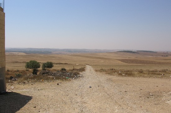
Photo 11: The fertile Al Fureijat plain- targeted for confiscation and separation by the Wall
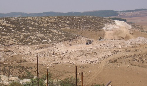
Photo 12: An Israeli bulldozers leveling lands in Arab Al Fureijat for Wall construction
Photo courtesy of LRC
( Photo 13: to the right hand side is the border checkpoint on road number 60 between Hebron district and Bir Sheva)
Photo courtesy of LRC
Prepared by
The Land Research Center
LRC