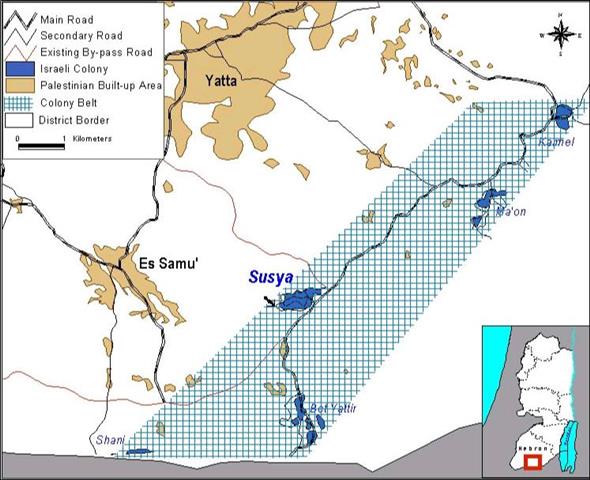
Situated south of the Palestinian village of Yatta and east of Es Samu', the colony of Susya is one of several colonies lying in the southern edge of the West Bank. These colonies form a belt that impedes the natural growth of Palestinian villages.
Moreover, the belt works on dragging the Green-Line (The Pre-1967 Border Line) inwards into the West Bank; thus, unilaterally delineating the borders of the prospective Palestinian entity when talks on the final status are just starting. (Figure 1)
Figure 1: Location Map of Susya Colony showing the belt of colonies
Susya was founded in September 1983, on 1800 dunums of land confiscated from the village of Yatta. It is designated as a religious colony, and in 1992 it housed 72 families. It has an archeological site, and is considered a tourist destination. Its built-up area was 340 dunums, but on the 18th of September1999, its colonists expanded its boundaries northwards and eastwards. First, they began by moving the electricity poles outside the colony's former fence, then two days later they installed 10 caravans on 4 dunums of land belonging to the Shreiteh family. This family has lost approximately 150 dunums to the colony (Figure 2).).
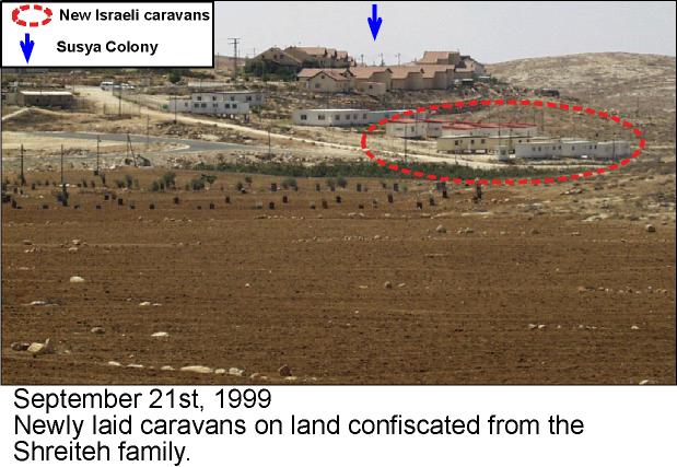
Figure 2: The newly installed caravans
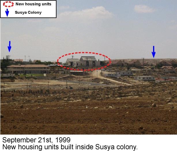
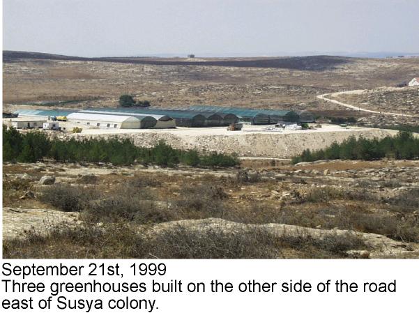
Since the beginning of 1999, 21 housing units have been constructed bringing the total number of units to over 60. Two months ago, 15 dunums belonging to the Mur family were confiscated for Israeli agricultural use. Recently, two new housing units and three greenhouses have been added (Figure 3, Figure 4)., ).
Yet this is not all, a base-coarse road (more than a kilometer in length) was opened to serve a one-settler colony at a hill top northeast of Susya (Figure 5).
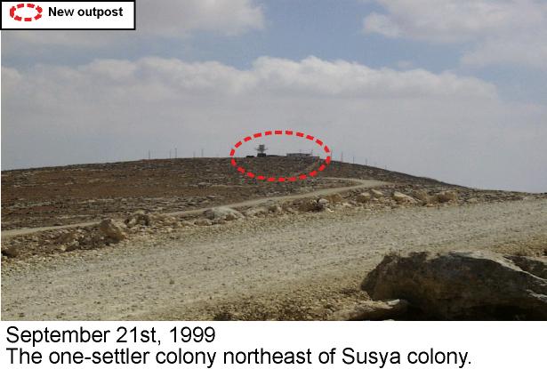
Figure 5: The lone colonist at the hill top
The fact that the Israeli authorities constructed a road for one colonist, indicates that further expansion of the colony is underway, or maybe even a new colony is envisaged. The new spot falls conveniently on the belt encircling Yatta and Es Samu' villages. Furthermore, this outpost lies farther northeast than the current greenhouses are located, and hence, it is feared that the area in between the two will be expropriated as a fait-accompli (Figure 6).
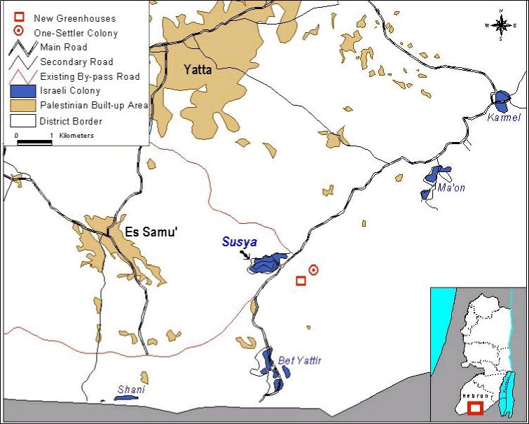
Figure 6: Distribution of the expansions
Finally, the seventh point in article XXXI of The Israeli-Palestinian Interim Agreement (alternatively known as Oslo II) states that 'Neither side shall initiate or take any step that will change the status of the West Bank and the Gaza Strip pending the outcome of the permanent status negotiations'. All the subsequent agreements, including Sharm El-Sheikh, have reiterated this pledge. However the Israeli government continues to create facts on the ground; shaping the map of the West Bank to its convenience.
Prepared by:
The Applied Research Institute – Jerusalem