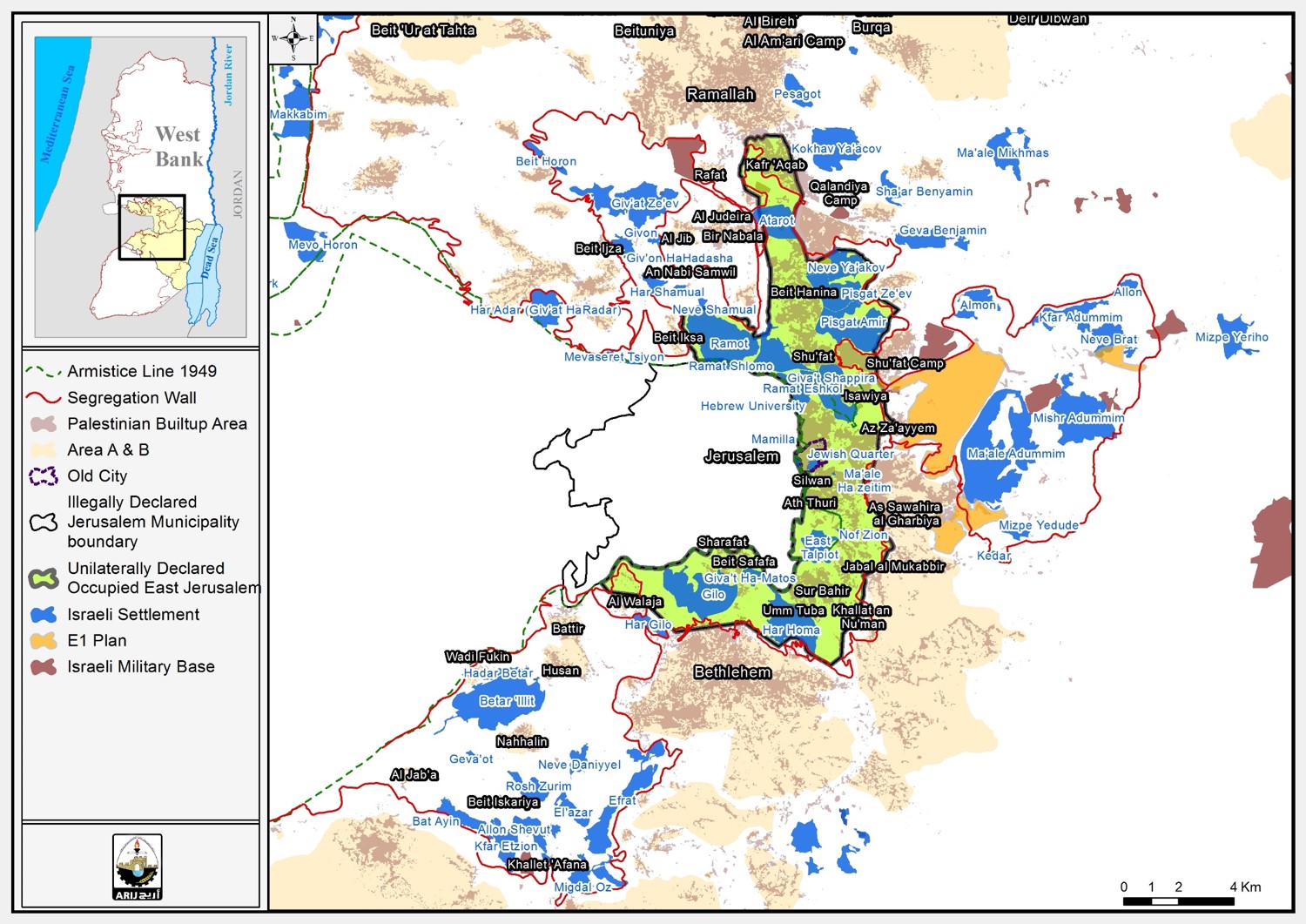
Salfit is a province located 15 miles southeast of Nablus, in the West Bank (Figure 1). It encompasses 28,000 hectares and has a population of 50,000. Seventeen Israeli colonies lie within the Salfit province. The first reported case of Israeli colonizing efforts in the province occured in 1978 when the Israeli colony of Ariel was built on 300 hectares of land in northern Salfit. In 1987, the Israeli industrial zone of Ganni Ariel was established west of Ariel on 35 hectares of land from the Palestinian village of Iskaka, located within the Salfit province.

Figure 1: Location map of Salfit
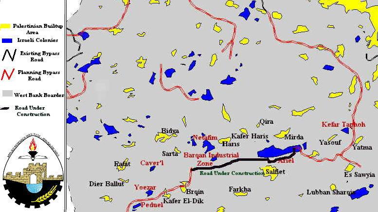
As of date, 700 hectares of Salfit land has been confiscated to facilitate the construction of Israeli bypass and agricultural roads. A new bypass road is presently under construction; it will link the Israeli colony Ariel with Nablus and Jerusalem via regional road #60. This road will be situated on more than 300 hectares, and result in the uprooting of more than 2,500 olive trees (Figure2 ), (Figure 3).
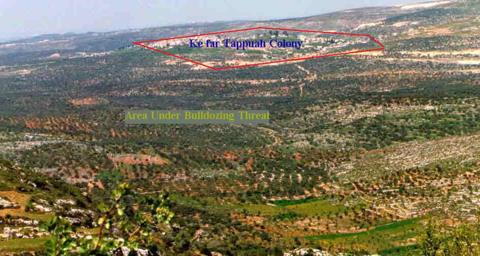
Figure2: Area threatened by new bypass road
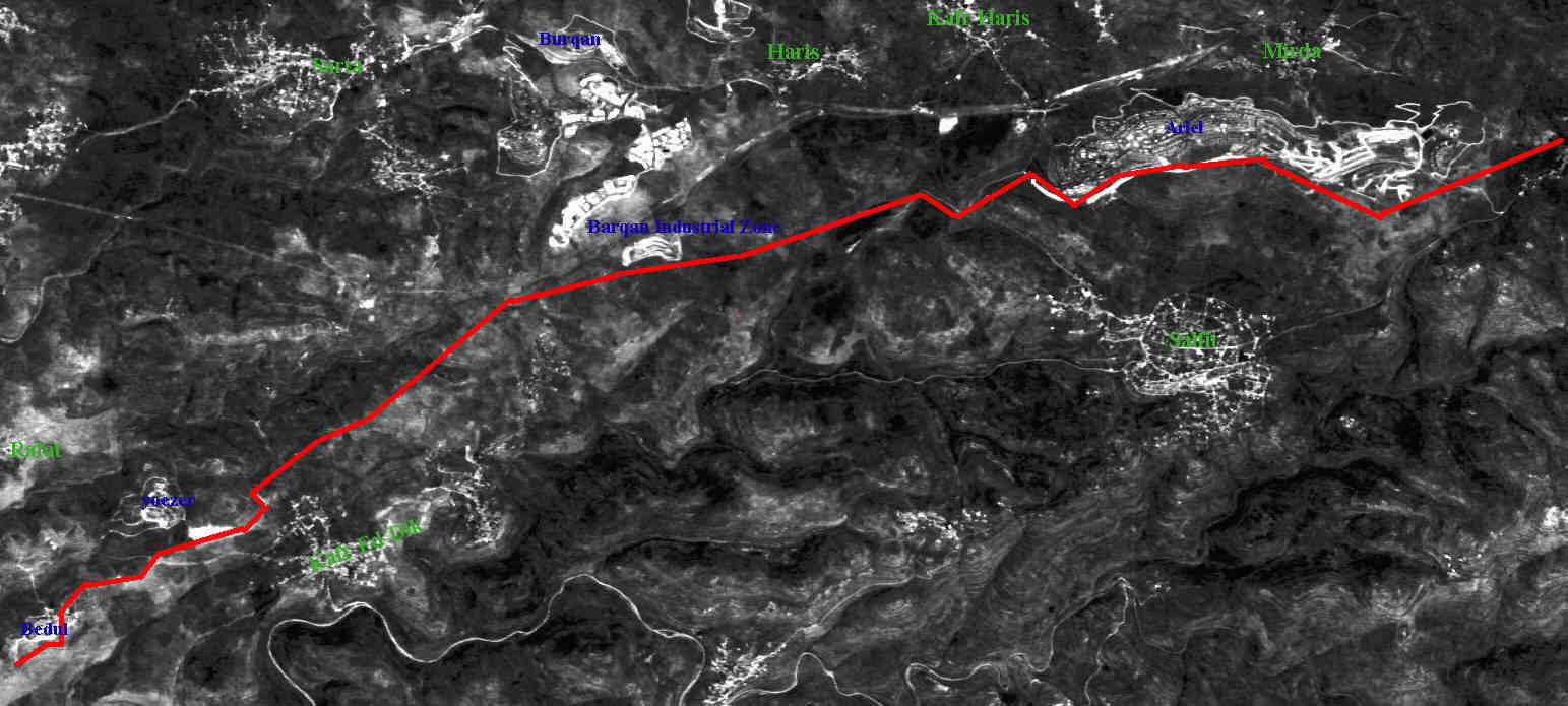
Figure3: Satellite image showing the location of new bypass road
Since the Israeli Prime Minister Netanyahu was elected in 1996, Salfit has been subjected to the following encroachments upon its land and natural resources:
-
September 1996: Under the supervision of the Israeli army, 300 hectares were bulldozed in a part of Salfit called Khalit Sarsour. The stated purpose was general security and the construction of a bypass road.
-
October 1996: Colonists from Ariel took over 10 hectares in Wadi Abed Alrahman and erected a fence around it, usually indicating impending land expropriation and eventual annexation to the colony.
-
December 1996: Ariel colonists took over an additional 300 hectares in Wadi Abed Alrahman to expand the buildup area of their colony.
-
January 1997: Several colonists from Ariel destroyed private Palestinian property and burned a large number of olive trees.
-
April 1997: The Israeli army opened a road 2.5 km in length and 21 meters in width as a step toward expropriating additional lands in northern Salfit.
-
May 1997: Residents of Salfit complained to the District Coordination Office (DCO) that waste water from Ariel colony was being discharged into their cultivated lands and near their drinking water.
-
June 1997: 360 hectares were expropriated to continue the construction of regional road #60 which is planned to link the northern colonies with Jerusalem.
-
August 1997: 3,000 fruit trees were uprooted by Ariel colonists in preparation to expropriate the land on which the trees were located and annex it to the nearby colonies.
-
December 1997: Ariel colonists, under the protection of the Israeli army, expropriated 300 hectares from the eastern parts of Salfit to expand the colony’s boundaries.
-
December 1997: 400 hectares of cultivated land owned by the residents of Salfit, Iskaka and Yasouf were bulldozed.
-
January 1998: An attempt was made by Ariel colonists and the Israeli army to take over 1,300 hectares of Salfit province to expand their colonies and connect them with the northern Taphoh colony (Figure 4).
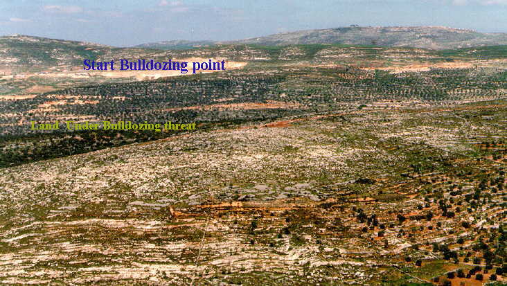
Figure 4: Land under expropriation threat
If the expropriation attempts listed above succeed, over 2000 hectares of Salfit province will be under the control of Israeli colonists. This means that, there will be practically no land left for the natural growth and expansion for Salfit residents.
Seven months ago, the residents of Salfit organized a sit-in tent located on the hill opposite of Ariel colony, facing the recently annexed land (Figure5). In addition, the residents of the Salfit province have organized several demonstrations and marches to protest the unjust manner in which they have been treated. Many Palestinians from nearby villages and towns of the West Bank came to support the residents of Salfit in their struggle against further colonization.
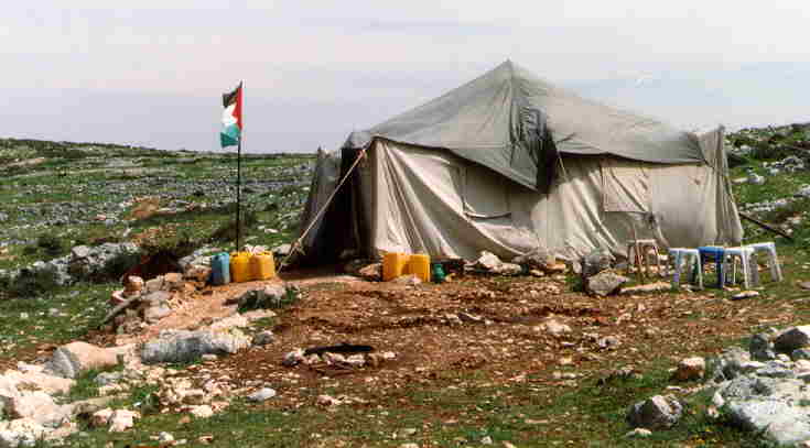
Figure 5: Palestinian protest tent at the threatened location site
As the Israeli government proceeds with its plans to build colonies and destroy cultivated Palestinian lands, it also continues to deny the residents of Salfit permits to plant trees, as Salfit lies in Area 'C', under complete Israeli control. The Israeli army contributes to the colonizing acts of colonists, which, in turn, intimidate local farmers and effectively force them to leave their land.
If the threatened 1,300 hectares of Salfit province is expropriated to the seventeen colonies in the province, the colonizers will have control over more land area than the remaining Salfit residents.
Furthermore, the high council of Ariel colony has initiated construction plans to build an Israeli university (Figure 6). The university will have an estimated population of twelve thousand students and lie within the master plan boundaries of Ariel colony. This will be the first university to be built within a West Bank colony.
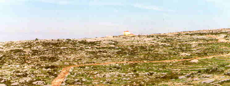
Figure 6: Location of planned Israeli university
Salfit is like many other areas in the West Bank that are subjected to a Judaization process, which aim at cleansing the province of its authentic residents. Salfit, the fruit Basket of the West Bank, is subject to expropriation to expand and link the colonies with bypass roads constituting a geographical separation between the Palestinian territories.
Colonies and land confiscation are the main obstacles challenging the peace talks between Israel and the Palestinians. Although the future of colonies are to be included in the final status negotiations, these negotiations are presently stalled and in the meantime colonizing activities continue unabated. United Nations resolutions state that the occupying power must not take any action that might alter the geography or population of the land that it occupies. Furthermore, the Fourth Geneva Convention of August 1949 (Part 3, Section 3, Article 49) states that 'the occupying power shall not deport or transfer parts of its own civilian population into the territories it occupies'.
Land has always been a primal and essential issue with Israel to execute its plan of turning the balance of the demography existence in the West Bank to their side. Israeli agenda of land expropriation have taken many shapes over the years but were associated eventually with building colonies on the Palestinian land in the West Bank. The selected areas to build the colonies, were always chosen after a thorough study of the site and accurate calculation of the benefits to be gained, both on the immediate and future levels.
Disregarding the political changes that took place over the past few years, the Israeli government continued with its colonization policy. Some of the various ways Israel used to entitle itself to the land it occupies are:
-
Colonial expansion on nearby lands of existing Israeli colonies
-
Closing vast areas of land after declaring it natural reserves
-
Building Bypass roads
But the most recent method, is expropriating land classified 'No man Land' to built colonies (East Talpiot, Ramat Rakhel).
Obviously, steps need to be taken to rectify the Israeli encroachment and to join in the spirit of the peace process and to respect the UN and the international community perceptiveness. Salfit, is just an example of the Israeli heedless acts in the West Bank that is leading the peace process to perish.
Prepared by:
The Applied Research Institute – Jerusalem