Sacrilege in the Bethlehem District Villages of Artas and El Walajeh
The State of Israel reached a new low recently through a series of demolitions of Palestinian holy sites. ...
The State of Israel reached a new low recently through a series of demolitions of Palestinian holy sites. ...
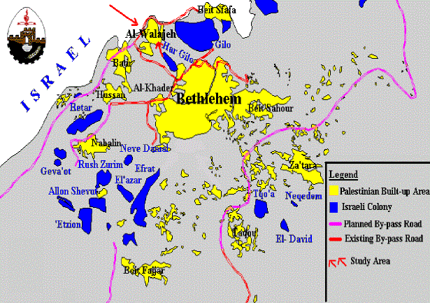
El Walajeh, a Palestinian village located 10 kilometers southeast of Jerusalem is surrounded by the Jewish ...
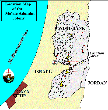
Maale Adumim, located east of the extended boundaries of East Jerusalem, is one of the largest colonies in ...
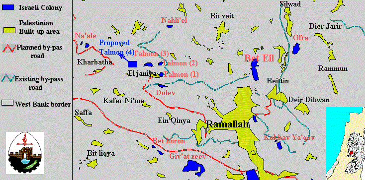
El Janiya village is one of the rural communities in Palestine spreading over 25,000 dunums of land. It ...
Throughout the years of occupation of the Palestinian territory, Israel has engaged in excessive and disproportionate violations of ...
This report highlights the events concerning colonizing activities in the West Bank and Gaza that occurred between the months ...
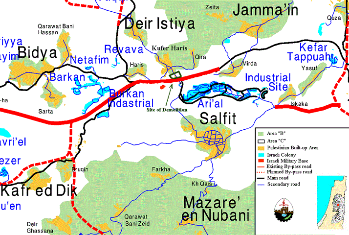
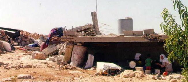
On 28 December 1998, Israeli soldiers entered the Palestinian village of Kufer Haris, forcefully removed the residents of ...
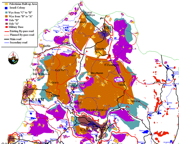
After the marathon of Wye meetings, the American administration was able to accomplish the Wye memorandum, which was signed ...
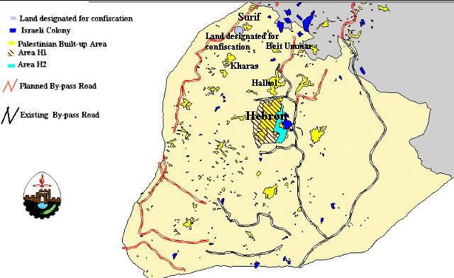
Surif is a small village in the north-western section of the Hebron District. It is located very close to ...
Since the signing of the Wye River Memorandum on 23 October 1998, the Israeli government has allowed the ...
Since 1967, most of the Palestinian communities have been subjected to a continuous wave of aggression by the Israeli ...
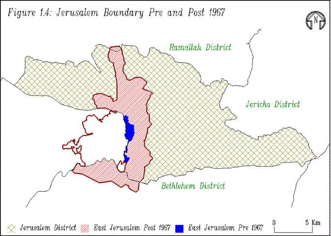
Making the Jewish population a majority of 76% of Jerusalem's population in contrast to 24% for the Palestinians ...
Introduction The Palestinian environment and its natural resources have been under human pressure since the Israeli occupation of ...
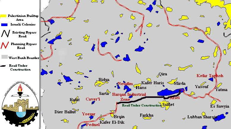
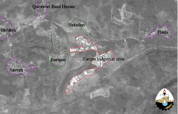
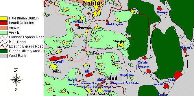
Salfit is a province located 15 miles southeast of Nablus, in the West Bank (Figure 1). It encompasses 28,000 ...
Introduction The many proposals put forward over the years for the solution to the Arab-Israeli conflict -with the ...
Introduction: Industrial pollution is considered one of the major issues in environmental protection. Industries contribute to the pollution ...
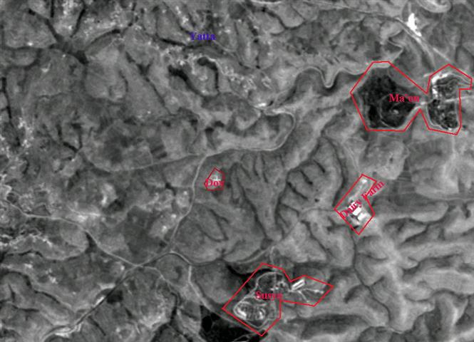
Yatta is one of the largest rural cities in Palestine, with a population of approximately 30,000. It is ...
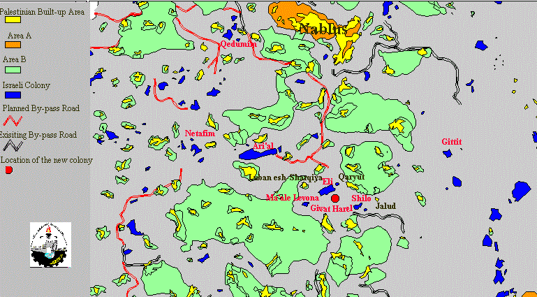
Jalud is a small Palestinian agricultural village spreading over an area of 4,000 acres. It is located 16 miles ...
The demolition of Palestinian houses by Israel has reached an unprecedented level. Between 1992 and 1995 approximately 539 Palestinian ...
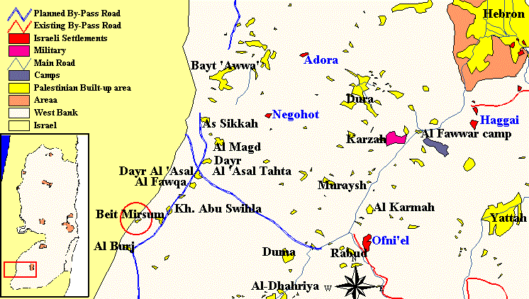
Beit Marsam is a small village located in the southern part of the Hebron district, less than half ...
Yatta is one of the major rural communities in Palestine, with a population of approximately 30,000. It is ...
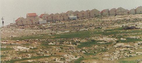
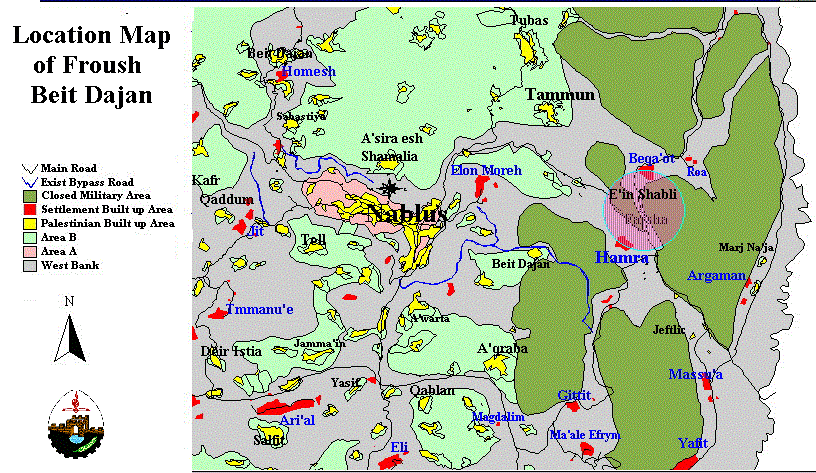
Froush Beit Dajan is a rural area located east of Nablus in the agricultural Fari'a region (Figure 1). ...
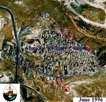
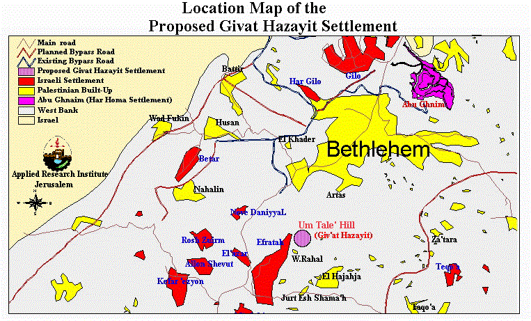
In continuation with its plans to separate Jerusalem from the remainder of the West Bank, Israel has begun ...
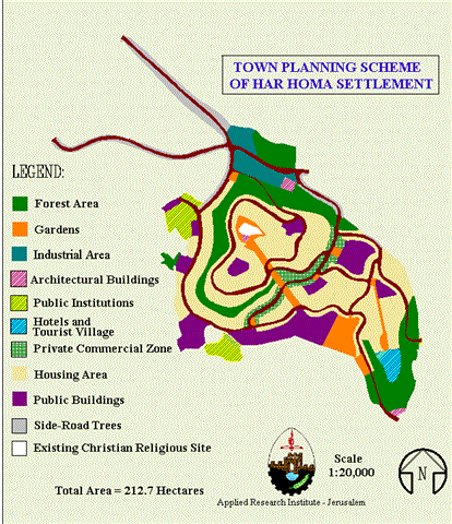
Table of Contents Abu Ghnaim in Details Chronology of Events Why Har Homa is an Obstacle to Peace? The ...
On 12 March 1997, the Israeli bulldozers resumed their work to open a road to reach the hill ...

........................................................

........................................................

........................................................

........................................................

This website and its content were initiated in 1993 by the Applied Research Institute – Jerusalem (ARIJ) and the Land Research Center (LRC) with the support from the European Union up until 2023. Since then, the Applied Research Institute – Jerusalem (ARIJ) has taken over the continued development and maintenance of the website. The views expressed remain solely those of ARIJ) and do not necessarily reflect those of the European Union.