• About The Project
  • Palestine in Century
  • Selected Maps
  • Glossary
  • About ARIJ
  • About LRC
  • By Year
    • Case Studies By Year
    • Daily Report By Year
Monday, August 10, 2026
POICA
No Result
View All Result
  • Home
  • Settlements
    • New Israeli Settlements
    • Settlement Expansion
  • Israeli Violations
    • Agriculture
    • Confiscation
    • Demolition
    • Environment
    • Eviction of Palestinians
    • Settlers Attacks
  • Bypass Roads
  • Israeli Plans
  • Segregation
    • Checkpoints
    • Closure
    • Separation Plans
  • Military Orders
  • Reports
    • Daily Report
    • Monthly Report
    • Quarterly Report
  • Home
  • Settlements
    • New Israeli Settlements
    • Settlement Expansion
  • Israeli Violations
    • Agriculture
    • Confiscation
    • Demolition
    • Environment
    • Eviction of Palestinians
    • Settlers Attacks
  • Bypass Roads
  • Israeli Plans
  • Segregation
    • Checkpoints
    • Closure
    • Separation Plans
  • Military Orders
  • Reports
    • Daily Report
    • Monthly Report
    • Quarterly Report
No Result
View All Result
POICA
No Result
View All Result

Reactivating E-1 Plan of Maale Adumim Settlement

July 18, 1999
in Israeli Plans
Reactivating E-1 Plan of Maale Adumim Settlement


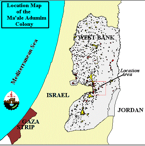
Maale Adumim, located east of the extended boundaries of East Jerusalem, is one of the largest colonies in the West Bank (Figure 1). Maale Adumim was established in 1975, and presently has a population of approximately 25,000.

Figure 1: The settlement of Maale Adumim

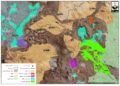
The colony's planning scheme, which was finalized in 1983, sets Maale Adumim borders to an area of approximately 8750 acres. Of these, about 1000 acres have been built so far, representing the colonies of Maale Adumim, Mishor Adumim, Kfar Adumim, and Allon (Figure 2). Several new housing units were constructed south of the present Maale Adumim (). Several new housing units were constructed south of the present Maale Adumim (Figure 3), and several parts of the planned colony will be built on areas previously declared by Israel as 'closed military area'.

Figure 2: Satellite image showing the existing and planned construction of Maale Adumim


Figure 3: Photo illustrating the southern expansion of Maale Adumim colony


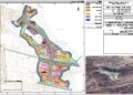
Three years ago, the Israeli government declared the expansion of Maale Adumim on over 3110 acres, (Figure 4) of the land from the Palestinian villages of Abu Dis, El 'Eizariya, 'Isawiya, 'Anata, and Ez Z'im . This expansion scheme known as E-1 plan which will link Maale Adumim with Pisgat Ze'ev, Pisgat Omer, Neve Yaa'acov, and the French Hill, creating a large bloc of colonies and eliminating any Palestinian presence in that area . E-1 is planned to have 3,500 housing units and absorb over 50,000 Israeli colonists. In a recent study conducted by the Israeli Peace group on May 3rd 1999, it is found that the number of empty housing units in Maale Adumim is 165 while 244 units are under construction.) of the land from the Palestinian villages of Abu Dis, El 'Eizariya, 'Isawiya, 'Anata, and Ez Z'im . This expansion scheme known as E-1 plan which will link Maale Adumim with Pisgat Ze'ev, Pisgat Omer, Neve Yaa'acov, and the French Hill, creating a large bloc of colonies and eliminating any Palestinian presence in that area . E-1 is planned to have 3,500 housing units and absorb over 50,000 Israeli colonists. In a recent study conducted by the Israeli Peace group on May 3rd 1999, it is found that the number of empty housing units in Maale Adumim is 165 while 244 units are under construction.

Figure 4: Forested land confiscated for the expansion of Maale Adumim


The decision to revive E-1 Plan was recently taken by Defense Minister Moshe Arens who determined to add 2560 acres of the West Bank land to the colony of Maale Adumim and connect it to Jerusalem. The decision was reported on May27th, 1999 by Israeli media and confirmed by Arens advisor, Avi Kalstein.

An example showing the Israeli's feverish attempt to reactivate that destructive plan and indicating the land cost of Israeli colony programs, on May 25th 1999, the Municipality of Maale Adumim prevented the Palestinians of Tur and Ez Z'im villages from reclaiming their 155 – dunum land which borders Maale Adumim colony in preparation to annex the land to the colony.

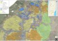
E-1 Plan is considered one major part of the comprehensive scheme 'Greater Jerusalem', which is an Israeli plan to annex an enormous area of the West Bank and to confirm its 1967 annexation of Palestinians East Jerusalem (Figure 5). Israel's 'Greater Jerusalem' scheme was formally and publicly endorsed by the Israeli Knesset on 28 May 1997 . The Israeli insistence upon complete Jewish control over all of Jerusalem has ensured the special significance of Maale Adumim's expansion. Israel's plan is to surround the Palestinian population of East Jerusalem with Jewish colonies; thus, legitimizing Jewish sovereignty over the entire Jerusalem area .

Figure 5: Proposed 'Greater Jerusalem' map


By implementing such a scheme, Israel will prevent a territorial link between the Palestinian communities of Bethlehem and Ramallah. A territorial link which is inevitable for the establishment of a Palestinian State.

It's worth mentioning that the newly PM-elect Barak's proposed map, published in Haaretz daily (May 27th, 1999) encompasses the Greater Jerusalem region (Maale Adumim, Beitar and Givat Ze'ev), Gush Etzion, the Jordan Rift, the Ariel settlement bloc, and the Hashmonain bloc centered around Kiryat Sefer. Thus, Maale Adumim colony will not be dismantled as several others which were constructed at the expense of Palestinian land.

With the expansion, Maale Adumim will border on Jerusalem and further cut off the eastern sector of the city, claimed by the Palestinians as a future capital, from its West Bank hinterland.

An enlarged Maale Adumim will also make it more difficult for Israel and the Palestinians to reach a creative solution on the future of Jerusalem, the most explosive issue in their conflict. 


Prepared by:
The Applied Research Institute – Jerusalem

Recommended For You

إقرار مخطط توسعي رئيسي في مستوطنة تقوع شرق بيت لحم

by arij
July 28, 2026
0
إقرار مخطط توسعي رئيسي في مستوطنة تقوع شرق بيت لحم

"تستهدف 6000 دونما من الأراضي الفلسطينية" صادقت الهيئة العامة لما يسمى "بالمجلس الإقليمي لمستوطنات غوش عتصيون" جنوب الضفة الغربية المحتلة في العشرين من شهر تموز من العام 2026...

Read moreDetails

تستهدف 6000 دونما من الأراضي الفلسطينية وشرعنة ستة مستوطنات جديدة
إقرار مخططات توسعة رئيسية في تجمع غوش عتصيون الاستيطاني جنوب الضفة الغربية المحتلة

by arij
July 22, 2026
0
تستهدف 6000 دونما من الأراضي الفلسطينية وشرعنة ستة مستوطنات جديدة  إقرار مخططات توسعة رئيسية في تجمع غوش عتصيون الاستيطاني جنوب الضفة الغربية المحتلة

صادقت الهيئة العامة لما يسمى "بالمجلس الإقليمي لمستوطنات غوش عتصيون" جنوب الضفة الغربية المحتلة في العشرين من شهر تموز من العام 2026 على مخطط هيكلي استيطاني واسع النطاق...

Read moreDetails

الآثار كأداة للضم الزاحف: مشروع القانون الإسرائيلي لإعادة هندسة الجغرافيا والهوية في الضفة الغربية

by arij
May 23, 2026
0
الآثار كأداة للضم الزاحف: مشروع القانون الإسرائيلي لإعادة هندسة الجغرافيا والهوية في الضفة الغربية

في خطوة تعكس تصاعد المساعي الإسرائيلية لإحكام السيطرة على الرواية التاريخية والجغرافيا الثقافية في الضفة الغربية، صادقت الهيئة العامة لـ الكنيست الإسرائيلي يوم 11 أيار 2026 على مشروع...

Read moreDetails

ذكرى الـ 50 ليوم الأرض: فلسطين بين ذاكرة الدم وصمود البقاء    

by arij
April 16, 2026
0

في الثلاثين من آذار، لا يستحضر يوم الأرض في الوعي الفلسطيني بوصفه مناسبة رمزية عابرة، بل كحدث تأسيسي متجدد يعكس استمرارية الصراع على الأرض والهوية. وبعد مرور خمسين...

Read moreDetails

Unprecedented Acceleration in Israeli Settlement Expansion in 2025

by arij
March 25, 2026
0
Unprecedented Acceleration in Israeli Settlement Expansion in 2025

Preface, The Israeli settlement policy in the occupied West Bank is one of the most significant obstacles to achieving a just and sustainable peace. Since the occupation of...

Read moreDetails
Next Post
Ongoing Violation of the Wye Agreement

Ongoing Violation of the Wye Agreement

LATEST NEWS

” 118 ألف دونم مهددة بالعزل في محافظة طوباس”  إسرائيل تستكمل مشروع “الخط القرمزي” وتوسع عزل الأراضي الفلسطينية شرق الضفة الغربية المحتلة

” 118 ألف دونم مهددة بالعزل في محافظة طوباس”
إسرائيل تستكمل مشروع “الخط القرمزي” وتوسع عزل الأراضي الفلسطينية شرق الضفة الغربية المحتلة

by arij
July 29, 2026
0

........................................................

إقرار مخطط توسعي رئيسي في مستوطنة تقوع شرق بيت لحم

إقرار مخطط توسعي رئيسي في مستوطنة تقوع شرق بيت لحم

by arij
July 28, 2026
0

........................................................

تستهدف 6000 دونما من الأراضي الفلسطينية وشرعنة ستة مستوطنات جديدة  إقرار مخططات توسعة رئيسية في تجمع غوش عتصيون الاستيطاني جنوب الضفة الغربية المحتلة

تستهدف 6000 دونما من الأراضي الفلسطينية وشرعنة ستة مستوطنات جديدة
إقرار مخططات توسعة رئيسية في تجمع غوش عتصيون الاستيطاني جنوب الضفة الغربية المحتلة

by arij
July 22, 2026
0

........................................................

“حتى النصف الأول من العام 2026 “, ” الاستيطان يلتهم الأرض الفلسطينية: ما يزيد عن 22 ألف دونم مستهدفة و 19 ألف وحدة استيطانية”

“حتى النصف الأول من العام 2026 “, ” الاستيطان يلتهم الأرض الفلسطينية: ما يزيد عن 22 ألف دونم مستهدفة و 19 ألف وحدة استيطانية”

by arij
July 22, 2026
0

........................................................

flag_yellow_lowEU-PfP-Logo

This website and its content were initiated in 1993 by the Applied Research Institute – Jerusalem (ARIJ) and the Land Research Center (LRC) with the support from the European Union up until 2023. Since then, the Applied Research Institute – Jerusalem (ARIJ) has taken over the continued development and maintenance of the website. The views expressed remain solely those of ARIJ) and do not necessarily reflect those of the European Union.
© 2026 Copyright | ARIJ | All Rights reserved.

No Result
View All Result
  • Home
  • Settlements
    • New Israeli Settlements
    • Settlement Expansion
  • Israeli Violations
    • Agriculture
    • Confiscation
    • Demolition
    • Environment
    • Eviction of Palestinians
    • Settlers Attacks
  • Bypass Roads
  • Israeli Plans
  • Segregation
    • Checkpoints
    • Closure
    • Separation Plans
  • Military Orders
  • Reports
    • Daily Report
    • Monthly Report
    • Quarterly Report

© 2026 Copyright | ARIJ | All Rights reserved.