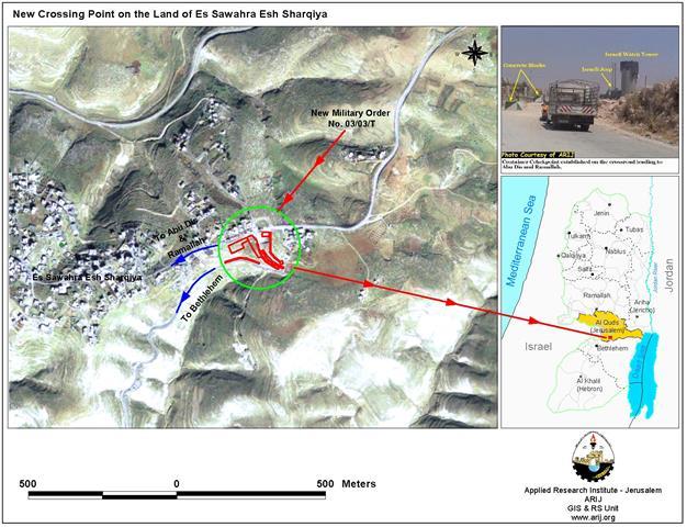
Israel Remodels Military Order #03/14/T North of Bethlehem
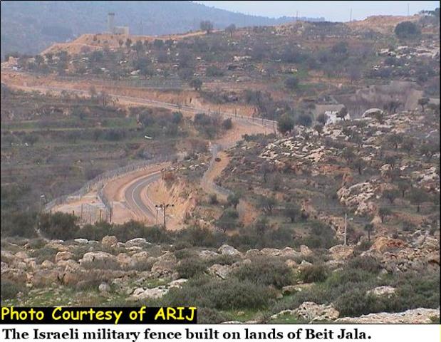
The northern entrance of Bethlehem district (8 Km south of Jerusalem) has always constituted an obstacle to the Israeli plans ...
The northern entrance of Bethlehem district (8 Km south of Jerusalem) has always constituted an obstacle to the Israeli plans ...
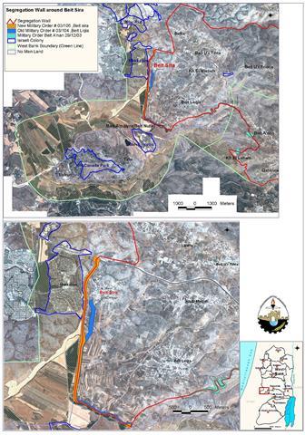
Beit Sira is a Palestinian village located 22 Km southwest of Ramallah district. Before the creation of the State of ...
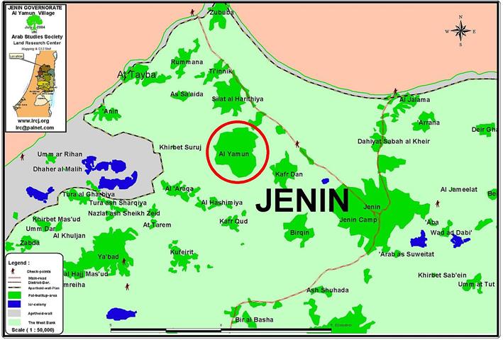
Location, population & area The town of Al Yamun is located 9 km to the west of Jenin city. ...
Location and population The border village of Attayba is located 16 km to the north west of Jenin ...
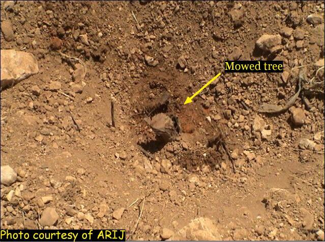
Israel continues to disregard the international laws as it continues with its violation of humanitarian laws and article 53 of ...
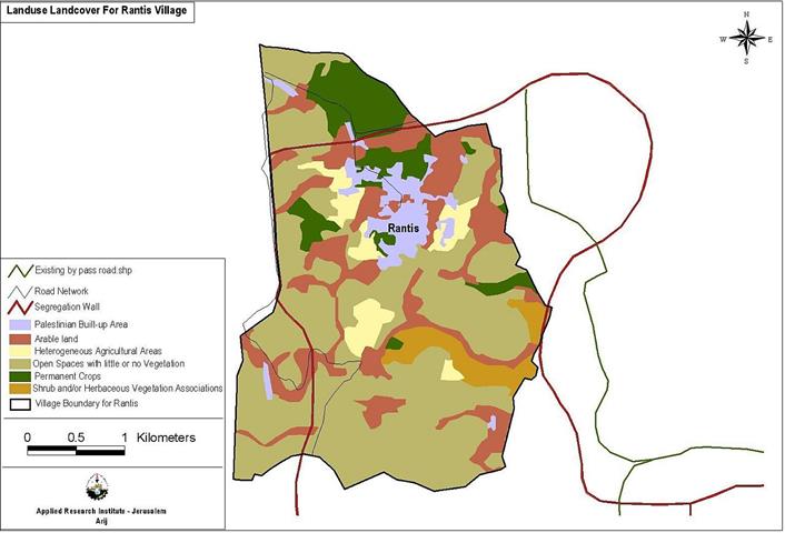
Rantis, is a small Palestinian village located to the northwest of Ramallah district in the Palestinian West Bank. It has ...
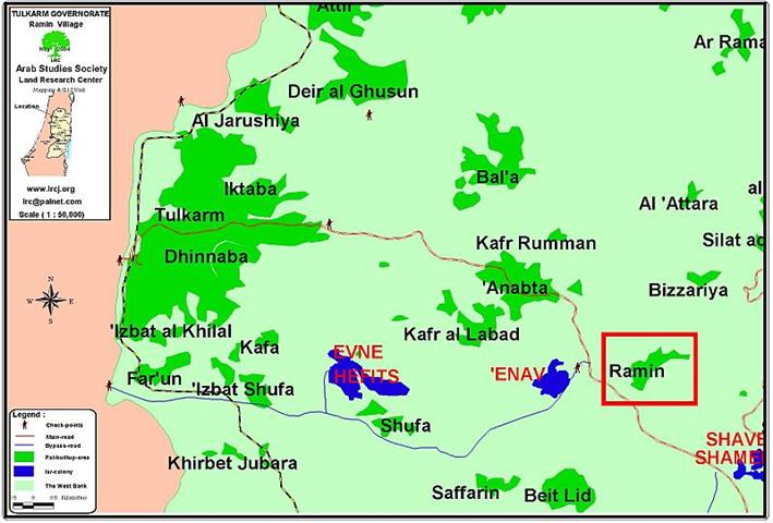
Location & Population: Ramin village is located 15 kilometers to the east of Tulkarem city. It houses a ...
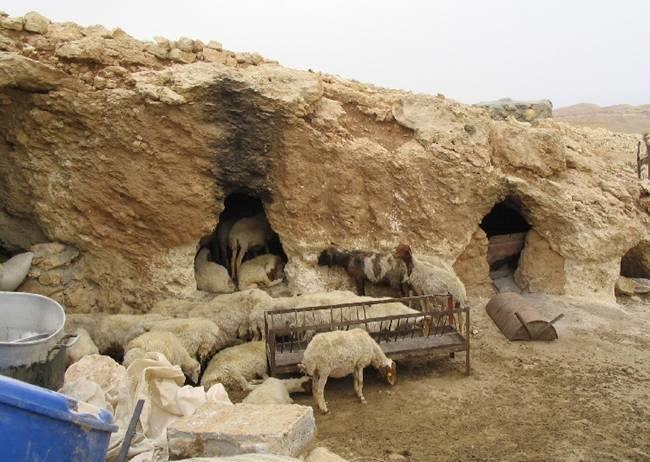
Introduction For thousands of years, Palestinian peasants and shepherds lived in many cave villages scattered in the area ...
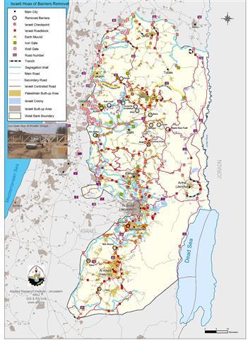
During the second week of June 2004, the Israeli Army command declared that it removed some forty barriers throughout the ...
During the past three and a half years, Israel has constructed more than 750 barriers in the West Bank dividing ...
Location and population Jinsafut village is located 15 km to the east of Qalqilyia city, and bounded by Tulkarem in ...
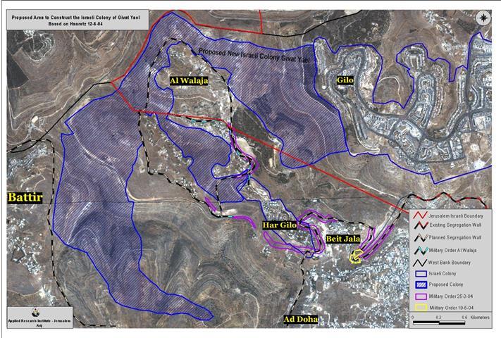
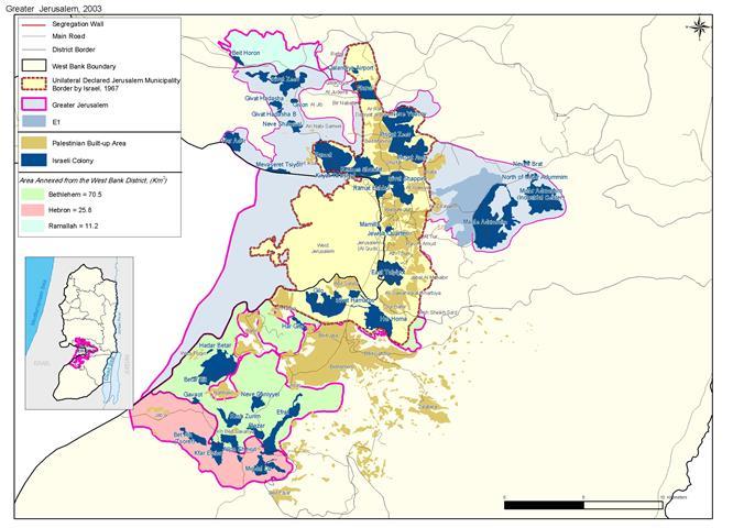
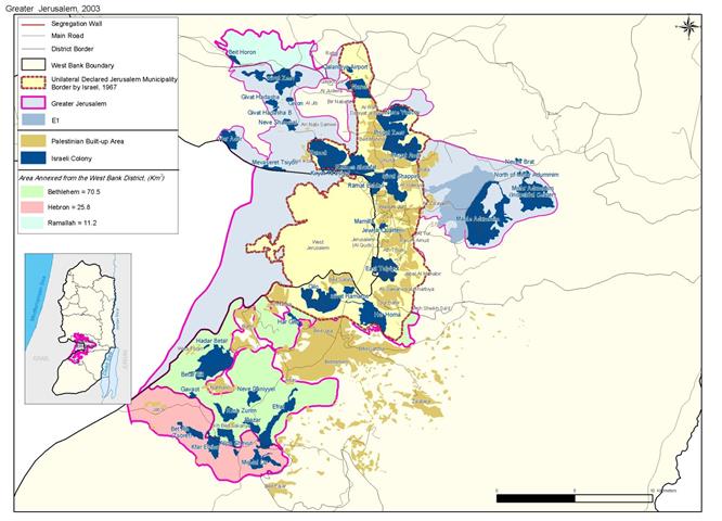
The Israeli Initiative calls for the expansion of the Israeli Jerusalem boundaries further to the south in order to add ...
The 50 Km2 Israeli crisscross Segregation Wall to enclave Bethlehem district as a part of the disengagement plan to isolate ...
A recent Satellite image analysis conducted by the GIS unit (Geographical Information system) unit at the Applied Research Institute-Jerusalem shows ...
Location:- El Khadr is a small village located 3km to the west of Bethlehem city and houses a population of ...
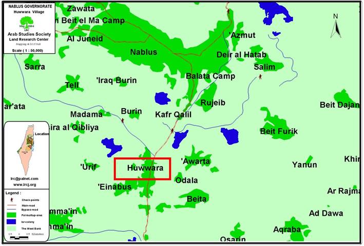
Location and population Huwwara town is located 7 km to the south of Nablus city. It houses a ...
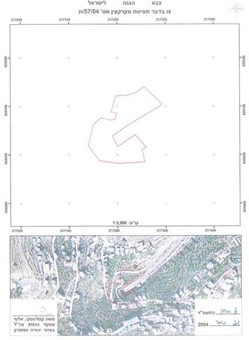
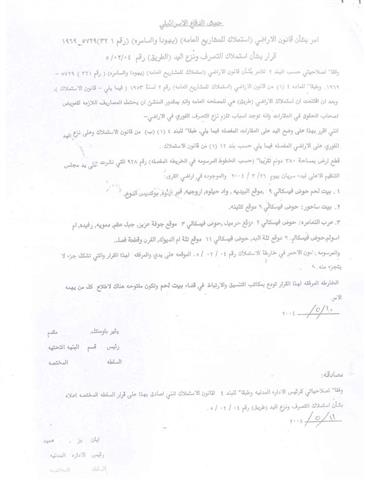
In February 2002, Yitzhak Etan, IDF Commander in the Occupied Palestinian Territories (OPT) issued military order number 02/02/C ...
Expanding the municipality borders of Jerusalem city is one of the goals Jerusalem Israelization. Today, through the implementation of the ...
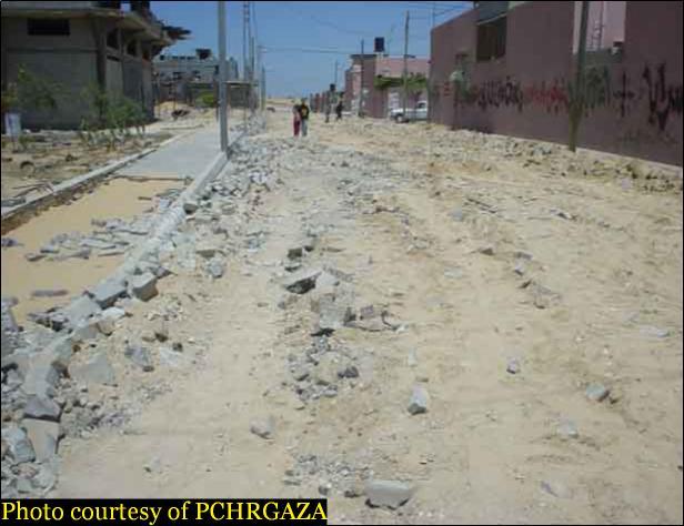
In cooperation with the Palestinian Center for Human Rights (www.pchrgaza.org)) Starting by severing all the geographic link to the ...
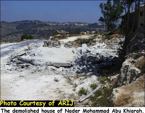
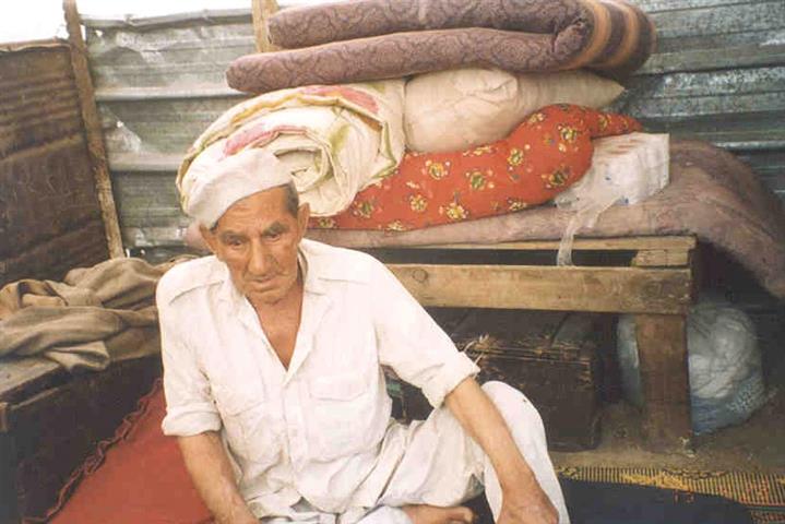
Imreha- Jenin: The elderly disabled Mr. Ali Turkman sitting in his mini barrack shop before it was demolished, Photo ...
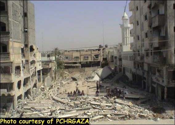
In cooperation with the Palestinian Center for Human Rights - Gaza PCHRGAZA A repetition of history, Palestinian flee ...
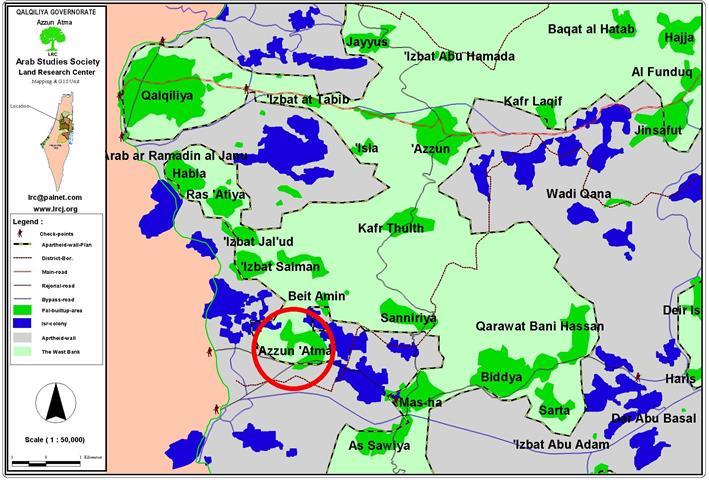
Location and Population: The village of Azzun is located two kilometers to the east of the Green Line and is ...
Background:- Jerusalem city has been for a long time the heart of the Palestinian-Israeli conflict. The question of a Palestinian ...
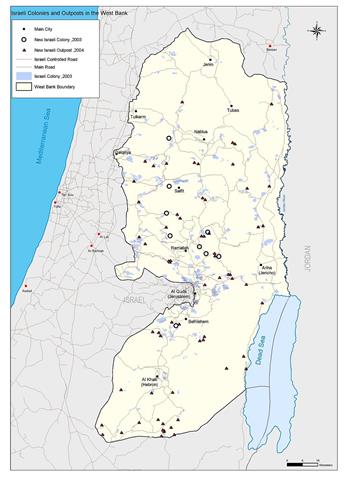
The Sunday, May 3, 2004 Likud party referendum on Gaza withdrawal plan did nothing but fuel the Israeli settler’s appetite ...
On February 2002, the Israeli army commenced the construction of a new ''bypass road'' southeast of Bethlehem. The road, ...

........................................................

........................................................

........................................................

........................................................

This website and its content were initiated in 1993 by the Applied Research Institute – Jerusalem (ARIJ) and the Land Research Center (LRC) with the support from the European Union up until 2023. Since then, the Applied Research Institute – Jerusalem (ARIJ) has taken over the continued development and maintenance of the website. The views expressed remain solely those of ARIJ) and do not necessarily reflect those of the European Union.