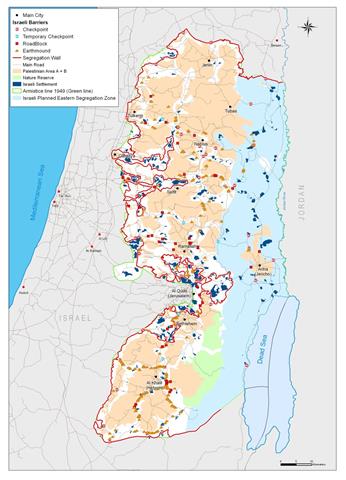
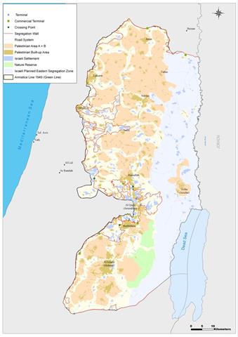
42 Palestinian Localities in the Eastern Segregation Zone are under daily Israeli aggression
Background: The eastern part of the West Bank includes the Jordan Valley and the upper part of the Dead Sea ...
Background: The eastern part of the West Bank includes the Jordan Valley and the upper part of the Dead Sea ...
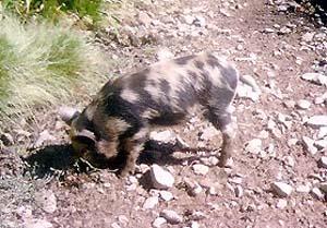
Israeli occupation authorities have released a large number of wild pigs in Deir Ballut which led to the spoilage of ...
The Israeli occupation forces started the construction of a separation barrier around the settlement of Tene (Ma'ale Omarim) to the ...
Finally, the Israeli occupation authorities decided to take Khirbet Jubara out of the Annexation and Expansion Wall, but only after ...
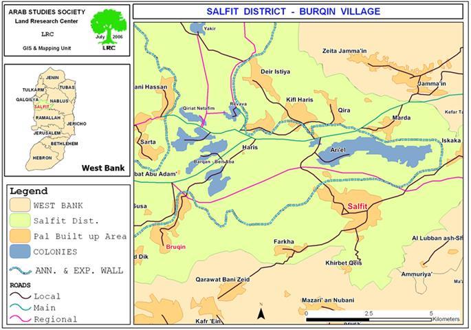
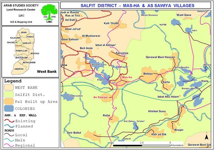
The village of Bruqin is located 13 kilometers to the west of the city of Salfit. It is considered to ...
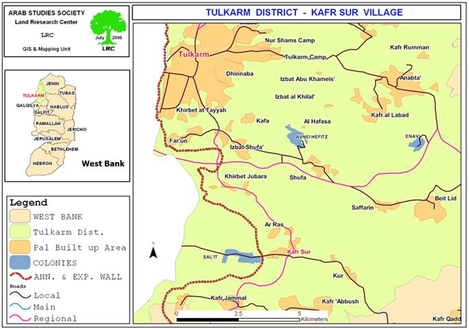
The Israeli settlers from the settlement of Sal�it (located on the Green Line west of the village of Kafr Sur ...
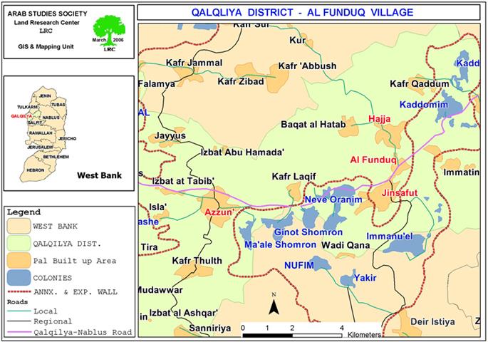
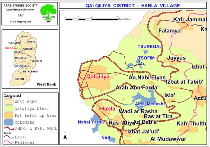
Qalgiliya Governorate The settlers from the Israeli settlement of Kedumim, located on the main road connecting between the cities of ...
This report highlights the chronology of events concerning the Israeli Colonizing Activities in the West Bank, Jerusalem and the Gaza ...
The Israeli occupation authorities announced last June tenders to construct 54 housing units for Jewish families in the southern part ...
The stone industry in Palestine is considered one of the most significant and active natural resource based sectors of the ...
Ma`ale Adumim settlement was established in 1975 by 23 Israeli families on a hilltop. It became a local council in ...
'The Israeli ‘defense' Forces permitted 3,000 Palestinian traders, residents of the West Bank and the Jordan Valley, who are over ...
Israeli bulldozers continue to devastate agricultural lands in the village of Sabastiya - Nablus governorate for the purpose of building ...
An additional 894.500 dunums (eight hundred ninety four dunums and five hundred square meters) of fertile agricultural land are targeted ...
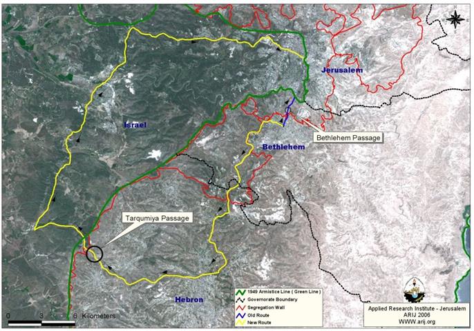
(Photo 1: Wall works in the western parts of Hebron governorate) The Governorate of Hebron is located in the ...
Early on June 27, 2006, the Israeli Army unleashed its anti-nature force of destruction on Beit Jala's land; northwest to ...
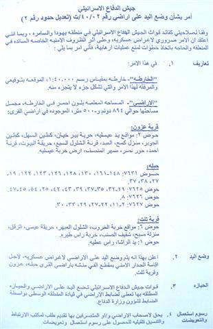
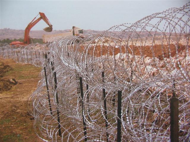
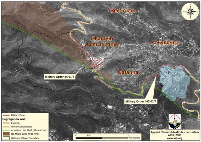
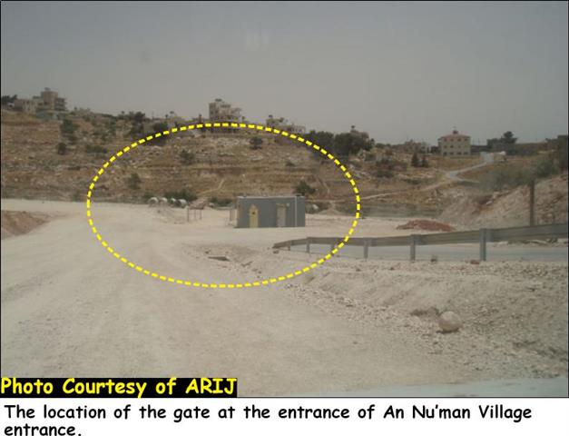
Qatanna village: Location and Population Qatanna, a Palestinian village located 12 Kilometers to the northwest of Jerusalem city, has an ...
Following the occupation of the West Bank, including East Jerusalem, and the Gaza Strip in 1967, thousands of Palestinian houses ...
Background Geographically, Gaza Strip forms the westernmost portion of the Palestinian territories, having land borders with Egypt on the south-west ...
The Israeli occupation authority, as part of its segregation Wall plan for the northwestern Bethlehem area, has installed a gate ...
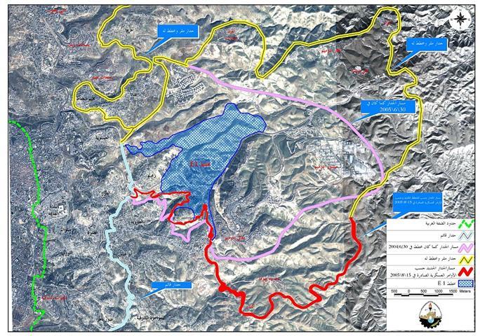
The Israeli Government endorsed on April 30, 2006, an updated Wall plan which included changes in a number of locations ...
وضعت محكمة العدل العليا الإسرائيلية نهاية لأحلام سكان قرية العيزرية في القدس الشرقية باستعادة أراضيهم بالطرق القانونية ...
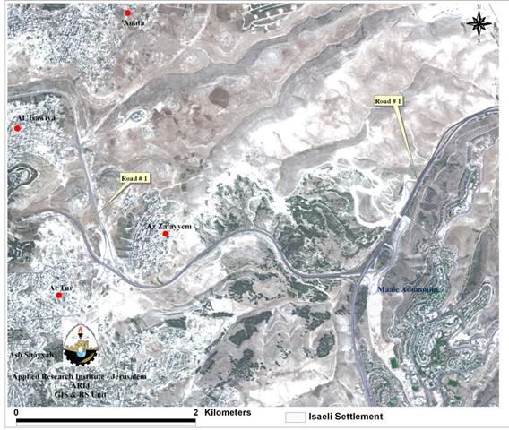
صورة رقم 1: مسكن المواطن زيد زيدان جابر في موقع طريق ضرغام في قرية الزعيم شرق الطور بعد ...
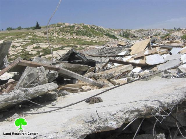
Photo 1: the house of Mr. Zeid Zeidan Jaber in Al Zayyem after demolition The Municipality of Jerusalem demolished ...
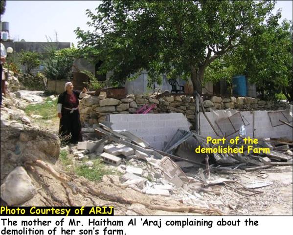
Starting from April, 2006, the Israeli occupation forces began to tighten measures on farmers and citizens of the village of ...

........................................................

........................................................

........................................................

........................................................

This website and its content were initiated in 1993 by the Applied Research Institute – Jerusalem (ARIJ) and the Land Research Center (LRC) with the support from the European Union up until 2023. Since then, the Applied Research Institute – Jerusalem (ARIJ) has taken over the continued development and maintenance of the website. The views expressed remain solely those of ARIJ) and do not necessarily reflect those of the European Union.