Violation: the occupation notified a number of structures with stop work
Location: Khirbet al-Tawil
Date: 05/01/2014
Perpetrators: the Inspection Sub-Committee of the Civil Administration
Victims: residents of the Khirbet
Details:
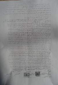
On 05/01/2014, and within the series of the frequent assaults and violations against the Khirbet and its villagers, the so-called Inspection Sub-Committee of the Israeli Civil Administration served three stop work orders on structures under the pretext of unlicensed construction within area classified C according to Oslo Accords. According to the data of Aqraba village council, 54 residential and agricultural structures were notified. Also, tents were also a target of demolition where water reservoirs were banned to be used by farmers.
It should be marked that the occupation gave the structures’ owners until 19/01/2014 to complete the licensing procedures, taking into consideration that the occupation does not acknowledge the village and does not accept any licensing application from it. The policy of serving stop work orders aim at expelling people from their lands for the favor of the following colonies expansion: Jetit, 3km to east, Ma’ale Afrayem 2.5km to the southeast, and Alon Mori to the south. The following table shows the notified structures:
|
Victim |
Family |
Nature of structure |
Order |
|
Firas Bani Fadil |
8 |
A barn of 100m2 |
161022 |
|
The village mosque |
|
The mosque facilities |
161021 |
|
Ateih Bani Omnieh |
4 |
Electricity pole |
399552 |
|
|
|
|
|
Khirbet al-Taweel:
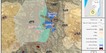
It is considered part of the eastern Aqraba town to the southeast of Nablus city, more specifically, in the natural block no. 10 of Aqraba's agricultural lands. It is 1.5km away from the built-up area of Aqraba.
Khirbet al- Taweel has 30000 dunums of agricultural and pastoral lands, 8000 dunums of which are arid mountains and sand lands. There are also 15000 arable dunums and 7000 dunums that are subject to colonial activities and colonies establishment.
al-Taweel has a population of 800 people and is part of Aqraba lands that totals 51,441 dunums1350 of which are built-up area and nine dunums that belong to al-Taweel. The minor part of those lands area classified as area B but the major parts are classified C on which the following colonies are founded:
- Jetit: established in 1973 with a total area of 1720dunums and a total population of 191 until 2005. It is 37km from the green line.
- Ma’ale Afrayiem: established in 1970 with a total population of 1423 until 2005 and a total area of 4778 dunums.
- Itmar : established in 1984 with a total population of 651 until 2005. It is 28km away from the green line.
Khirbet al-Taweel is composed of four small Islamic and Roman smaller Khirbets namely Tal Al Khashaba, Mrasal-deen, and Al- Arqan. There are several old wells spread over the agricultural lands proving that the town was anciently inhabited. The moderate climate of winter ensures best plantation and abundant pastures which have encouraged farmers to use the land and even reside in it. There is not even a single farmer who does not have an agricultural land in this town.
Noteworthy, farmers and shepherds have been undergoing several harassments by colonists and soldiers. Harassments varied as follows (herds chase, agricultural machines confiscation, farmers expel, imprisonment, IDs detention, and tents and barracks demolitions). In addition, the occupation tends to force closures at the main entrances of the village and to ban villagers from digging water harvesting cisterns and herding in the agricultural lands.
Prepared by
The Land Research Center
LRC


