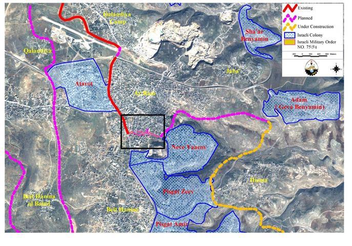
The Israeli military forces issued a military order number T/69/05 stipulating the confiscation of lands from Beit Ummer and Halhul towns in Hebron Governorate for the expansion of Karmei Zur settlement. Karmei Zur settlement was established in 1984 over lands originally owned by Palestinians from Beit Ummer and Halhul. It is affiliated to Etzion Block of settlements and in 2003 housed a population of 623 settlers (FMEP).
The military order was handed to Palestinian land owners on April 6th, 2005, and gave an ultimatum of only 7 days for objection to the Israeli military committee in Beit El.

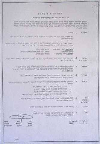
Photo 1: Military order No. T/69/05)

Photo 2: military order No. T/69/05

Photo 3: Military order No. T/69/05
To verify the order, Commander of the Israeli army in the West Bank, general Ya'ir Neve, used the same clich- in all recent land confiscation military orders: ' According to my authorities as a commander of the Israeli defense forces in Judea and Samaria, and as I believe of the necessity to issue such an order, and because of current security situations in the area and the need to take steps to prevent terrorist attacks, I here by order the following..etc '.
The order states that an area of 45.5 dunums (a strip of land at a length of 3241 meters and maximum width of 26 meters) will be confiscated for constructing a new fence around the settlement. This would be the second fence as the settlement is already surrounded with one. The land declared in the military order will be entrapped between the old fence and the new proposed fence. It is an agricultural area mostly planted with grape, peach and apple trees. Its size is almost three times larger than the current size of Karmei Zur settlement. In fact, the latest confiscation aims to achieve many goals, amongst which are the following:
To annex the nearby illegal colonial outpost which was erected on the eve of Sharon's winning the 2001 elections. The outpost site currently contains a number of caravans as appeares in the attached aerial photo. This outpost was established on Halhul's land to the south of the original settlement Karmei Zur.
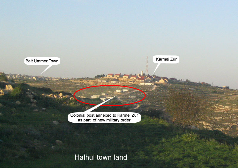
(Photo 4: Karmei Zur from south – Photo courtesy of LRC)
-
To enlarge the current size of Karmei Zur settlement by three folds.
-
To cut geographical continuity between Beit Ummer and Halhul towns as the settlement is located between the two.
-
To grab as much agricultural lands as possible from the two towns.
-
To stop any natural expansion for the two Palestinian towns in the direction of the settlement.
The land targeted for confiscation is owned by the families of Abu Dayyeh, Abu Yusif, 'Aqil, Barbarawi and Midhia from Halhul, as well as the families of Abu 'Ayash, Bregheith, Amu Marya, Awad and Bu'ran from Beit Ummer. The land owners carry documents of ownership, including Turkish taboo that proves their ownership of the land. The targeted families decided to file a suit against the military order, beginning with an immediate objection to the Military Objections Committee in Beit Eil. According to the order, the target lands are located in the following areas:
Beit Ummer lands:
1. Shi'ib Qandul, basin number 3;
2. Daher Hamad, Wadi Al Amir, basin number 2.
Halhul lands:
1. Shi'ib Al Haj, basin number 8.
The Israeli civil administration officer who conveyed the order to farmers and land owners claimed that the separated lands will be accessible only upon getting permission from the Israeli military. According to him, three fence gates will be established for this purpose (See attached aerial photo). However, Palestinian farmers and land owners do not believe that due to the fact that they have frequently been denied access to their fields and exposed to continuous settlers' attacks in that particular area since the start of the current Intifada (uprising) four years ago.
Gradual land grabbing
On March 31st, 2005, just one week before the handing over of the aforementioned order, another two military orders were issued regarding the same lands. The first military order carries the number of S/04/05 (378), 5730-1970, announcing the closure of the land surrounding the settlement 'for military and security purposes' .

( Photo 5 – copy of military closure order No. S/04/05 (378)

( Photo 6 – map attached to military closure order No. S/04/05 (378)
The order also states that no one could enter the land at day and/or at night without acquiring permission from the Israeli military. The second military order carries the number of 04/05 (393), (5730 -1970), (5763 -2003) prohibiting Palestinian building in the targeted land for ' military and security purposes'. (The striped part appeared on the attached map is the no – building part, the white part is the current settlement built up area).

(Photo 7- copy of military closure order No. 04/05 ( 393)

( Photo 8- map attached to military closure order No. 04/05 ( 393)
The status of Israeli settlements
The Israeli settlements in the West Bank are illegal in international laws, many United Nations Security Council resolutions affirmed this, one of which is the United Nations Security Council Resolution 452 which 'calls upon the Government and people of Israel to cease, on an urgent basis, the establishment, construction and planning of settlements in the Arab territories occupied since 1967, including Jerusalem.' Additionally the Forth Geneva Convention states in Article 49 that 'The occupying power shall not deport or transfer parts of its own population into the territories it occupies.'The Forth Geneva Convention in Article 174 also prohibits the 'extensive destruction and appropriation of property not justified by military necessity and carried out unlawfully and wantonly.' Thus the confiscation of lands for settlements and settlements' expansion is illegal and Israel should be held accountable in front of the whole world for violating the international laws and Geneva Conventions.
Prepared by
The Land Research Center
LRC