The commander of the Israeli army- central command, general Ya'ir Nave issued three military orders stipulating the confiscation of hundreds of Palestinian owned lands as follows:
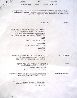
1- Military order number T/183/05 stipulates the confiscation of 292 dunums of land from Dura town (basin number 52) Ad Dahiriyatown (basin number 5) and Ar Ramadin village in the southern parts of Hebron district. The aims of the confiscation, according to the order, is for military purposes and to build the ' security Wall' in the area.
Photo 1: copy of military order No. (T/183/05)
2- Military order number T/92/05 stipulates the confiscation of 7 square meters of land scattered in the following areas: Dura town's land, basin 13 ( Qanan Rish, Khallet Abu Fasha and Khirbet Karme) and Yata town's land, basin 13 ( Khirbet Um Al Amad). The purpose of this confiscation is to erect surveillance cameras around the settlement of Otni'el south of Hebron city which was established in 1983 and had the population of 698 settlers at the end of 2003 ( source- Foundation for Middle East Peace).

(Photo 2: copy of military order No. T/92/05))
3- Military order number T/94/05 stipulates the confiscation of 7 square meters of land from Hebron city, basin number 8 (Al Harayeq location). Again, the purpose of this confiscation is to erect surveillance cameras around the settlement of Hagai at the southern edge of Hebron city. This settlement was established in 1984 and had the population of 388 settlers by the end of 2003 (source- Foundation for Middle East Peace).

Photo 3: copy of military order No. T/942/05
Legal procedures
35 land owners and farmers from Dura, Ad Dahiriya and Ar Ramadin presented legal cases against the military order number T/183/05 through the offices of the Land Defense Committee- Hebron district authorized by the Palestinian National Authority to defend land cases in Israeli courts. Most of their target lands are located near the green line ( armistice line) where the Israelis intend to build new sections of the Annexation and Expansion Wall. According to lawyer Haitham Al Qadi the land whose total area is 292 dunums is owned by the heirs of Late Mr. Mohammed Al Haj Sabha and his brother Mr. Hussein from Dura town as well as other farmers and land owners from Ad Dahiriya and Ar Ramadin.
Previous land confiscation and separation orders
Earlier this year, a military order was issued by the Israeli army carrying the number of T/05/71 ( see attached copy) stipulating the confiscation of 689.9 dunums of lands from Ar Ramadin and neighboring Arab Al Fureijat.

Photo 4: copy of military order number (T/05/71))
Another two military orders were published this year for the same purpose, the first of which carries the number of T/04/05 stipulating the confiscation and separation of 10104 dunums from the lands of As Samu', Yatta and Ad Dahiriya. The second carries the number of T/02/05 stipulating the confiscation of 119 dunums from the lands of Ad Dahiriyaas well.


Photos 5 & 6: copies of the two orders numbers T/04/05 and T/02/05) & : copies of the two orders numbers T/04/05 and T/02/05)
The Wall in Hebron district: facts and figures
The estimated total length of the Wall in Hebron district ( west, south and east) is 125 km. The total area estimated to be separated behind the Wall is 403.6 KM2, while the total area estimated to be bulldozed under the route of the Wall is 12.5 KM2. This brings to 416 KM2 the total area of lands expected to be confiscated or separated by the construction of the Wall, representing 39% of the whole area of Hebron district ( 1064 KM2), See Map 1

Source: LRC GIS department. GIS department.
(Photo 7: works are underway to the south of Ad Dahiriya â?? Hebron )
Prepared by
The Land Research Center
LRC


