• About The Project
  • Palestine in Century
  • Selected Maps
  • Glossary
  • About ARIJ
  • About LRC
  • By Year
    • Case Studies By Year
    • Daily Report By Year
Friday, October 3, 2025
POICA
No Result
View All Result
  • Home
  • Settlements
    • New Israeli Settlements
    • Settlement Expansion
  • Israeli Violations
    • Agriculture
    • Confiscation
    • Demolition
    • Environment
    • Eviction of Palestinians
    • Settlers Attacks
  • Bypass Roads
  • Israeli Plans
  • Segregation
    • Checkpoints
    • Closure
    • Separation Plans
  • Military Orders
  • Reports
    • Daily Report
    • Monthly Report
    • Quarterly Report
No Result
View All Result
POICA
No Result
View All Result

Hundreds of dunums confiscated for bypass road construction

May 7, 2007
in Military Orders
Hundreds of dunums confiscated for bypass road construction

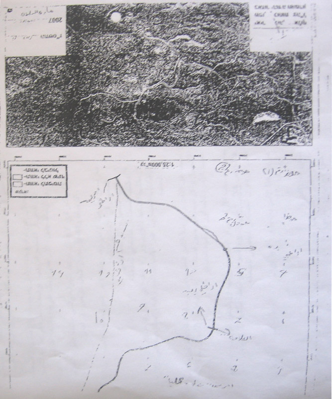
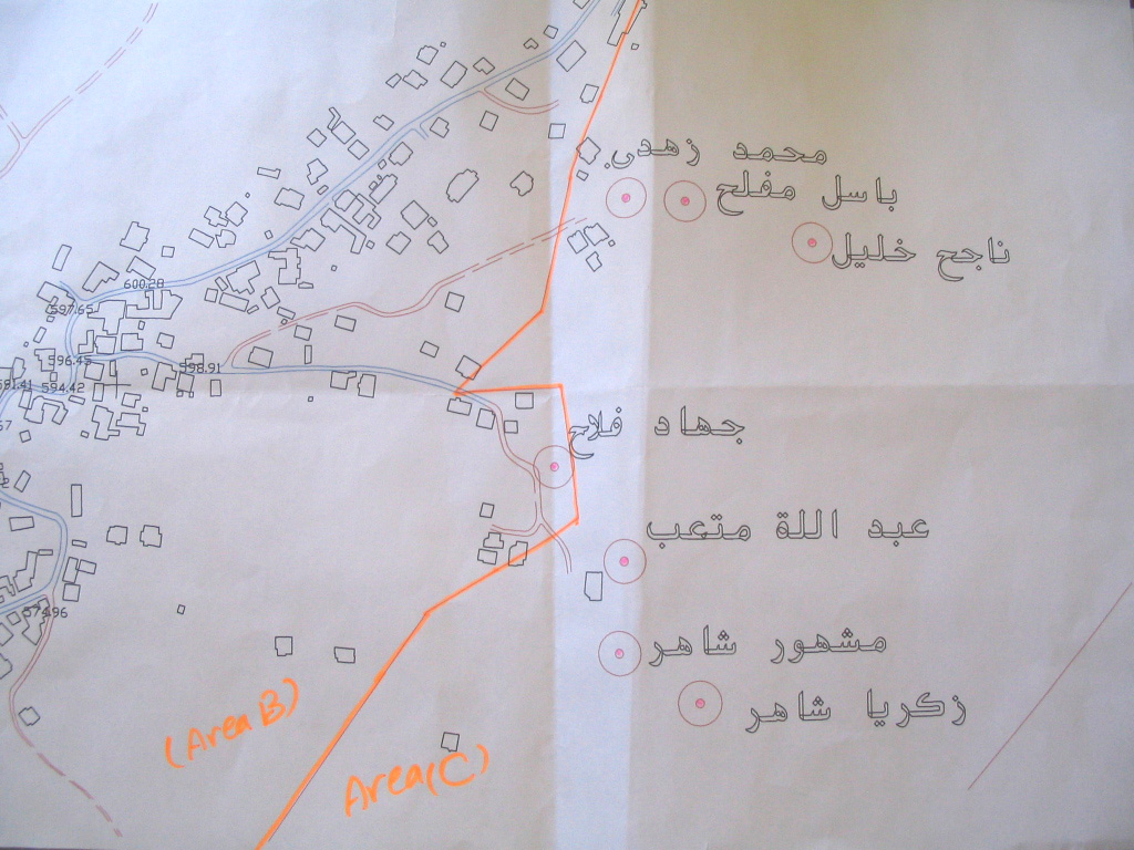
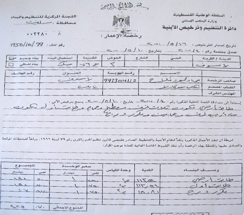
The Israeli occupation authorities issued a military decree stating the confiscation of 198 dunums and 400 square meters of the lands of Ya'bad, Zabadah and Barata'a villages in Jenin governorate.  The decree which carries the number of T/10/01 said the lands would be confiscated for the establishment of a bypass colonial road at the length of 9354 meter ( an average width of 25-70 meters).


(Photo 1& 2: a copy of the military order)


The planned road is aimed at linking the colonial post of Mevo Dotan 2 established in the year 2004 with the Rihan colonial block to the west of the Annexation and Expansion Wall.  By so doing, hundreds of dunums of fertile agricultural lands will be besieged between the bypass road, the colony of Mevo Dotan 2 and the Wall to the west.

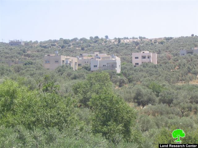
(Photo 3 : a view of Mevo Dotan colonial post)


The colony of Mevo Dotan 2 started on Yab'ad land with two caravans (mobile homes) in the year 2004 when there was much talking about the possibility of a unilateral Israeli withdrawal from the Gaza Strip and parts of the West Bank.  Currently, it has 15 caravans and it has been provided with basic infrastructure requirements, such as, roads, water and electricity.


The original colony – Mevo Dotan 1- which is located few km to the east of Mevo Dotan 2 was established in the year 1978. In 2004, it had the total population of  287 and a municipal area of 3152 dunums of which 122 dunums are built up area (source- Foundation for Middle East Peace-Washington).  


Background to Ya'bad town

The town is located 17 km to the south west of Jenin city with a total population of 15000. The town's total land area is 17258 dunums of which 3819 dunums built up area. 19% of the population is registered refugees who were dismissed of their homes and properties inside the green line during the war of 1948. About 150 families are currently dependent on foreign aid for living as a result of the closure and the going economic sanctions.


Ya'bad's land taken by the Wall

The head of Ya'bad municipality Mr. Walid Al 'Abadi said in an interview with LRC field worker that the farmers of Ya'bad have become more reluctant to tend their remaining agricultural lands in the south of the town due to continuous Israeli harassments and encroachments. He added that the Annexation and Expansion Wall has deducted about 20 % of Ya'bad lands (3451 dunums of the total land area of 17258 dunums). On the other hand, the bypass road that was opened between Ya'bad, Barta'a and Um Arihan in the other side of the Wall has destroyed or separated about 25 % of the total area of Ya'bad's lands, 4314 dunums.


(Photo 4: the untended land of Ya'bad town)


In the year 2004, the Israeli occupation authorities issued another military decree stipulating the confiscation of yet another 4000 dunums of the village's north western land for the purpose of establishing an industrial zone affiliated to Sheked colony, although no practical steps has been taken yet in this regards. In case this decree was implemented the only artisan well which currently provides the village with 100 m3/hour would  be totally contaminated by the industrial waste. 


Two agricultural gates

The occupation authorities imposed harsh restrictions on farmers' access into their lands separated by the Wall. Only 8% of the total farmers in the town were given passing permits by the Israeli military to go through the two Wall agricultural gates; gate number 300 which is located at the north western corner of the town, and gate number 356 located at the south western corner of the town.


The Israeli restrictions on farmers and land owners are coupled with similar measures against the town manpower who are denied access in to the Israeli labor market under security pretexts which increased the percentage of unemployment in the town to 62.


House demolition warnings

Recently, a number of house demolition warnings has been distributed to owners in the town under the pretext of building without license inside the borders of zone C, according to Oslo classification, although the town's municipality had presented a town planning scheme to Beit Eil court in the year 1980 and no decision has been taken upon it yet.


Seven colonies

The Ya'bad town and its periphery villages are surrounded with seven Israeli colonies which all set up at its land and the land of surrounding villages. Four of these colonies have already been annexed into Israeli proper by the Annexation and Expansion Wall, namely: Shaked, Hinnanit, Rihan and Tel Menashe which all situated in the north of Ya'bad and have the total population of 6797 in the year 2004 who live in a  1655 dunums built up area and municipal boundaries of 16270 dunums ( Source- Foundation for Middle East Peace- Washington DC).  On the other hand, the southern Ya'bad land is controlled by Mevo Dotan 1 and 2 colonies and by bypass roads.


 Prepared by
The Land Research Center
LRC

Recommended For You

سلطات الاحتلال الإسرائيلي تستغل ‘المنفعة العامة’ لنهب الموارد الفلسطينية

by arij
September 30, 2025
0
سلطات الاحتلال الإسرائيلي تستغل ‘المنفعة العامة’ لنهب الموارد الفلسطينية

في الاول من شهر ايلول من العام 2025، نشرت الإدارة المدنية الإسرائيلية، الذراع الأيمن لحكومة الاحتلال الإسرائيلي أمرا عسكريا جديدا تحت عنوان " أمر ءبشأن قانون الأراضي (الاستملاك...

Read moreDetails

The Occupation Targets the Village of Raba Southeast of Jenin with Military Orders and Seizes Vast Areas of Its Lands

by arij
September 13, 2025
0
الاحتلال يستهدف بأوامر عسكرية قرية رابا جنوب شرق جنين ويصادر مساحات واسعة من أراضيها

 The Israeli occupation Army have continued their policy of plundering Palestinian lands, as their bulldozers leveled wide areas of agricultural land in the village of Raba, southeast of...

Read moreDetails

الاحتلال يستهدف بأوامر عسكرية قرية رابا جنوب شرق جنين ويصادر مساحات واسعة من أراضيها

by arij
September 13, 2025
0
الاحتلال يستهدف بأوامر عسكرية قرية رابا جنوب شرق جنين ويصادر مساحات واسعة من أراضيها

  واصلت قوات الاحتلال الإسرائيلي سياسة نهب الأراضي الفلسطينية، حيث أقدمت آلياتها على تجريف أراض زراعية واسعة في قرية رابا جنوب شرق محافظة جنين، تمهيدا لشق شارع عسكري...

Read moreDetails

Nablus Governorate’s Archaeological Sites Face Israeli Expropriation Plans

by arij
September 11, 2025
0
” المواقع الأثرية في محافظة نابلس… ساحة مفتوحة أمام مخططات المصادرة الإسرائيلية “

On 10 August, 2025, the Israeli Civil Administration (ICA), issued a booklet of military orders signed by the head of the so-called ‘Israeli Civil Administration’ in the occupied...

Read moreDetails

” المواقع الأثرية في محافظة نابلس… ساحة مفتوحة أمام مخططات المصادرة الإسرائيلية “

by arij
August 26, 2025
0
” المواقع الأثرية في محافظة نابلس… ساحة مفتوحة أمام مخططات المصادرة الإسرائيلية “

في العاشر من شهر اب من العام 2025, أصدرت الإدارة المدنية الإسرائيلية كراسة أوامر عسكرية موقعة من قبل رئيس ما يسمى "بالإدارة المدنية الإسرائيلية" في الضفة الغربية المحتلة,...

Read moreDetails
Next Post
Wall amendments: more land grabbing

Wall amendments: more land grabbing

LATEST NEWS

Annexation of the Jordan Valley: Implications for the Two-State Solution and Regional Stability

Annexation of the Jordan Valley: Implications for the Two-State Solution and Regional Stability

by arij
September 29, 2025
0

........................................................

Isolation of Three Villages Northwest of Jerusalem: Silent Annexation Creeps toward the Capital

عزل ثلاث قرى فلسطينية شمال غرب مدينة القدس: الضم الاسرائيلي الصامت يزحف نحو محيط العاصمة

by arij
September 24, 2025
0

........................................................

Isolation of Three Villages Northwest of Jerusalem: Silent Annexation Creeps toward the Capital

Isolation of Three Villages Northwest of Jerusalem: Silent Annexation Creeps toward the Capital

by arij
September 24, 2025
0

........................................................

سياسات التهويد في القدس: من السيطرة المكانية إلى طمس الهوية عبر التسمية

سياسات التهويد في القدس: من السيطرة المكانية إلى طمس الهوية عبر التسمية

by arij
September 23, 2025
0

........................................................

flag_yellow_lowEU-PfP-Logo

This website and its content were initiated in 1993 by the Applied Research Institute – Jerusalem (ARIJ) and the Land Research Center (LRC) with the support from the European Union up until 2023. Since then, the Applied Research Institute – Jerusalem (ARIJ) has taken over the continued development and maintenance of the website. The views expressed remain solely those of ARIJ) and do not necessarily reflect those of the European Union.

© 2025 Copyright ARIJ . All Rights reserved. .

No Result
View All Result
  • Home
  • Settlements
    • New Israeli Settlements
    • Settlement Expansion
  • Israeli Violations
    • Agriculture
    • Confiscation
    • Demolition
    • Environment
    • Eviction of Palestinians
    • Settlers Attacks
  • Bypass Roads
  • Israeli Plans
  • Segregation
    • Checkpoints
    • Closure
    • Separation Plans
  • Military Orders
  • Reports
    • Daily Report
    • Monthly Report
    • Quarterly Report

© 2025 Copyright ARIJ . All Rights reserved. .