The Israeli occupation army issued new amendments for three military orders concerning the Wall path in the lands of a number of villages number in Tulkarem governorate. The three amendments were carried out as followed:
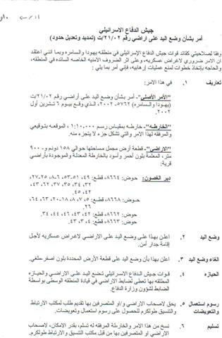
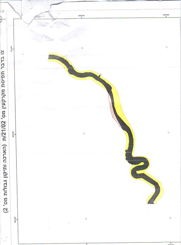
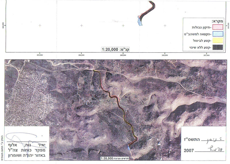
1- Order number T/21/02 which was signed on 6 October, 2002. This amendment put hand over 158 dunums and 900 square meters ( the area colored in red and black in the attached map) which was destroyed under the current path of the Annexation and Expansion Wall. In the meantime, it reduced the width of the Wall path by narrowing the patrol road that runs along the western side of the Wall path and by decreasing the distance between the main body of the Wall and its parallel fences on both sides. Consequently, the order abandoned the confiscation of the area that is colored in yellow in the attached map. The target land belongs to the village of Deir Al Ghusun, Tulkarem governorate, basins 8664, 8668,8662 and 8663.
(Photos 1, 2 & 3: a copy of the military order number T/21/02 and the attached maps)
2- Order number T/22/02 signed on 20 May, 2003. It put hand over an area of 74 dunums and 300 square meters ( the area colored in red and black in the attached map) located under the path of the Wall and belongs to the village of Shuweika at the southern edge of Tulkarem city. As in the previous order the width of the Wall path was reduced by narrowing the patrol road that runs along the western side of the Wall path and by decreasing the distance between the main body of the Wall and its parallel fences on both sides. Consequently, the order abandoned the confiscation of the area that is colored in yellow in the attached map. The target land is located in basins 8435, 8438, 8430 and 8425.
(Photos 4,5, 6 & 7: a copy of the military order number T/22/02 and the attached maps)
3- Order number T/24/02 signed on 20 August, 2002. It put hand over an area of 193 dunums and 800 square meters ( the area colored in red and black in the attached map) located under the path of the Wall and belongs to the villages of Ar Ras and Faro'un in Tulkarem city. As in the previous order the width of the Wall path was reduced by narrowing the patrol road that runs along the western side of the Wall path and by decreasing the distance between the main body of the Wall and its parallel fences on both sides. Consequently, the order abandoned the confiscation of the area that is colored in yellow in the attached map. The target land is located in basins 2, 8472 and 8473.
(Photos 8,9 &10: a copy of the military order number T/24/02 and the attached maps)
Meaningless step
In an interview with LRC field worker Mr. Eid Yassin, the head of Ar Ras municipality described the Israeli Wall revision in Tulkarem region as meaningless given that the Israeli occupation authorities maintain a no-man zone of 150 meters on each side of the Wall which means that, in practice, the Palestinians land owners cannot take benefit of their returned land. On the other hand, Mr. Abdul khaliq Jubara who works at Tulkarem municipality said that the Israeli Wall revision decision was made to maneuver the Israeli supreme court's decision of 2006 which ruled that Khirbet Jubara and another two homes in Ar Ras village should be taken out of the Wall.
Wall impacts
As a result of the construction of the Wall more than 400 dunums of agricultural land were destroyed under its route and about 2500 dunums were separated behind it in the village of Deir Al Ghusun. Moreover, the only water well in the village was, also, confiscated and separated behind the Wall.
In Faro'un village, the Wall has destroyed 1000 dunums under its route and almost half of its land -4000 dunums- were separated behind it.
As regards Khirbet Jubara the whole village was separated behind the Wall putting about 300 people in a big jail and making their life miserable.
In Ar Ras village, about 250 dunums of fertile agricultural land were devastated under the route of the Wall and hundreds others were separated behind it.
Prepared by
The Land Research Center
LRC


