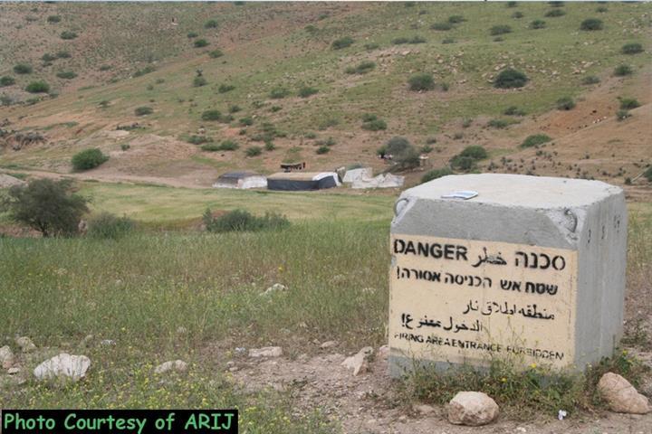
On the 18th of January 2015, the Israeli Occupation Authorities issued the military order “ S/1/99 (Amendment border No.6) (5885 -2015) (Firing Zone No. 912)”, extending the expropriation of 410,672 dunums of lands as “Closed Military Zone”, while another 212 dunums deducted from the order since it became part of the illegal settlement of Ma’aleh Adumim.
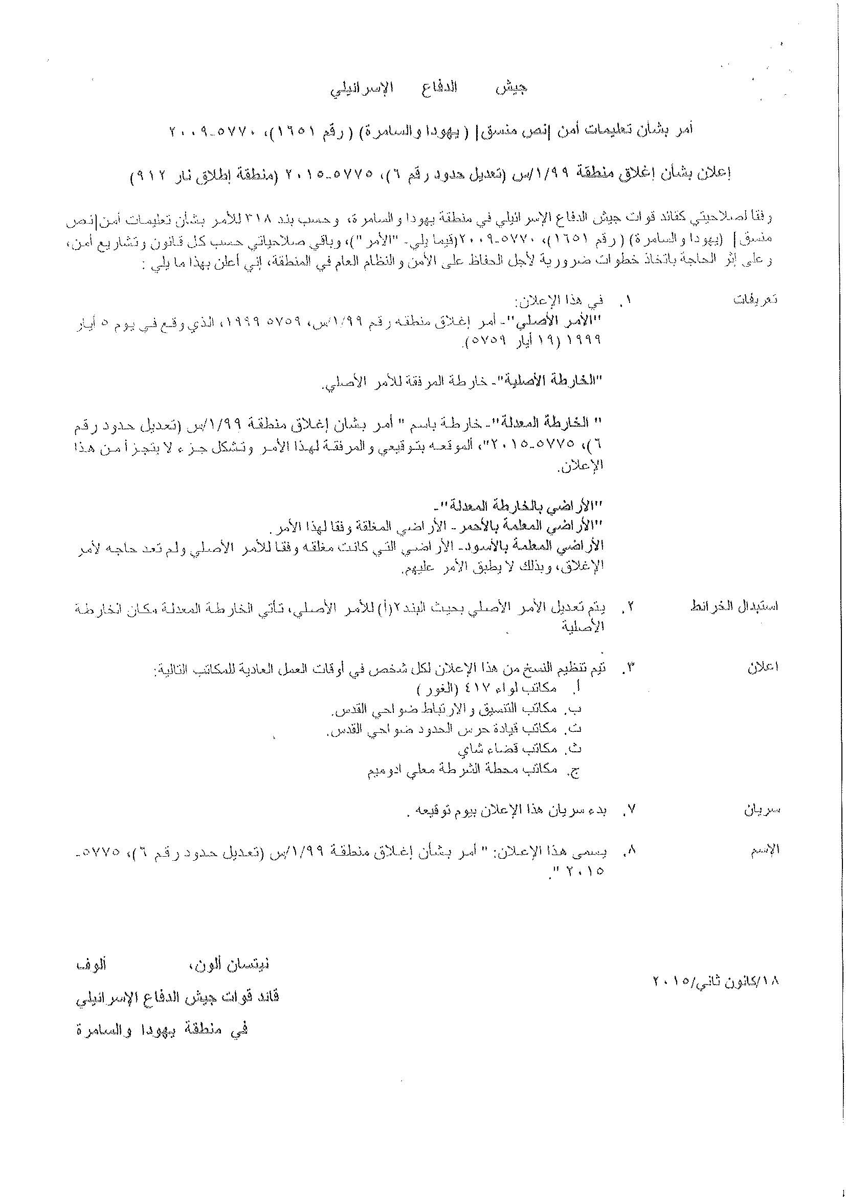
Military order “ S/1/99 (Amendment border No.6) (5885 -2015) (Firing Zone No. 912)”
According to the military order, which signed by Nitssan Allon, the commander of the Israeli Occupation Forces in the West Bank, the lands confiscated for security pretexts.
It’s worth pointed that on the 5th of May 1999, the Israeli Authorities issued the military order No. S/1/99 (5785-1999) which targeted the same aforementioned areas (410,884 dunums, including the 212 dunums) and declared it “Closed military area”.
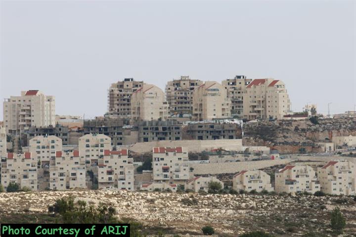
However, the area (212 dunums) which removed from the Firing zone area, is located east of Ma’ale Adumim settlement and part of it located within the border of the settlement.
The Israeli Authorities looking forward to expand Ma’ale Adumim settlement from the east. Also, the area that removed from the declaration of Closed Military area is already used by the Israeli settlers in Ma’ale Adumim settlement, where they build a “sport center”, which included playgrounds, gym, etc. Furthermore, they also, start to construct a road in the area, which seemingly that they planning to construct a new colonial neighborhood to be a part of Ma’ale Adumim settlement.
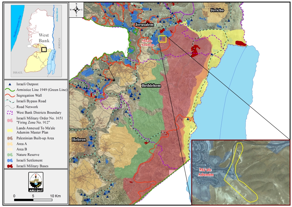
In a geopolitical analysis conducted by the GIS Department at ARIJ, the area targeted by the military extending order located at the eastern part of the West Bank, started from the southern part of Jericho governorate, to the east of Jerusalem city, then the areas at the east of Bethlehem governorate to reach to the eastern part of Hebron governorate.
The “closed military area” or the Firing Zone No. 912 ( 410,672 dunums), located at the eastern part of West Bank, is border by the natural reserve area (166,538 dunums) from the west and from the east an area (around 140,000 dunums) confiscated by the Israeli Authorities in 2009, which added to the Israeli settlement of Ma’ale Adumim.
Therefore an entire area of 717,210 dunums (12.6 % from the total area of the West Bank) captured by Israel under security and military purposes and nature reserve areas, where the Palestinians denied their right to reach to their lands in the targeted area. See the map below:
Map for the expropriated lands including the natural reserve area
Obviously, the Israeli Occupation Authorities intentionally capturing the natural reserve lands and firing zone areas in addition to close military areas, just after the year 1967 for colonial and expansionist desires.
The systematic Israeli “security & military purposes” expropriation are no more than an Israeli quirky ways to confiscate the Palestinian lands for the interest of building and expanding the illegal settlements.
Actually , the expropriation orders as “Closed military area” showing how the Israeli Authorities confiscated Palestinian land in the West Bank under several claims; security needs, state lands, closed military areas and Firing zone, and then they transfer these land to the interest of building and expanding the illegal settlements and their outposts in all parts of the oPt.
Closed Military Areas:
Following the Israeli military occupation of the Palestinian Territory in the year 1967, Israeli started building the illegal settlements in all parts of the West Bank while preventing the Palestinian residents from reaching , cultivating and developing over their lands mainly for the claim of “closed military area”.
It’s worth mentioning that 999,185 dunums in the West Bank (which constitute 17.6% from the total W.B area) classified as closed military areas and firing zones.
For more information about “State land and firing zone” follow this link: https://poica.org/details.php?Article=7318.
Prepared by:
The Applied Research Institute – Jerusalem


