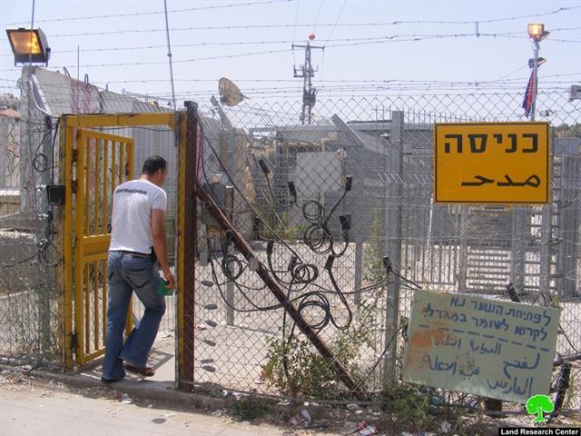
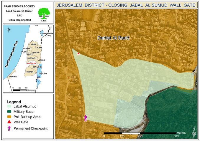
(photo 1: Azzune Atmeh sole ghetto gate)
By the end of the first half of February, 2009, the Israeli occupation authorities completed the siege of Azzun Atme village by building the Segregation Wall around it form all sides turning the village into a big real prison.
(photo 2: Azzune Atme sealed off)
The latest development was in compliance with the Military Order number T/08/06 dated 28 of November, 2008 calling for the re-routing of the Wall in the village.
The re-routing of the Wall which took two months to accomplish confiscated the total of 16 dunums and 580 meters of the village’s southern and southwestern lands in parcels 7, 8 and 10. The Wall started to be established on the villages’ lands in 2006. The alternated route has a length of 4 kilometers starting from the western entrance of Azzun Al Atma along by-pass road 505 until it reaches the colony of Sha'ari Tiqva in the east. Two additional agricultural gates were also added; the first one at the southern entrance of the village while the second one was placed near Al Shilla water cistern in the western side of the village. Moreover, two additional military observation towers were introduced as well as placing motion sensors on the new electrical fence as well as closing the gaps in the current fence.
As a result, thousands of additional agricultural dunums are isolated now behind the new Wall. The isolated lands are owned by Palestinian farmers from the villages of Siniria, Al Zawiya and Masha. Their entrance to their lands are now contingent upon getting permits from the relevant occupation authorities. As such, their access to their lands will become harder and maybe even impossible.
Background to Azzun Atmeh:
The village of Azzun Atme is located 3 kilometers away from the Green Line. Its population is about 1976 individual, 80% of whom work in the agriculture sector while 15% work inside Israel. The remaining population work in the Palestinian public sector and in commerce. The village total land area is 8081 dunums and its built up area is 336 dunums.
Surrounding colonies:
The village is surrounded by four colonies as followed:
1. Sha'ari Tiqva colony from both the eastern and northern directions (established in 1982, its population by the end of 2007 was 3931, its built up area is 915 dunums and its municipal area is 1045 dunums- Source: Foundation For the Middle East Peace). It confiscated more than 1000 dunums from the lands of the village as well as lands of the villages of Sinirya, Masha, Beit Amin and as Zawiya.
(photo 3: The village school surrounded by the houses of the settlement of Sha'are Tikva)
Photographer: Osnat Rabin
2. Oranit colony from the western direction ( established in 1984. its population by the end of 2007 was 5987, while its built up and municipal area is 878 dunums (Source: ibid).
3. Elkana colony from the south eastern side ( established in 1977, its municipal area is 1198 dunums, built up area is 758 dunums and its population by the end of 2007 was 3000 settlers (Source: ibid).
4. Ets Efrayem colony from the eastern side of the village between the colonies of Sha'ari Tiqva and Elkana ( established in 1985, its population by the end of 2007 was 704 settlers, its municipal area is 458 dunums and its built up area is 184 dunums (Source: ibid).
Wall impacts on local citizens:
- The whole village population find themselves now in a complete prison with only one passage gate at the northern entrance to the village. This gate is called by local people the ' death gate' due to the harsh and humiliation measures on the part of the Israeli army against people entering or leaving the village. One result of this barbaric treatment is the death in 2006 of a man who was hit by a car inside the village and denied exit by soldiers manning the checkpoint until he bled to death. More over, the gate is totally closed from midnight until 5 AM which puts the lives of local people under potential risk.
- According to local village councils, the Wall has isolated behind thousands of dunums from Azzun Atme and neighboring villages as followed:
- 1800 dunums from Azzun Atme and Siniriya mostly planted with olive trees and covered ground crops ( inside plastic houses) ;
-
1100 dunum from az Zawiya and Masha planted with olive orchards;
-
800 dunums between Azzun Atme and the green line opposite Kafr Qasem town inside the green line. On the whole, the total of 3700 dunums of land lie inside the Wall at the current time which threatens the very existence of many families in the area who totally depend on agriculture as main income.
Village partitioned:
To make it even worse, the Israeli occupation authorities partitioned the village by completely separating 9 houses in which 75 people live from the rest of the village. The houses which are located at the southern side of the village are about 200 meters away from the rest of the village and their residents are obliged to commute in and out of their area only on foot carrying their stuff and every day needs. This situation has been in force since the year 2000. After the completion of the Wall further restrictions were imposed on the movement of those people living in these houses, such as, the restrictions on the types of commodities and stuff that are allowed access as well as daily raids and harassment which have turned the lives of those people into a continuous nightmare.
Related case studies:
1. The Re-Routing of the Israeli Racist Wall in the Village of Azzun Atme, 24,December,2008.
2. Azzun Atme village engulfed by two walls, 05, November,2007;
3. A New Section of the Segregation Wall is being constructed in Azzun Atma, Qalqilia Governorate, January, 2007.
Prepared by:
The Land Research Center
LRC


