• About The Project
  • Palestine in Century
  • Selected Maps
  • Glossary
  • About ARIJ
  • About LRC
  • By Year
    • Case Studies By Year
    • Daily Report By Year
Monday, March 30, 2026
POICA
No Result
View All Result
  • Home
  • Settlements
    • New Israeli Settlements
    • Settlement Expansion
  • Israeli Violations
    • Agriculture
    • Confiscation
    • Demolition
    • Environment
    • Eviction of Palestinians
    • Settlers Attacks
  • Bypass Roads
  • Israeli Plans
  • Segregation
    • Checkpoints
    • Closure
    • Separation Plans
  • Military Orders
  • Reports
    • Daily Report
    • Monthly Report
    • Quarterly Report
No Result
View All Result
POICA
No Result
View All Result

Israel gives green light to new master plan for Talmon B colony at the expense of Palestinian villages

October 2, 2017
in Settlement Expansion
إعلام عن منح سريان مفعول لمخطط تفصيلي جديد في مستعمرة ” تلمون ب”  على حساب مئات الدونمات الزراعية الفلسطينية


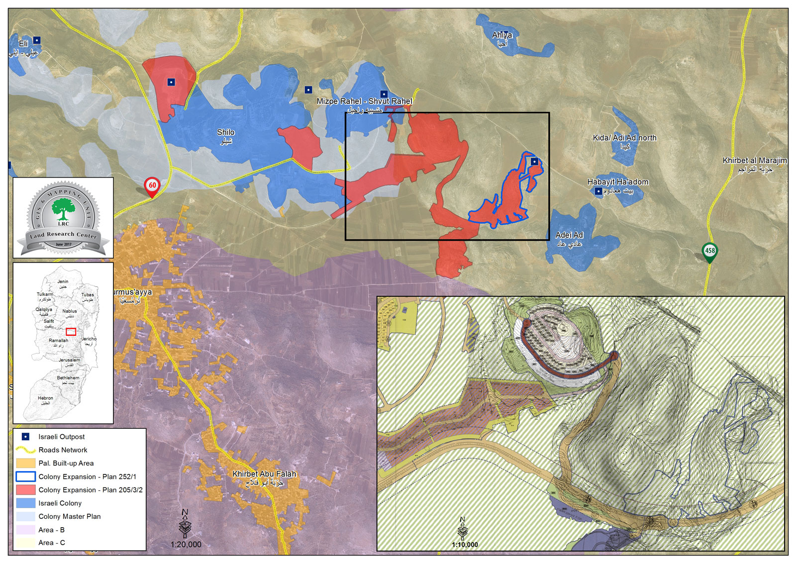
  • Violation: validating a colony's master plan
  • Location:  Ras Karkar and Al-Mazra'a Al-Qibliya villages
  • Date:  June 19, 2017
  • Perpetrators: Talmon B colony
  • Victims:  Palestinian owners of lands

Details:

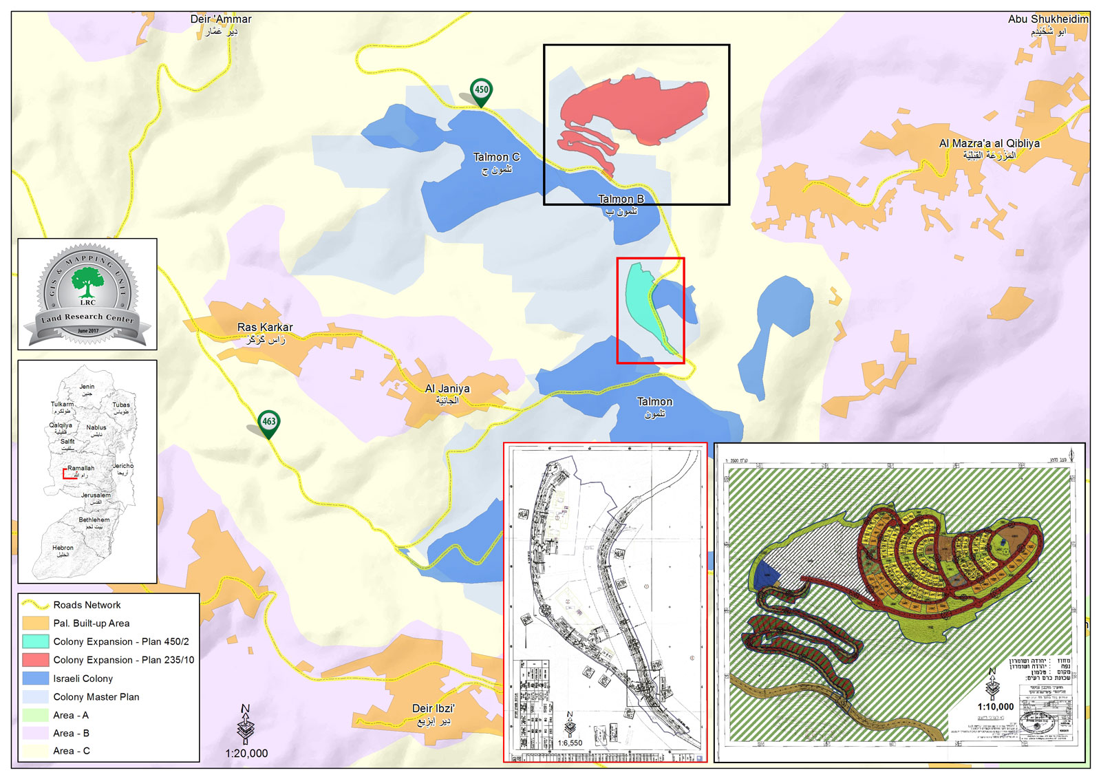
The webpage of Israel Ministry of Interior featured on June 919, 2017 an announcement for Higher Planning Council- Israel Civil Administration, which gives the validation number 235/10 to new master plan for Talmon B colony, north Ramallah governorate.

According to the plan coupled with an illustrative map, the use of  432 dunums founded in the periphery of Talmon B will be transferred from agricultural to residential and road uses. Also, the plan includes the construction of 255 residential units at the expense of Ras Karkar and Al-Mazra'a Al-Qibliya villages' lands.


Photo 1: the advertisement of the plan number 235/10


Photos 2-5: part of the plan number 235/10

It is reported that the targeted lands are founded within the natural block number 2 in the locations known as Wad Abu Mohammed and Wad Abu Qrei' from Al-Mazra'a Al-Qibliya village. From Ras Karkar village, the plan targeted lands founded within the natural block number 9 in the location known as Shu'bit Dheib.


Photo 6: picture illustrating the targeted locations


The plan's objectives:

  • Changing the use of lands from agricultural to residential areas A+B, public institutions, commercial zones, open areas, future planning area, landscape areas and roads.
  • Determining the uses of lands designated for the plan
  • Determining construction restrictions in the plan area
  • Delineating road networks
  • Determining conditions and phases of construction within the plan

The targeted lands are located nearby Talmon colony and are declared inaccessible for Palestinians for that reason. Owners and farmers cannot access lands but through special permits that are issued once or twice a year.

  • Ras Karkar[i]

15 kilometer north  west of Ramallah, Ras Karkar is surrounded by Deir 'Ammar (north),  Kafr Ni'ma and Deir Ibziq  (south), Al Jania (east), Bani Harth (west).

Ras Karkar has a population of 2450 people according to statistics conducted by the Palestinian Central Bureau of Statistics  in 2008. It has a total area of 5050, 330 of which are a built-up area of the village. 

The Israeli occupation devoured more than 32  dunums of the lands of the village for Talmon C colony which was built in 1989. Moreover, bypass number '463 took over 295 dunums of the village lands.

  According to Oslo Accords, 19% of Ras Karkar is under Area B (PA has full civil and security control) while most of the village lands (81%) is under Area C (Israel maintains full security and administrative control). Here are the area in dunums:

  • Area B (940) dunums
  • Area C (4110) dunums

About Al-Mazra’a Al-Gharbiya:

It is located 12km to the northwest of Ramallah city. The village is edged by Abu Shkeidim area from the north, Talmon colony from the west, Abu Qash village from the east, and Ein Qiniya village from the south.

The village has a total land area of 15,275 dunums, of which 1165 dunums are the built-up area. Around 5000 people inhabit the village (2014).

The Israeli occupation confiscated around 329 dunums from the village’s lands to establish the colonies of Nahliel (1984) and the colony of Talmon (1989).

Also, the bypass road number 450 confiscated 75 dunums from the village.

According to Oslo lands classifications, the village lands are as follows:

  • 8533 dunums are area classified “B”
  • 6742 dunums are area classified “C”


[i] Source: Geographic Information System- Monitoring Israeli Violations Team- Land Research Center


Prepared by
 The Land Research Center
LRC


Recommended For You

على ما مساحته 1006.4 دونما من أراضي بلدة يانون
“سلطات الاحتلال الإسرائيلي تشرع بتغيير نفوذ بؤرة استيطانية في الضفة الغربية المحتلة”

by arij
March 14, 2026
0
على ما مساحته 1006.4 دونما من أراضي بلدة يانون  “سلطات الاحتلال الإسرائيلي تشرع بتغيير نفوذ بؤرة استيطانية في الضفة الغربية المحتلة”

في الثاني عشر من شهر شباط من العام 2026, نشر رئيس قسم الاستيطان والتنظيم فيما يسمى "بالإدارة المدنية الإسرائيلية", الذراع الأيمن لحكومة الاحتلال الإسرائيلية اعلانا مفاده " اعلان...

Read moreDetails

حين تتقلص الخريطة: تسارع غير مسبوق في توسّع المستوطنات الإسرائيلية خلال عام 2025

by arij
February 16, 2026
0
حين تتقلص الخريطة: تسارع غير مسبوق في توسّع المستوطنات الإسرائيلية خلال عام 2025

مقدمة: - ان السياسة الاستيطانية الإسرائيلية في الضفة الغربية المحتلة هي واحدة من أكثر القضايا التي تقف عائقا في تحقيق سلام عادل وقابل للحياة في الأراضي الفلسطينية المحتلة....

Read moreDetails

حين يصبح الاستيطان سياسة دولة: 26 ألف وحدة جديدة تهدد الضفة الغربية

by arij
November 27, 2025
0
حين يصبح الاستيطان سياسة دولة: 26 ألف وحدة جديدة تهدد الضفة الغربية

في ظلّ صمتٍ دوليٍّ متزايد، يكشف معهد الأبحاث التطبيقية – القدس (أريج) عن طرح سلطات الاحتلال الإسرائيلي مخططات بناء استيطانية لأكثر من 26 ألف وحدة استيطانية جديدة في...

Read moreDetails

Expansion of Gilo Settlement: A Strategic Plan to Isolate Bethlehem and Undermine Palestinian Rights

by arij
May 12, 2025
0
Expansion of Gilo Settlement: A Strategic Plan to Isolate Bethlehem and Undermine Palestinian Rights

The Israeli Civil Administration has announced a new settlement expansion plan—No. 101-1284223—which outlines the construction of 1,990 new settlement units on approximately 175.9 dunums of land extending towards...

Read moreDetails

إسرائيل تمضي قدمًا في مخطط استيطاني جديد على أراضي مدينة بيت جالا، في انتهاك للقانون الدولي وحرمان الفلسطينيين من أراضيهم

by arij
April 29, 2025
0
Israel Advances Settlement Plan on Ancient Olive Groves on lands of Beit Jala city, Violating International Law and depriving Palestinians their lands

  في أواخر شهر شباط من العام 2025، صادقت دولة الاحتلال الإسرائيلي على مخطط استيطاني جديدة لبناء حي سكني للمستوطنين على مساحة 22.2 دونما من الأراضي الفلسطينية لتابعة...

Read moreDetails
Next Post
الإعلان عن إيداع مخطط تفصيلي جديد لمستعمرة “عميحاي” على أراضي قرية جالود بمحافظة نابلس

الإعلان عن إيداع مخطط تفصيلي جديد لمستعمرة "عميحاي" على أراضي قرية جالود بمحافظة نابلس

LATEST NEWS

سلطات الاحتلال الإسرائيلي تستهدف قرية الجيب بأمر عسكري جديد

سلطات الاحتلال الإسرائيلي تستهدف قرية الجيب بأمر عسكري جديد

by arij
March 17, 2026
0

........................................................

على ما مساحته 1006.4 دونما من أراضي بلدة يانون  “سلطات الاحتلال الإسرائيلي تشرع بتغيير نفوذ بؤرة استيطانية في الضفة الغربية المحتلة”

على ما مساحته 1006.4 دونما من أراضي بلدة يانون
“سلطات الاحتلال الإسرائيلي تشرع بتغيير نفوذ بؤرة استيطانية في الضفة الغربية المحتلة”

by arij
March 14, 2026
0

........................................................

الاحتلال الإسرائيلي يستهدف مشاريع تنموية في قرية جورة الشمعة جنوب شرق بيت لحم

الاحتلال الإسرائيلي يستهدف مشاريع تنموية في قرية جورة الشمعة جنوب شرق بيت لحم

by arij
March 14, 2026
0

........................................................

سلطات الاحتلال الإسرائيلي تستخدم الأوامر العسكرية لتعمق المشروع الاستيطاني في الضفة الغربية المحتلة

سلطات الاحتلال الإسرائيلي تستخدم الأوامر العسكرية لتعمق المشروع الاستيطاني في الضفة الغربية المحتلة

by arij
February 26, 2026
0

........................................................

flag_yellow_lowEU-PfP-Logo

This website and its content were initiated in 1993 by the Applied Research Institute – Jerusalem (ARIJ) and the Land Research Center (LRC) with the support from the European Union up until 2023. Since then, the Applied Research Institute – Jerusalem (ARIJ) has taken over the continued development and maintenance of the website. The views expressed remain solely those of ARIJ) and do not necessarily reflect those of the European Union.

© 2026 Copyright | ARIJ | All Rights reserved.

No Result
View All Result
  • Home
  • Settlements
    • New Israeli Settlements
    • Settlement Expansion
  • Israeli Violations
    • Agriculture
    • Confiscation
    • Demolition
    • Environment
    • Eviction of Palestinians
    • Settlers Attacks
  • Bypass Roads
  • Israeli Plans
  • Segregation
    • Checkpoints
    • Closure
    • Separation Plans
  • Military Orders
  • Reports
    • Daily Report
    • Monthly Report
    • Quarterly Report

© 2026 Copyright | ARIJ | All Rights reserved.