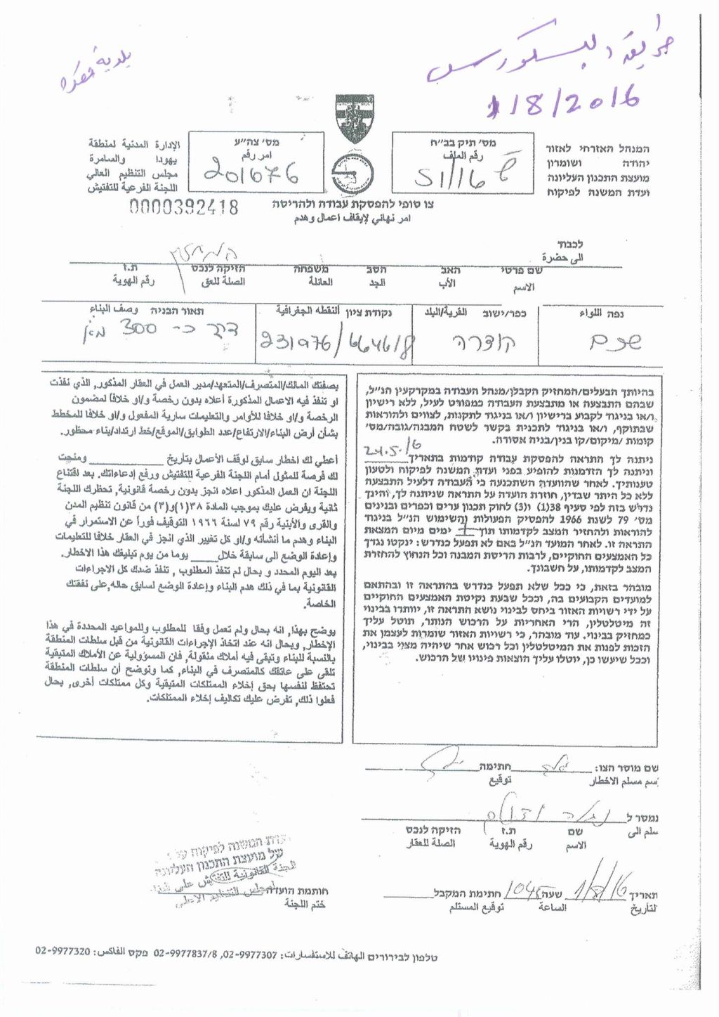
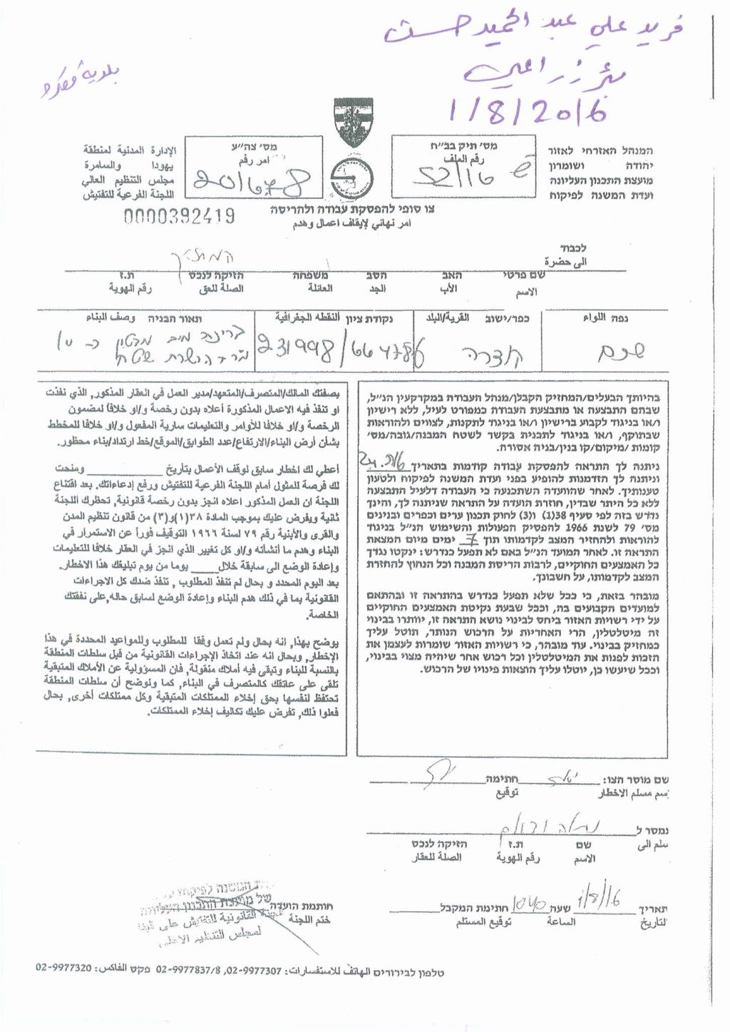
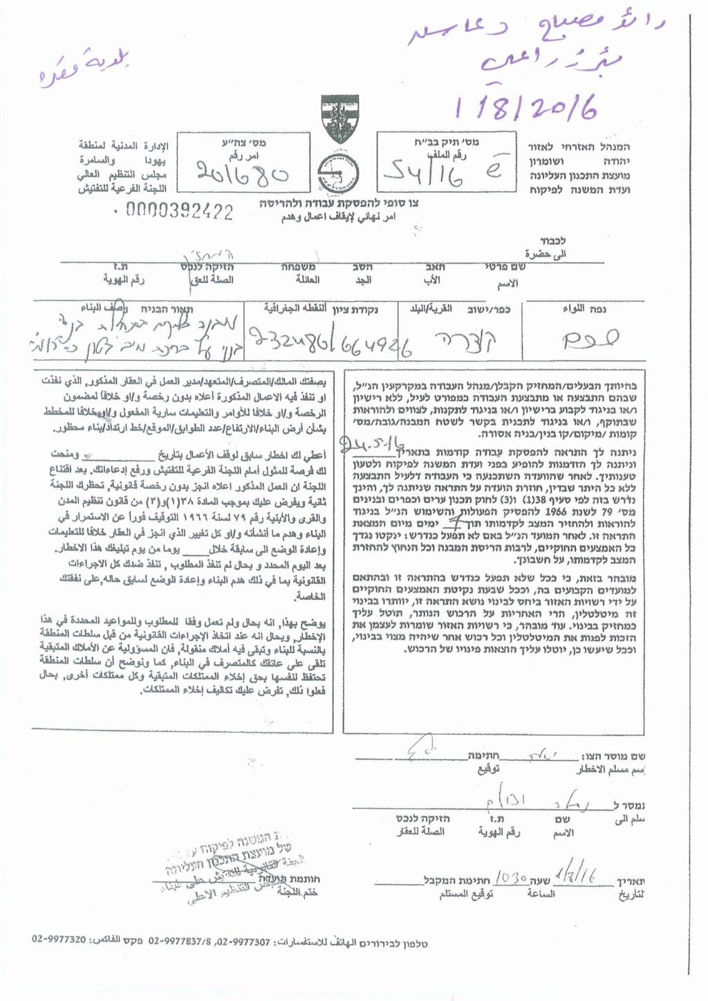
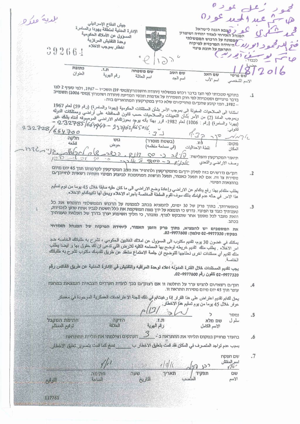
On the 2nd of August 2016, the Israeli Civil Administration escorted by the Israeli Army stormed the Palestinian town of Qusra, south of Nablus city, and handed out military orders to demolish two agricultural water wells and to evacuate more than 50 dunums of Palestinian lands planted with 50 olive trees and used for the construction of 5 water wells and agricultural rooms….
The demolition orders, claimed that the targeted water wells built without permits from the Israeli Authorities, and for that, the demolition orders gave the owners of the water wells 7 days to demolish the targeted wells or to get the building permits form the Israeli Civil Administration. While the evacuation order claimed that the targeted land which used to construct the 5 water wells and rooms, classified by the Israeli Authorities as “State land”. The order gave the owners 45 days to demolish all the structures build in the targeted land.
|
Details about the targeted structures |
|||
|
Military Orders No. |
Type of orders |
Type of targeted structures |
Name of the owners |
|
201678 |
Demolition order |
Agricultural water well |
Fared Ali Abed Al Hamed Hassan |
|
201680 |
Demolition order |
Agricultural water well |
Raid Musbah Da’as |
|
201676 |
Demolition order |
Road (length = 300 meters) established on 1.5 dunums of land |
Qusra Municipality |
|
392661 |
Evacuation order |
50 dunums of land, planted with 50 trees and 800 square meters structures |
Mahmoud Za’al Odeh |
|
Hatim Yousif Abu Ridah |
|||
|
Hashim Abed Al Majed Odeh |
|||
|
Mohammad Shukri Odeh |
|||
|
Fathalla Mahmoud Abu Ridah |
|||
Photocopies for the military orders
An analysis done by the Geo-Informatics department in the Applied Research Institute- Jerusalem (ARIJ), showed that the targeted land and water wells located in area classified as “Area C” (according to Oslo agreement, 1995), which it under the control of the Israeli Occupation Authorities. In the area “C” the Israeli Authorities used to prevent the Palestinians from building their houses or any other structures they needs, without getting the permits from the Israeli Civil Administration. As a matter of fact the process of issuing building permits from the “Israeli Civil Administration” is sophisticated, and costs a lot of time and money where most of the Palestinian requests for issuing such permits are most often rejected.
Furthermore, the analysis showed that the targeted lands (about 53.4 dunums ) are not classified as “State land” as the Evacuation order claimed.
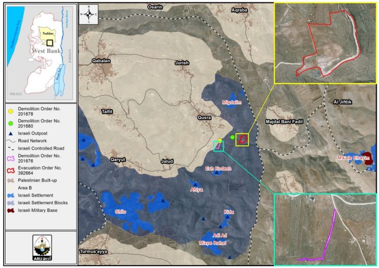
Moreover, the targeted land and structures located within the “ Israeli “corridor of Shilo” which includes a number of illegal Israeli settlements and outposts, military bases and Israeli road network, and also, part of Palestinian towns and villages, where hundreds of Palestinian lives ….
It is worth to mention that the corridors areas were de facto created as a result of the construction of the Segregation Wall where the Israeli-created corridors area link between the Eastern segregation zone (the area located along the Palestinian- Jordanian borders) and the Western segregation zone (the area located between the path of the Segregation wall and the Armistice Line 1949 ‘Green line”)
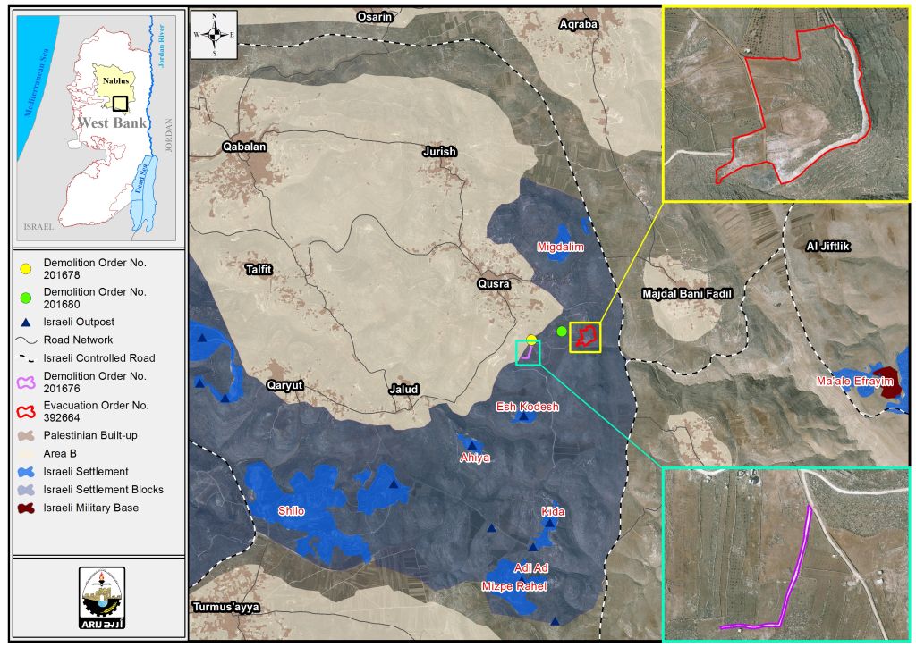
Furthermore, the Israeli colonial corroders is a very strategic area for the Israeli Occupation, where it keen to keep its control over these areas for “security and colonial considerations” and mainly to find a geographical contiguity between the Israeli settlements and outpost in all parts on the oPt. See the map below:
Map showed the location of the targeted water wells and the agricultural land
Actually, This is not the first time that the Israeli Authorities targeted the residents of Qusra town, south of Nablus governorate with the demolition or halt construction orders, where from the beginning of 2016, the Israeli Civil Administration issued tens of military orders that targeted structures in Qusra town, under the claim of lacking building permits. Following are part of the case studies prepared about the military orders that targeted structures in Qusra town:
- “ A series of halt-of-construction orders in three Palestinian communities in southern Nablus Governorate” … https://poica.org/details.php?Article=9653
- Funded by the Dutch Representative Office
- The Israeli occupation notifies agricultural structures of Stop-Work in Qusra town…. http://www.old.poica.org/details.php?Article=9485
- Demolition and stop-work orders on structures in Qusra village.. http://www.old.poica.org/details.php?Article=9051
- The Israeli occupation notifies structures with demolition in the Nablus village of Qusra…. http://www.old.poica.org/details.php?Article=7948
Qusra Town:
Qusra is a Palestinian village in the Nablus Governorate, located southeast of Nablus City. It is bordered by Majdal Bani Fadil and Duma to the east, Jurish to the north, Talfit to the west, and Jalud to the south. For more information about Qusra town, check the link below: http://vprofile.arij.org/nablus/pdfs/vprofile/Qusra_vp_en.pdf
Prepared By
The Applied Research Institute – Jerusalem
ARIJ

