During the month of July, the so-called “Israeli ministry of Interior” published on its website seven town planning schemes prepared and approved by the “Higher Planning Council” of the Israeli Civil Administration for building in three Israeli settlements in the occupied West Bank. The settlements were identified as Ma’ale Adumim east of Jerusalem (J2[1]), Ariel in Salfit Governorate and Har Adar settlement northwest of Jerusalem (J2). Schemes' approvals were advertised in several major Israeli newspapers such as “Ma’ariv” and “Israel today”. See Table 1 for more details
|
Table 1: Details of Town planning schemes |
|||||
|
No. |
Settlement Name |
TPS No. |
Description |
Date of Deposit in the Newspaper |
Affected Palestinian community |
|
1 |
Maale Adumim |
יוש/ 1/ 54/ 7/ 1/ 420 |
Nofe Hasela’ South (7) neighborhood – parcel No. 102 |
14/07/2016 |
Abu Dis |
|
2 |
Maale Adumim |
יוש/ 2/ 48/ 7/ 1/ 420 |
Nofe Hasela’ North (7) neighborhood- parcel No. 439-400 |
14/07/2016 |
Ad Dahr Al Gharbi |
|
3 |
Ariel |
יוש/ 4/ 4/ 1/ 130 |
Commerce and Industry |
01/07/2016 |
Salfit- Al Wajh Al Shami |
|
4 |
Maale Adumim |
יוש/ 40/ 1/ 1/ 420 |
—– |
14/07/2016, |
Al Izariyah |
|
5 |
Maale Adumim |
יוש/ 44/ 7/ 1/ 420 |
Nofe Hasela’ South (7) neighborhood – parcel No. 103, 104 |
07/07/2016 |
Abu Dis |
|
6 |
Maale Adumim |
יוש/ 56/ 3/ 1/ 420 |
Magdim Neighborhood, Parcels 50,52,54,56,58. |
14/07/2016, |
Al Izariyah |
|
7 |
Har Adar |
יוש/ 19/ 3/ 214 |
Kherbit Njeim , Shu’ab Gloss |
07/07/2016 .ע |
|
|
Source: Israeli Ministry of Interior |
|||||
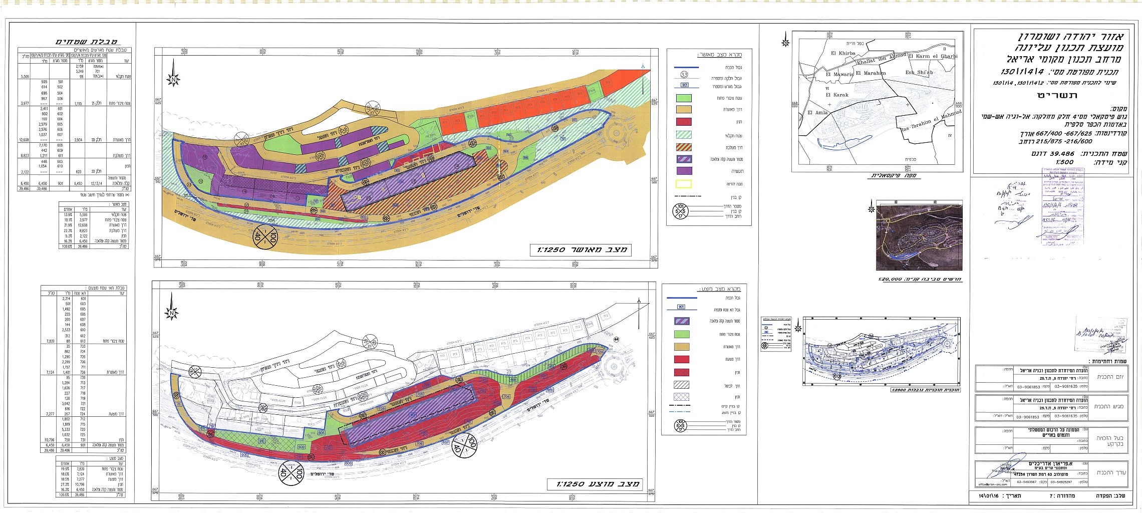
The plans come in accordance with article 20/24 of the 1966 Jordanian Town Planning and Building Law Number 79, which was in use before the Israeli occupation of the West Bank and was later amended following Israel’s occupation of the West Bank in June 1967 war by the Israeli Occupation Authorities on the basis of Military order No. 418[2] to comply with Israel’s interests and settlement plans in the occupied Palestinian territory. See Copies of the plans as deposited

TPS No. : יוש/ 1/ 54/ 7/ 1/ 420


Extensive building and expansion activities in Israeli settlements in the Western Segregation Zone
Israel is stepping up its settlement activity in Israeli settlements in the Western Segregation Zone (WSZ), in the area that has become isolated between the 1949 Armistice Line (Green Line) and the Israeli Segregation Wall[3]. During the year 2016, and based on information provided by the Israeli ministry of Interior, expansion is underway in 19 Israeli settlements in the occupied West Bank, most notably in the settlements located in what Israel classifies as “settlement blocs”[4].
Israel wants to draw the borders of its “State” based on bitter facts it is creating on the ground; that is to construct the segregation wall in a way that will annex the five major settlements blocs in the oWB to Its proper (the Ariel and Kedumim settlement bloc in Salfit Governorate, the Modi’in Illit Settlement bloc in Ramallah Governorate, the Gush Etzion Settlement bloc in Bethlehem Governorate, the Ma’ale Adumim settlement bloc and the Giv’at Ze’ev settlement bloc in Jerusalem Governorate) along with settlements in the Jordan valley and settlements in occupied East Jerusalem; with absolute disregard to the sequences of such an approach on the Palestinians; Table 2 gives details of the plans that were issued since January 2016.
|
Table 2: Approved Israeli Plans since January 2016 in Settlements in the occupied West Bank |
|||||
|
No. |
Settlement Name |
TPS Number |
Purpose and Lands Targeted |
Date of Plan Deposit |
Location from Wall |
|
1 |
Alon Shevut |
1/ 6/ 6/ 405 |
Alon Shevut North |
31/03/2016 |
West |
|
2 |
Ariel |
35/ 3/ 2/ 130 |
Parcel No. 171 |
13/01/2016 |
West |
|
Ariel |
4/ 4/ 1/ 130 |
Commerce and Industry |
1/7/2016 |
West |
|
|
3 |
Beit Arye |
5/ 201 |
Construction instructions |
14/01/2016 |
West |
|
4 |
Efrat |
50/ 5/ 410 |
Parcel No. 119 |
11/3/2016 |
West |
|
5 |
Etz Efrayem |
9/ 126 |
additional construction rights, an extra storey and protected spaces |
12/1/2016 |
West |
|
6 |
Givat Zeev |
1/ 10/ 1/ 220 |
Neve Ashdar |
15/02/2016 |
West |
|
Givat Zeev |
17/ 2/ 215 |
Givat Zeev |
23/03/2016 |
West |
|
|
7 |
Givon Hadasha |
7/ 216 |
Ha Zayit neighborhood |
9/5/2016 |
West |
|
8 |
Har Adar |
19/ 3/ 214 |
plots No. 1066A and -1066 B |
7/7/2016 |
West |
|
9 |
Hemdat |
א/ 304 |
NA |
31/01/2016 |
East |
|
10 |
Immanuel |
9/ 120 |
extra building rights on the roofs of buildings |
12/1/2016 |
West |
|
11 |
Karmiel |
1/ 1/ 507 |
Extra housing units |
6/4/2016 |
East |
|
12 |
Maale Adumim |
1/ 26/ 7/ 1/ 420 |
Parcel No. 270 |
19/05/2016 |
West |
|
|
Maale Adumim |
1/ 54/ 7/ 1/ 420 |
Parcel No. 102 |
14/07/2016 |
West |
|
|
Maale Adumim |
2/ 19/ 7/ 1/ 420 |
Parcels No. 319, 320, 321 |
26/05/2016 |
West |
|
|
Maale Adumim |
2/ 48/ 7/ 1/ 420 |
Parcel No. 8 and Parcel No. 402 |
14/07/2016 |
West |
|
|
Maale Adumim |
21/ 2/ 2/ 2/ 420 |
Parcel No. 1- 717A |
21/04/2016 |
West |
|
|
Maale Adumim |
24/ 1/ 1/ 420 |
build your own home area – Forest Area |
26/05/2016 |
West |
|
|
Maale Adumim |
30/ 7/ 1/ 420 |
Malae Adumim East |
26/05/2016 |
West |
|
|
Maale Adumim |
40/ 1/ 1/ 420 |
NA |
14/07/2016 |
West |
|
|
Maale Adumim |
43/ 4/ 1/ 420 |
Parcel No. 5 |
21/04/2016 |
West |
|
|
Maale Adumim |
44/ 7/ 1/ 420 |
Parcel No. 103 + 104 |
7/7/2016 |
West |
|
|
Maale Adumim |
50/ 3/ 1/ 420 |
Parcel No. 37 |
5/5/2016 |
West |
|
|
Maale Adumim |
56/ 3/ 1/ 420 |
Parcel No. 50,52,54,56,58. |
14/07/2016 |
West |
|
|
Maale Adumim |
6/ 2/ 7/ 1/ 420 |
Parcel No. 34 |
21/04/2016 |
West |
|
|
Maale Adumim |
6/ 4/ 2/ 420 |
Parcel No. 401, 402 |
7/4/2016 |
West |
|
13 |
Maale Mikhmas |
2/ 1/ 1/ 225 |
a change in building residential zone A |
29/01/2016 |
East |
|
14 |
Naaleh |
1/ 2/ 207 |
Parcel No. 91 |
21/04/2016 |
West |
|
15 |
Neve Daniel |
2/ 1/ 2/ 402 |
Parcel No. 50 |
1/1/2016 |
West |
|
Neve Daniel |
3/ 1/ 2/ 402 |
Parcel No. 69 |
21/01/2016 |
West |
|
|
16 |
Oranit |
16/ 121 |
10 units in a residential area, for public buildings |
1/4/2016 |
West |
|
17 |
Rotem |
א/ 322 |
NA |
23/03/2016 |
East |
|
18 |
Tene |
1/ 515 |
Single family units |
21/04/2016 |
East |
|
Tene |
5/ 515 |
28 units + 20 units of accommodation |
1/1/2016 |
East |
|
|
19 |
Zufim |
6/ 4/ 149 |
Viewers center – a change in the area of public buildings construction |
17/05/2016 |
West |
|
Source: Israeli Ministry of Interior Retrieved on 2 August 2016 |
|||||
In the meantime, Israel have escalated its systematic demolition campaign against Palestinian properties in areas under its full control according to the Oslo Accords signed by Israel and the Palestine Liberation Organization (PLO) in 1993, known as “Area C” and within the illegally and unilaterally expanded Jerusalem municipal boundaries, under the pretext of unlicensed construction. During the first half of 2016 (January –July/2016), Israel has carried out a wide demolition campaign in the oPt affecting 344 Palestinian homes and 374 structures, an increase of 154% and 274% (respectively) of last year demolitions.
Ariel and Ma’ale Adumim Settlements at a glance :
- Ariel settlement was established in 1978 on lands of Kif Hareth, Salfit , Marda and Iskaka villages in Salfit Governorate. Today, the settlements occupies a total land area of 5475 dunums and is home to 18928 Israeli settlers.
- Ma’ale Adumim Settlement was established in 1978 on lands of Al Izariyah, Az Zayem and Abu Dis towns in Jerusalem Governorate. Today, the settlement occupies a total land area of 6620 dunums and is home to almost 51,000 Israeli settlers.
[1] Israeli Settlements in Jerusalem Governorate are classified according to their administrative status: (1)settlements inside the Israeli defined municipal boundary (the J1 area), they are: The Jewish Quarter, Neve Yacoov, Pisgat Ze’ev, Pisgat Amir, Nof Zion, East Telpiot, Atarot, Ramot Allon, Ramat Shlomo (Rechecs Shu’fat), Rama Eshkol, Hebrew University (Har Hazofim),Giv’at Shapira, Settlers Houses in Jerusalem, Mamilla ,Gilo, Har Homa, Ras Al Amoud (Ma’ale Hazeitim) and Giv’at Hamatos. (2) Settlements within the Jerusalem governorate and outside the municipal boundary (the J2 area), they are: Ma’ale Adumim, Mishor Adumim, Kfar Adumim, Almon (Anatot), Kedar, Mitzpe Yedude, Neve Brat, Allon, Neve Samuel, Har Samuel, Har Adar, Giv’at Ze’ev, Kalya, Roman Bating House, Giv’on Hadasha, Giv’on, Har Adar. Kochav Yacov, Geva’ Benyamin (Adam), Sha’are Benyamin and Mevesert Zion.
[2] Military Order No.418: It was issued in March 1971 and 'amended' Law number 79 of 1996. Under this order, all significant decisions on permits and plans would be made by a High Planning Council appointed by the Military Commander. MO 418 also allowed the High Planning Council to prepare, amend, cancel, disregard, or dispense any plan or permit; it also had the authority to exempt persons from obtaining the necessary license. Most members of the High Planning Council have been military officers and all have been Israeli citizens. The amendment to this law has advanced the establishment of new settlements and the expansion of existing ones while it prohibited the natural development of the Palestinian community simply by rejecting permits and demolishing Palestinian houses under the pretext of building without proper building authorization. .
[3] In 2002, Israel commenced the construction of the Segregation Wall in the occupied Palestinian territory with great focus on Jerusalem city and settlement blocks. Accordingly, the latest update route of the segregation wall showed that the wall is set to annex three major Israeli settlement blocs surrounding the city of Jerusalem, Ma’ale Adumim settlement bloc, Giv’a tZeev Settlement block and Gush Etzion settlement block, in addition to Ariel settlement block in northern West Bank, and Mod’in Illit settlement block in the middle, established on lands of Raallah Governorate. In total, the wall is set to annex 107 Israeli settlements to its proper, 733 km square of Palestinian land, 13% of the total West Bank area.
[4] On May 26, 2015, the Israeli Prime Minister Benjamin Netanyahu told the European Union’s top foreign policy official (Federica Mogherini) that he is willing to resume talks with the Palestinians, with his goal being to reach understandings on the borders of settlement blocs that Israel would annex under any peace agreement.
Prepared by:
The Applied Research Institute – Jerusalem


